


Suphan Buri, Thailand
เทศบาลเมืองสุพรรณบุรี
Suphan Buri is a regional capital of 53,399 people in Suphan Buri, Thailand.
Why visit Suphan Buri
Townapedia lists 10 museums and landmarks, 4 parks and trails, 26 places to eat and 14 places to stay in and around town.
Weather in Suphan Buri
Forecast from MET Norway (CC BY 4.0). Full forecast
About Suphan Buri
Suphan Buri (Thai pronunciation: [sù.pʰān būrīː]) is a town (thesaban mueang) in central Thailand. It covers tambon Tha Philiang and parts of tambons Rua Yai and Tha Rahat, all within the Mueang Suphan Buri District. As of 2006 it had a population of 26,656. The town is 101 km north-northwest of Bangkok.
From the Wikipedia article Suphan Buri (this version), under CC BY-SA 4.0.
Travel tips from other travellers: Suphan Buri on Wikivoyage (CC BY-SA 4.0).
Photos of Suphan Buri


Museums and landmarks10



Parks, trails and playgrounds4

Restaurants and cafes26

Bad Monday
Cafe · Coffee Shop · 1.7 km
Soi Mu Ban Ying Ruai
Mo-Fr 07:00-17:00; Sa-Su 08:00-17:00

14 more on the map.
Where to stay14

2 more on the map.
History
The moated settlement that Karen Mudar records as Suphanburi encloses 366 ha, which makes it one of the three largest on the central plain, after Nakhon Pathom and beside Phraek Si Racha, and one of the seven regional centres in her four-level administrative hierarchy; the region assigned to it holds nine moated settlements, and its moat, unlike several others on the plain, shows no sign of enlargement within the first-millennium period she covers. Her sample consists of moated settlements carrying Dvaravati material culture, which she dates as a group from the beginning of the 6th century, some five centuries before the traditional foundation of the town; she dates no individual site, and the Suphanburi moat has not been dated on its own.
Baker and Pasuk connect the town's beginnings to the decline of U Thong. On their account the people of U Thong may have moved some 30 kilometres north-east, and the plan of the town they reached is a hybrid. It stands in a bend of the river, closed by a moat measuring 1.9 by 0.7 kilometres, with a major forest temple outside the walls in the Dvaravati manner, but the moat is a strict rectangle rather than the usual conch shape and a relic stupa in Angkorian style stands at the centre. They hold that both the walls and the stupa may date to the 12th century.
Read more of the history
Kilns at Ban Bang Pun, on the Suphan river north of the town, were making large stoneware jars in the Southern Song period of the 12th and 13th centuries, on a technology brought from southern China. Sherds from them have been found as far away as the Phetchaburi city wall and the mouth of the Khaem Nu in Chanthaburi.
19th-century Siamese historian and statesman Damrong Rajanubhab speculated that the city was founded under the name Suvarnapurī around 1350, around the time when nearby U Thong was plagued by an epidemic. U Thong was the capital of the Kingdom of Suphannaphum, one of the mueang of the Dvaravati period, in which Ramathibodi I had reigned before founding Ayutthaya, the capital of the homonymous kingdom in the same period. U Thong's ancient name was Suphannaphum or Suvarnabhumi (literally: the origin or birthplace of gold), which was probably abandoned when the water shortage epidemic raged and Suvarnapurī was founded along the Tha Chin River. Ramathibodi appointed his brother-in-law Khunluang Pha Ngua as governor of Suvarnapurī, who gave the city its present name Suphanburi and who would become king of Ayutthaya in 1370 with the name Borommarachathirat I.
Later, Suphanburi remained a frontier town between Siam and the kingdoms that alternated in modern day Burma. Several battles were fought in its surroundings between the Siamese and Burmese armies until the first half of the 19th century. The most important was the one that took place on January 18, 1593 in Nong Sarai, a few kilometers northwest of the city. The battle was in progress, when the Siamese king Naresuan challenged the heir to the throne of the Toungoo dynasty to a duel on the back of elephants to decide the fate of the clash. Within minutes Naresuan killed his rival, the Burmese troops withdrew and Ayutthaya thus gained independence after 29 years of vassalage at Pegu's court. The provincial coat of arms still remembers this duel.
The municipality took on its present form during the reign of Mongkut (1851-1868), when the central nucleus was unified with the neighboring settlements. Suphanburi underwent major changes in the years between the 20th and 21st centuries at the behest of Banharn Silpa-Archa, a wealthy entrepreneur native of the city who was prime minister of Thailand between 1995 and 1996. Banharn was accused of spending the 90% of the national budget for the Suphanburi Province. Among the various infrastructures he had built, many of which took the name Baharn-Jaemsai (Jaemsai is the name of his wife), there are seven schools, a 123-meter high tower in the city center, another tower where a clock and a series of pedestrian bridges that cross wide, almost deserted streets.
From the History section of Suphan Buri on Wikipedia, under CC BY-SA 4.0.
More about Suphan Buri
Geography
Suphan Buri lies on the Tha Chin River (known locally as the Suphan River), at an elevation of 11 metres (36 ft). The surrounding area is low-lying and flat, with rice farms covering much of the land.
Arts and culture
Suphan Buri is the place where Luk thung Superstar Pumpuang Duangjan was buried and is sometimes called the Thai Nashville, as it is an important center of the music industry.
From the Wikipedia article Suphan Buri, under CC BY-SA 4.0.
Notable people from Suphan Buri
 Thitipan PuangchanThai association football playerPhoto: El Loko Foto, CC BY 4.0
 Banhan Sinlapa-achaPrime Minister of Thailand (1932-2016)Photo: Banharn_Silpa-archa.jpg : พีรพัฒน์..., CC BY 2.0
 UthongKing of Ayutthaya, SiamPhoto: CKasa, CC BY-SA 3.0
 Aed CarabaoThai guitaristPhoto: Peerapat Wimolrungkarat (พีรพัฒน์..., CC BY 2.0
 Borommarachathirat IKing of Ayutthaya kingdomPhoto: FrameHotep, CC BY 4.0
 Chumpol Silpa-archaMinister of Tourism and Sports (1940-2013)Photo: Government of Thailand, CC BY-SA 4.0
 Anuwat NoicheunphanThai footballerPhoto: El_Loko für www.thai-fussball.com, CC BY 4.0
 Napat ThamrongsupakornThai footballerPhoto: El_Loko für www.thai-fussball.com, CC BY 4.0
- Suraphol SombatcharoenThai singer
- Sornphet SornsuphanThai singer
- Therdsak ChaimanThai association football player and manager
- Thanawat SuengchitthawonThai and French association football player
Born in Suphan Buri, according to Wikidata (CC0). Each name links to its Wikipedia article.
Churches and places of worship17
Shopping12
Gas and EV charging5
Schools, colleges and libraries11
Healthcare14
วีระศักดิ์คลินิกเวชกรรม
Hospital · 1.4 km
150 ถนนเณรแก้ว ต.ท่าระหัด อ.เมือง จ.สุพรรณบุรี
Map of Suphan Buri
113 places. The map loads OpenStreetMap tiles when you open it.
Getting there and nearby towns
Kamphaeng Saen Airport (KDT) is the nearest airport with scheduled flights listed in OpenStreetMap, 47 km away.
- Pak Kret 74 km southeast, about 1 h 15 min by car
- Nakhon Pathom 73 km south, about 1 h 15 min by car
- Ban Pong 78 km south, about 1 h 15 min by car
- Mueang Nonthaburi 80 km southeast, about 1 h 15 min by car
- Kanchanaburi 81 km southwest, about 1 h 15 min by car
- Lak Si 82 km southeast, about 1 h 15 min by car
- Sai Mai 83 km southeast, about 1 h 30 min by car
- Chatuchak 86 km southeast, about 1 h 30 min by car
- Bang Sue 86 km southeast, about 1 h 30 min by car
- Bangkok 90 km southeast, about 1 h 30 min by car
Drive times are estimates from straight-line distance, not routes.
Towns near Suphan Buri


_(cropped).jpg)


Keep exploring
Local news
Headlines from INDB.
Reviews, tips and questions
Loading what members have shared...
Sources and licences
- GeoNames (CC BY 4.0): population, coordinates, regions and time zone
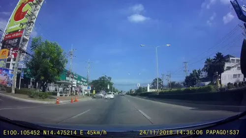
- Mapillary (see each image): photos
- OpenStreetMap contributors (ODbL 1.0): places, airports, map data
- Wikidata (CC0 1.0): elevation, founding date, time zone, website
- Wikimedia Commons (see each image): photos
- Wikipedia (CC BY-SA 4.0): overview and history text
Photo credits
- วัดพระรูป อ.เมือง จ.สุพรรณบุรี (13), กสิณธร ราชโอรส, CC BY-SA 4.0
- Wat Khae, Mrrpmeowfurry, CC0
- Wat Saraphi, Mrrpmeowfurry, CC0
- วัดพระรูป อ.เมือง จ.สุพรรณบุรี (12), กสิณธร ราชโอรส, CC BY-SA 4.0
- วัดจำปา wat jumpha 09, Teerayut_Srisopa, CC BY-SA 3.0
- Reclining buddha in Praroop temple, Patibutkan, CC BY-SA 3.0
- วัดจำปา wat jumpha 02, Teerayut_Srisopa, CC BY-SA 3.0
- วัดโหน่งเหน่ง wat nong-neng 06, Teerayut_Srisopa, CC BY-SA 3.0
- วัดเจดีย์ยอดเหล็ก wat Chadi yodlek 03, Teerayut_Srisopa, CC BY-SA 3.0
- วัดพระรูป อ.เมือง จ.สุพรรณบุรี (6), กสิณธร ราชโอรส, CC BY-SA 4.0
- หน้าต่างธรรม, Nawa1509, CC BY-SA 4.0
- วัดพระรูป อ.เมือง จ.สุพรรณบุรี (4), กสิณธร ราชโอรส, CC BY-SA 4.0
- วัดพระรูป อ.เมือง จ.สุพรรณบุรี (14), กสิณธร ราชโอรส, CC BY-SA 4.0
- วัดโหน่งเหน่ง wat nong-neng 01, Teerayut_Srisopa, CC BY-SA 3.0
- วัดโหน่งเหน่ง wat nong-neng 07, Teerayut_Srisopa, CC BY-SA 3.0
- วัดพระรูป อ.เมือง จ.สุพรรณบุรี (21), กสิณธร ราชโอรส, CC BY-SA 4.0
- วัดพระรูป อ.เมือง จ.สุพรรณบุรี (1), กสิณธร ราชโอรส, CC BY-SA 4.0
- วัดพระรูป อ.เมือง จ.สุพรรณบุรี (18), กสิณธร ราชโอรส, CC BY-SA 4.0
- วัดจำปา wat jumpha 03, Teerayut_Srisopa, CC BY-SA 3.0
- วัดจำปา wat jumpha 04, Teerayut_Srisopa, CC BY-SA 3.0
- วัดเจดีย์ยอดเหล็ก wat Chadi yodlek 02, Teerayut_Srisopa, CC BY-SA 3.0
- วัดโหน่งเหน่ง wat nong-neng 03, Teerayut_Srisopa, CC BY-SA 3.0
- วัดพระรูป อ.เมือง จ.สุพรรณบุรี (15), กสิณธร ราชโอรส, CC BY-SA 4.0
- วัดพระรูป อ.เมือง จ.สุพรรณบุรี (19), กสิณธร ราชโอรส, CC BY-SA 4.0
- วัดจำปา wat jumpha 05, Teerayut_Srisopa, CC BY-SA 3.0
- วัดโหน่งเหน่ง wat nong-neng 08, Teerayut_Srisopa, CC BY-SA 3.0
- เจดีย์ยอดเหล็ก อ.เมือง จ.สุพรรณบุรี (2), กสิณธร ราชโอรส, CC BY-SA 4.0
- วัดเจดีย์ยอดเหล็ก wat Chadi yodlek 01, Teerayut_Srisopa, CC BY-SA 3.0
- วัดพระรูป อ.เมือง จ.สุพรรณบุรี (5), กสิณธร ราชโอรส, CC BY-SA 4.0
- วัดจำปา wat jumpha 07, Teerayut_Srisopa, CC BY-SA 3.0
- วัดพระรูป อ.เมือง จ.สุพรรณบุรี (20), กสิณธร ราชโอรส, CC BY-SA 4.0
- วัดเจดีย์ยอดเหล็ก wat Chadi yodlek 04, Teerayut_Srisopa, CC BY-SA 3.0
- วัดพระรูป อ.เมือง จ.สุพรรณบุรี (17), กสิณธร ราชโอรส, CC BY-SA 4.0
- วัดโหน่งเหน่ง wat nong-neng 04, Teerayut_Srisopa, CC BY-SA 3.0
- วัดพระรูป อ.เมือง จ.สุพรรณบุรี (16), กสิณธร ราชโอรส, CC BY-SA 4.0
- วัดจำปา wat jumpha 01, Teerayut_Srisopa, CC BY-SA 3.0
- วัดโหน่งเหน่ง wat nong-neng 05, Teerayut_Srisopa, CC BY-SA 3.0
- วัดพระรูป อ.เมือง จ.สุพรรณบุรี (11), กสิณธร ราชโอรส, CC BY-SA 4.0
- เจดีย์ยอดเหล็ก อ.เมือง จ.สุพรรณบุรี (3), กสิณธร ราชโอรส, CC BY-SA 4.0
- วัดพระรูป อ.เมือง จ.สุพรรณบุรี (3), กสิณธร ราชโอรส, CC BY-SA 4.0
- Dragon Descendants Museum - panoramio, Rittigai, CC BY-SA 3.0
- Street-level photo, beddhist, CC BY-SA 4.0
- Street-level photo, rusmanoon, CC BY-SA 4.0
- Street-level photo, rusmanoon, CC BY-SA 4.0
- Street-level photo, rusmanoon, CC BY-SA 4.0
- Street-level photo, poramet, CC BY-SA 4.0


Page built November 10, 2026. Spotted a mistake? Tell us or suggest a place.