


Phra Nakhon Si Ayutthaya, Thailand
เทศบาลนครพระนครศรีอยุธยา
Phra Nakhon Si Ayutthaya is a regional capital of 50,830 people in Phra Nakhon Si Ayutthaya, Thailand, founded in 1350.
Why visit Phra Nakhon Si Ayutthaya
Townapedia lists 197 museums and landmarks, 7 parks and trails, 123 places to eat, 71 places to stay and 9 attractions in and around town.
Highlights include Pridi-Thamrong Bridge, Chao Sam Phraya National Museum, Ayothaya Floating Market and Ayutthaya Historical Park.
Weather in Phra Nakhon Si Ayutthaya
Forecast from MET Norway (CC BY 4.0). Full forecast
About Phra Nakhon Si Ayutthaya
Phra Nakhon Si Ayutthaya, commonly known locally as Ayutthaya, is the capital of Phra Nakhon Si Ayutthaya province in Thailand. It lies on an island at the confluence of the Chao Phraya and Pa Sak rivers. Ayutthaya was the capital of the Ayutthaya Kingdom and, between the 14th and 18th centuries, grew into one of the world's largest cities and a major hub of diplomacy and commerce, before its destruction during the Burmese invasion of 1767.
From the Wikipedia article Phra Nakhon Si Ayutthaya (city) (this version), under CC BY-SA 4.0.
Travel tips from other travellers: Phra Nakhon Si Ayutthaya on Wikivoyage (CC BY-SA 4.0).
Photos of Phra Nakhon Si Ayutthaya


Things to do9



Museums and landmarks197

Chao Sam Phraya National Museum
Museum · 1.7 km
Museum in Ayutthaya, Thailand
108
Tu-Su 09:00-16:00

Ayothaya Floating Market
Monument and historic site · 1.9 km
65/19
Mo-Su 09:00-18:00

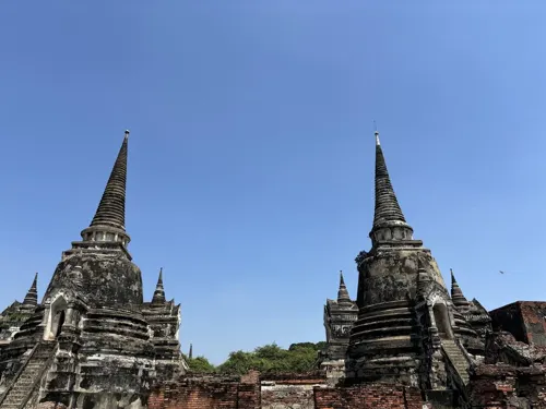
Wat Chaiwatthanaram
Monument and historic site · 3.9 km
Buddhist temple in Ayutthaya Historical Park, Thailand




185 more on the map.
Parks, trails and playgrounds7



Phranakhon Si Ayutthaya Rajabhat University Stadium
Sports field and stadium · 1.7 km
Restaurants and cafes123
Grandparent's café
Cafe · Burger, Thai, Coffee Shop · 1.1 km
ถนนนเรศวร
Mo-Su 08:00-20:00
REACH Coffee slowbar
Cafe
8 12 U-Thong Road, Hor Rattanachai Subdistrict Phra Nakhon Si Ayutthaya District Ayutthaya
Mo-Su 09:00-17:30


8 Oct Cafe
Cafe · Coffee Shop · 1.1 km
31/9 ซอยหอรัตนไชย 4
09:00-17:30; Fr,Sa off
Sweet Times swimming pool
Cafe · Sandwich, Hotdog, Pancake, Ice Cream, Crepe, Sausage, Cake · 0.8 km
ถนนปะธน
Th-Tu 11:00-19:00
Malakor Cafe & Restaurant
Restaurant · Tea, Cake, Coffee Shop, Thai · 1.3 km
ถนนชิกุน
Mo-Su 08:00-22:00
111 more on the map.
History
Ayutthaya was officially founded in 1351[a] by King Uthong, who went there to escape a smallpox outbreak in Lopburi and proclaimed it the capital of his kingdom, often referred to as the Ayutthaya Kingdom or Siam. Archaeological and written evidence has revealed that Ayutthaya was inhabited as early as the late 13th century, before the arrival of Uthong. Further evidence of this can be seen with Wat Phanan Choeng, which was founded in 1324.
Ayutthaya became the second Siamese capital after Sukhothai. Early Western accounts describe Ayutthaya as a "noble" and "wealthy" city. In the late Ayutthaya period, European visitors described it as among the world's wealthiest and most cosmopolitan cities. It is estimated that by the year 1600, Ayutthaya had a population of about 300,000, with the population perhaps reaching 1,000,000 around 1700, making it one of the world's largest cities at that time, a period during which UNESCO describes Ayutthaya as flourishing into one of the world's largest and most cosmopolitan urban areas and a center of global diplomacy and commerce.
Read more of the history
In 1767, the city was destroyed by the Burmese army, resulting in the collapse of the kingdom. The ruins of the old city are preserved in the Ayutthaya Historical Park, which is recognised internationally as a World Heritage Site. The ruins, characterised by the prang (reliquary towers) and gigantic monasteries, give an idea of the city's past splendour.
Modern Ayutthaya was refounded a few kilometres to the east. Although the former royal capital never regained its previous political prominence, the area remained inhabited and gradually developed into a provincial capital. Over time, conservation and archaeological work concentrated on the ruined core of the old city, while the modern urban centre expanded beyond the island. Today, Ayutthaya's historic monuments and cultural landscape continue to shape the city's identity and economy, particularly through heritage tourism and religious pilgrimage.
From the History section of Phra Nakhon Si Ayutthaya (city) on Wikipedia, under CC BY-SA 4.0.
More about Phra Nakhon Si Ayutthaya
Geography
The city is located about 40 miles (64 km) north of Bangkok, at the confluence of the Chao Phraya, Lopburi and Pa Sak rivers, and on the main north–south railway linking Chiang Mai to Bangkok. The old city is on an island formed by a bend of the Chao Phraya on the west and south sides, the Pa Sak on the east side and the Klong Muang canal on the northern side.
Ayutthaya is geographically characterized as an island city surrounded by three major rivers: the Lopburi River to the north, the Pa Sak River to the east, and the Chao Phraya River to the south and west. The city's layout demonstrates sophisticated hydraulic engineering and urban planning, featuring an extensive network of man-made canals excavated for transportation, flood drainage, and domestic water supply. According to UNESCO, Ayutthaya was characterized by a systematic city-planning grid of roads, canals, and moats, supported by an extremely advanced hydraulic water-management system during the Ayutthaya period. During this period, the city was sometimes known as the "Venice of the East".
The internal canal system consisted of three primary north-south arteries that served as the backbone of the city's functional zones:
Arts and culture
The Ayutthaya period is considered a formative era for Thai literature, characterized by the development of diverse poetic forms such as klong (Thai: โคลง), chan (Thai: ฉันท์), and lilit (Thai: ลิลิต). Early works were primarily religious or ceremonial, such as the Lilit Ongkan Chaeng Nam (Incantation of the Water of Allegiance).
The reign of King Narai (1656–1688) represented a major literary peak, during which the first Thai textbook, Chindamani (Thai: จินดามณี), was produced to formalize the language against increasing foreign influence. Other significant courtly works from this era include the epic poem Lilit Phra Lo and the development of nirat (travel poetry), which merged romantic themes with observations of journeys.
Beyond courtly literature, the period saw the emergence of popular oral traditions, most notably the epic of Khun Chang Khun Phaen. Although its modern written form was compiled later, the story originated as folk ballads (sepha) during the late Ayutthaya period, providing insights into contemporary social customs and daily life. The late Ayutthaya period under King Borommakot experienced a further resurgence of literature, focusing on Buddhist jataka tales and refined courtly poetry, and the Ramakien (the Thai version of the Ramayana), which became a foundational text for royal Khon (masked dance) performances.
Education
Ayutthaya Wittayalai School and Chomsurang Upatham School are the principal secondary schools located in Ayutthaya city.
Phranakhon Si Ayutthaya Rajabhat University and Rajamangala University of Technology Suvarnabhumi are the two universities located in the city proper.
From the Wikipedia article Phra Nakhon Si Ayutthaya (city), under CC BY-SA 4.0.
Notable people from Phra Nakhon Si Ayutthaya
 Pridi BanomyongThai prime minister (1900-1983)Photo: Thai government (รัฐบาลไทย), Public domain
 Phutthayotfa ChulalokKing of Siam (1737–1809)Photo: Unknown author Unknown author, Public domain
 TaksinKing of SiamPhoto: Tmd, CC BY-SA 4.0
 EkkathatKing of AyutthayaPhoto: FrameHotep, CC BY-SA 4.0
 UthumphonKing of SiamPhoto: Unknown author Unknown author, Public domain
 Thai SaKing of AyutthayaPhoto: Chainwit., CC BY 4.0
 Borommakotking of AyutthayaPhoto: FrameHotep, CC BY-SA 4.0
 SongthamKing of AyutthayaPhoto: FrameHotep, CC BY-SA 4.0
 Narubadin WeerawatnodomThai footballerPhoto: ClassVelt55, CC BY-SA 4.0
- TrailokkanatKing of Siam
- Prasat ThongKing of Ayutthaya
- Maha Sura SinghanatVice King of Siam (1744-1803)
Born in Phra Nakhon Si Ayutthaya, according to Wikidata (CC0). Each name links to its Wikipedia article.
Where to stay71
Churches and places of worship93
Shopping9
Gas and EV charging7
Schools, colleges and libraries53
Healthcare11
Dr.Khaowfang clinic
Clinic and pharmacy · 2.7 km
158/48 ซอยอโยธยา 3/2, หมู่บ้านสบายสบาย คลองสวนพลู, Ayutthaya, Thailand
Map of Phra Nakhon Si Ayutthaya
250 places. The map loads OpenStreetMap tiles when you open it.
Getting there and nearby towns
Don Mueang International Airport (DMK) is the nearest airport with scheduled flights listed in OpenStreetMap, 49 km away.
- Saraburi 42 km northeast, about 42 min by car
- Sai Mai 48 km south, about 48 min by car
- Pak Kret 50 km south, about 50 min by car
- Lak Si 52 km south, about 52 min by car
- Suphan Buri 51 km west, about 51 min by car
- Mueang Nonthaburi 55 km south, about 55 min by car
- Khlong Sam Wa 56 km south, about 56 min by car
- Chatuchak 58 km south, about 58 min by car
- Bang Sue 60 km south, about 1 h by car
- Bangkok 67 km south, about 1 h by car
Drive times are estimates from straight-line distance, not routes.
Towns near Phra Nakhon Si Ayutthaya


Keep exploring
Local news
Headlines from INDB.
Reviews, tips and questions
Loading what members have shared...
Sources and licences
- GeoNames (CC BY 4.0): population, coordinates, regions and time zone
- Mapillary (see each image): photos
- OpenStreetMap contributors (ODbL 1.0): places, airports, map data
- Wikidata (CC0 1.0): elevation, founding date, time zone, website, landmarks and historic places
- Wikimedia Commons (see each image): photos
- Wikipedia (CC BY-SA 4.0): overview and history text
Photo credits
- Naresuan-Road-Ayutthaya, Kounosu, CC BY-SA 3.0
- Phra Nakhon Si Ayutthaya - panoramio (4), Anil Kaushik, CC BY-SA 3.0
- Phra Nakhon Si Ayutthaya - panoramio (3), Anil Kaushik, CC BY-SA 3.0
- Phra Nakhon Si Ayutthaya - panoramio (5), Anil Kaushik, CC BY-SA 3.0
- Phra Nakhon Si Ayutthaya - panoramio (2), Anil Kaushik, CC BY-SA 3.0
- Phra Nakhon Si Ayutthaya - panoramio (1), Anil Kaushik, CC BY-SA 3.0
- Chao Sam Phraya Museum - 2017-02-13 (033), Iudexvivorum, CC0
- Wat Chaiwatthanaram by drone, Average trinmo, CC BY-SA 4.0
- วัดนักบุญยอแซฟ551, CKasa, CC BY-SA 3.0
- Ayutwputhaisawan0506a, Fotograf / Photographer: Heinrich Damm ( User:Hdamm , Hdamm at de.wikipedia.org ), CC BY 2.0
- 2025-02-03 Wat Maha That (Ayutthaya) วัดมหาธาตุ อยุธยา - img 15, Chainwit., CC BY 4.0
- Ayuthistparkmap, Heinrich Damm ( User:Hdamm , Hdamm at de.wikipedia.org ), CC BY 2.0
- AYW School, Dosantos~thwiki, CC BY-SA 4.0
- Watpanuncheung, The original uploader was Toutou at Thai Wikipedia ., CC BY-SA 3.0
- Wat Ratchaburana, Ayutthaya 20231230, This Photo was taken by Supanut Arunoprayote . Feel free to use any of my images, but please mention me as the author and may send me a message. (สามารถใช้ภาพได้อิสระ..., CC BY 4.0
- Ayutthaya Wat Yai Chai Mongkhon 2, Mr.Peerapong Prasutr, CC BY-SA 4.0
- Wat Kasattrathira - Ayutthaya - Thailand - 01 (34901980896), Adam Jones from Kelowna, BC, Canada, CC BY-SA 2.0
- Wat Maheyong, Ayutthaya 0326, Michael Gunther, CC BY-SA 4.0
- Ayutthaya - Wat Phanom Yong - 0004, Stefan Fussan, CC BY-SA 3.0
- วัดบรมพุทธาราม, Wattana, CC BY-SA 3.0
- Pom Phet fortress, Ayutthaya 01, Daniel R. Witte, CC BY-SA 4.0
- Mercado flotante, Ayutthaya, Tailandia, 2013-08-23, DD 01, Diego Delso, CC BY-SA 3.0
- โรงพยาบาลพระนครศรีอยุธยา - panoramio, obarber in thailand, CC BY 3.0
- วัดนก416, CKasa, CC BY-SA 3.0
- วัดไชยวัฒนาราม 4 จังหวัดพระนครศรีอยุธยา, Kriengsak Jirasirirojanakorn, CC BY-SA 4.0
- Entrance of Wat Ratchaburana (Ayutthaya), This Photo was taken by Supanut Arunoprayote . Feel free to use any of my images, but please mention me as the author and may send me a message. (สามารถใช้ภาพได้อิสระ..., CC BY 4.0
- เจดีย์ประธาน วัดใหญ่ชัยมงคล, Mastertongapollo, CC BY-SA 4.0
- Bridge Span (18137040376), Michael Coghlan from Adelaide, Australia, CC BY-SA 2.0
- Templo Mahathat, Ayutthaya, Tailandia, 2013-08-23, DD 06, Diego Delso, CC BY-SA 3.0
- พระพุทธไตรรัตนนายก (วัดพนัญเชิง), Mastertongapollo, CC BY-SA 4.0
- Gate of Ayutthaya, Christophe95, CC BY-SA 4.0
- Floods Swamp Historic City in Thailand - NASA Earth Observatory, NASA's Earth Observatory, CC BY 2.0
- 02d-Wat Suwandararam (NgnL)-08713, No(0)GoodNamesLeft, CC BY-SA 4.0
- 02d-Wat Suwandararam (NgnL)-08714, No(0)GoodNamesLeft, CC BY-SA 4.0
- (2019) วัดสุวรรณดารารามราชวรวิหาร อ.พระนครศรีอยุธยา จ.พระนครศรีอยุธยา (2), กสิณธร ราชโอรส, CC BY-SA 4.0
- (2019) วัดสุวรรณดารารามราชวรวิหาร อ.พระนครศรีอยุธยา จ.พระนครศรีอยุธยา (5), กสิณธร ราชโอรส, CC BY-SA 4.0
- (2019) วัดสุวรรณดารารามราชวรวิหาร อ.พระนครศรีอยุธยา จ.พระนครศรีอยุธยา (6), กสิณธร ราชโอรส, CC BY-SA 4.0
- (2019) วัดสุวรรณดารารามราชวรวิหาร อ.พระนครศรีอยุธยา จ.พระนครศรีอยุธยา, กสิณธร ราชโอรส, CC BY-SA 4.0
- (2019) วัดสุวรรณดารารามราชวรวิหาร อ.พระนครศรีอยุธยา จ.พระนครศรีอยุธยา (3), กสิณธร ราชโอรส, CC BY-SA 4.0
- (2019) วัดสุวรรณดารารามราชวรวิหาร อ.พระนครศรีอยุธยา จ.พระนครศรีอยุธยา (4), กสิณธร ราชโอรส, CC BY-SA 4.0
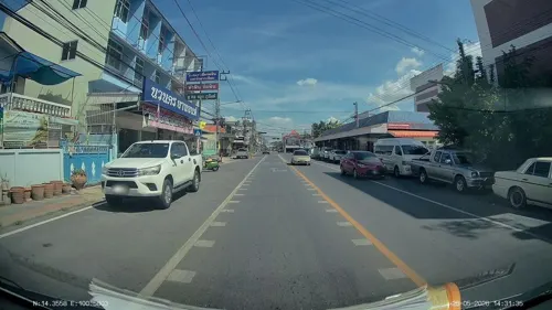
- Street-level photo, ThailandCambodia, CC BY-SA 4.0
- Street-level photo, ThailandCambodia, CC BY-SA 4.0
- Street-level photo, ThailandCambodia, CC BY-SA 4.0
- Street-level photo, ThailandCambodia, CC BY-SA 4.0
- Street-level photo, ThailandCambodia, CC BY-SA 4.0
- Street-level photo, ThailandCambodia, CC BY-SA 4.0
- Street-level photo, ThailandCambodia, CC BY-SA 4.0
- Street-level photo, ThailandCambodia, CC BY-SA 4.0
- Street-level photo, ThailandCambodia, CC BY-SA 4.0
- Street-level photo, InadaYuka, CC BY-SA 4.0
- Street-level photo, ozflor, CC BY-SA 4.0


Page built November 10, 2026. Spotted a mistake? Tell us or suggest a place.