


Bang Bua Thong, Thailand
เทศบาลนครบางบัวทอง
Bang Bua Thong is a town of 41,567 people in Nonthaburi, Thailand, founded in March 14, 1938.
Why visit Bang Bua Thong
Townapedia lists 3 places to eat in and around town.
Weather in Bang Bua Thong
Forecast from MET Norway (CC BY 4.0). Full forecast
About Bang Bua Thong
Bang Bua Thong (Thai: บางบัวทอง, pronounced [bāːŋ būa̯ tʰɔ̄ːŋ]) is a city in Thailand's Bangkok Metropolitan Region.
From the Wikipedia article Bang Bua Thong (this version), under CC BY-SA 4.0.
Restaurants and cafes3

Sathaniyang
Restaurant · Thai Bbq, Drinks, Asian, Chicken, Thai, Steak House, Barbecue, Fries, Sausage, Juice, Wings, Thai Bbk, Regional · 1.5 km
หมูกระทะ-ร้านอาหาร-เครื่องดื่ม-นั่งชิล
โยธาธิการ นนทบุรี 2003
Mo-Su 17:00-24:00

Churches and places of worship3

Wat Borom Racha Kanchana Phi Sek Anuson
Place of worship · 0.6 km
Mo-Fr 08:00-17:00, Sa-Su 08:00-18:00


Shopping2

บัวทองเบเกอรี่ Buathongbakery สาขาเเยกไทรน้อย
Grocery · 1.4 km
888/32 ถนนกาญจนาภิเษก, ตำบลบางบัวทอง
Gas and EV charging1
Schools, colleges and libraries3
Healthcare1
Map of Bang Bua Thong
13 places. The map loads OpenStreetMap tiles when you open it.
Getting there and nearby towns
Don Mueang International Airport (DMK) is the nearest airport with scheduled flights listed in OpenStreetMap, 19 km away.
- Pak Kret 8 km east, about 8 min by car
- Mueang Nonthaburi 12 km southeast, about 12 min by car
- Bang Kruai 14 km southeast, about 14 min by car
- Taling Chan 16 km south, about 16 min by car
- Bang Sue 17 km southeast, about 17 min by car
- Lak Si 17 km east, about 17 min by car
- Chatuchak 18 km southeast, about 18 min by car
- Bangkok Noi 18 km south, about 18 min by car
- Bangkok 20 km southeast, about 20 min by car
- Dusit 19 km southeast, about 19 min by car
Drive times are estimates from straight-line distance, not routes.
Towns near Bang Bua Thong


Keep exploring
Local news
Headlines from INDB.
Reviews, tips and questions
Loading what members have shared...
Sources and licences
- GeoNames (CC BY 4.0): population, coordinates, regions and time zone
- Mapillary (see each image): photos
- OpenStreetMap contributors (ODbL 1.0): places, airports, map data
- Wikidata (CC0 1.0): elevation, founding date, time zone, website
- Wikimedia Commons (see each image): photos
- Wikipedia (CC BY-SA 4.0): overview and history text
Photo credits
- วัดบรมราชากาญจนาภิเษก - panoramio, easy4444, CC BY 3.0
- วัดเล่งเน่ยยี่ 2 - panoramio, easy4444, CC BY 3.0
- Wat Borom Racha Kanchana Phi Sek Anuson, Thanate Tan, CC BY 2.0
- Thai Signature, Siriwan Suebnukarn, CC BY-SA 4.0
- Nonthaburi - Bangbuathong, Perjonasson, CC BY-SA 4.0
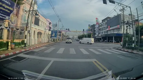
- Street-level photo, ThailandCambodia, CC BY-SA 4.0
Page built November 10, 2026. Spotted a mistake? Tell us or suggest a place.