


Bang Khun Thian, Thailand
เขตบางขุนเทียน
Bang Khun Thian is a city of 165,491 people in Bangkok, Thailand.
Why visit Bang Khun Thian
Townapedia lists 35 museums and landmarks, 47 parks and trails, 196 places to eat, 21 places to stay and 26 attractions in and around town.
Highlights include Bhumibol Bridge, Chaloem Phan 53 Bridge, Baan Kudichin Museum and Berlin Pharmaceutical Museum.
Weather in Bang Khun Thian
Forecast from MET Norway (CC BY 4.0). Full forecast
About Bang Khun Thian
Bang Khun Thian (Thai: บางขุนเทียน, pronounced [bāːŋ kʰǔn tʰīan]) is one of the 50 districts (khet) of Bangkok, Thailand. Its neighbors, clockwise from the north, are Bang Bon, Chom Thong, and Thung Khru Districts of Bangkok, Phra Samut Chedi district of Samut Prakan province and Mueang Samut Sakhon district of Samut Sakhon province. Bang Khun Thian is Bangkok's southernmost district, and the only one bordering the Bay of Bangkok (upper Gulf of Thailand).
From the Wikipedia article Bang Khun Thian district (this version), under CC BY-SA 4.0.
Photos of Bang Khun Thian

Things to do26


Kanchanaphisek Bridge
Bridge · 11.7 km
Thai road bridge over the Chao Phraya


Memorial Bridge
Bridge · 10.9 km
Bridge crossing Chao Phraya River, Thailand

Phitthaya Sathian Bridge
Bridge · 11.6 km
Bridge in Bangkok, Thailand

Phra Pok Klao Bridge
Bridge · 10.9 km
Road bridge in Bangkok, Thailand

14 more on the map.
Museums and landmarks35


Berlin Pharmaceutical Museum
Museum · 12.0 km
Medical museum in Bangkok, Thailand

Grand Palace
Museum · 11.5 km
Official residence of the King of Thailand since 1782


Queen Sirikit Museum of Textiles
Museum · 11.6 km
History museum, Textile museum in Grand Palace, Bangkok

Saha Chat monument
Monument and historic site · 11.7 km
Monument in Phra Nakhon district, Bangkok

Silpa Bhirasri National Museum
Museum · 11.7 km
Modern art museum in Bangkok, Thailand

Silpakorn University Art Gallery
Museum · 11.7 km
Art gallery and museum in Bangkok, Thailand

Baan Kao Lao Rueng Museum
Museum · 12.1 km
History museum in Bangkok, Thailand
Pavilion of Regalia, Royal Decorations and Coins
Museum · 11.6 km
Museum in Bangkok, Thailand
23 more on the map.
Parks, trails and playgrounds47


Chao Phraya Sky Park
Park · 10.9 km
Elevated park in Bangkok, Thailand


Princess Mother Memorial Park
Park · 10.8 km
Park in Bangkok, Thailand



Thian Thale Phatthana Phrueksa Phirom Park
Park · 4.8 km
Park in Bangkok, Thailand
สวนสาธารณะเฉลิมพระเกียรติฯ บางบอน
Park · 4.4 km
อาณาจักรธรรมชาติย่านบางบอน ที่จัดแสดงโครงการพระราชดำริของพระบาทสมเด็จพระเจ้าอยู่หัวภูมิพลอดุลยเดช 9 ภายใต้แนวคิด “สวน 9 เนิน...
Uncle Sorn's Park
Park · 9.0 km
พื้นที่สีเขียวประเภทสวน ลุงศรณ์ เป็นชาวสวนคนเดียวในบางกอกใหญ่ที่ลงทะเบียนเป็นเกษตรกรในเขตบางกอกใหญ่...
35 more on the map.
Restaurants and cafes196
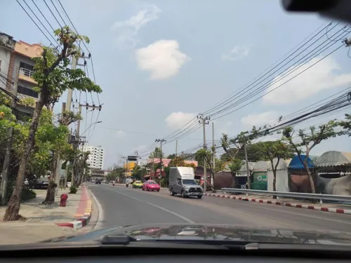
ซือหวังสุกี้หม่าล่า สาขาพุทธบูชา-บางมด
Restaurant · Chinese, Grill · 5.4 km
ร้านสุกี้หม่าล่าสายพานสูตรพิเศษ เพิ่มเตาปิ้งย่างฟรี บุฟเฟ่ต์น้ำจิ้งด้วยนะ คัดสรรค์มาเพื่อลูกค้าโดยเฉพาะ...
266/4 ถนนพุทธบูชา, บางมด
Mo-Su 11:00-02:00
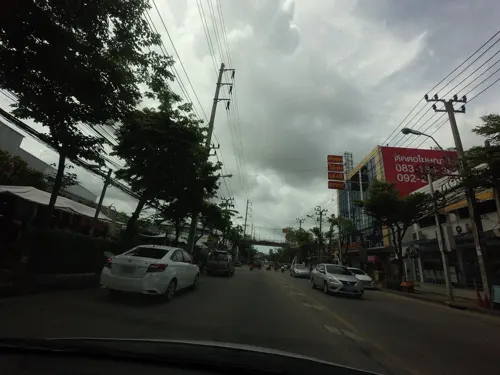
Baan Pakistan
Restaurant · 7.3 km
Charming little restaurant in a beautifully renovated wooden boat with Mediterranean, Indian, and Thai dishes
Mo-Su 10:00-21:00
Cocoa Village by Heart Village
Cafe · 4.9 km
Cocoa café and art studio
Mo, Tu, Th, Fr 12:00-20:00; Sa, Su 09:00-18:00

BBQ house & Hotpot
Restaurant · 9.0 km
All-you-can-eat buffet of grill and/or hot pot
2128/10-11 Charoenkrung Road Wat Prayakrai Bangkorleam
Mo-Su 16:00-23:00

Bar Craft O'Clock
Bar and pub · 8.1 km
Craft and imported beer, Thai and Western dishes, Savory bakeries
ถนนเพชรเกษม 69
Mo-Su 16:00-01:00

กาโตว์ เฮ้าส์ ปั๊มซัสโก้ วัดยายร่ม
Cafe · Bakery · 3.7 km
595 ถนนพระรามที่ 2, แขวงบางมด
Mo-Su 08:00-19:00
184 more on the map.
History
Bang Khun Thian is an old district, believed to have been established in 1867 as an amphoe of Thonburi.
In 1972, Thonburi and Phra Nakhon Provinces were combined into Bangkok metropolis. Administrative units in the newly combined capital province were renamed from amphoe and tambon to "district" (khet) and "sub-district" (khwaeng). Thus, Bang Khun Thian became a district of Bangkok, composed of seven sub-districts: Bang Khun Thian, Bang Kho, Chom Thong, Bang Mot, Tha Kham, Bang Bon, and Samae Dam.
Due to population increases, a portion of Bang Khun Thian district was set up with its own district office and called Bang Khun Thian Branch 1. This new unit oversaw four sub-districts: Bang Khun Thian, Bang Kho, Bang Mot, and Chom Thong. In 1989, Bang Khun Thian Branch 1 was made a full district called Chom Thong District. In 1997, Bang Bon sub-district was separated from Bang Khun Thian and became its own district.
From the History section of Bang Khun Thian district on Wikipedia, under CC BY-SA 4.0.
More about Bang Khun Thian
Economy
Bang Khun Thian, particularly its Tha Kham Sub-district, is a centre of seafood aquaculture, mostly shrimp. Most of Tha Kam's residents—70 to 80%—are aquaculture farmers and aquaculture occupies much of the district's land area. The industry is jeopardised by coastal erosion—the shoreline has retreated more than a kilometre since 1952—and since 2009, wastewater pollution has negatively impacted cultivation and farmer incomes have declined by 30–90 percent.
From the Wikipedia article Bang Khun Thian district, under CC BY-SA 4.0.
Notable people from Bang Khun Thian
- Chin SophonpanichThai banker (1910-1988)
Born in Bang Khun Thian, according to Wikidata (CC0). Each name links to its Wikipedia article.
Where to stay21
Yu ga Chan Guest House
Motel and hotel · 9.1 km
513/97 Pradu 31 Alley, uni villa soi 9
Churches and places of worship52
Wat Bang Khun Thian Nok
Place of worship · Thai Mahanikaya · 5.1 km
1 หมู่ 7 Chom Thong 19
Wat Kiat Pradit
Place of worship · Thai Mahanikaya · 6.5 km
30/68 ซอยสุขสวัสดิ์ 11
Wat Nang Ratchaworawihan
Place of worship · Thai Mahanikaya · 5.8 km
ซอยวุฒากาศ 42
Wat Ratcha-orasaram Ratchaworawihan
Place of worship · Thai Mahanikaya · 5.5 km
เอกชัย, จอมทอง
Wat Yai Rom
Place of worship · Thai Mahanikaya · 3.6 km
24 ซอยพระรามที่ 2 ซอย 33
Wat Bang Khun Thian Klang
Place of worship · Thai Mahanikaya · 5.1 km
Shopping92
Bakery Maker
Grocery · 3.3 km
88/44-45 สำเพ็ง 2 (ปากซอย 1) ถนนกัลปพฤกษ์, แขวงบางแค
Big C
Grocery · 6.6 km
1050 แขวงบุคคโล เขตธนบุรี สมเด็จพระเจ้าตากสิน, กรุงเทพมหานคร
Gas and EV charging45
Schools, colleges and libraries52
Healthcare49
Emma Clinic (Rama 2)
Clinic and pharmacy
129/328-329 ถนนบางขุนเทียน, กรุงเทพมหานคร
Map of Bang Khun Thian
250 places. The map loads OpenStreetMap tiles when you open it.
Getting there and nearby towns
Don Mueang International Airport (DMK) is the nearest airport with scheduled flights listed in OpenStreetMap, 33 km away.
- Phasi Charoen 6 km north, about 6 min by car
- Thon Buri 9 km northeast, about 9 min by car
- Nong Khaem 10 km northwest, about 10 min by car
- Bangkok Noi 12 km northeast, about 12 min by car
- Bangkok 12 km northeast, about 12 min by car
- Taling Chan 13 km north, about 13 min by car
- Dusit 16 km northeast, about 16 min by car
- Samut Prakan 19 km east, about 19 min by car
- Mueang Nonthaburi 24 km north, about 24 min by car
- Pak Kret 29 km north, about 29 min by car
Drive times are estimates from straight-line distance, not routes.
Towns near Bang Khun Thian


Keep exploring
Local news
Headlines from INDB.
Reviews, tips and questions
Loading what members have shared...
Sources and licences
- GeoNames (CC BY 4.0): population, coordinates, regions and time zone
- Mapillary (see each image): photos
- OpenStreetMap contributors (ODbL 1.0): places, airports, map data
- Wikidata (CC0 1.0): elevation, founding date, time zone, website, landmarks and historic places
- Wikimedia Commons (see each image): photos
- Wikipedia (CC BY-SA 4.0): overview and history text
Photo credits
- Rama II road at Central Rama II, Manop, CC BY-SA 3.0
- Rama II Road, Bang Khun Thian, Thanapas.som, CC BY-SA 4.0
- Bhumibol 2020, Jean pierre Grosset, CC BY-SA 4.0
- สะพานเฉลิมพันธุ์ ๕๓ มกราคม 2563 01, Chainwit., CC BY-SA 4.0
- สะพานช้างโรงสี Saphan Chang Rong Si Bridge (October 2021) - img 01, Chainwit., CC BY-SA 4.0
- Charoenpadana bridge, Sry85, CC BY-SA 4.0
- สะพานเจริญรัช 31, BerryJ, CC BY-SA 3.0
- Kan0424, Toneder, Public domain
- สะพานดำรงสถิต969, CKasa, CC BY-SA 3.0
- Bkksaphanphut0609, Heinrich Damm ( User:Hdamm , Hdamm at de.wikipedia.org ), CC BY 2.0
- Chai Phatthanasilp ชัยพัฒนศิลป์ 01, Chainwit., CC BY-SA 4.0
- 2022 January - Phra Pokklao Bridge, Chainwit., CC BY-SA 4.0
- Baan Kudichin Museum (2026) 01, Medelam, CC BY-SA 4.0
- Grand Palace Bangkok, Thailand, Andy Marchand, CC BY-SA 3.0
- Queen Sirikit Museum of Textiles 2, Vano111ru, CC BY-SA 4.0
- อนุสาวรีย์หมู (สหชาติ) - Pig Monument, Bangkok (October 2021) - img 05, Chainwit., CC BY-SA 4.0
- Silpa Bhirasri National Museum พิพิธภัณฑสถานแห่งชาติ ศิลป์ พีระศรี อนุสรณ์ (2020) - img 04, Chainwit., CC BY-SA 4.0
- Bkksilpakorn0306a, Hdamm, CC BY-SA 3.0
- NarongchaiV 1018-02-0008, Narongchaiv, CC BY-SA 3.0
- Bangkok Suan Romaninart Park IMG 6834, Bjoertvedt, CC BY-SA 4.0
- น้ำพุพานโลหะ สวนสราญรมย์ Bronze Fountain of Saransom Park, Chainwit., CC BY-SA 4.0
- Samray Church, Bangkok 1 2, dahlfred, CC BY-SA 3.0
- Assumption Cathedral Bangkok 2023-10 อาสนวิหารอัสสัมชัญ, Chainwit., CC BY-SA 4.0
- Wat Karawah (cropped), Supanut Arunoprayote, CC BY 4.0
- Tampak Depan Gereja Santa Cruz Kudi Chin (2026) 02, Medelam, CC BY-SA 4.0
- Bkkwangthaphra0603e, Hdamm, CC BY-SA 3.0
- NV 1035-02-0011, Narongchaiv, CC BY-SA 3.0
- CentralPlaza Rama 2 Bangkok 01.02.2018, Tvcccp, CC BY-SA 4.0
- โรงพยาบาลนครธน 03, Dharmadana, CC BY-SA 4.0
- Asiatique The Riverfront - A wharf02, Wakorinda, CC BY-SA 4.0
- พระอุโบสถ วัดหนังราชวรวิหาร (1), กสิณธร ราชโอรส, CC BY-SA 3.0
- Seacon Bangkae, This Photo was taken by Supanut Arunoprayote . Feel free to use any of my images, but please mention me as the author and may send me a message. (สามารถใช้ภาพได้อิสระ..., CC BY-SA 4.0
- วัดบางขุนเทียนนอก เขตจอมทอง กรุงเทพมหานคร (23), กสิณธร ราชโอรส, CC BY-SA 4.0
- วัดบางขุนเทียนใน เขตจอมทอง กรุงเทพมหานคร (6), กสิณธร ราชโอรส, CC BY-SA 4.0
- วัดบางขุนเทียนกลาง เขตจอมทอง กรุงเทพมหานคร (6), กสิณธร ราชโอรส, CC BY-SA 4.0
- วัดเกียรติประดิษฐ์ 02, Dharmadana, CC BY-SA 4.0
- วัดบางบอน เขตบางบอน กรุงเทพมหานคร (13), กสิณธร ราชโอรส, CC BY-SA 4.0
- วัดยายร่ม, Dharmadana, CC BY-SA 4.0
- โรงพยาบาลสมเด็จพระปิ่นเกล้า, Dharmadana, CC BY-SA 4.0
- Seacon Bangkae 06.23, This Photo was taken by Supanut Arunoprayote . Feel free to use any of my images, but please mention me as the author and may send me a message. (สามารถใช้ภาพได้อิสระ..., CC BY 4.0
- Thonburirompark1, Chanada.tham, CC BY-SA 4.0
- สะพานหัน 2564 Saphan Han (October 2021) - img 01, Chainwit., CC BY-SA 4.0
- Bangkok 2014 PD 087, Bin im Garten, CC BY 3.0
- Chao Phraya Sky Park เจ้าพระยาสกายปาร์ค สวนลอยฟ้าเจ้าพระยา (October 2021) - img 19, Chainwit., CC BY-SA 4.0
- สวนเพชร1, Phoebus 28, CC BY-SA 4.0
- Berlin Pharmaceutical Museum, Bangkok, Thailand, C411978, CC0
- WatNuannoraditSchoolEmblem, Wat Nuannoradit School, Public domain
- วิทยาลัยพณิชยการธนบุรี, Dharmadana, CC BY-SA 4.0
- King Rama VI Museum, Phra Borom Maha Ratchawang subdistrict, Phra nakhon, Bangkok, Thailand - panoramio, trungydang, CC BY 3.0
- Street-level photo, kasetitkml_pipitchai, CC BY-SA 4.0
- Street-level photo, kasetitkml_pipitchai, CC BY-SA 4.0
- Street-level photo, kasetitkml_pipitchai, CC BY-SA 4.0
- Street-level photo, kasetitkml_pipitchai, CC BY-SA 4.0
- Street-level photo, mishari, CC BY-SA 4.0
- Street-level photo, kasetitkml_pipitchai, CC BY-SA 4.0
- Street-level photo, noonishere, CC BY-SA 4.0
- Street-level photo, kirana, CC BY-SA 4.0
- Street-level photo, ThailandCambodia, CC BY-SA 4.0
- Street-level photo, poramet, CC BY-SA 4.0
- Street-level photo, kasetitkml_pipitchai, CC BY-SA 4.0
- Street-level photo, mishari, CC BY-SA 4.0


Page built November 10, 2026. Spotted a mistake? Tell us or suggest a place.