


Huai Khwang, Thailand
เขตห้วยขวาง
Huai Khwang is a town of 78,175 people in Bangkok, Thailand.
Why visit Huai Khwang
Townapedia lists 27 museums and landmarks, 43 parks and trails, 258 places to eat, 65 places to stay and 14 attractions in and around town.
Highlights include Chaliam La 56 bridge, Chulalongkorn University Auditorium, Bangkok Art and Culture Centre and Jim Thompson House.
Weather in Huai Khwang
Forecast from MET Norway (CC BY 4.0). Full forecast
About Huai Khwang
Huai Khwang (Thai: ห้วยขวาง, pronounced [hûa̯j kʰwǎːŋ]) is one of the 50 districts (khet) of Bangkok, Thailand. It is east of the city centre. Neighbouring districts are Chatuchak, Wang Thonglang, Bang Kapi, Suan Luang, Watthana, Ratchathewi, and Din Daeng.
From the Wikipedia article Huai Khwang district (this version), under CC BY-SA 4.0.
Photos of Huai Khwang


Things to do14


Chulalongkorn University Auditorium
Cinema and theater · 6.6 km
Chulalongkorn University Auditorium is the main auditorium of Chulalongkorn University in Bangkok, Thailand

Dan Neramit
Monument and historic site · 5.1 km
Amusement park in Thailand

Green Bridge
Bridge · 5.6 km
Elevated cycle and footpath in Bangkok, Thailand


Sea Life Bangkok Ocean World
Zoo and aquarium · 5.8 km
Aquarium in Bangkok, Thailand

Happyland
Monument and historic site · 6.7 km
Former amusement park in Bangkok, Thailand

2 more on the map.
Museums and landmarks27

Bangkok Art and Culture Centre
Museum · 6.2 km
Art museum and cultural center in Bangkok


Nai Lert Park Heritage Home
Museum · 4.8 km
Historic house museum in Bangkok, Thailand

Science Center for Education
Museum · 6.3 km
Science museum in Bangkok, Thailand



Children's Discovery Museum
Museum · 4.2 km
Museum in Bangkok, Thailand
Queen Savang Vadhana Museum
Museum · 5.8 km
History museum in Bangkok, Thailand
15 more on the map.
Parks, trails and playgrounds43

Benjakitti Park
Park · 5.7 km
Park in the Khlong Toei District of central Bangkok


Chatuchak Park
Park · 4.3 km
Public park just north of Chatuchak Weekend Market



Chak Phupha Su Maha Nathee Park
Park · 4.3 km
Park in Bangkok, Thailand
31 more on the map.
Restaurants and cafes258
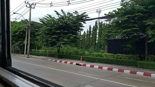
amphawa นาคนิวาส
Restaurant · Thai, Regional · 3.7 km
ร้านอาหารไทย วิถีพื้นบ้าน
45, 48 ซอยนาคนิวาส 1, แขวงลาดพร้าว
Mo-Su 10:00-22:00
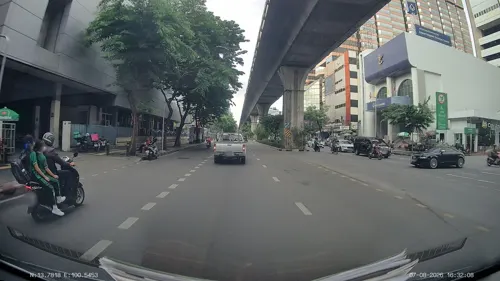
Lively Machine Ratchadapisek 24
Cafe · Coffee Shop, International · 2.4 km
44-45 Ratchadapisek
Mo-Su 07:00-17:00
Mama Bingsu , Bangkok 10310, Thaïlande
Cafe · Bingsu, Coffee Shop, Ice Cream · 2.4 km
999/166 Condo Than Living Ratchada-Prachauthit Ramkhamhaeng Soi, 39, Prachauthit Road, whangthonglang, Wang Thonglang
10:00-22:30

Kyuka Izakaya
Restaurant · Japanese · 3.4 km
KYUKA Izakaya (きゅうか ) is not a regular Japanese restaurant, but space for people to gather up and share delicious eats and happiness.
Lat Phrao District
18:00-01:00
Kuaytiew LaapMueng Krungthep Mahanakorn
Restaurant · Burger, Chicken · 2.4 km
81 ซอยวิภาวดีรังสิต 16/35 ( MRt รัชดา 19), แขวงดินแดง
Mo-Su 09:30-20:00
Sukee Mala Hotpot
Restaurant · Chinese · 2.1 km
Belle, Rama IX Rd, Khwaeng Huai Khwang, Khet Huai Khwang
Mo-Su 17:00-22:00

246 more on the map.
History
Huai Khwang district was established in an area formerly part of Phaya Thai in 1973. Adjustments to the district were made in 1978, adjusting boundaries with neighboring districts Phaya Thai and Bang Kapi, and again in 1993, creating the new Din Daeng District.
The name "Huai Khwang" literally means "barricaded creek" (huai meaning creek, and khwang meaning barricaded), as the area was once made up of wetlands and small waterways; in the past, canals (also known as khlongs) were the primary means of transport.
Today, the district has become a popular destination for a new generation of Chinese immigrants, earning it the nickname "New Chinatown", to distinguish it from Bangkok's traditional Chinatown in Yaowarat, located in the Samphanthawong district.
In July 2026, officers at Huai Khwang Police Station were found to be wearing badges with dragon symbols without authorization for the past 3 to 4 years, leading to widespread social media criticism. Metropolitan Police Bureau 1 subsequently ordered all stations under its jurisdiction to remove the dragon-shaped shoulder badges from their uniforms.
From the History section of Huai Khwang district on Wikipedia, under CC BY-SA 4.0.
More about Huai Khwang
Economy
Nok Mini (formerly SGA Airlines) has its headquarters in the district.
Thai Sky Airlines formerly had its head office in Room 708 of the 7th floor of the Le Concorde Tower in Huai Khwang District.
From the Wikipedia article Huai Khwang district, under CC BY-SA 4.0.
Where to stay65
1989 Hostel & Café
Motel and hotel · 2.4 km
19 65/2 Ratchada Soi 19 Road Din Daeng
Churches and places of worship22
Ganesha Shrine at Huai Khwang intersection
Place of worship · 0.6 km
ถนนรัชดาภิเษก
Wat Phra Ram 9 Kanchanaphisek
Place of worship · Thai Thammayut · 2.5 km
Shopping55
Growpets โกรว์เพ็ทช็อป สาขาลาดพร้าววังหิน
Grocery · 3.2 km
99/188 ซอยลาดพร้าววัังหิน 13
Gas and EV charging27
Schools, colleges and libraries58
Healthcare51
Map of Huai Khwang
250 places. The map loads OpenStreetMap tiles when you open it.
Getting there and nearby towns
Don Mueang International Airport (DMK) is the nearest airport with scheduled flights listed in OpenStreetMap, 15 km away.
- Din Daeng 2 km northwest, about 2 min by car
- Wang Thonglang 4 km east, about 4 min by car
- Lat Phrao 4 km northeast, about 4 min by car
- Watthana 5 km south, about 5 min by car
- Chatuchak 6 km north, about 6 min by car
- Bang Sue 6 km northwest, about 6 min by car
- Dusit 6 km west, about 6 min by car
- Bangkok 9 km west, about 9 min by car
- Bang Kapi 7 km east, about 7 min by car
- Khlong Toei 7 km south, about 7 min by car
Drive times are estimates from straight-line distance, not routes.
Towns near Huai Khwang


Keep exploring
Local news
Headlines from INDB.
Reviews, tips and questions
Loading what members have shared...
Sources and licences
- GeoNames (CC BY 4.0): population, coordinates, regions and time zone
- Mapillary (see each image): photos
- OpenStreetMap contributors (ODbL 1.0): places, airports, map data
- Wikidata (CC0 1.0): elevation, founding date, time zone, website, landmarks and historic places
- Wikimedia Commons (see each image): photos
- Wikipedia (CC BY-SA 4.0): overview and history text
Photo credits
- Huai Khwang Station concourse level (2), NC-MyLifeArm, CC BY-SA 4.0
- Huai Khwang Station concourse level (1), NC-MyLifeArm, CC BY-SA 4.0
- Huai Khwang Station platform level (2), NC-MyLifeArm, CC BY-SA 4.0
- Huai Khwang Station platform level (1), NC-MyLifeArm, CC BY-SA 4.0
- Huai Khwang Station MRT สถานี ห้วยขวาง (April2021) 02, Chainwit., CC BY-SA 4.0
- Huai Khwang Station MRT สถานี ห้วยขวาง (April2021) 01, Chainwit., CC BY-SA 4.0
- April 2021 ห้วยขวาง กรุงเทพมหานคร Huai Khwang Bangkok 02, Chainwit., CC BY-SA 4.0
- April 2021 ห้วยขวาง กรุงเทพมหานคร Huai Khwang Bangkok 01, Chainwit., CC BY-SA 4.0
- Ganesh Shrine at Huai Khwang, Bangkok ศาลพระพิฆเนศ สี่แยกห้วยขวาง (April2021) 05, Chainwit., CC BY-SA 4.0
- Ganesh Shrine at Huai Khwang, Bangkok ศาลพระพิฆเนศ สี่แยกห้วยขวาง (April2021) 04, Chainwit., CC BY-SA 4.0
- Ganesh Shrine at Huai Khwang, Bangkok ศาลพระพิฆเนศ สี่แยกห้วยขวาง (April2021) 08, Chainwit., CC BY-SA 4.0
- Ganesh Shrine at Huai Khwang, Bangkok ศาลพระพิฆเนศ สี่แยกห้วยขวาง (April2021) 01, Chainwit., CC BY-SA 4.0
- Ganesh Shrine at Huai Khwang, Bangkok ศาลพระพิฆเนศ สี่แยกห้วยขวาง (April2021) 07, Chainwit., CC BY-SA 4.0
- Ganesh Shrine at Huai Khwang, Bangkok ศาลพระพิฆเนศ สี่แยกห้วยขวาง (April2021) 06, Chainwit., CC BY-SA 4.0
- Ganesh Shrine at Huai Khwang, Bangkok ศาลพระพิฆเนศ สี่แยกห้วยขวาง (April2021) 03, Chainwit., CC BY-SA 4.0
- Huai Khwang Station MRT สถานี ห้วยขวาง (April2021) 03, Chainwit., CC BY-SA 4.0
- Huai Khwang Station MRT สถานี ห้วยขวาง (April2021) 04, Chainwit., CC BY-SA 4.0
- Bangkok-Huai Khwang - Luckin Coffee (2026), Chainwit., CC BY 4.0
- Huai Khwang at night - panoramio, carbon60, CC BY-SA 3.0
- Samsen Nok, Huai Khwang, Bangkok 10310, Thailand - panoramio (1), song songroov, CC BY 3.0
- Samsen Nok, Huai Khwang, Bangkok 10310, Thailand - panoramio, song songroov, CC BY 3.0
- สะพานเฉลิมหล้า 56 เขตปทุมวัน กรุงเทพมหานคร (4), กสิณธร ราชโอรส, CC BY-SA 4.0
- Chulalongkorn University Auditorium, Supanut Arunoprayote, CC BY-SA 4.0
- สะพานเสาวนี, Jane3030, CC BY-SA 3.0
- Siam Ocean World, Terence Ong, CC BY 2.5
- Bangkok Art and Culture Centre building, Cush2k, CC BY-SA 3.0
- Jim Thompson House spirit house, BrokenSphere, CC BY 3.0
- Kamthieng, Flickr user: neajjean https://www.flickr.com/people/neajjean/, CC BY-SA 2.0
- Центр популяризации и развития научных знаний (20250430112057), MikSed, CC BY-SA 4.0
- Bkkwangsuanpakkardlp03, Heinrich Damm ( User:Hdamm , Hdamm at de.wikipedia.org ), CC BY 2.0
- Exterior of Thai Bank Museum (2026) 01, Medelam, CC BY-SA 4.0
- Bangkok Benjakiti Park 2, Mr.Peerapong Prasutr, CC BY-SA 4.0
- Benjasiri park, Lerdsuwa, CC BY-SA 3.0
- Chatuchak park, Lerdsuwa, CC BY-SA 3.0
- 2021 สวนชูวิทย์ Chuvit Garden, Chainwit., CC BY-SA 4.0
- Dusit Zoo bear statue, Ahoerstemeier, CC BY-SA 3.0
- Lumphini Park as seen from Dusit Arun (2025) - img 01, Chainwit., CC BY 4.0
- Парк Патхумвананурак (20250319120345), MikSed, CC BY-SA 4.0
- Santiphap Park 2, Mx. Granger, CC0
- สวนวชิรเบญจทัศ (สวนรถไฟ) IMG 7315, PEAK99, CC BY-SA 4.0
- Bangkok Thailand Temple (2026) 01, Medelam, CC BY-SA 4.0
- วัดพระมหาไถ่ April2021 Holy Redeemer Church Bangkok 05, Chainwit., CC BY-SA 4.0
- Mahavajiravut Building 06.23, This Photo was taken by Supanut Arunoprayote . Feel free to use any of my images, but please mention me as the author and may send me a message. (สามารถใช้ภาพได้อิสระ..., CC BY 4.0
- Srinakharinwirot University Bangkok Thailand April 2021, Chainwit., CC BY-SA 4.0
- Ganesh Shrine at Huai Khwang, Bangkok ศาลพระพิฆเนศ สี่แยกห้วยขวาง (April2021) 02, Chainwit., CC BY-SA 4.0
- Thai Army Sports Stadium, www.thai-fussball.com, CC BY 3.0
- Bangkok hospital building01, BDMS, Public domain
- CentralPlaza Grand Rama IX - Entrance, The original uploader was Magnamonkun at Thai Wikipedia ., CC BY 3.0
- ตึกโรงพยาบาลพระรามเก้า, Kookaroo, CC BY-SA 3.0
- NMR 1536, Noobythailand, CC BY-SA 4.0
- Regents-Bangkok, Aliciaregents, CC BY-SA 4.0
- วัดพระราม 9 กาญจนาภิเษก King Rama IX Golden Jubilee Temple (41), กสิณธร ราชโอรส, CC BY-SA 4.0
- เมรุวัดลาดพร้าว2562, Mythorn, CC BY-SA 4.0
- วัดอุทัยธาราม เขตห้วยขวาง กรุงเทพมหานคร (6), กสิณธร ราชโอรส, CC BY-SA 4.0
- วัดพรหมวงศาราม3, Dharmadana, CC BY-SA 4.0
- วัดใหม่ช่องลม 2, Dharmadana, CC BY-SA 4.0
- วัดกุนนทีรุทธาราม3, Dharmadana, CC BY-SA 4.0
- Nai Lert Park Heritage Home (2023 December) - img 01, Chainwit., CC BY 4.0
- Dan Neramit castle in 2005, ong from Seattle, USA, CC BY 2.0
- Green Bridge Lumpini-Banjakiti (11), กสิณธร ราชโอรส, CC BY-SA 4.0
- Street-level photo, ozflor, CC BY-SA 4.0
- Street-level photo, ThailandCambodia, CC BY-SA 4.0
- Street-level photo, kasetitkml_pipitchai, CC BY-SA 4.0
- Street-level photo, kasetitkml_pipitchai, CC BY-SA 4.0
- Street-level photo, ThailandCambodia, CC BY-SA 4.0
- Street-level photo, mishari, CC BY-SA 4.0
- Street-level photo, kasetitkml_pipitchai, CC BY-SA 4.0
- Street-level photo, jrcarlsen, CC BY-SA 4.0
- Street-level photo, mishari, CC BY-SA 4.0
- Street-level photo, mishari, CC BY-SA 4.0
- Street-level photo, toffy, CC BY-SA 4.0


Page built November 10, 2026. Spotted a mistake? Tell us or suggest a place.