


Weather in Mae Tha
Forecast from MET Norway (CC BY 4.0). Full forecast
About Mae Tha
Mae Tha (Thai: แม่ทา; IPA: [mɛ̂ː tʰāː]) is a district (amphoe) of Lamphun province, northern Thailand.
From the Wikipedia article Mae Tha district, Lamphun (this version), under CC BY-SA 4.0.
Churches and places of worship1

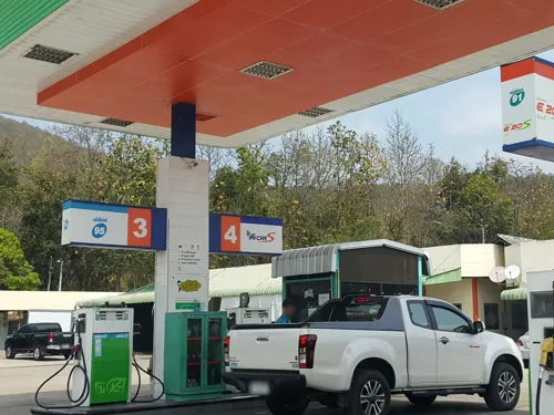
Gas and EV charging1
Schools, colleges and libraries1

Healthcare1

History
The minor district (king amphoe) Mae Tha was established in 1939, when it was split off from Mueang Lamphun district. It was upgraded to a full district on 22 July 1958.
From the History section of Mae Tha district, Lamphun on Wikipedia, under CC BY-SA 4.0.
More about Mae Tha
Geography
Neighboring districts are (from the south clockwise): Thung Hua Chang, Ban Hong, Pa Sang and Mueang Lamphun of Lamphun Province, Mae On of Chiang Mai province, Mueang Lampang, Hang Chat and Soem Ngam of Lampang province.
The Khun Tan Range stretches from north to south along the district.
From the Wikipedia article Mae Tha district, Lamphun, under CC BY-SA 4.0.
Map of Mae Tha
4 places. The map loads OpenStreetMap tiles when you open it.
Getting there and nearby towns
Chiang Mai International Airport (CNX) is the nearest airport with scheduled flights listed in OpenStreetMap, 38 km away.
- Lamphun 19 km northwest, about 19 min by car
- Pa Sang 22 km west, about 22 min by car
- San Kamphaeng 31 km north, about 31 min by car
- San Pa Tong 32 km northwest, about 32 min by car
- Hang Dong 34 km northwest, about 34 min by car
- Chiang Mai 40 km northwest, about 40 min by car
- Lampang 42 km southeast, about 42 min by car
- Chom Thong 49 km west, about 49 min by car
- Ban Aen Mai 72 km southwest, about 1 h 15 min by car
- Long 85 km southeast, about 1 h 30 min by car
Drive times are estimates from straight-line distance, not routes.
Towns near Mae Tha


Keep exploring
Local news
Headlines from INDB.
Reviews, tips and questions
Loading what members have shared...
Sources and licences
- GeoNames (CC BY 4.0): population, coordinates, regions and time zone
- Mapillary (see each image): photos
- OpenStreetMap contributors (ODbL 1.0): places, airports, map data
- Wikidata (CC0 1.0): elevation, founding date, time zone, website
- Wikimedia Commons (see each image): photos
- Wikipedia (CC BY-SA 4.0): overview and history text
Photo credits
- Вид из поезда (20260423075839), MikSed, CC BY-SA 4.0
- Sala Mae Tha Station Building, Tealsp, CC BY-SA 4.0
- Street-level photo, jrcarlsen, CC BY-SA 4.0
Page built November 10, 2026. Spotted a mistake? Tell us or suggest a place.