


Nong Bua Lamphu, Thailand
เทศบาลเมืองหนองบัวลำภู
Nong Bua Lamphu is a regional capital of 34,401 people in Nong Bua Lamphu, Thailand.
Why visit Nong Bua Lamphu
Townapedia lists 3 museums and landmarks, 1 park or trail, 9 places to eat, 7 places to stay and 4 attractions in and around town.
Highlights include Nussara Homstay.
Weather in Nong Bua Lamphu
Forecast from MET Norway (CC BY 4.0). Full forecast
About Nong Bua Lamphu
Nong Bua Lam Phu (Thai pronunciation: [nɔ̌ːŋ būa lām pʰūː]) is a town in Thailand, capital of Nong Bua Lamphu Province. It is on the central eastern border of the province, approximately 45 kilometers south-west of the city of Udon Thani and from there, accessed by route 210. The town lies 536 km north-north-east of Bangkok.
From the Wikipedia article Nong Bua Lamphu (this version), under CC BY-SA 4.0.
Travel tips from other travellers: Nong Bua Lamphu on Wikivoyage (CC BY-SA 4.0).
Photos of Nong Bua Lamphu


Things to do4



Museums and landmarks3

Nong Bua Lam Phu Observatory
Monument and historic site · 4.0 km
Mo-Su 08:30-20:30
Parks, trails and playgrounds1

Restaurants and cafes9
Kinaree Stake and House
Restaurant · Steak House, Thai, Lao, Local · 1.8 km
หนองบัวบำภู - อุดรธานี (210)
Mo-Su 06:00-21:00


Notable people from Nong Bua Lamphu
- Duangaksorn ChaideeThai weightlifter
- Naphat SeesraumThai footballer
- Isariya Maromassociation football player
Born in Nong Bua Lamphu, according to Wikidata (CC0). Each name links to its Wikipedia article.
Where to stay7
Churches and places of worship12
Shopping2
Gas and EV charging4
Schools, colleges and libraries2
Healthcare2
Map of Nong Bua Lamphu
46 places. The map loads OpenStreetMap tiles when you open it.
Getting there and nearby towns
Udon Thani International Airport (UTH) is the nearest airport with scheduled flights listed in OpenStreetMap, 42 km away.
- Nong Wua So 15 km east, about 15 min by car
- Kut Chap 28 km northeast, about 28 min by car
- Na Klang 29 km northwest, about 29 min by car
- Si Bun Rueang 32 km southwest, about 32 min by car
- Non Sang 40 km south, about 40 min by car
- Udon Thani 44 km northeast, about 44 min by car
- Erawan 53 km west, about 53 min by car
- Ban Phan Don 57 km east, about 57 min by car
- Nong Khai 82 km northeast, about 1 h 15 min by car
- Loei 82 km northwest, about 1 h 15 min by car
Drive times are estimates from straight-line distance, not routes.
Towns near Nong Bua Lamphu


Keep exploring
Local news
Headlines from INDB.
Reviews, tips and questions
Loading what members have shared...
Sources and licences
- GeoNames (CC BY 4.0): population, coordinates, regions and time zone
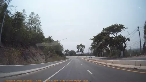
- Mapillary (see each image): photos
- OpenStreetMap contributors (ODbL 1.0): places, airports, map data
- Wikidata (CC0 1.0): elevation, founding date, time zone, website
- Wikimedia Commons (see each image): photos
- Wikipedia (CC BY-SA 4.0): overview and history text
Photo credits
- NongbuaLamphu SanLakMueang091223a, Me and yu, CC BY-SA 3.0
- วัดศรีคูณเมือง จังหวัดหนองบัวลำภู 02, อภิชิต พีรทิตยา, CC BY-SA 4.0
- วัดศรีคูณเมือง จังหวัดหนองบัวลำภู 01, อภิชิต พีรทิตยา, CC BY-SA 4.0
- วิวจากร้านอาหารบริเวณจุดพักรถเส้นทาง หนองบัวลำภู-อุดรธานี - panoramio, ::::=UT=::::, CC BY-SA 3.0
- ร้านกาแฟเล็กๆที่จุดพักบนเขาเส้นทางกลับไปอุดรธานี - panoramio, ::::=UT=::::, CC BY-SA 3.0
- บ้านกาแฟเชิงภู - panoramio, ::::=UT=::::, CC BY-SA 3.0
- วังบัวบาน@หนองบัวลำภู - panoramio, o_bankok, CC BY-SA 3.0
- บนภูพานน้อย - panoramio, ::::=UT=::::, CC BY-SA 3.0
- Street-level photo, kyoko, CC BY-SA 4.0
- Street-level photo, mapcreator, CC BY-SA 4.0
- Street-level photo, mapcreator, CC BY-SA 4.0
- Street-level photo, mapcreator, CC BY-SA 4.0
- Street-level photo, jrcarlsen, CC BY-SA 4.0
- Street-level photo, kyoko, CC BY-SA 4.0
- Street-level photo, mapcreator, CC BY-SA 4.0
- Street-level photo, mapcreator, CC BY-SA 4.0
- Street-level photo, mishari, CC BY-SA 4.0
Page built November 10, 2026. Spotted a mistake? Tell us or suggest a place.