


Phaya Thai, Thailand
เขตพญาไท
Phaya Thai is a town of 70,238 people in Bangkok, Thailand, founded in May 1, 1966.
Why visit Phaya Thai
Townapedia lists 66 museums and landmarks, 60 parks and trails, 214 places to eat, 51 places to stay and 35 attractions in and around town.
Highlights include Chaliam La 56 bridge, Chamai Maru Chet Bridge, Chatuchak Market and Wang Suan Phakkat.
Weather in Phaya Thai
Forecast from MET Norway (CC BY 4.0). Full forecast
About Phaya Thai
Phaya Thai (Thai: พญาไท, pronounced [pʰā.jāː tʰāj]) is a district in central Bangkok, Thailand. From the north clockwise, its neighbouring districts are: Bang Sue, Chatuchak, Din Daeng, Ratchathewi, and Dusit. Despite sharing a name, due to boundary changes, Phaya Thai Road and Phaya Thai BTS Station are in the adjoining Ratchathewi District.
From the Wikipedia article Phaya Thai district (this version), under CC BY-SA 4.0.
Things to do35


Chulalongkorn University Auditorium
Cinema and theater · 4.8 km
Chulalongkorn University Auditorium is the main auditorium of Chulalongkorn University in Bangkok, Thailand

Green Bridge
Bridge · 5.2 km
Elevated cycle and footpath in Bangkok, Thailand


National Theatre
Cinema and theater · 5.9 km
Theatre in Bangkok, Thailand

Chaloem Wan Chat bridge
Bridge · 4.9 km
Bridge and road intersection in Bangkok, Thailand
Chaturaphak Rangsarit Bridge
Bridge · 3.9 km
Bridge in Bangkok, Thailand
23 more on the map.
Museums and landmarks66

Chatuchak Market
Monument and historic site · 2.4 km
Sa-Su 09:00-18:00; We-Th 07:00-18:00; Fr 18:00-00:00

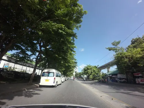
Thai Labour Museum
Museum · 3.1 km
Museum in Bangkok, Thailand
Ratchathewi Road

14 October 1973 Memorial
Monument and historic site · 5.4 km
Memorial in Thailand

Bangkok Art and Culture Centre
Museum · 4.0 km
Art museum and cultural center in Bangkok

Bangkok Corrections Museum
Museum · 5.5 km
Prison museum in Bangkok, Thailand


Berlin Pharmaceutical Museum
Museum · 5.5 km
Medical museum in Bangkok, Thailand

Democracy Monument
Monument and historic site · 5.1 km
Monument in Bangkok, Thailand

54 more on the map.
Parks, trails and playgrounds60


Benjakitti Park
Park · 5.9 km
Park in the Khlong Toei District of central Bangkok

Chatuchak Park
Park · 3.4 km
Public park just north of Chatuchak Weekend Market

Chulalongkorn University Centenary Park
Park · 5.0 km
Public park in Bangkok


Khlong Chong Nonsi Public Park
Park · 6.3 km
Park in Bangkok, Thailand


48 more on the map.
Restaurants and cafes214
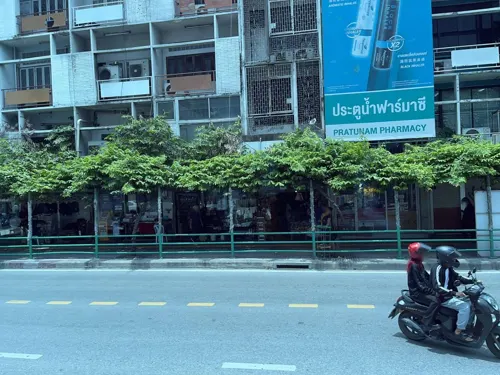
Everything Halal Restaurant
Restaurant · Indian, Pakistani, Burmese · 3.1 km
Everything Halal is a delightful restaurant serving an exquisite blend of Pakistani and Chettinad cuisine, tantalizing your taste buds...
120 89 Ratchaprarop 1 Alley
Mo-Su 10:00-22:00
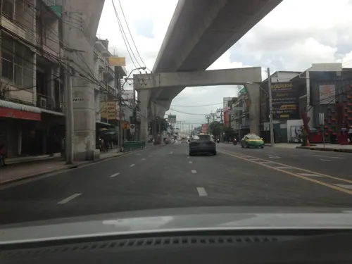
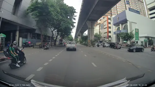
Aribica Specialty Coffee X Amplify Coffee Roasters
Cafe · Coffee Shop
Mo-Fr 07:00-17:30; Sa-Su 08:00-18:30


202 more on the map.
History
Phaya Thai district was set up in 1966 by taking areas that were part of Dusit and Bang Kapi Districts. It was named after Phaya Thai palace, which was built in 1909 at King Rama V's behest. Since then, many changes to the district have been made. In 1973, the Huai Khwang district was separated from Phaya Thai. Later in 1978, as an effort to balance the population among districts, the boundaries between Phaya Thai, Huai Khwang, and Bang Kapi Districts were modified. A new Ratchathewi district was created by carving off the southern part of Phaya Thai in 1989. In 1993, some eastern parts were moved out of the district to the newly-formed Din Daeng, leaving Phaya Thai with only one remaining sub-district, Sam Sen Nai.
Due to the split off of Ratchathewi, Phaya Thai Road is no longer in Phaya Thai District. It runs through Ratchathewi and Pathum Wan. Similarly, Phaya Thai BTS Station is in Ratchathewi, on Phaya Thai Road.
During the reign of King Rama VI, Phaya Thai was an area filled with military cantonments. "Sanam Pao" is another familiar name of the area, owing to the original name of Phahonyothin Road, the area's main thoroughfare, and also because it was once used as a military firing range.
From the History section of Phaya Thai district on Wikipedia, under CC BY-SA 4.0.
Notable people from Phaya Thai
 Francis Xavier Vira ArpondratanaThai Catholic archbishopPhoto: สิริชัย วงศ์ษา, CC0
- Samuth SithnaruepolThai boxer
Born in Phaya Thai, according to Wikidata (CC0). Each name links to its Wikipedia article.
Where to stay51
Churches and places of worship31
Shopping56
Tops Market Century Plaza
Grocery · 2.2 km
15 Phayathai Rd, Khwaeng Thanon Phaya Thai, Khet Ratchathewi, Krung Thep Maha Nakhon 10400
Gas and EV charging23
Schools, colleges and libraries59
King Mongkut's University of Technology North Bangkok
School · 5.4 km
Healthcare54
Map of Phaya Thai
250 places. The map loads OpenStreetMap tiles when you open it.
Getting there and nearby towns
Don Mueang International Airport (DMK) is the nearest airport with scheduled flights listed in OpenStreetMap, 16 km away.
- Dusit 3 km west, about 3 min by car
- Din Daeng 3 km east, about 3 min by car
- Bang Sue 4 km north, about 4 min by car
- Huai Khwang 4 km east, about 4 min by car
- Pom Prap Sattru Phai 4 km southwest, about 4 min by car
- Bangkok 5 km southwest, about 5 min by car
- Bang Phlat 4 km west, about 4 min by car
- Pathum Wan 5 km southwest, about 5 min by car
- Chatuchak 6 km north, about 6 min by car
- Bang Rak 6 km south, about 6 min by car
Drive times are estimates from straight-line distance, not routes.
Towns near Phaya Thai


Keep exploring
Local news
Headlines from INDB.
Reviews, tips and questions
Loading what members have shared...
Sources and licences
- GeoNames (CC BY 4.0): population, coordinates, regions and time zone
- Mapillary (see each image): photos
- OpenStreetMap contributors (ODbL 1.0): places, airports, map data
- Wikidata (CC0 1.0): elevation, founding date, time zone, website, landmarks and historic places
- Wikimedia Commons (see each image): photos
- Wikipedia (CC BY-SA 4.0): overview and history text
Photo credits
- Bangkok skytrain Saphan Khwal, Colocho, CC BY-SA 2.5
- สะพานเฉลิมหล้า 56 เขตปทุมวัน กรุงเทพมหานคร (4), กสิณธร ราชโอรส, CC BY-SA 4.0
- BKK Saphan Chamai Maruchet, Hdamm, CC BY-SA 3.0
- สะพานช้างโรงสี Saphan Chang Rong Si Bridge (October 2021) - img 01, Chainwit., CC BY-SA 4.0
- สะพานเจริญราษฎร์ 32, Dharmadana, CC BY-SA 4.0
- Chulalongkorn University Auditorium, Supanut Arunoprayote, CC BY-SA 4.0
- Krung Thong Bridge 05499, dsin_travel, CC BY 2.0
- สะพานดำรงสถิต969, CKasa, CC BY-SA 3.0
- โรงละครแห่งชาติ April2021 Thailand National Theatre Bangkok 01, Chainwit., CC BY-SA 4.0
- อนุสรณ์สถาน 14 ตุลา ถ่ายเมื่อกันยายน 2563 14 October 1973 Memorial 02, Chainwit., CC BY-SA 4.0
- Bangkok Art and Culture Centre building, Cush2k, CC BY-SA 3.0
- Mahachai,Correction Museum, Samran Rat,bangkok - panoramio, trungydang, CC BY 3.0
- Bangkok Kunsthalle - exterior (2026) - img 02, Chainwit., CC BY 4.0
- Bangkok National Museum, This Photo was taken by Supanut Arunoprayote . Feel free to use any of my images, but please mention me as the author and may send me a message. (สามารถใช้ภาพได้อิสระ..., CC BY 4.0
- 010-Democracy Monument, Nawit science, CC BY-SA 4.0
- Bangkok Benjakiti Park 2, Mr.Peerapong Prasutr, CC BY-SA 4.0
- Chatuchak park, Lerdsuwa, CC BY-SA 3.0
- CU100YearsPark2018, BunBn, CC BY-SA 4.0
- Dusit Zoo bear statue, Ahoerstemeier, CC BY-SA 3.0
- สวนสาธารณะคลองช่องนนทรี 01, Dharmadana, CC BY-SA 4.0
- Lumphini Park as seen from Dusit Arun (2025) - img 01, Chainwit., CC BY 4.0
- Парк Патхумвананурак (20250319120345), MikSed, CC BY-SA 4.0
- สวนหลวงพระราม 8 ๘, Phoebus 28, CC BY-SA 4.0
- Bangkok Suan Romaninart Park IMG 6834, Bjoertvedt, CC BY-SA 4.0
- Bangkokphrasumenfort03, Fotograf / Photographer: Heinrich Damm ( User:Hdamm , Hdamm at de.wikipedia.org ), CC BY 2.0
- Bangkok Thailand Temple (2026) 01, Medelam, CC BY-SA 4.0
- วัดพระมหาไถ่ April2021 Holy Redeemer Church Bangkok 05, Chainwit., CC BY-SA 4.0
- Wat Karawah (cropped), Supanut Arunoprayote, CC BY 4.0
- Conception Church, Bangkok, Supanut Arunoprayote, CC BY-SA 4.0
- Srinakharinwirot University Bangkok Thailand April 2021, Chainwit., CC BY-SA 4.0
- Bkkwangsuanpakkardlp03, Heinrich Damm ( User:Hdamm , Hdamm at de.wikipedia.org ), CC BY 2.0
- UTCC 2, Mx. Granger, CC0
- Chatuchak Market (8270018927), Ian Gratton from Sutton-n-Craven, North Yorkshire, England, CC BY 2.0
- The Baiyoke Tower II closeup in Bangkok, Thaliand, Paolobon140, CC0
- Place ParkQueenSirikit, Thanyakij, Public domain
- Santiphap Park 2, Mx. Granger, CC0
- Building 8 Samsenwittayalai, JasperVanHelpe, CC BY-SA 4.0
- วัดจอมสุดาราม เขตดุสิต กรุงเทพมหานคร (9), กสิณธร ราชโอรส, CC BY-SA 4.0
- วัดน้อยนพคุณ เขตดุสิต กรุงเทพมหานคร (5), กสิณธร ราชโอรส, CC BY-SA 4.0
- วัดอภัยทายาราม (วัดมะกอก) เขตราชเทวี กรุงเทพมหานคร (3), กสิณธร ราชโอรส, CC BY-SA 4.0
- วัดอัมพวัน เขตดุสิต กรุงเทพมหานคร (16), กสิณธร ราชโอรส, CC BY-SA 4.0
- วัดไผ่ตัน เขตพญาไท กรุงเทพมหานคร (24), กสิณธร ราชโอรส, CC BY-SA 4.0
- วัดกุนนทีรุทธาราม3, Dharmadana, CC BY-SA 4.0
- โรงพยาบาลรามาธิบดี, Sarawinmomo, CC BY-SA 4.0
- สะพานหัน 2564 Saphan Han (October 2021) - img 01, Chainwit., CC BY-SA 4.0
- Rajavithi Hospital 2019-10-06, Sry85, CC BY-SA 4.0
- Berlin Pharmaceutical Museum, Bangkok, Thailand, C411978, CC0
- Green Bridge Lumpini-Banjakiti (11), กสิณธร ราชโอรส, CC BY-SA 4.0
- วิทยาลัยแพทยศาสตร์พระมงกุฎเกล้า, Sean Schepers, CC0
- โรงพยาบาลพระมงกุฎเกล้า, Dharmadana, CC BY-SA 4.0
- วัดใหม่ทองเสน 1, Wachararwish, CC BY-SA 3.0
- Street-level photo, DriveWithHoang, CC BY-SA 4.0
- Street-level photo, ThailandCambodia, CC BY-SA 4.0
- Street-level photo, mishari, CC BY-SA 4.0
- Street-level photo, ratirat, CC BY-SA 4.0
- Street-level photo, ratirat, CC BY-SA 4.0
- Street-level photo, ratirat, CC BY-SA 4.0
- Street-level photo, jrcarlsen, CC BY-SA 4.0
- Street-level photo, ratirat, CC BY-SA 4.0
- Street-level photo, mishari, CC BY-SA 4.0
- Street-level photo, mishari, CC BY-SA 4.0
- Street-level photo, ratirat, CC BY-SA 4.0
- Street-level photo, ratirat, CC BY-SA 4.0
- Street-level photo, jrcarlsen, CC BY-SA 4.0
- Street-level photo, ratirat, CC BY-SA 4.0
- Street-level photo, ThailandCambodia, CC BY-SA 4.0
- Street-level photo, mishari, CC BY-SA 4.0


Page built November 10, 2026. Spotted a mistake? Tell us or suggest a place.