


Ratchathewi, Thailand
เขตราชเทวี
Ratchathewi is a town of 73,035 people in Bangkok, Thailand, founded in November 9, 1989.
Why visit Ratchathewi
Townapedia lists 136 museums and landmarks, 85 parks and trails, 136 places to eat, 33 places to stay and 39 attractions in and around town.
Highlights include Snake Farm of Queen Saovabha Memorial Institute, Chaloem Phan 53 Bridge, Jim Thompson House and Bangkok Art and Culture Centre.
Weather in Ratchathewi
Forecast from MET Norway (CC BY 4.0). Full forecast
About Ratchathewi
Ratchathewi (Thai: ราชเทวี, pronounced [râːt.t͡ɕʰā.tʰēː.wīː]) is a district (khet) in central Bangkok, Thailand. Clockwise from the north, its neighboring districts are Phaya Thai, Din Daeng, Huai Khwang, Watthana, Pathum Wan and Dusit.
From the Wikipedia article Ratchathewi district (this version), under CC BY-SA 4.0.
Photos of Ratchathewi

Things to do39

Snake Farm of Queen Saovabha Memorial Institute
Zoo and aquarium · 2.9 km
Mo-Fr 09:30-15:30; Sa-Su 09:30-13:00


Chulalongkorn University Auditorium
Cinema and theater · 2.3 km
Chulalongkorn University Auditorium is the main auditorium of Chulalongkorn University in Bangkok, Thailand

Green Bridge
Bridge · 3.4 km
Elevated cycle and footpath in Bangkok, Thailand


Memorial Bridge
Bridge · 4.4 km
Bridge crossing Chao Phraya River, Thailand


27 more on the map.
Museums and landmarks136


Bangkok Art and Culture Centre
Museum · 1.4 km
939 ถนนพระราม 1
Tu-Su 10:00-20:00
Open in Google Maps · Wikipedia · +66 2 214 6630;+66 2 214 6631;+66 2 214 6632;+66 2 214 6633;+66 2 214 6634;+66 2 214 6635;+66 2 214 6636;+66 2 214 6637;+66 2 214 6638

Golden Mount
Monument and historic site · 3.0 km
344 ถนนบริพัตร
Mo-Su 07:00-19:00

Sea Life Bangkok Ocean World
Monument and historic site · 1.3 km
Aquarium in Bangkok, Thailand
991 Rama 1 Rd
Mo-Su 10:00-21:00

Victory Monument
Monument and historic site · 0.8 km
Monument in Bangkok, Thailand


Bangkok Kunsthalle
Museum · 2.9 km
Art gallery in Bangkok, Thailand
599 ซอยพันธจิตต์


The Venerable Phra Achan Man Bhuridatto Museum at Wat Pathum Wanaram
Museum · 1.5 km
We-Su 08:00-17:00



Baan Kao Lao Rueng Museum
Museum · 3.1 km
History museum in Bangkok, Thailand
124 more on the map.
Parks, trails and playgrounds85


King Rama IX Memorial Park
Park · 1.8 km
Public Park in Bangkok
ถนนศรีอยุธยา, แขวงสวนจิตรลดา

Pathumwananurak Park
Park · 1.3 km
Public park in Bangkok, Thailand
5/1-5/40 ถนนราชดำริ, แขวงปทุมวัน


Chao Phraya Sky Park
Park · 4.4 km
Elevated park in Bangkok, Thailand

Chatuchak Park
Park · 5.9 km
Public park just north of Chatuchak Weekend Market

Chulalongkorn University Centenary Park
Park · 2.4 km
Public park in Bangkok


Khlong Chong Nonsi Public Park
Park · 3.8 km
Park in Bangkok, Thailand


73 more on the map.
Restaurants and cafes136
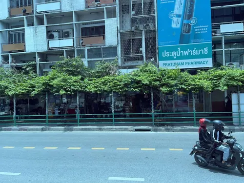
Everything Halal Restaurant
Restaurant · Indian, Pakistani, Burmese · 1.1 km
Everything Halal is a delightful restaurant serving an exquisite blend of Pakistani and Chettinad cuisine, tantalizing your taste buds...
120 89 Ratchaprarop 1 Alley
Mo-Su 10:00-22:00
Front Room
Restaurant · Thai · 2.0 km
Thai restaurant in Waldorf Astoria Bangkok.
151 ถนนราชดำริ, Pathum Wan
Mo-Su 11:30-15:00, 17:30-22:00
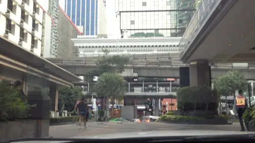
Balcony Lounge and Humidor Cigar Bar
Bar and pub · Cake, Coffee Shop, Tea · 1.8 km
973 ถนนเพลินจิต
Mo-Su 08:00-00:00
Bull & Bear
Restaurant · Steak House, Restaurant · 2.0 km
151 ถนนราชดำริ, Pathum Wan
Mo-Su 11:30-14:30,17:30-22:00

The Brasserie
Restaurant · French · 2.0 km
French restaurant in bangkok
151 ถนนราชดำริ, Pathum Wan
Mo-Su 06:30-10:30 11:30-15:00

CRAFT
Cafe · Cake, Coffee Shop, Donut, Ice Cream, International, Pancake · 2.6 km
78 ซอยต้นสน
Mo-Su 07:00-23:00
CityFresh centralwOrld
Cafe · Ice Cream, Juice, Cake · 1.5 km
5th Floor, Unit KC504 ถนนราชดำริ
Mo-Su 10:00-22:00
124 more on the map.
History
The district was part of Dusit district prior to 1966, and part of Phaya Thai District from 1966 to 1989, when it was elevated to its own district. The name is inherited from Ratchathewi Intersection, which is the intersection of Phetchaburi Road and Phaya Thai Road. The name originally comes from a royal consort to King Chulalongkorn, Phra Nangchao Sukumalmarsri Phra Ratchathewi. The term Phra Rachathewi (also spelled Phra Rajadevi) is a royal rank for royal consorts.
From the History section of Ratchathewi district on Wikipedia, under CC BY-SA 4.0.
More about Ratchathewi
Education
Valaya Alongkorn Rajabhat University: Bangkok Campus, Rajabhat University located at 153 Phetchaburi Road, Thung Phaya Thai Sub-District, Ratchathewi District near Siam Commercial Bank, Phetchaburi Road Branch, its name after Valaya Alongkorn, Princess of Phetchaburi.
The Indonesian School of Bangkok, is located at the Indonesian Embassy compound in the district.
Sri Ayudhya School, a high school located on Si Ayutthaya Road, Thanon Phaya Thai Sub-District, Ratchathewi District.
Santirat Witthayalai School, a high school located on Si Ayutthaya Road, Thung Phaya Thai Sub-District, Ratchathewi District.
Amnuay Silpa School, a coeducational private school located on Si Ayutthaya Road, Thung Phaya Thai Sub-District, Ratchathewi District.
Phaya Thai School, primary school located on Si Ayutthaya Road, Thung Phaya Thai Sub-District, Ratchathewi District.
Saint Dominic School, boys' school located on New Phetchaburi Road, Makkasan Sub-District, Ratchathewi District
Wannasorn Tower, the education hub located by the Phaya Thai junction, was founded by Uraiwan Sivakul, a Chemistry tutor. The tower is now the main hub of Thai tutoring schools.
From the Wikipedia article Ratchathewi district, under CC BY-SA 4.0.
Where to stay33
Grande Centre Point Ratchadamri
Motel and hotel · 2.1 km
153/2 Soi Mahatlek - Luang 1, Ratchadamri Road, Lumpini, Pathumwan
Churches and places of worship41
Wat Benchamabophit Dusit Wanaram Ratchaworawihan
Place of worship · Thai Mahanikaya · 2.3 km
69 ถนนพระรามที่ 5
Wat Thep Sirinthrawat Ratchaworawihan
Place of worship · Thai Thammayut · 2.5 km
Wat Pathum Wanaram Ratchaworawihan
Place of worship · Thai Thammayut · 1.4 km
969 ถนนพระรามที่ 1
Wat Chai Mongkhon
Place of worship · Thai Mahanikaya · 1.7 km
375 ถนนพระรามที่ 1
Shopping69
Gas and EV charging21
Schools, colleges and libraries40
Saipanya School Under the Royal Patronage of her Majesty the Queen
School · 2.7 km
1598 ถนนกรุงเกษม, ป้อมปราบศัตรูพ่าย
Healthcare36
Map of Ratchathewi
250 places. The map loads OpenStreetMap tiles when you open it.
Getting there and nearby towns
Don Mueang International Airport (DMK) is the nearest airport with scheduled flights listed in OpenStreetMap, 19 km away.
- Pom Prap Sattru Phai 2 km west, about 2 min by car
- Dusit 3 km northwest, about 3 min by car
- Phaya Thai 3 km north, about 3 min by car
- Pathum Wan 3 km southwest, about 3 min by car
- Bangkok 4 km west, about 4 min by car
- Bang Rak 3 km south, about 3 min by car
- Samphanthawong 3 km southwest, about 3 min by car
- Bang Phlat 5 km northwest, about 5 min by car
- Din Daeng 5 km northeast, about 5 min by car
- Huai Khwang 5 km east, about 5 min by car
Drive times are estimates from straight-line distance, not routes.
Towns near Ratchathewi


Keep exploring
Local news
Headlines from INDB.
Reviews, tips and questions
Loading what members have shared...
Sources and licences
- GeoNames (CC BY 4.0): population, coordinates, regions and time zone
- Mapillary (see each image): photos
- OpenStreetMap contributors (ODbL 1.0): places, airports, map data
- Wikidata (CC0 1.0): elevation, founding date, time zone, website, landmarks and historic places
- Wikimedia Commons (see each image): photos
- Wikipedia (CC BY-SA 4.0): overview and history text
Photo credits
- Thanon Phaya Thai, Ratchathewi, Bangkok 10400, Thailand - panoramio (20), song songroov, CC BY 3.0
- Thanon Phaya Thai, Ratchathewi, Bangkok 10400, Thailand - panoramio (21), song songroov, CC BY 3.0
- Thanon Phaya Thai, Ratchathewi, Bangkok 10400, Thailand - panoramio (18), mohigan, CC BY-SA 3.0
- Thanon Phaya Thai, Ratchathewi, Bangkok 10400, Thailand - panoramio (25), song songroov, CC BY 3.0
- สะพานเฉลิมพันธุ์ ๕๓ มกราคม 2563 01, Chainwit., CC BY-SA 4.0
- BKK Saphan Chamai Maruchet, Hdamm, CC BY-SA 3.0
- Charoenpadana bridge, Sry85, CC BY-SA 4.0
- สะพานเจริญรัช 31, BerryJ, CC BY-SA 3.0
- Chulalongkorn University Auditorium, Supanut Arunoprayote, CC BY-SA 4.0
- Krung Thong Bridge 05499, dsin_travel, CC BY 2.0
- Bkksaphanphut0609, Heinrich Damm ( User:Hdamm , Hdamm at de.wikipedia.org ), CC BY 2.0
- สะพานนรรัตน์สถาน, Dharmadana, CC BY 4.0
- Bkk saphan phan fa lilat, Hdamm, CC BY-SA 3.0
- Siam Ocean World, Terence Ong, CC BY 2.5
- VictoryMonumentBKK, KungDekZa, CC BY-SA 3.0
- Bangkok Kunsthalle - exterior (2026) - img 02, Chainwit., CC BY 4.0
- King Prajadhipok Museum, Lerdsuwa, CC BY-SA 3.0
- Vimanmek Mansion, Gisling, CC BY-SA 3.0
- Baan Kudichin Museum (2026) 01, Medelam, CC BY-SA 4.0
- Santiphap Park 2, Mx. Granger, CC0
- A gate of King Rama IX Memorial Park 20221016 165652, Xiengyod~commonswiki, CC BY-SA 4.0
- Парк Патхумвананурак (20250319120345), MikSed, CC BY-SA 4.0
- Benjasiri park, Lerdsuwa, CC BY-SA 3.0
- Chatuchak park, Lerdsuwa, CC BY-SA 3.0
- CU100YearsPark2018, BunBn, CC BY-SA 4.0
- 2021 สวนชูวิทย์ Chuvit Garden, Chainwit., CC BY-SA 4.0
- Dusit Zoo bear statue, Ahoerstemeier, CC BY-SA 3.0
- สวนสาธารณะคลองช่องนนทรี 01, Dharmadana, CC BY-SA 4.0
- Lumphini Park as seen from Dusit Arun (2025) - img 01, Chainwit., CC BY 4.0
- Assumption Cathedral Bangkok 2023-10 อาสนวิหารอัสสัมชัญ, Chainwit., CC BY-SA 4.0
- คริสตจักรไครสต์เชิร์ช เขตบางรัก กรุงเทพมหานคร (6), กสิณธร ราชโอรส, CC BY-SA 4.0
- วัดพระมหาไถ่ April2021 Holy Redeemer Church Bangkok 05, Chainwit., CC BY-SA 4.0
- Wat Karawah (cropped), Supanut Arunoprayote, CC BY 4.0
- Conception Church, Bangkok, Supanut Arunoprayote, CC BY-SA 4.0
- Tampak Depan Gereja Santa Cruz Kudi Chin (2026) 02, Medelam, CC BY-SA 4.0
- Pathumwan Institute of Technology - Bangkok IMG 7303, Bjoertvedt, CC BY-SA 4.0
- Mahavajiravut Building 06.23, This Photo was taken by Supanut Arunoprayote . Feel free to use any of my images, but please mention me as the author and may send me a message. (สามารถใช้ภาพได้อิสระ..., CC BY 4.0
- Bkkwangsuanpakkardlp03, Heinrich Damm ( User:Hdamm , Hdamm at de.wikipedia.org ), CC BY 2.0
- Queen Saovabha Memorial Institute main building, Paul_012, CC BY-SA 3.0
- Platinum Fashion Mall, jetalone, CC BY 2.0
- Main auditorium of Chulalongkorn University IMG 0338, Carnopus, CC BY-SA 3.0
- Bird's-eye view of Triam Udom Suksa School, Paul_012, CC BY-SA 3.0
- Siam Center Night view 201801, Wpcpey, CC BY-SA 4.0
- Bangkok Art and Culture Centre building, Cush2k, CC BY-SA 3.0
- Dusit Arun at Dusit Central Park (07-09-2025) - views - Chulalongkorn Hospital, Chainwit., CC BY 4.0
- Siam Discovery 06.23, This Photo was taken by Supanut Arunoprayote . Feel free to use any of my images, but please mention me as the author and may send me a message. (สามารถใช้ภาพได้อิสระ..., CC BY 4.0
- MBK Bangkok 1, Christian Henrich, CC BY-SA 2.5
- 0059 - Wat Pathum Wanaram, Sven.petersen, CC BY 3.0
- Golden Mount3, Kriengsak Jirasirirojanakorn, CC BY-SA 4.0
- Nai Lert Park Bangkok, Terence Ong, CC BY 2.5
- Pantip Plaza taken from Baiyoke Tower 2, Jarcje, CC BY-SA 4.0
- The Baiyoke Tower II closeup in Bangkok, Thaliand, Paolobon140, CC0
- Jim Thompson House spirit house, BrokenSphere, CC BY 3.0
- Thailand Bangkok Bumrungrad International Hospital entrance-building, Teesal ( talk ) ( Uploads ), Public domain
- CentralWorld-2015, Imtaiki, CC BY-SA 4.0
- Amarin Plaza Ratchaprasong May 2021, Chainwit., CC BY-SA 4.0
- Building of Church of Christ in Thailand, Tonbi ko, CC BY-SA 3.0
- Central Chidlom, Syced, CC0
- 005-วัดสระเกศราชวรมหาวิหาร (ภูเขาทอง), Nawit science, CC BY-SA 4.0
- วัดเทพศิรินทราวาสราชวรวิหาร เขตป้อมปราบศัตรูพ่าย กรุงเทพมหานคร (41), กสิณธร ราชโอรส, CC BY-SA 4.0
- ตึกแม้นศึกษาสถาน, บพิธ อภิวันทนกุล, CC BY-SA 3.0
- Klang hospital, Sry85, CC BY-SA 3.0
- Mater Dei Institute Bangkok 2021 โรงเรียนมาแตร์เดอีวิทยาลัย, Chainwit., CC BY-SA 4.0
- Samyan Mitrtown สามย่านมิตรทาวน์, Chainwit., CC BY-SA 4.0
- พิพิธภัณฑ์พระอาจารย์มั่น ภูริทตฺโต วัดปทุมวนาราม (๒๕๖๘) - ภาพ 02, Chainwit., CC BY 4.0
- พระอุโบสถวัดเบญจมบพิตรดุสิตวนารามราชวรวิหาร4, Mastertongapollo, CC BY-SA 4.0
- วิทยาลัยแพทยศาสตร์พระมงกุฎเกล้า, Sean Schepers, CC0
- โรงพยาบาลพระมงกุฎเกล้า, Dharmadana, CC BY-SA 4.0
- Bangkok 2014 PD 087, Bin im Garten, CC BY 3.0
- All Seasons Place awash with light in 2009 2, Mark Fischer, CC BY-SA 2.0
- Chao Phraya Sky Park เจ้าพระยาสกายปาร์ค สวนลอยฟ้าเจ้าพระยา (October 2021) - img 19, Chainwit., CC BY-SA 4.0
- Green Bridge Lumpini-Banjakiti (11), กสิณธร ราชโอรส, CC BY-SA 4.0
- Kiakkai Bridge - 2026 08 21 - 01, Anna Frodesiak, CC0
- Street-level photo, DriveWithHoang, CC BY-SA 4.0
- Street-level photo, mapcreator, CC BY-SA 4.0
- Street-level photo, mishari, CC BY-SA 4.0
- Street-level photo, ratirat, CC BY-SA 4.0
- Street-level photo, tana129, CC BY-SA 4.0
- Street-level photo, mishari, CC BY-SA 4.0
- Street-level photo, lvl5, CC BY-SA 4.0
- Street-level photo, mapcreator, CC BY-SA 4.0
- Street-level photo, dukeduke, CC BY-SA 4.0
- Street-level photo, kasetitkml_pipitchai, CC BY-SA 4.0
- Street-level photo, mishari, CC BY-SA 4.0
- Street-level photo, ThailandCambodia, CC BY-SA 4.0
- Street-level photo, mishari, CC BY-SA 4.0
- Street-level photo, lin_wang, CC BY-SA 4.0
- Street-level photo, mishari, CC BY-SA 4.0


Page built November 10, 2026. Spotted a mistake? Tell us or suggest a place.