


Why visit Akbaba
Townapedia lists 10 museums and landmarks, 6 parks and trails and 9 places to eat in and around town.
Highlights include Amycus, Argyronion and Beykoz Korusu.
Weather in Akbaba
Forecast from MET Norway (CC BY 4.0). Full forecast
About Akbaba
Akbaba is a neighbourhood in the municipality and district of Beykoz, Istanbul Province, Turkey. Its population is 2,771 (2022). It is home to the türbe of Akbaba Sultan (Akbaba Mehmed Efendi or Akmehmet Efendi in short), a Bektashi Sufi baba who participated in the Conquest of Constantinople and was a mentor of Ottoman Sultan Mehmet the Conqueror (reigned 1444–1446, 1451–1481). Following the Conquest, he moved to this valley rich with spring waters and established a tekke with his dervish murids.
From the Wikipedia article Akbaba, Istanbul (this version), under CC BY-SA 4.0.
Museums and landmarks10

Amycus
Monument and historic site · 2.8 km
Ancient city of Bithynia, in modern-day Turkey
Argyronion
Monument and historic site · 3.8 km
Ancient city of Bithynia in modern-day Turkey
Chalcaea
Monument and historic site · 5.2 km
Ancient city of Thrace in modern-day Turkey
Chelae
Monument and historic site · 4.0 km
Ancient coastal settlement on the Bosphorus
Daphne Mainomene
Monument and historic site · 3.2 km
Ancient city of Bithynia, in modern-day Turkey

Joshua's Hill
Monument and historic site · 3.0 km
Prominence in northeast Istanbul
Mochadion
Monument and historic site · 5.3 km
Ancient city of Bithynia, in modern-day Turkey
Moukaporis
Monument and historic site · 3.2 km
Ancient city of Bithynia, in modern-day Turkey
Palodes
Monument and historic site · 3.4 km
Ancient city of Bithynia, in modern-day Turkey

Cam ve Billur Müzesi
Museum · 1.8 km
Kaymakdonduran Caddesi, İstanbul
Parks, trails and playgrounds6

Restaurants and cafes9


Churches and places of worship17



Tokatköy Mahallesi Camii
Place of worship · Sunni · 2.3 km
35 Hazreti Yuşa Caddesi, İstanbul


5 more on the map.
Shopping2
Schools, colleges and libraries7
İstanbul Beykoz Şehit Ömer Halisdemir Mesleki ve Teknik Anadolu Lisesi
School · 2.3 km
53 Şahinkaya Caddesi, İstanbul
Healthcare8
Tokatköy Gönül Eczanesi
Clinic and pharmacy · 2.0 km
271/A Sultan Aziz Caddesi, İstanbul
Map of Akbaba
59 places. The map loads OpenStreetMap tiles when you open it.
Getting there and nearby towns
Istanbul Atatürk Airport (ISL) is the nearest airport with scheduled flights listed in OpenStreetMap, 31 km away.
- Dereseki 1 km east, about 1 min by car
- Zekeriya 9 km northwest, about 9 min by car
- Rumelifeneri 9 km north, about 9 min by car
- Uskumruköy 11 km northwest, about 11 min by car
- Bahçeköy 11 km west, about 11 min by car
- Ümraniye 15 km south, about 15 min by car
- Üsküdar 17 km southwest, about 17 min by car
- Sancaktepe 19 km southeast, about 19 min by car
- Istanbul 21 km southwest, about 21 min by car
- Fatih 21 km southwest, about 21 min by car
Drive times are estimates from straight-line distance, not routes.
Local news
Headlines from INDB.
Reviews, tips and questions
Loading what members have shared...
Sources and licences
- GeoNames (CC BY 4.0): population, coordinates, regions and time zone
- Mapillary (see each image): photos
- OpenStreetMap contributors (ODbL 1.0): places, airports, map data
- Wikidata (CC0 1.0): elevation, founding date, time zone, website, landmarks and historic places
- Wikimedia Commons (see each image): photos
- Wikipedia (CC BY-SA 4.0): overview and history text
Photo credits
- Akbaba Merkez Camii emesi 1761587839, Mkurtel, CC BY-SA 4.0
- Akbaba Sultan 2024-04-27 17.33.23 1793268331, Canercangul, CC BY-SA 4.0
- Akbaba Tekkesi Haziresi 2024-04-27 17.36.42 1793268353, Canercangul, CC BY-SA 4.0
- Sosyal bilimler binası, Sahinkara43, CC BY-SA 4.0
- Beykoz Surp Nigoayos Kilisesi 1761588400, Mkurtel, CC BY-SA 4.0
- Могила святого Юши, Юрочкин Роман, CC BY-SA 4.0
- Yeni Kampüs Açılış Töreni, Sahinkara43, CC BY-SA 4.0
- BGCM 21, Neda Atuğ, CC BY 4.0
- Canfeda Hatun Camii 1761587725, Mkurtel, CC BY-SA 4.0
- Molla Fenari Camii IMG 3304, Ali Osman Dilekoğlu, CC BY-SA 4.0
- Canfeda Hatun Camii emesi 1761587629, Mkurtel, CC BY-SA 4.0
- Tarihi Karakulak emesi 1761587991, Mkurtel, CC BY-SA 4.0
- Kırklar Sultan Türbesi 2024-04-27 16.40.45 1793268209, Canercangul, CC BY-SA 4.0
- Molla Fenari Camii IMG 3308, Ali Osman Dilekoğlu, CC BY-SA 4.0
- II. Mahmut Çeşmesi, Dereseki IMG 3281, Ali Osman Dilekoğlu, CC BY-SA 4.0
- II. Mahmut Çeşmesi, Dereseki IMG 3278, Ali Osman Dilekoğlu, CC BY-SA 4.0
- II. Mahmut Çeşmesi, Dereseki IMG 3288, Ali Osman Dilekoğlu, CC BY-SA 4.0
- BGCM 03, Neda Atuğ, CC BY 4.0
- BGCM 02, Neda Atuğ, CC BY 4.0
- BGCM 13, Neda Atuğ, CC BY 4.0
- BGCM 01, Neda Atuğ, CC BY 4.0
- BGCM 04, Neda Atuğ, CC BY 4.0
- BGCM 05, Neda Atuğ, CC BY 4.0
- BGCM 11, Neda Atuğ, CC BY 4.0
- BGCM 10, Neda Atuğ, CC BY 4.0
- BGCM 14, Neda Atuğ, CC BY 4.0
- BGCM 19, Neda Atuğ, CC BY 4.0
- BGCM 12, Neda Atuğ, CC BY 4.0
- BGCM 18, Neda Atuğ, CC BY 4.0
- BGCM 16, Neda Atuğ, CC BY 4.0
- BGCM 17, Neda Atuğ, CC BY 4.0
- BGCM 06, Neda Atuğ, CC BY 4.0
- BGCM 15, Neda Atuğ, CC BY 4.0
- BGCM 08, Neda Atuğ, CC BY 4.0
- BGCM 07, Neda Atuğ, CC BY 4.0
- BGCM 20, Neda Atuğ, CC BY 4.0
- BGCM 09, Neda Atuğ, CC BY 4.0
- Abraham Paşa Köşkü 2026-07-05 22.27.38 1783279696, Emirhan Sağdır, CC BY-SA 4.0
- Sksss22, Volkvn, CC BY-SA 4.0
- Beykoz glass and crystal museum entrance door 2025, İmmortalance, CC BY-SA 4.0
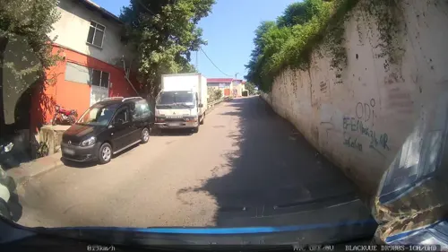
- Street-level photo, yercizenler, CC BY-SA 4.0
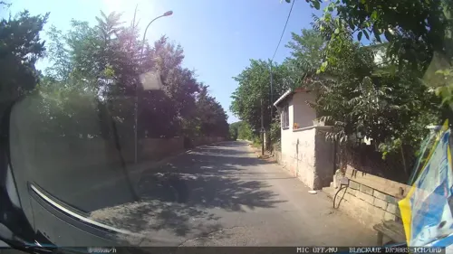
- Street-level photo, yercizenler, CC BY-SA 4.0
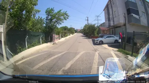
- Street-level photo, yercizenler, CC BY-SA 4.0
- Street-level photo, yercizenler, CC BY-SA 4.0
- Street-level photo, yercizenler, CC BY-SA 4.0
- Street-level photo, yercizenler, CC BY-SA 4.0
- Street-level photo, yercizenler, CC BY-SA 4.0
- Street-level photo, yercizenler, CC BY-SA 4.0
- Street-level photo, yercizenler, CC BY-SA 4.0


Page built November 8, 2026. Spotted a mistake? Tell us or suggest a place.