


Why visit Rumelifeneri
Townapedia lists 8 museums and landmarks, 4 parks and trails, 5 places to eat, 3 places to stay and 6 attractions in and around town.
Highlights include Anadolu Feneri, Rumeli Feneri, Chalcaea and Chelae.
Weather in Rumelifeneri
Forecast from MET Norway (CC BY 4.0). Full forecast
About Rumelifeneri
Rumelifeneri (named after the lighthouse Rumeli Feneri) is a neighbourhood in the municipality and district of Sarıyer, Istanbul Province, Turkey. Its population is 4,337 (2022).
From the Wikipedia article Rumelifeneri, Istanbul (this version), under CC BY-SA 4.0.
Things to do6



Museums and landmarks8

Chalcaea
Monument and historic site · 5.6 km
Ancient city of Thrace in modern-day Turkey
Chelae
Monument and historic site · 5.2 km
Ancient coastal settlement on the Bosphorus

Mochadion
Monument and historic site · 4.0 km
Ancient city of Bithynia, in modern-day Turkey
Myrileion
Monument and historic site · 2.1 km
Ancient city of Thrace in modern-day Turkey
Phosphorus
Monument and historic site · 4.6 km
Ancient city of Thrace in modern-day Turkey

Parks, trails and playgrounds4
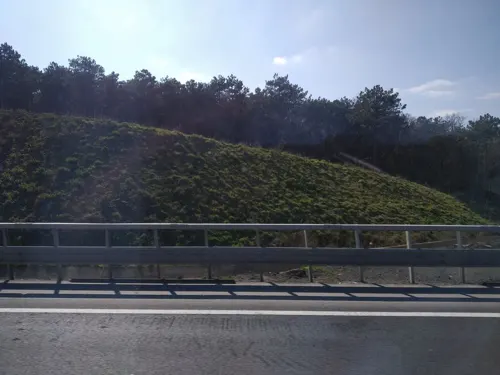
İstanbul Sarıyer Feneryolu Yaban Hayatı Geliştirme Sahası
Hiking and trails · 3.0 km


Restaurants and cafes5




History
Archaeological evidence in the area of the village dates back to the late Byzantine era, although a now lost Greek inscription dating to the 3rd century CE was formerly on display at the Greek cemetery of the village.
The village is named after a local lighthouse, which is attested in portolans and literary sources since at least the 15th century. Petrus Gyllius, who visited it in the mid-16th century, described it as octagonal, and ascribed to it a Byzantine origin. Its Greek inhabitants named it Phanarion (Φανάριον, "lighthouse"), often in the diminutive Phanarakion (Φαναράκιον). In 1768, Rumeli Feneri Fort was built by a Greek engineer for the Ottoman Empire, possibly on older foundations. It is now in ruins. Rumelifeneri was involved was the rebellion of Kabakçı Mustafa.
Before World War I, the village was inhabited by Greeks—some 900 inhabitants in the late 19th century—and had a church dedicated to St. George (possibly built on a Byzantine predecessor), and the hagiasma (sacred well) known as tis Tsirpinas (της Τσίρπινας).
From the History section of Rumelifeneri, Istanbul on Wikipedia, under CC BY-SA 4.0.
Where to stay3
Churches and places of worship3
Shopping1
Schools, colleges and libraries1
Healthcare1
Map of Rumelifeneri
32 places. The map loads OpenStreetMap tiles when you open it.
Getting there and nearby towns
Istanbul Airport (IST) is the nearest airport with scheduled flights listed in OpenStreetMap, 30 km away.
- Zekeriya 8 km southwest, about 8 min by car
- Uskumruköy 7 km west, about 7 min by car
- Ümraniye 24 km south, about 24 min by car
- Üsküdar 25 km south, about 25 min by car
- Istanbul 28 km southwest, about 28 min by car
- Sancaktepe 28 km south, about 28 min by car
- Fatih 27 km southwest, about 27 min by car
- Esenler 29 km southwest, about 29 min by car
- Bağcılar 30 km southwest, about 30 min by car
- Bahçelievler 33 km southwest, about 33 min by car
Drive times are estimates from straight-line distance, not routes.
Local news
Headlines from INDB.
Reviews, tips and questions
Loading what members have shared...
Sources and licences
- GeoNames (CC BY 4.0): population, coordinates, regions and time zone
- Mapillary (see each image): photos
- OpenStreetMap contributors (ODbL 1.0): places, airports, map data
- Wikidata (CC0 1.0): elevation, founding date, time zone, website, landmarks and historic places
- Wikimedia Commons (see each image): photos
- Wikipedia (CC BY-SA 4.0): overview and history text
Photo credits
- Rumeli Feneri, Sarıyer p2, VikiPicture, CC BY-SA 3.0
- Rumelifeneri Liman Çeşmesi, Ali Osman Dilekoğlu, CC BY-SA 4.0
- Rumelifeneri Liman Çeşmesi Kitabe, Ali Osman Dilekoğlu, CC BY-SA 4.0
- Ahmet Ağa Çeşmesi, Rumelifeneri Kitabe, Ali Osman Dilekoğlu, CC BY-SA 4.0
- Ahmet Ağa Çeşmesi, Rumelifeneri IMG 0055, Ali Osman Dilekoğlu, CC BY-SA 4.0
- Rumelifeneri Kalesi 2025-09-28 13-42-28, Özgür Arda BAYRAM, CC BY-SA 4.0
- Rumelifeneri Kalesi 2025-09-28 13-42-01, Özgür Arda BAYRAM, CC BY-SA 4.0
- Anadolu Feneri, Recep Cirik, CC BY-SA 3.0
- Yavuz Sultan Selim Bridge1, Glabb, CC BY-SA 3.0
- KoçUniversity2, Jorge1767, Public domain
- Rumeli Feneri, Sarıyer p3, VikiPicture, CC BY-SA 3.0
- Garipçe Kalesi p2, Jan 2014, VikiPicture, CC BY-SA 3.0
- Rumeli Feneri Castle p1, Jan 2014, VikiPicture, CC BY-SA 3.0
- Hasan Paşa Kulesi, Artemco, CC BY-SA 4.0
- Ramazan Ağa Cami 2024-02-03 16.38.36 1791375759, Ali Osman Dilekoğlu, CC BY-SA 4.0
- Rumeli Feneri Yeni Camii 07, Mahrujan, CC BY-SA 4.0
- Rumeli Feneri Yeni Camii 01, Mahrujan, CC BY-SA 4.0
- Rumeli Feneri Park Çeşmesi Kitabe, Ali Osman Dilekoğlu, CC BY-SA 4.0
- Rumeli Feneri Park Çeşmesi IMG 0068, Ali Osman Dilekoğlu, CC BY-SA 4.0
- Rumeli Feneri Yeni Camii 02, Mahrujan, CC BY-SA 4.0
- Rumeli Feneri Yeni Camii 03, Mahrujan, CC BY-SA 4.0
- Rumeli Feneri Yeni Camii 08, Mahrujan, CC BY-SA 4.0
- Rumeli Feneri Yeni Camii 05, Mahrujan, CC BY-SA 4.0
- Rumeli Feneri Yeni Camii 06, Mahrujan, CC BY-SA 4.0
- Rumeli Feneri Yeni Camii 04, Mahrujan, CC BY-SA 4.0
- Yeni Camii Çeşmesi 2024-02-03 16.35.16 1791375812, Ali Osman Dilekoğlu, CC BY-SA 4.0
- Rumeli feneri limanından bogaza giris - panoramio, alibarisondul, CC BY 3.0
- Sarıyer banner, alibarisondul, CC BY 3.0
- Bogaz girişi - panoramio, fazlı senel, CC BY-SA 3.0
- Rumeli Feneri 2024-02-03 16.27.37 1791374671, Ali Osman Dilekoğlu, CC BY-SA 4.0
- Rumeli Feneri 1899-11-30 00.00.00 1793473805, Berkinson.jpeg, CC BY-SA 4.0
- Rumeli Feneri 2024-02-03 16.31.32 1791374673, Ali Osman Dilekoğlu, CC BY-SA 4.0
- Rumeli Feneri 2025-09-28 14-07-16, Özgür Arda BAYRAM, CC BY-SA 4.0
- Rumeli Feneri 2025-09-28 14-02-17, Özgür Arda BAYRAM, CC BY-SA 4.0
- Rumeli Feneri 2025-09-28 14-02-57, Özgür Arda BAYRAM, CC BY-SA 4.0
- Rumeli Feneri 2025-09-28 14-07-59, Özgür Arda BAYRAM, CC BY-SA 4.0
- Rumeli Feneri 2025-09-28 14-02-03, Özgür Arda BAYRAM, CC BY-SA 4.0
- Garipçe - panoramio, Turhan Akman, CC BY 3.0
- Liman yolu - panoramio, Allen Turner, CC BY-SA 3.0
- Rumeli Feneri... - panoramio, Sinan Şahin, CC BY 3.0
- Street-level photo, yercizenler, CC BY-SA 4.0
- Street-level photo, achive, CC BY-SA 4.0


Page built November 8, 2026. Spotted a mistake? Tell us or suggest a place.