


Why visit Çerkezköy
Townapedia lists 8 museums and landmarks, 24 parks and trails, 285 places to eat, 13 places to stay and 1 attraction in and around town.
Highlights include Bülent Ecevit Parkı.
Weather in Çerkezköy
Forecast from MET Norway (CC BY 4.0). Full forecast
About Çerkezköy
Çerkezköy is a municipality and district of Tekirdağ Province, Turkey. Its area is 86 km2, and its population is 206,829 (2022). Çerkezköy is located in inland Thrace just to the west of the outlying Istanbul districts of Çatalca and Silivri. Çerkezköy is an industrial area. It is 56 km (35 mi) from Tekirdağ and 110 km (68 mi) from Istanbul but in many ways has closer links to the bigger city. The mayor is Vahap Akay (Independent).
From the Wikipedia article Çerkezköy (this version), under CC BY-SA 4.0.
Travel tips from other travellers: Çerkezköy on Wikivoyage (CC BY-SA 4.0).
Things to do1

Museums and landmarks8

Prof. Dr. Türkan Saylan Eğitim Kültür ve Sanat Merkezi
Museum · 0.7 km
Fatih Caddesi

Parks, trails and playgrounds24


12 more on the map.
Restaurants and cafes285

Çizgi Döner
Restaurant · Chicken, Turkish · 1.2 km
20-22 D Cengiz Topel Caddesi, Çerkezköy/TEKİRDAĞ
Mo-Su 09:00-21:00



273 more on the map.
History
Until the 1800s this was a village called 'Türbedere'. 'Türbe' is the Turkish for 'tomb' and the village took its name from the tomb of the eldest son of sultan Bayezid I, Süleyman Çelebi, who was murdered here in 1410 when fleeing from his brothers during the Ottoman Interregnum. The tomb was destroyed by Bulgarian troops when they occupied the town for nine months during the war for Bulgarian Independence in 1912.
Çerkezköy was founded as a settlement for refugees from the Caucasus following the Russo-Turkish War of 1877-1878 ('Çerkez' being the Turkish pronunciation of 'Circassian'). Soon after, following the independence of Bulgaria from the Ottoman Empire further waves of refugees from Bulgaria came to replace the Caucasians and Çerkezköy was designated as a municipality (Turkish: belediye) in 1911. It became a township of Saray district in 1922 and a district in 1958.
The land here is flat, watered by the River Çorlu and good soil for farming, so until the 1970s Çerkezköy was a pleasant small town in a rural setting. But it is also on the main highway from Istanbul to Europe and in 1971 was designated an area for industrial development. Grants were made available by the Turkish state for investors and a large industrial area was constructed on 4 km2 (1.5 sq mi) of land near the town.
From the History section of Çerkezköy on Wikipedia, under CC BY-SA 4.0.
Where to stay13
Churches and places of worship10
Shopping106
Gas and EV charging11
Schools, colleges and libraries26
Nurullah Narin Ortaokulu
School · 0.9 km
G.M.K.P Mahallesi Narin Caddesi Kartal Sokak Emniyet Müdürlüğü Karşısı, Çerkezköy/TEKİRDAĞ
Ticaret ve Sanayi Odası Anadolu Lisesi
School · 1.1 km
9 İstasyon Mah. Hacı Fahri Zümbül Cad., Çerkezköy/TEKİRDAĞ
Hacı Fahri Zümbül Mesleki Ve Teknik Anadolu Lisesi
School · 1.3 km
Hacı Fahri Zümbül Caddesi, Çerkezköy
Healthcare57
Map of Çerkezköy
250 places. The map loads OpenStreetMap tiles when you open it.
Getting there and nearby towns
Tekirdağ Çorlu Atatürk Airport (TEQ) is the nearest airport with scheduled flights listed in OpenStreetMap, 17 km away.
- Çorlu 22 km southwest, about 22 min by car
- Silivri 31 km southeast, about 31 min by car
- Marmara Ereğlisi 35 km south, about 35 min by car
- Vize 38 km northwest, about 38 min by car
- Çatalca 42 km southeast, about 42 min by car
- Tekirdağ 53 km southwest, about 53 min by car
- Lüleburgaz 55 km west, about 55 min by car
- Tepecik 54 km southeast, about 54 min by car
- Beylikdüzü 63 km southeast, about 1 h by car
- Arnavutköy 63 km east, about 1 h by car
Drive times are estimates from straight-line distance, not routes.
Local news
Headlines from INDB.
Reviews, tips and questions
Loading what members have shared...
Sources and licences
- GeoNames (CC BY 4.0): population, coordinates, regions and time zone
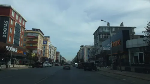
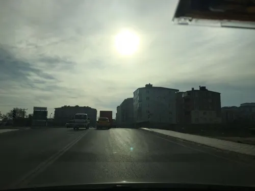
- Mapillary (see each image): photos
- OpenStreetMap contributors (ODbL 1.0): places, airports, map data
- Wikidata (CC0 1.0): elevation, founding date, time zone, website
- Wikimedia Commons (see each image): photos
- Wikipedia (CC BY-SA 4.0): overview and history text
Photo credits
- 2016.10-446-021a aerial view Çerkezköy District,Turkey thu06oct2016-1414h UTC+2(CEST), Rik Schuiling / TropCrop-TCS, CC BY-SA 4.0
- ÇERKEZKÖY MERKEZ OSMANLI CAMİ - panoramio, mehmetkursun, CC BY-SA 3.0
- Çerkezköy Saat Kulesi, Rainforcement, CC BY-SA 4.0
- AKSOYLAR MOBİLYA ÇERKEZKÖY - panoramio, mehmetkursun, CC BY-SA 3.0
- LC WAIKIKI ÇERKEZKÖY MAĞAZASI - panoramio, mehmetkursun, CC BY-SA 3.0
- İSTİKBAL ÇETİNLER MOBİLYA MAĞAZASI ÇERKEZKÖY - panoramio, mehmetkursun, CC BY-SA 3.0
- Çerkezköy Yeni Gar, Krnzysf, CC BY 4.0
- Çerkezköy Milli Tren, Krnzysf, CC BY 4.0
- 03.11.25 Çerkezköy E68038, Phil Richards, CC BY-SA 4.0
- Çerkezköy Train Road, Krnzysf, CC BY 4.0
- Çerkezköy Train Station, Krnzysf, CC BY 4.0
- SGK ÇERKEZKÖY İLÇE MÜDÜRLÜĞÜ - panoramio, mehmetkursun, CC BY-SA 3.0
- ÇERKEZKÖY ORGANİZE SANAYİ BÖLGESİ GİRİŞ - panoramio, mehmetkursun, CC BY-SA 3.0
- Köşem park - panoramio, celalettin macit, CC BY 3.0
- VatanSizeMinnettardırAnıtı, Rainforcement, CC BY-SA 4.0
- ISS042-E-261103 - View of Earth, Earth Science and Remote Sensing Unit , Lyndon B. Johnson Space Center, Public domain
- ISS056-E-185240 - View of Earth, Earth Science and Remote Sensing Unit, NASA Johnson Space Center, Public domain
- ISS053-E-107154 - View of Earth, Earth Science and Remote Sensing Unit , Lyndon B. Johnson Space Center, Public domain
- ISS053-E-110016 - View of Earth, Earth Science and Remote Sensing Unit , Lyndon B. Johnson Space Center, Public domain
- ISS056-E-185241 - View of Earth, Earth Science and Remote Sensing Unit, NASA Johnson Space Center, Public domain
- ISS060-E-64475 - View of Earth, Earth Science and Remote Sensing Unit, NASA Johnson Space Center, Public domain
- ISS042-E-261104 - View of Earth, Earth Science and Remote Sensing Unit , Lyndon B. Johnson Space Center, Public domain
- ISS042-E-261102 - View of Earth, Earth Science and Remote Sensing Unit , Lyndon B. Johnson Space Center, Public domain
- ISS056-E-184692 - View of Earth, Earth Science and Remote Sensing Unit, NASA Johnson Space Center, Public domain
- ISS042-E-261101 - View of Earth, Earth Science and Remote Sensing Unit , Lyndon B. Johnson Space Center, Public domain
- ISS060-E-64474 - View of Earth, Earth Science and Remote Sensing Unit, NASA Johnson Space Center, Public domain
- ISS060-E-64473 - View of Earth, Earth Science and Remote Sensing Unit, NASA Johnson Space Center, Public domain
- ISS060-E-64472 - View of Earth, Earth Science and Remote Sensing Unit, NASA Johnson Space Center, Public domain
- ISS047-E-117479 - View of Earth, Earth Science and Remote Sensing Unit , Lyndon B. Johnson Space Center, Public domain
- ALTINYILDIZ by Otansev - panoramio, otansev, CC BY-SA 3.0
- Kapaklı - Karaağaç Village Mosque - 20250602145757, Sadrettin, CC BY-SA 4.0
- Kapaklı - Karaağaç Village Mosque - 20250602145451, Sadrettin, CC BY-SA 4.0
- Kapaklı - Karaağaç Village Mosque - 20250602145027, Sadrettin, CC BY-SA 4.0
- Kapaklı - Karaağaç Village Mosque - 20250602145146, Sadrettin, CC BY-SA 4.0
- Kapaklı - Karaağaç Village Mosque - 20250602145133, Sadrettin, CC BY-SA 4.0
- Kapaklı - Karaağaç Village Mosque - 20250602145508, Sadrettin, CC BY-SA 4.0
- Kapaklı - Karaağaç Village Mosque - 20250602145317, Sadrettin, CC BY-SA 4.0
- Kapaklı - Karaağaç Village Mosque - 20250602145215, Sadrettin, CC BY-SA 4.0
- Kapaklı - Karaağaç Village Mosque - 20250602145608, Sadrettin, CC BY-SA 4.0
- Kapaklı - Karaağaç Village Mosque - 20250602145539, Sadrettin, CC BY-SA 4.0
- Street-level photo, elifmeva, CC BY-SA 4.0
- Street-level photo, mcamlica, CC BY-SA 4.0
- Street-level photo, mcamlica, CC BY-SA 4.0
- Street-level photo, mcamlica, CC BY-SA 4.0
- Street-level photo, mcamlica, CC BY-SA 4.0
- Street-level photo, mcamlica, CC BY-SA 4.0
- Street-level photo, mcamlica, CC BY-SA 4.0
- Street-level photo, elifmeva, CC BY-SA 4.0
- Street-level photo, mcamlica, CC BY-SA 4.0
- Street-level photo, mcamlica, CC BY-SA 4.0
- Street-level photo, mcamlica, CC BY-SA 4.0
- Street-level photo, mcamlica, CC BY-SA 4.0
- Street-level photo, mcamlica, CC BY-SA 4.0
- Street-level photo, mcamlica, CC BY-SA 4.0
- Street-level photo, mcamlica, CC BY-SA 4.0
- Street-level photo, elifmeva, CC BY-SA 4.0
- Street-level photo, mcamlica, CC BY-SA 4.0
- Street-level photo, mcamlica, CC BY-SA 4.0
- Street-level photo, elifmeva, CC BY-SA 4.0
- Street-level photo, mcamlica, CC BY-SA 4.0
- Street-level photo, mcamlica, CC BY-SA 4.0
- Street-level photo, mcamlica, CC BY-SA 4.0
- Street-level photo, mcamlica, CC BY-SA 4.0


Page built November 8, 2026. Spotted a mistake? Tell us or suggest a place.