


Why visit Altlandsberg
Townapedia lists 64 museums and landmarks, 50 parks and trails, 146 places to eat, 24 places to stay and 6 attractions in and around town.
Highlights include Kinderbauernhof Mümmelmann, Tierhof „Mensch – Natur“, Radiomuseum Berlin in Brandenburg and Berliner Torturm.
Weather in Altlandsberg
Forecast from MET Norway (CC BY 4.0). Full forecast
About Altlandsberg
Altlandsberg (German pronunciation: [ˈaltlantsˌbɛʁk] ) is a historic town in the district of Märkisch-Oderland, in Brandenburg, Germany. It is situated about 22 km (14 mi) east of Berlin.
From the Wikipedia article Altlandsberg (this version), under CC BY-SA 4.0.
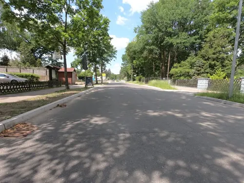
Photos of Altlandsberg


Things to do6
Kinderbauernhof Mümmelmann
Zoo and aquarium · 5.6 km
33 - 34 Dorfstraße, Petershagen/Eggersdorf
Tu-Su 10:00-18:00

Tierhof „Mensch – Natur“
Zoo and aquarium · 8.2 km
Projekt zur Arterhaltung vom Aussterben bedrohter Nutztiere
1 Oschatzer Ring, Berlin
Mo 08:00-18:30; Tu-Fr 08:30-18:30; Sa,Su 10:30-17:30

Hofladen
Farm and orchard · 7.0 km
1 Dorfstraße, Altlandsberg
Jan-Mar: Mo-Sa 08:00-16:00; Apr-Oct: Mo-Sa 08:00-17:00, Su...
Hofladen Peters
Farm and orchard · 7.9 km
24 Löhmer Dorfstraße, Werneuchen
Mo-Sa 09:00-17:00; Su,PH 09:00-12:00
Geflügelzucht Gisela Peters
Farm and orchard · 7.9 km
24 Löhmer Dorfstraße, Werneuchen
Museums and landmarks64


Gründerzeitmuseum im Gutshaus Mahlsdorf
Museum · 10.4 km
Museum in Berlin, Germany


Margarete Näfe
Monument and historic site · 3.1 km
Stolperstein für Margarete Näfe, geb.Tietz

Richard Jänsch
Monument and historic site · 3.9 km
Stolperstein für Richard Jänsch



52 more on the map.
Parks, trails and playgrounds50



Strandbad Bötzsee
Sports field and stadium · 6.9 km
Altlandsberger Chaussee, Eggersdorf
Mo-Su 10:00-20:00


Badewiese Löhmer Chaussee
Beach · 7.3 km
Während der Freibadsaison tägl. ab 10 Uhr geöffnet (Öffnungsdauer witterungsabhängig)
Freibad Neuenhagen
Sports field and stadium · 5.4 km
1 Liebermannweg, Neuenhagen bei Berlin
38 more on the map.
Restaurants and cafes146
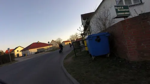
Landhaus Hönow
Restaurant · Regional · 6.4 km
23 Dorfstraße, Hoppegarten
Fr-Tu 12:00-22:00; We,Th 12:00-14:00,17:00-22:00
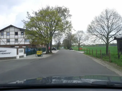
Landhaus Remonte
Restaurant · German · 8.4 km
1 Münchehofer Straße, Hoppegarten
Tu-Sa 11:30-22:00; Su,PH 11:30-21:00; Mo off
Lina Restaurant
Restaurant · Asian, Sushi · 5.1 km
59 Hönower Chaussee, Neuenhagen bei Berlin
Mo-Th 11:30-22:00; Fr 11:30-23:00; Sa 12:00-23:00; Su 12:00-22:00
Pizzaria Villa Toscana
Restaurant · Italian, Italian Pizza · 7.2 km
29 Freienwalder Straße, Werneuchen
Mo-Su 12:00-23:00
Trattoria Casa Romana
Restaurant · Italian, Pizza, Pasta, Fish, Bar And Grill · 7.0 km
20 Altlandsberger Chaussee, Petershagen/Eggersdorf
PH,Mo-Su 11:00-22:00

Hami Cuisine
Restaurant · Asian · 7.8 km
93 Am Försterweg, Strausberg
Mo-Sa 11:00-21:00; PH 12:00-20:00; Su 12:00-20:00
Kayserschnitzel
Restaurant · German · 7.1 km
24b Waldstraße, Petershagen/Eggersdorf
We-Sa 12:00-24:00+; Mo,Tu off
Königliches Brauhaus Festsaal & Restaurant
Restaurant · Regional
2 Krummenseestraße, Altlandsberg
Mo-Tu off; We-Su 12:00-22:00
Pizza Swat
Restaurant · Pizza, Burger, Pasta, Salad · 8.0 km
29 Albin-Köbis-Ring, Strausberg
11:30-21:00
134 more on the map.
History
Altlandsberg was first mentioned in a 1230 deed, it was located at the site of a former Slavic (Sprevane) settlement. The area then was resettled in the course of the German Ostsiedlung, promoted both by the Ascanian Margraves of Brandenburg and the rivaling Margraves of Meissen from the House of Wettin. The town's name may refer to Saxon Landsberg Castle and therefore indicate an establishment by the Wettins. In 1245 the tensions rose to an armed conflict, in which the Ascanians maintained their grounds. From that time on Altlandsberg remained with Brandenburg.
Read more of the history
The city was laid out at the behest of the Ascanian rulers, their successor Margrave Louis I from the Bavarian House of Wittelsbach even established a monastery of the Servite Order in 1335, which was dissolved during the Protestant Reformation. Altlandsberg was devastated by the Hussites in 1432, it was affected by several town fires and plague epidemics in the 16th century. The medieval town was burnt down completely in 1632 during the Thirty Years' War. A hoard of 7450 gold and silver coins dating from the 14th and early 15th century was discovered in the grounds of the former manor in late 2016. The dates suggest that it was buried in order to protect it during the Hussite wars. It is the largest hitherto found in the state of Brandenburg, and is now being examined in the archeological museum in Brandenburg an der Havel.
From the History section of Altlandsberg on Wikipedia, under CC BY-SA 4.0.
Notable people from Altlandsberg
 Dagmar EnkelmannGerman politicianPhoto: Unknown author Unknown author, CC BY 3.0
 Erasmus SchöferGerman writer (1931–2022)Photo: HpSchaefer Hans Peter Schaefer..., CC BY-SA 3.0
- J. Christian B. KirschGerman general secretary
- Hans BuchholzGerman bomber pilot and Knight's Cross recipient
Born in Altlandsberg, according to Wikidata (CC0). Each name links to its Wikipedia article.
Where to stay24
Seehotel Villago
Motel and hotel · Mediterranean · 7.2 km
89 Altlandsberger Chaussee, Petershagen/Eggersdorf
Hotel Seeschloss am Bötzsee
Motel and hotel · 7.0 km
102 Altlandsberger Chaussee, Petershagen-Eggersdorf
Churches and places of worship30
Katholische Kirche St. Joseph
Church · Roman Catholic · 7.8 km
16 Lamprechtstraße, Werneuchen
Dorfkirche Krummensee
Church · Protestant · 4.2 km
13a Dorfstraße, Werneuchen
Adventkapelle Neuenhagen
Church · Seventh Day Adventist · 5.5 km
19 Kleiststraße, Neuenhagen bei Berlin
Shopping66
Gas and EV charging18
Schools, colleges and libraries43
Friedrich von Canitz Grundschule Blumberg
School · 8.5 km
10 Schulstraße, Ahrensfelde
Healthcare18
Kastanien-Apotheke
Clinic and pharmacy · 5.5 km
16 Ernst-Thälmann-Straße, Fredersdorf-Vogelsdorf
Map of Altlandsberg
250 places. The map loads OpenStreetMap tiles when you open it.
Getting there and nearby towns
Berlin Brandenburg Airport "Willy Brandt" (BER) is the nearest airport with scheduled flights listed in OpenStreetMap, 27 km away.
- Werneuchen 8 km north, about 8 min by car
- Strausberg 11 km east, about 11 min by car
- Woltersdorf 12 km south, about 12 min by car
- Bernau bei Berlin 16 km northwest, about 16 min by car
- Erkner 16 km south, about 16 min by car
- Berlin 22 km west, about 22 min by car
- Biesenthal 23 km north, about 23 min by car
- Eichwalde 23 km south, about 23 min by car
- Schönefeld 25 km southwest, about 25 min by car
- Schulzendorf 25 km south, about 25 min by car
Drive times are estimates from straight-line distance, not routes.
Towns near Altlandsberg


Keep exploring
Local news
Headlines from INDB.
Reviews, tips and questions
Loading what members have shared...
Sources and licences
- GeoNames (CC BY 4.0): population, coordinates, regions and time zone
- Mapillary (see each image): photos
- OpenStreetMap contributors (ODbL 1.0): places, airports, map data
- Wikidata (CC0 1.0): elevation, founding date, time zone, website, landmarks and historic places
- Wikimedia Commons (see each image): photos
- Wikipedia (CC BY-SA 4.0): overview and history text
Photo credits
- 20250411 xl 1929-Altlandsberg, Molgreen, CC BY-SA 4.0
- Altlandsberg Haus Lindenberg, Clemensfranz, CC BY-SA 3.0
- Altlandsberg Strausberger Strasse 6, Clemensfranz, CC BY-SA 3.0
- Druckerei Altlandsberg, Picture taken by Marcus Cyron, CC BY-SA 3.0
- Poststraße Altlandsberg, Lukas Beck, CC BY-SA 4.0
- 20240828 xl 1110-Marktplatz (Altlandsberg), Molgreen, CC BY-SA 4.0
- Altlandsberg Marktplatz Platz der SA um 1941, Assenmacher, CC BY-SA 3.0
- Altlandsberg Marktplatz Marktbrunnen Johannes Niedlich, Assenmacher, CC BY-SA 3.0
- Altlandsberg Marktplatz, Assenmacher, CC BY-SA 3.0
- Altlandsberg Marktplatz Friedrich-Ludwig-Jahn-Denkmal, Assenmacher, CC BY-SA 3.0
- Altlandsberg Marktplatz 1955, Assenmacher, CC BY-SA 3.0
- Altlandsberg Marktplatz Sowjetische Gräber, Assenmacher, CC BY-SA 3.0
- Altlandsberg Marktplatz um 1910, Assenmacher, CC BY-SA 3.0
- Altstadt Altlandsberg 89, Marcus Cyron, CC BY-SA 3.0
- Altlandsberg Sowjetischer Ehrenfriedhof, Clemensfranz, CC BY-SA 3.0
- Stadtpfarrkirche St. Marien Altlandsberg Innen, Lukas Beck, CC BY-SA 4.0
- Stadtpfarrkirche St. Marien Altlandsberg Innenansicht, Lukas Beck, CC BY-SA 4.0
- Altlandsberg St. Marien 01, ErwinMeier, CC BY-SA 4.0
- 20251115 xl 1716-Altlandsberg Markt, Nachtansicht, Molgreen, CC BY-SA 4.0
- Bahnhofsgebäude Altlandsberg 2013, Slartu ( Diskussion ), CC BY-SA 3.0 de
- Altlandsberg Am Markt 6, Clemensfranz, CC BY-SA 3.0
- Altlandsberg St. Marien 02, ErwinMeier, CC BY-SA 4.0
- Altlandsberg Stadtpfarrkirche St. Marien Blick vom Kirchturm Richtung Berlin, Assenmacher, CC BY-SA 3.0
- Altlandsberg Stadtpfarrkirche St. Marien Blick auf den Kirchplatz, Assenmacher, CC BY-SA 3.0
- Altlandsberg Stadtpfarrkirche St. Marien Blick vom Kirchturm über den Chor 01, Assenmacher, CC BY-SA 3.0
- Altlandsberg Stadtpfarrkirche St. Marien Blick vom Kirchturm über den Chor 02, Assenmacher, CC BY-SA 3.0
- Altlandsberg Stadtpfarrkirche St. Marien Südostansicht mit Chor 01, Assenmacher, CC BY-SA 3.0
- Altlandsberg Stadtpfarrkirche St. Marien Panorama Richtung Berlin, Assenmacher, CC BY-SA 3.0
- Altlandsberg St. Marien 03, ErwinMeier, CC BY-SA 4.0
- Bahnhof Altlandsberg 2013, Slartu at German Wikipedia, CC BY-SA 3.0 de
- Altlandsberg Poststrasse 18, Clemensfranz, CC BY-SA 3.0
- Stadtpfarrkirche St. Marien Altlandsberg, Lukas Beck, CC BY-SA 4.0
- Altlandsberg Schlosskirche 01, ErwinMeier, CC BY-SA 4.0
- 20260808 xl 1906-Schlossgut Altlandsberg, Molgreen, CC BY-SA 3.0
- Gutshaus Mahlsdorf, Spationaut, CC BY-SA 3.0
- Erholungspark Marzahn 2009, Karl-Heinz Meurer, CC BY-SA 3.0
- Alice Salomon Hochschule Berlin, Auto1234, CC BY 3.0 de
- Alb.-Duerer-Str Kreuzkirche Mahlsdorf 2012-4-08 ama fec (126), Angela M. Arnold (44 penguins), CC BY-SA 2.0
- Melanchthon-Schule02, jo1997jo, CC BY-SA 3.0
- Friedhof Fredersdorf - Grabmal Bohm 4, Marcus Cyron, CC BY-SA 3.0
- Dorfkirche Eggersdorf 10, Marcus Cyron, CC BY-SA 3.0
- Kirche Blumberg (Ahrensfelde) 04, Sinuhe20, CC BY-SA 3.0
- Dorfkirche Buchholz Südostansicht, Assenmacher, CC BY-SA 4.0
- Dorfkirche Krummensee Südostansicht ohne Einfriedung, Assenmacher, CC BY-SA 4.0
- Friedrich von Canitz Grundschule Blumberg und Schulmuseum Blumberg (Brandenburg), Singlespeedfahrer, CC0
- Dorfkirche Löhme 2021 NE, Hans G. Oberlack, CC BY-SA 4.0
- Werneuchen - St. Michael-Kirche, Kvikk, CC BY-SA 4.0
- Werneuchen - St. Joseph-Kirche, Kvikk, CC BY-SA 4.0
- Peter-Weiss-Platz Berlin-Hellersdorf, Singlespeedfahrer, CC0
- 20260524 xl 1939-Hotel Flora, Molgreen, CC BY-SA 3.0
- 20240728 xl 1357-Gedenkstele Hans-Georg Jakobson, Molgreen, CC BY-SA 4.0
- Einstein-Gymnasium Neuenhagen, Frau Kretschmer, CC BY-SA 3.0 de
- Altlandsberg Berliner Torturm Juni 2014, Assenmacher, CC BY-SA 3.0
- Altlandsberg Strausberger Torturm1, Kvikk, CC BY-SA 3.0
- Stolperstein für Frieda Borkowsky (Altlandsberg), Christian Michelides, CC BY-SA 4.0
- Stolperstein für Günter Borkowsky (Altlandsberg), Christian Michelides, CC BY-SA 4.0
- Stolperstein für Margarete Näfe (Altlandsberg), Christian Michelides, CC BY-SA 4.0
- Stolperstein für Richard Jänsch (Altlandsberg), Christian Michelides, CC BY-SA 4.0
- Fr.-Hals-Platz Mahlsdorf 2012-4-08 ama fec (118), Angela M. Arnold (44 penguins), CC BY-SA 2.0
- Landgasthof Zum Mühlenteich, Molgreen, CC BY-SA 4.0
- Seehotel Villago, Molgreen, CC BY-SA 4.0
- 20260526 xl 0741-Hotel Seeschloss am Bötzsee, Molgreen, CC BY-SA 3.0
- Katholische Kirche St Hubertus Petershagen 1, Marcus Cyron, CC BY-SA 3.0
- Fredersdorf,Kirche,Wappenbaum, M_H.DE, CC BY-SA 3.0
- 20230824 xl 1624-Ev. Peterskirche, Molgreen, CC BY-SA 4.0
- Bibliothek Petershagen-Eggersdorf, Molgreen, CC BY-SA 4.0
- Ausstellungszentrum Pyramide Berlin, Singlespeedfahrer, CC0
- Paul-Levi-Platz Hellersdorf 2012-01-15 AMA fec (64), 44penguins (Angela M. Arnold), CC BY-SA 3.0
- Street-level photo, britiger, CC BY-SA 4.0
- Street-level photo, stefanhrt, CC BY-SA 4.0
- Street-level photo, DBSEV_SBB, CC BY-SA 4.0
- Street-level photo, moenk, CC BY-SA 4.0
- Street-level photo, DBSEV_SBB, CC BY-SA 4.0
- Street-level photo, carlheinz, CC BY-SA 4.0
- Street-level photo, thodon, CC BY-SA 4.0
- Street-level photo, dertony, CC BY-SA 4.0
- Street-level photo, polarmap, CC BY-SA 4.0
- Street-level photo, stefanhrt, CC BY-SA 4.0
- Street-level photo, stefanhrt, CC BY-SA 4.0
- Street-level photo, carlheinz, CC BY-SA 4.0
- Street-level photo, DBSEV_SBB, CC BY-SA 4.0
- Street-level photo, carlheinz, CC BY-SA 4.0
- Street-level photo, Jope, CC BY-SA 4.0
- Street-level photo, 468p, CC BY-SA 4.0
- Street-level photo, armarian, CC BY-SA 4.0
- Street-level photo, carlheinz, CC BY-SA 4.0
- Street-level photo, stefanhrt, CC BY-SA 4.0
- Street-level photo, polarmap, CC BY-SA 4.0
- Street-level photo, polarmap, CC BY-SA 4.0
- Street-level photo, stefanhrt, CC BY-SA 4.0
- Street-level photo, DBSEV_SBB, CC BY-SA 4.0


Page built November 9, 2026. Spotted a mistake? Tell us or suggest a place.