


Bernau bei Berlin, Germany
Bernau bei Berlin is a town of 34,866 people in Brandenburg, Germany.
Why visit Bernau bei Berlin
Townapedia lists 71 museums and landmarks, 44 parks and trails, 126 places to eat, 14 places to stay and 23 attractions in and around town.
Highlights include Der Hofladen, Stener Berg, Henkerhaus and Alter Speicher.
Weather in Bernau bei Berlin
Forecast from MET Norway (CC BY 4.0). Full forecast
About Bernau bei Berlin
Bernau bei Berlin (German pronunciation: [bɛʁˈnaʊ baɪ bɛʁˈliːn] , lit. 'Bernau near Berlin'; commonly named Bernau) is a town in the Barnim district in Brandenburg in eastern Germany, located about 10 km (6.2 mi) northeast of Berlin.
From the Wikipedia article Bernau bei Berlin (this version), under CC BY-SA 4.0.
Photos of Bernau bei Berlin


Things to do23
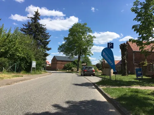
Der Hofladen
Farm and orchard · 8.1 km
Hausgemachte Fruchtaufstriche, Gelees, Obstsäfte, Liköre, Eier, Kräuteressige, Kräuteröle, hausgemachte Wurst
22 Dorfstraße, Biesenthal
May-Dec Tu-Fr 09:00-18:00, May-Dec Sa 08:00-18:00, May-Dec Su,PH...



Hofladen Peters
Farm and orchard · 8.5 km
24 Löhmer Dorfstraße, Werneuchen
Mo-Sa 09:00-17:00; Su,PH 09:00-12:00

Geflügelzucht Gisela Peters
Farm and orchard · 8.5 km
24 Löhmer Dorfstraße, Werneuchen
11 more on the map.
Museums and landmarks71

Henkerhaus
Museum
1 Am Henkerhaus, Bernau bei Berlin
Sa,Su 10:00-13:00,14:00-17:00; Mo-Fr 09:00-12:00,14:00-17:00; PH...

Alter Speicher
Museum · 6.7 km
Kornspeicher und Wasserturm in Hobrechtsfelde. Ausstellung zu Rieselfeldern und Stadtgut. Eintritt gegen freiwillige Spende 1-2€.

Schloß Börnicke
Monument and historic site · 3.7 km
1 Ernst-Thälmann-Straße, Bernau bei Berlin

Steintor (Heimatmuseum Bernau)
Museum
1 Hussitenstraße
Tu-Fr 09:00-12:00,14:00-17:00; Sa,Su,PH 10:00-13:00,14:00-17:00


Denkmal für Gefallene der Roten Armee (1947)
Monument and historic site



59 more on the map.
Parks, trails and playgrounds44


Krimhildpark
Park · 1.5 km
Https://www.bernau-bei-berlin.de/de/stadtportraet/sehenswertes/parks/artikel-spiel-_und_naturerlebnispfad_nibelungen.html
24/7



32 more on the map.
Restaurants and cafes126
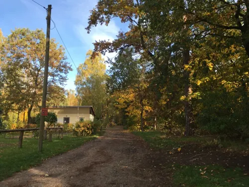
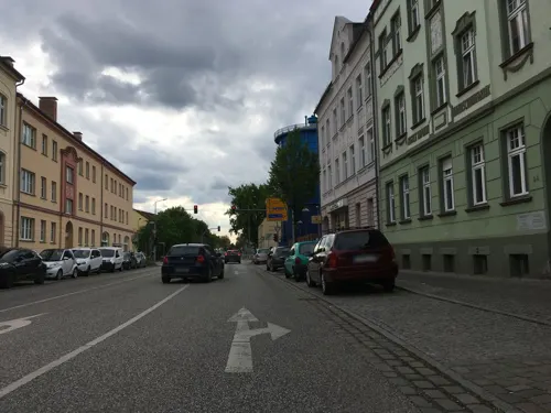
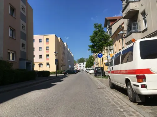
Hofgeflüster
Restaurant · German
14 Brüderstraße, Bernau bei Berlin
Tu 17:00-22:00; We-Sa 12:00-22:00; Su 12:00-21:00
India1
Restaurant · Indian
22 Berliner Straße, Bernau bei Berlin
Mo-Tu 11:30-22:00; We 17:00-22:00; Th 11:30-22:00; Fr-Sa...
Kaffeehaus Jeanette
Cafe · Coffee Shop, Regional
4a Alte Goethestraße, Bernau bei Berlin
Tu-Su 10:00-17:00

Kim
Restaurant · Asian, Sushi · 0.8 km
Sushi Thailand & Asia Spezialitäten
32 Heinersdorfer Straße, Bernau bei Berlin
Mo,We-Su 10:00-22:00
Gasthaus Lindow
Restaurant · German · 1.8 km
42 Paul-Singer-Straße, Bernau bei Berlin
We-Th 17:00+; Fr-Su 12:00+
Hoi An Restaurant
Restaurant · Vietnamese, Sushi · 5.9 km
14 Kastanienallee, Panketal
We-Mo 11:30-21:30

Kaffee-Haus Madlen im Café Max
Cafe · Ice Cream, Regional · 8.2 km
10 Robert-Rössle-Straße, Berlin
PH,Th-Su 12:00-20:30
La Vita Pizzeria
Restaurant · Italian, Ice Cream, Pizza, Pasta · 8.0 km
30 Wiltbergstraße, Berlin
Mo-Su 11:00-22:00
114 more on the map.
History
Archaeological excavations of Mesolithic-era sites indicate that the area has been inhabited since about 8800 BC. The city was first mentioned in 1232. It was historically spelled "Bärnau" [ˈbɛʁnaʊ̯] and since changed to Bernau [ˈbɛrnaʊ̯]. The reasons for its founding are not known. According to legend, Albert I of Brandenburg permitted the founding of the city in 1140 because of the good beer which was offered to him.
Bernau underwent an economic boom before the Thirty Years' War. Large parts of the defensive wall with town gate and wet moats were built during that period. These helped Bernau defend itself successfully against attackers, including the Hussites in 1432. However, conditions declined after the war and the plague. Frederick I of Prussia settled 25 Huguenot families, comprising craftsmen, farmers, traders, and scientists, in the town in 1699.
From the 18th century, Bernau was part of the Kingdom of Prussia, and from 1815 to 1947, it was administratively located in the Province of Brandenburg.
During World War II, in 1943–1945, it was the location of a subcamp of the Sachsenhausen concentration camp. In early 1945, a death march of prisoners of various nationalities from the dissolved camp in Żabikowo to Sachsenhausen passed through the town.
Read more of the history
From 1947 to 1952 it was part of the State of Brandenburg in East Germany, from 1952 to 1990 of the East German Bezirk Frankfurt and since 1990 again in Brandenburg in modern Germany. In 1842 a railway line was opened. One of the first electrical suburban railway lines in the world began operation in 1924. A line of the Berlin S-Bahn connected Bernau with the Stettiner Bahnhof (today Berlin Nordbahnhof) in Berlin. The ADGB Trade Union School (Bundesschule des Allgemeinen Deutschen Gewerkschaftsbundes), designed by Bauhaus director Hannes Meyer, opened in 1930. It was included as part of the World Heritage Site the Bauhaus and its Sites in Weimar, Dessau and Bernau in July 2017.
From the History section of Bernau bei Berlin on Wikipedia, under CC BY-SA 4.0.
Notable people from Bernau bei Berlin
 Jeanette BiedermannGerman singer and actressPhoto: BJ , Ruth Moschner Fanclub, CC BY-SA 4.0
 Robert RetschkeGerman bicycle racerPhoto: Jérémy-Günther-Heinz Jähnick, CC BY-SA 3.0
 Hans-Christoph BerndtGerman politicianPhoto: Dr. Frank Gaeth, CC BY-SA 4.0
 Charlotte MäderGerman discus throwerPhoto: Unknown author Unknown author, Public domain
- Kennet EichhornGerman footballer
- Peter HempelGerman canoeist
- Johann Friedrich NetteGerman architect (1672–1714)
- Hans-Jürgen BuchnerGerman singer songwriter
- Horst BöhmeGerman chemist (1908–1996)
- Paul MaurerGerman association football player
- Gino GerhardiGerman bobsledder
- Reinhard Vom BauerGerman actor
Born in Bernau bei Berlin, according to Wikidata (CC0). Each name links to its Wikipedia article.
Where to stay14
Churches and places of worship25
Evangelisch-Methodistische Kirche
Church · Methodist · 4.7 km
15 Straße der Jugend, Panketal
Shopping59
Gas and EV charging12
Schools, colleges and libraries36
Evangelische Grundschule Bernau
School · Evangelical · 0.7 km
65-67 Ladeburger Chaussee, Bernau bei Berlin
Healthcare24
Immanuel Klinikum Bernau Herzzentrum Brandenburg
Hospital
17 Ladeburger Chaussee, Bernau bei Berlin
Map of Bernau bei Berlin
250 places. The map loads OpenStreetMap tiles when you open it.
Getting there and nearby towns
Berlin Brandenburg Airport "Willy Brandt" (BER) is the nearest airport with scheduled flights listed in OpenStreetMap, 35 km away.
- Biesenthal 10 km north, about 10 min by car
- Wandlitz 11 km northwest, about 11 min by car
- Werneuchen 11 km southeast, about 11 min by car
- Altlandsberg 16 km southeast, about 16 min by car
- Berlin 21 km southwest, about 21 min by car
- Hohen Neuendorf 21 km west, about 21 min by car
- Birkenwerder 21 km west, about 21 min by car
- Eberswalde 23 km northeast, about 23 min by car
- Strausberg 23 km southeast, about 23 min by car
- Oranienburg 24 km west, about 24 min by car
Drive times are estimates from straight-line distance, not routes.
Towns near Bernau bei Berlin


Keep exploring
Local news
Headlines from INDB.
Reviews, tips and questions
Loading what members have shared...
Sources and licences
- GeoNames (CC BY 4.0): population, coordinates, regions and time zone
- Mapillary (see each image): photos
- OpenStreetMap contributors (ODbL 1.0): places, airports, map data
- Wikidata (CC0 1.0): elevation, founding date, time zone, website
- Wikimedia Commons (see each image): photos
- Wikipedia (CC BY-SA 4.0): overview and history text
Photo credits
- Bernau bei Berlin, Marienkirche, Epitaph, Dguendel, CC BY 4.0
- Bernau bei Berlin St. Marienkirche Mosaik Glockengussanlage, Assenmacher, CC BY-SA 3.0
- Bernau bei Berlin St. Marienkirche Findling Glockengussanlage, Assenmacher, CC BY-SA 3.0
- Bernau bei Berlin ADGB Schule Wohntrakte vorne, User:Dabbelju, CC BY 2.5
- Ehrenmal Berlin-Buch 02, Olaf Tausch, CC BY 3.0
- Dorfkirche Ladeburg, Ulrich Waack, Public domain
- Bernau Ehrenfriedhof2, Catatine, CC BY-SA 4.0
- ADGB Schule Bernau 5149, Sebastian Wallroth, CC BY 3.0
- Herz-Jesu-Kirche (Bernau), Botulph, CC BY-SA 3.0
- Bernau, St. Marien (74), Subbass1, CC BY-SA 4.0
- Boernicke Schloss, Doris Antony , Berlin, CC BY-SA 3.0
- Bernau Kriegerdenkmal 01, Sinuhe20, CC BY-SA 3.0 de
- Hellsee 09, Geoprofi Lars, CC BY-SA 4.0
- Bernau bei Berlin Hospital St. Georg mit Hospitalgebäude und Kapelle, Escla, CC BY-SA 3.0
- Dorfkirche Buch 01, Unknown author, CC BY-SA 2.5
- Ausstich Roentgental Sumpf, Kds11, CC BY-SA 3.0
- Schäferpfühle Ladeburg, Kds11, CC BY-SA 3.0
- NSG Mittelbruch I, Emberiza citriniella, CC BY-SA 3.0
- Panke 08, Olaf Tausch, CC BY 3.0
- Goethepark Bernau bei Berlin, Singlespeedfahrer, CC0
- Bernau bei Berlin Stadtpark I, Assenmacher, CC BY-SA 3.0
- Schlosspark Berlin-Buch 003, Sebastian Wallroth, CC BY 4.0
- Boernicke church, Doris Antony , Berlin, CC BY-SA 3.0
- Schlosspark Berlin-Buch 012, Sebastian Wallroth, CC BY 4.0
- Dorfkirche Löhme 2021 NE, Hans G. Oberlack, CC BY-SA 4.0
- Willmersdorf church, Doris Antony , Berlin, CC BY-SA 3.0
- Ruednitz church, Doris Antony , Berlin, CC BY-SA 3.0
- Steintor, Bernau (26859118672), Steffen Zahn from Berlin, Germany, CC BY 2.0
- Bernau Pulverturm, Fridolin freudenfett, CC BY-SA 4.0
- Bernau bei Berlin Steintor und Hungerturm, User:Dabbelju, CC BY-SA 3.0
- Bernau bei Berlin Henkerhaus, User:Dabbelju, CC BY-SA 3.0
- Panketal Hobrechtsfelde Kornspeicher, Mazbln, CC BY-SA 3.0
- Baudenkmal Bundesschule Bernau Waldfrieden 12, Ladeburg LIVE, CC BY-SA 4.0
- Büste Robert-Rössle-Str 10 (Buch) Max Delbrück&Hans Scheib&2003, OTFW , Berlin, CC BY-SA 3.0
- Bernau bei Berlin Pulverturm, User:Dabbelju, CC BY-SA 3.0
- Skulptur Im Werden Emerita Pansowova Külz-Park Bernau bei Berlin, Brandenburg, Deutschland 03, Singlespeedfahrer, CC0
- Bernau bei Berlin OT Ladeburg Dorfkirche, Kvikk, CC BY-SA 3.0
- Schlosskirche Berlin-Buch 01, Olaf Tausch, CC BY 3.0
- Marienkirche Bernau bei Berlin, de:Benutzer:Lewa, CC BY-SA 3.0
- Baudenkmal Bundesschule Bernau Waldfrieden 3, Ladeburg LIVE, CC BY-SA 4.0
- Stener Berg, Sinuhe20, CC BY-SA 3.0
- Holland Park Schwanebeck, Geoprofi Lars, CC BY-SA 4.0
- Street-level photo, carlheinz, CC BY-SA 4.0
- Street-level photo, carlheinz, CC BY-SA 4.0
- Street-level photo, mappinggeek, CC BY-SA 4.0
- Street-level photo, carlheinz, CC BY-SA 4.0
- Street-level photo, carlheinz, CC BY-SA 4.0
- Street-level photo, carlheinz, CC BY-SA 4.0
- Street-level photo, carlheinz, CC BY-SA 4.0
- Street-level photo, carlheinz, CC BY-SA 4.0
- Street-level photo, carlheinz, CC BY-SA 4.0
- Street-level photo, carlheinz, CC BY-SA 4.0
- Street-level photo, carlheinz, CC BY-SA 4.0
- Street-level photo, carlheinz, CC BY-SA 4.0
- Street-level photo, carlheinz, CC BY-SA 4.0
- Street-level photo, carlheinz, CC BY-SA 4.0
- Street-level photo, DBSEV_SBB, CC BY-SA 4.0
- Street-level photo, DBSEV_SBB, CC BY-SA 4.0
- Street-level photo, kartonage, CC BY-SA 4.0


Page built November 9, 2026. Spotted a mistake? Tell us or suggest a place.