


Why visit Woltersdorf
Townapedia lists 58 museums and landmarks, 20 parks and trails, 38 places to eat, 11 places to stay and 20 attractions in and around town.
Highlights include Aussichtsturm Kranichsberg, Kranichsberg, Anna Neumann, geb.Lampel and Fanny Tempelberg.
Weather in Woltersdorf
Forecast from MET Norway (CC BY 4.0). Full forecast
About Woltersdorf
Woltersdorf (German pronunciation: [ˈvɔltɐsdɔʁf]) is a municipality in the Oder-Spree district in Brandenburg. It is often referred to as "near Berlin" (German: "bei Berlin") or "near Erkner" (German: "bei Erkner") as there are a number of other places bearing the same name in Germany.
From the Wikipedia article Woltersdorf, Brandenburg (this version), under CC BY-SA 4.0.
Photos of Woltersdorf


Things to do20




8 more on the map.
Museums and landmarks58

Anna Neumann, geb.Lampel
Monument and historic site
Stolperstein für Anna Neumann, geb.Lampel

Fanny Tempelberg
Monument and historic site · 1.0 km
Stolperstein für Fanny Tempelberg, geb.Altmann

Frieda Meyersohn, geb.Herzberg
Monument and historic site · 0.6 km
Stolperstein für Frieda Meyersohn, geb.Herzberg

Gertrud Tempelberg
Monument and historic site · 1.0 km
Stolperstein für Gertrud Tempelberg

Gustav Gumpert
Monument and historic site · 0.8 km
Stolperstein für Gustav Gumpert


Otto Feldstein
Monument and historic site · 2.2 km
Stolperstein für Otto Feldstein


Siegmund Gumpert
Monument and historic site · 0.8 km
Stolperstein für Siegmund Gumpert

Siegmund Meyersohn
Monument and historic site · 0.6 km
Stolperstein für Siegmund Meyersohn
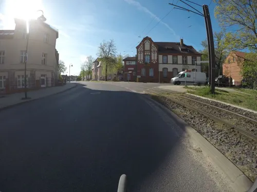
Ehemaliges Kaiserliches Postamtsgebäude
Monument and historic site · 3.0 km
30 Straße der Jugend, Rüdersdorf bei Berlin
46 more on the map.
Parks, trails and playgrounds20

Wassersport Zentrum Rüdersdorf
Marina and boat launch · 2.2 km
Fäkalienanlage max. bis ca. 3,50m Breite erreichbar

8 more on the map.
Restaurants and cafes38
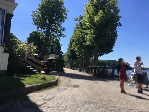
Woltersdorfer Braugasthof
Restaurant · Regional · 1.8 km
2b An der Schleuse, Woltersdorf
Tu-Su 11:30-21:00
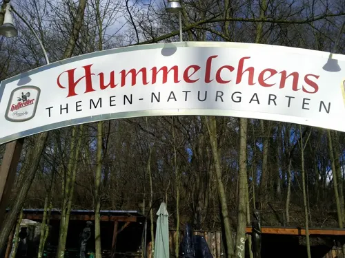
Gasthaus Klabautermann
Restaurant · Regional · 1.4 km
27-28 Ethel-und-Julius-Rosenberg-Straße, Woltersdorf
Sa 12:00-23:00; Su 10:00-23:00
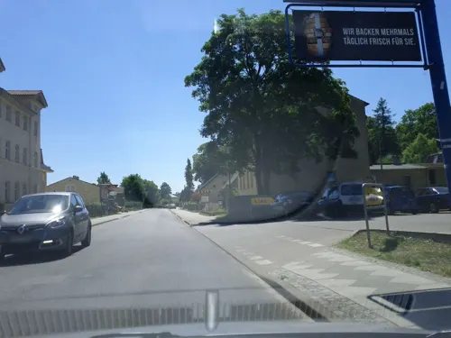
BaSon Asia-Bistro
Restaurant · Asian · 0.7 km
Mo-Sa 09:00-21:00; PH 10:00-21:00; Su off

Restaurant Flakenseeterrassen
Restaurant · Regional · 1.9 km
2 Strandpromenade, Woltersdorf
Tu-Th 11:30-19:30; Fr-Su 08:30-20:00; Mo 11:30-20:00
VTJ Liebesquelle
Restaurant · Vietnamese, Thai, Japanese · 1.7 km
2 Brunnenstraße, Woltersdorf
Mo-Su 11:00-21:30
Chau Asiatisches Restaurant
Restaurant · 2.8 km
1 Dr.-Wilhelm-Külz-Straße, Rüdersdorf bei Berlin
PH,Tu-Su 11:00-21:00
Dang Long
Restaurant · Asian · 2.8 km
55a Ernst-Thälmann-Straße, Rüdersdorf bei Berlin
Tu-Su 11:00-22:00

Hennig
Bakery · 0.6 km
1 August-Bebel-Straße, Woltersdorf
Mo-Sa 06:30-17:00; Su 07:30-17:00
26 more on the map.
History
Around 1240 14 farmer families settled on a bank. Today the church, the city hall and the "old school" (German "alte Schule") are located here, representing the Woltersdorf "downtown". The first residents were farmers and mariners. In 1319 Woltersdorf was first documented as Waltersdorf slawika. Waltersdorf means "the village from Walter".
In 1375 Woltersdorf was first noted in the "Landbuch". Together with Rahnsdorf, it paid taxes for the castle of Köpenick.
In 1487 Berlin acquired Woltersdorf. Then in 1550 a lock was built between the Flakensee and the Kalksee, the same year the first church of Woltersdorf was built. Between 1618 till 1648 Woltesdorf was desolated (Thirty Years' War) and temporarily uninhabited. About 1886 a touristic observation tower is built on top of the Kranichsberge. It granted a great perspective from a height of 105 meters, and on clear days you were able to see the Berliner Fernsehturm. Inside the tower today is an exhibition "When Woltersdorf still was Hollywood" (German "Als Woltersdorf noch Hollywood war"). It recalls the 1920s, where Joe May shot famous movies (Das indische Grabmal (1920), Herrin der Welt (1919) and Der Tiger von Eschnapur). Today you are able to find remains of the movie scenery on site.
Read more of the history
At the end of the 19th century the rail from Berlin to the east was finished. In the bordering commune of Woltersdorf, Erkner, a train station was built. Many Berlin people had their summer residence in Woltersdorf. Since 1913 a tramway has run between the lock and the S-Bahn station of Rahnsdorf.
From the History section of Woltersdorf, Brandenburg on Wikipedia, under CC BY-SA 4.0.
More about Woltersdorf
Geography
The municipality is located at the three lakes Flakensee, Kalksee and the Bauernsee, between Schöneiche, the Berlin forest and Erkner.
Woltersdorf borders (in clockwise direction, starting in north) on Rüdersdorf, Erkner, Berlin and Schöneiche.
From the Wikipedia article Woltersdorf, Brandenburg, under CC BY-SA 4.0.
Notable people from Woltersdorf
- Bodo RudwaleitEast German footballer
- Ursula GrableyGerman actress (1908–1977)
- Jörg VogelsängerGerman politician
- Nicolaus ZangiusGerman composer
- Vera FriedländerGerman author, literature professor, and survivor of the holocaust (1928-2019)
- Diethelm TriemerGerman speedway rider
Born in Woltersdorf, according to Wikidata (CC0). Each name links to its Wikipedia article.
Where to stay11
Churches and places of worship6
St. Michael
Church · Protestant · 0.7 km
29 Rudolf-Breitscheid-Straße, Woltersdorf
Landeskirchliche Gemeinschaft (LKG) Woltersdorf
Church · Evangelical · 1.2 km
9 Werderstraße, Woltersdorf
Neuapostolische Kirche Erkner
Church · New Apostolic · 2.5 km
100 Flakenseeweg, Erkner
Shopping13
Gas and EV charging6
Schools, colleges and libraries7
Healthcare11
Hirsch Apotheke
Clinic and pharmacy · 2.9 km
2 Otto-Nuschke-Straße, Rüdersdorf bei Berlin
Hochschulklinik für Psychiatrie und Psychotherapie
Clinic and pharmacy · 1.6 km
82-83 Seebad, Rüdersdorf bei Berlin
Map of Woltersdorf
190 places. The map loads OpenStreetMap tiles when you open it.
Getting there and nearby towns
Berlin Brandenburg Airport "Willy Brandt" (BER) is the nearest airport with scheduled flights listed in OpenStreetMap, 20 km away.
- Erkner 4 km south, about 4 min by car
- Zeuthen 15 km southwest, about 15 min by car
- Strausberg 17 km northeast, about 17 min by car
- Schönefeld 18 km southwest, about 18 min by car
- Königs Wusterhausen 19 km southwest, about 19 min by car
- Berlin 24 km west, about 24 min by car
- Fürstenwalde 24 km southeast, about 24 min by car
- Blankenfelde-Mahlow 26 km southwest, about 26 min by car
- Blankenfelde 26 km southwest, about 26 min by car
- Bernau bei Berlin 27 km northwest, about 27 min by car
Drive times are estimates from straight-line distance, not routes.
Towns near Woltersdorf


Keep exploring
Local news
Headlines from INDB.
Reviews, tips and questions
Loading what members have shared...
Sources and licences
- GeoNames (CC BY 4.0): population, coordinates, regions and time zone
- Mapillary (see each image): photos
- OpenStreetMap contributors (ODbL 1.0): places, airports, map data
- Wikidata (CC0 1.0): elevation, founding date, time zone, website, landmarks and historic places
- Wikimedia Commons (see each image): photos
- Wikipedia (CC BY-SA 4.0): overview and history text
Photo credits
- Ortskern von Woltersdorf bei Berlin, Picture taken by Marcus Cyron, CC BY-SA 2.5
- Stolperstein An den Fuchsbergen 5 (Woltersdorf) Isaak Grans, OTFW , Berlin, CC BY-SA 3.0
- Stolperstein Herthastraße 26 (Woltersdorf) Grete Schlögel, OTFW , Berlin, CC BY-SA 3.0
- Stolperstein Herthastraße 26 (Woltersdorf) Konrad Karp, OTFW , Berlin, CC BY-SA 3.0
- Stolperstein Herthastraße 26 (Woltersdorf) Wilhelm Sternberg, OTFW , Berlin, CC BY-SA 3.0
- Stolperstein Herthastraße 26 (Woltersdorf) Amalie Müller, OTFW , Berlin, CC BY-SA 3.0
- DEU-BB-LOS-Woltersdorf Public bookcase - I, Own work, CC BY-SA 4.0
- Woltersdorf - Baumschulenstrasse - geo.hlipp.de - 36806, Colin Smith on geo.hlipp.de, CC BY-SA 2.0
- Woltersdorf-Berliner-Straße, Bildarbeiter, CC BY-SA 4.0
- Stolperstein Puschkinallee 27 (Woltersdorf) Cornelius Hubers, OTFW , Berlin, CC BY-SA 3.0
- 041 Rahnsdorf-Woltersdorf 88P1290528, Robert Hösle, CC BY-SA 4.0
- 023 Rahnsdorf-Woltersdorf 88P1290518, Robert Hösle, CC BY-SA 4.0
- 038 Rahnsdorf-Woltersdorf 88P1290525, Robert Hösle, CC BY-SA 4.0
- Woltersdorf - Triebwagen 7 (Tramcar 7) - geo.hlipp.de - 36807, Colin Smith on geo.hlipp.de, CC BY-SA 2.0
- 2018-08-08 DE-BB Woltersdorf, Berliner Straße @ Puschkinallee, T57 30 Linie 87 (49875214332), Paul Korecky, CC BY-SA 2.0
- Clp 20120809 WS Tw 19 und Bw 90 Btf Woltersdorf, Christian Liebscher ( Platte ), CC BY-SA 3.0
- 2018-08-05 DE-BB Woltersdorf, Berliner Straße, Hst. Thälmannplatz (49629471073), Paul Korecky, CC BY-SA 2.0
- Clp 20100921 WS 19 Btf Woltersdorf, Christian Liebscher ( Platte ), CC BY-SA 3.0
- Clp 20120809 WS Bw 90 Btf Woltersdorf, Christian Liebscher ( Platte ), CC BY-SA 3.0
- Woltersdorf Works Car 19, User:Alex Noble, CC0
- Clp 20120809 WS Tw 19 Btf Woltersdorf, Christian Liebscher ( Platte ), CC BY-SA 3.0
- 2018-08-05 DE-BB Woltersdorf, Betriebshof, 218, T57 27, 2 (49635441108), Paul Korecky, CC BY-SA 2.0
- 2018-08-08 DE-BB Woltersdorf, Betriebshof, Rekowagen 19 (49871083832), Paul Korecky, CC BY-SA 2.0
- Tabor-Kirche (Rahnsdorf) Turm, Bodo Kubrak, CC0
- Puettberge, Erstbesinns, CC0
- Kranichsberg Aussichtsturm 01, Assenmacher, CC BY-SA 3.0
- KircheKalkberge, Picture taken by Marcus Cyron, CC BY-SA 3.0
- Kirche Woltersdorf, Exprimidor, CC BY-SA 4.0
- 20260902 xl 1109-Campingplatz Flakensee-West, Molgreen, CC BY-SA 3.0
- Stolperstein für Fanny Tempelberg (Woltersdorf), Christian Michelides, CC BY-SA 4.0
- Stolperstein für Gertrud Tempelberg (Woltersdorf), Christian Michelides, CC BY-SA 4.0
- Stolperstein für Anna Neumann (Woltersdorf), Christian Michelides, CC BY-SA 4.0
- Stolperstein Ethel-und-Julius-Rosenberg-Str 7 (Woltersdorf) Fanny Tempelberg, OTFW , Berlin, CC BY-SA 3.0
- Stolperstein für Frieda Meyersohn (Woltersdorf), Christian Michelides, CC BY-SA 4.0
- Stolperstein Ethel-und-Julius-Rosenberg-Str 7 (Woltersdorf) Gertrud Tempelberg, OTFW , Berlin, CC BY-SA 3.0
- Stolperstein für Gustav Gumpert (Woltersdorf), Christian Michelides, CC BY-SA 4.0
- Stolperstein für Jacob Neumann (Woltersdorf), Christian Michelides, CC BY-SA 4.0
- Stolperstein für Manfred Neumann (Woltersdorf), Christian Michelides, CC BY-SA 4.0
- Stolperstein für Otto Feldstein (Woltersdorf), Christian Michelides, CC BY-SA 4.0
- Stolperstein für Ruth Neumann (Woltersdorf), Christian Michelides, CC BY-SA 4.0
- Stolperstein für Siegmund Gumpert (Woltersdorf), Christian Michelides, CC BY-SA 4.0
- Stolperstein für Siegmund Meyersohn (Woltersdorf), Christian Michelides, CC BY-SA 4.0
- Street-level photo, britiger, CC BY-SA 4.0
- Street-level photo, carlheinz, CC BY-SA 4.0
- Street-level photo, stefanhrt, CC BY-SA 4.0
- Street-level photo, DBSEV_SBB, CC BY-SA 4.0
- Street-level photo, DBSEV_SBB, CC BY-SA 4.0
- Street-level photo, polarmap, CC BY-SA 4.0
- Street-level photo, polarmap, CC BY-SA 4.0
- Street-level photo, DBSEV_SBB, CC BY-SA 4.0
- Street-level photo, DBSEV_SBB, CC BY-SA 4.0
- Street-level photo, britiger, CC BY-SA 4.0
- Street-level photo, balgofil, CC BY-SA 4.0
- Street-level photo, polarmap, CC BY-SA 4.0
- Street-level photo, mfa, CC BY-SA 4.0
- Street-level photo, masterofnoroad, CC BY-SA 4.0
- Street-level photo, stefanhrt, CC BY-SA 4.0
- Street-level photo, stefanhrt, CC BY-SA 4.0
- Street-level photo, kartonage, CC BY-SA 4.0
- Street-level photo, knistertoni, CC BY-SA 4.0
- Street-level photo, balgofil, CC BY-SA 4.0
- Street-level photo, polarmap, CC BY-SA 4.0


Page built November 9, 2026. Spotted a mistake? Tell us or suggest a place.