


Wernberg-Köblitz, Germany
Wernberg-Köblitz is a town of 5,830 people in Bavaria, Germany.
Why visit Wernberg-Köblitz
Townapedia lists 24 museums and landmarks, 10 parks and trails, 26 places to eat, 3 places to stay and 37 attractions in and around town.
Highlights include Auf der Höhe, Blödenzellhöhe, Burg Wernberg and Golfplatz Schwanhof.
Weather in Wernberg-Köblitz
Forecast from MET Norway (CC BY 4.0). Full forecast
About Wernberg-Köblitz
Wernberg-Köblitz (German pronunciation: [ˈvɛʁnbɛʁk ˈkøːblɪts]) is a market town in the district of Schwandorf in Bavaria, Germany.
From the Wikipedia article Wernberg-Köblitz (this version), under CC BY-SA 4.0.
Things to do37

25 more on the map.
Museums and landmarks24


12 more on the map.
Parks, trails and playgrounds10

Golfplatz Schwanhof
Golf course · 6.5 km
18 hole Par 72
1 Klaus-Conrad-Allee, Luhe-Wildenau
09:00-18:00


Restaurants and cafes26

Gasthof Sperl
Restaurant · German · 1.0 km
24 Bahnhofstraße, Wernberg-Köblitz
Mo-Su 07:30-14:00,16:30-22:00
Alter Pfarrhof
Restaurant · International
3 Schloßbergweg, Wernberg-Köblitz
Tu-Su 17:00-23:00; Su 11:30-14:00; Nov-Feb Su 17:00-23:00 off
Burkhard
Restaurant · German
10 Marktplatz, Wernberg-Köblitz
Su-Tu 11:30-15:00; Mo-We,Sa 17:30-23:00; Fr off
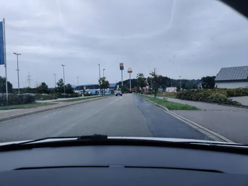
Bamler brot & café
Bakery · 1.9 km
36 Klaus-Conrad-Straße, Wernberg-Köblitz
Mo-Fr 05:30-16:00; Sa 05:00-12:00
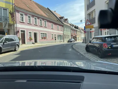


Pizza & Co, Restaurant
Restaurant · Pizza · 5.2 km
24 Marktplatz, Pfreimd
Gasthof zum schwarzen Bären
Restaurant · Regional · 5.2 km
4 Sankt-Vitus-Straße, Wernberg-Köblitz
14 more on the map.
History
The first mention of Wernberg Castle dates to 1280 when Konrad of Paulsdorfer bought the building. Later the castle became a possession of the noble Notthafft family.
From the History section of Wernberg-Köblitz on Wikipedia, under CC BY-SA 4.0.
Where to stay3
Churches and places of worship32
Expositurkirche Sankt Vitus und Leonhard
Church · Catholic · 5.2 km
7 Sankt-Vitus-Straße, Wernberg-Köblitz
Sankt Barbara - Wallfahrtskirche, Eixlbergkirche
Church · Catholic · 5.0 km
Am Eixlberg, Pfreimd
Shopping10
Gas and EV charging9
Schools, colleges and libraries3
Landgraf-Ulrich-Schule Pfreimd (Grund- und Mittelschule)
School · 5.7 km
13 Landgraf-Johann-Straße, Pfreimd
Healthcare5
Nikolaus-Apotheke
Clinic and pharmacy · 5.4 km
2 Leuchtenberger Straße, Luhe-Wildenau
Map of Wernberg-Köblitz
159 places. The map loads OpenStreetMap tiles when you open it.
Getting there and nearby towns
Verkehrslandeplatz Bayreuth (BYU) is the nearest airport with scheduled flights listed in OpenStreetMap, 62 km away.
- Amberg 24 km southwest, about 24 min by car
- Kümmersbruck 24 km southwest, about 24 min by car
- Windischeschenbach 29 km north, about 29 min by car
- Sulzbach-Rosenberg 30 km west, about 30 min by car
- Burglengenfeld 38 km south, about 38 min by car
- Maxhütte-Haidhof 38 km south, about 38 min by car
- Regenstauf 47 km south, about 47 min by car
- Roding 46 km southeast, about 46 min by car
- Cham 50 km southeast, about 50 min by car
- Pegnitz 50 km northwest, about 50 min by car
Drive times are estimates from straight-line distance, not routes.
Local news
Headlines from INDB.
Reviews, tips and questions
Loading what members have shared...
Sources and licences
- GeoNames (CC BY 4.0): population, coordinates, regions and time zone
- Mapillary (see each image): photos
- OpenStreetMap contributors (ODbL 1.0): places, airports, map data
- Wikidata (CC0 1.0): elevation, founding date, time zone, website
- Wikimedia Commons (see each image): photos
- Wikipedia (CC BY-SA 4.0): overview and history text
Photo credits
- Bild Wernberg Köblitz 2010 01, Alois Köppl, Gleiritsch, CC BY-SA 3.0
- Darstellung Burg Wernberg aus dem Jahr 1667 Quelle Marktarchiv Wernberg-Köblitz, Marktarchiv Wernberg-Köblitz, Public domain
- Söllitz 16 01 2016 02, Alois Köppl, Gleiritsch (=Zusatz), CC BY-SA 4.0
- Bild Pfreimd Marktplatz 2010, Alois Köppl, Gleiritsch, CC BY-SA 3.0
- Pfreimd Eixlberg, Wallfahrtskirche St. Barbara, GZilch, CC BY-SA 4.0
- Bild Oberpfreimd 2010, Alois Köppl, Gleiritsch, CC BY-SA 3.0
- Wernberger Kirche, Zenit, CC BY-SA 3.0
- St. Emmeram Oberköblitz 29. Mai 2016 01, Alois Köppl, Gleiritsch (=Zusatz), CC BY-SA 4.0
- Saltendorf St. Paul 29. Mai 2016 02, Alois Köppl, Gleiritsch (=Zusatz), CC BY-SA 4.0
- Luhe St Martin 29 Mai 2016, Alois Köppl, Gleiritsch (=Zusatz), CC BY-SA 4.0
- 2022 Pfreimd Pauluskirche, Alois Köppl, Gleiritsch, CC BY 3.0
- Denkmal Bayern Wernberg D-3-76-150-23 Burg Wernberg bei Nacht, M.B.Kammerer, CC BY-SA 3.0 de
- Burg Wernberg 2011 01, Alois Köppl, Gleiritsch, CC BY 3.0
- Wernberg St. Anna Orgel, Regerman, CC BY-SA 4.0
- Burg Wernberg bei Nacht, Andreas Buchner, CC BY-SA 3.0
- 2023 Unterköblitz 02, Alois Köppl, Gleiritsch, CC BY 3.0
- 2023 Unterköblitz 01, Alois Köppl, Gleiritsch, CC BY 3.0
- 2023 Wernberg 04, Alois Köppl, Gleiritsch, CC BY 3.0
- 2023 Wernberg 01, Alois Köppl, Gleiritsch, CC BY 3.0
- 2023 Wernberg 02, Alois Köppl, Gleiritsch, CC BY 3.0
- Aerial image of the Burg Wernberg (view from the south), Carsten Steger, CC BY-SA 4.0
- 2023 Oberköblitz St Emmeram 01, Alois Köppl, Gleiritsch, CC BY 3.0
- Unterköblitz, St. Josef (20), Subbass1, CC BY 3.0
- Unterköblitz, St. Josef (18), Subbass1, CC BY 3.0
- Unterköblitz, St. Josef (34), Subbass1, CC BY 3.0
- Unterköblitz, St. Josef (19), Subbass1, CC BY 3.0
- Unterköblitz, St. Josef (21), Subbass1, CC BY 3.0
- Unterköblitz, St. Josef (32), Subbass1, CC BY 3.0
- Unterköblitz, St. Josef (33), Subbass1, CC BY 3.0
- Unterköblitz, St. Josef (09), Subbass1, CC BY 3.0
- Street-level photo, foxconn11, CC BY-SA 4.0
- Street-level photo, atze02, CC BY-SA 4.0
- Street-level photo, SuedOstLink, CC BY-SA 4.0
- Street-level photo, sp8962de, CC BY-SA 4.0
- Street-level photo, foxconn11, CC BY-SA 4.0
- Street-level photo, foxconn11, CC BY-SA 4.0
- Street-level photo, SuedOstLink, CC BY-SA 4.0
- Street-level photo, SuedOstLink, CC BY-SA 4.0
- Street-level photo, atze02, CC BY-SA 4.0
- Street-level photo, natebus, CC BY-SA 4.0
- Street-level photo, SuedOstLink, CC BY-SA 4.0
- Street-level photo, atze02, CC BY-SA 4.0


Page built November 9, 2026. Spotted a mistake? Tell us or suggest a place.