


Why visit Pfreimd
Townapedia lists 67 museums and landmarks, 11 parks and trails, 38 places to eat, 7 places to stay and 39 attractions in and around town.
Highlights include Auf der Höhe, Blödenzellhöhe, Freilandmuseum Oberpfalz and Bauernmuseum Edelmannshof.
Weather in Pfreimd
Forecast from MET Norway (CC BY 4.0). Full forecast
About Pfreimd
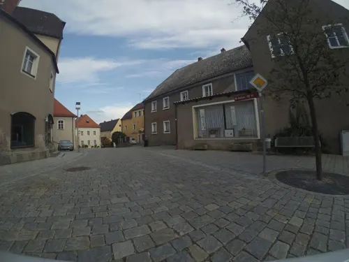
Pfreimd (German pronunciation: [pfʁaɪmt] ) is a town in the district of Schwandorf, in Bavaria, Germany. It is situated on the river Naab, 19 km north of Schwandorf, and 20 km south of Weiden in der Oberpfalz. It is also close to the border with the Czech Republic.
From the Wikipedia article Pfreimd (this version), under CC BY-SA 4.0.
Things to do39

27 more on the map.
Museums and landmarks67



55 more on the map.
Parks, trails and playgrounds11

Freibad Perschen
Sports field and stadium · 3.1 km
20 Neusather Straße, Nabburg
Mo-Su 09:00-20:00,09:00-11:00,17:00-19:00 || "bei Schlechtwetter"


Restaurants and cafes38

Gasthof Sperl
Restaurant · German · 5.8 km
24 Bahnhofstraße, Wernberg-Köblitz
Mo-Su 07:30-14:00,16:30-22:00

Alter Pfarrhof
Restaurant · International · 5.5 km
3 Schloßbergweg, Wernberg-Köblitz
Tu-Su 17:00-23:00; Su 11:30-14:00; Nov-Feb Su 17:00-23:00 off
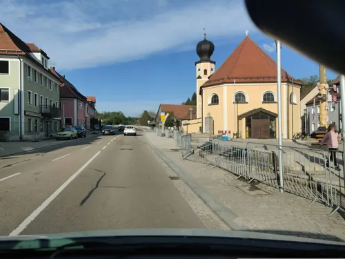
Burkhard
Restaurant · German · 5.5 km
10 Marktplatz, Wernberg-Köblitz
Su-Tu 11:30-15:00; Mo-We,Sa 17:30-23:00; Fr off
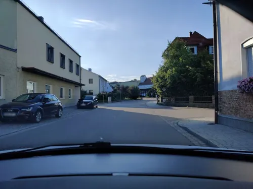
Gaststätte Sauerer
Restaurant · Regional · 4.8 km
17 Bahnhofstraße, Nabburg
Mo-Tu 09:00-14:00; Th 09:00-14:00,18:00-22:00; Fr...
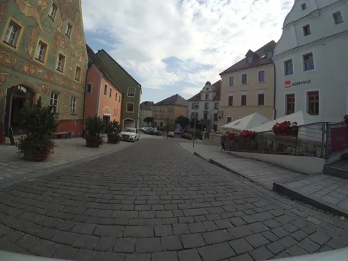
Restaurant Jetschy
Restaurant · Burger, German · 4.2 km
1 Oberer Markt, Nabburg
Mo 11:00-13:30,16:30-22:00; We-Fr 11:00-13:30,16:30-22:00; Sa...
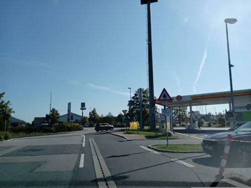


Bamler brot & café
Bakery · 5.5 km
36 Klaus-Conrad-Straße, Wernberg-Köblitz
Mo-Fr 05:30-16:00; Sa 05:00-12:00
26 more on the map.
Where to stay7
Churches and places of worship25
Nikolauskirche
Church · Roman Catholic · 4.2 km
13 Perschener Straße, Nabburg
Sankt Barbara - Wallfahrtskirche, Eixlbergkirche
Church · Catholic · 1.8 km
Am Eixlberg, Pfreimd
Shopping16
Gas and EV charging8
Schools, colleges and libraries8
Healthcare5
St.- Anna-Apotheke
Clinic and pharmacy · 5.5 km
9 Nürnberger Straße, Wernberg-Köblitz
Map of Pfreimd
224 places. The map loads OpenStreetMap tiles when you open it.
Getting there and nearby towns
Verkehrslandeplatz Bayreuth (BYU) is the nearest airport with scheduled flights listed in OpenStreetMap, 67 km away.
- Wernberg-Köblitz 6 km north, about 6 min by car
- Kümmersbruck 23 km west, about 23 min by car
- Amberg 24 km west, about 24 min by car
- Sulzbach-Rosenberg 31 km west, about 31 min by car
- Maxhütte-Haidhof 33 km south, about 33 min by car
- Burglengenfeld 33 km south, about 33 min by car
- Windischeschenbach 35 km north, about 35 min by car
- Regenstauf 41 km south, about 41 min by car
- Roding 41 km southeast, about 41 min by car
- Cham 45 km southeast, about 45 min by car
Drive times are estimates from straight-line distance, not routes.
Local news
Headlines from INDB.
Reviews, tips and questions
Loading what members have shared...
Sources and licences
- GeoNames (CC BY 4.0): population, coordinates, regions and time zone
- Mapillary (see each image): photos
- OpenStreetMap contributors (ODbL 1.0): places, airports, map data
- Wikidata (CC0 1.0): elevation, founding date, time zone, website
- Wikimedia Commons (see each image): photos
- Wikipedia (CC BY-SA 4.0): overview and history text
Photo credits
- Oberpfreimd kirche orgel, Regerman, CC BY-SA 4.0
- Bild Pfreimd Brunnen Marktplatz, Alois Köppl, Gleiritsch, CC BY-SA 3.0
- Bild Pfreimd Marktplatz 2010, Alois Köppl, Gleiritsch, CC BY-SA 3.0
- Burg Wernberg 2011 01, Alois Köppl, Gleiritsch, CC BY 3.0
- Perschen-Neusath-WJP-1, W.J.Pilsak, CC BY-SA 3.0
- Nabburg Mähntor 006, GFreihalter, CC BY-SA 4.0
- Nabburg Stadtkirche, Claudia Sadewasser, CC BY-SA 4.0
- Nabburg (Mittelschulstraße 2), luckyprof, CC BY-SA 3.0
- Naabburg, Oberer Markt 6-001, Tilman2007, CC BY-SA 3.0
- NabburgNikolausKirche 21, Allexkoch, CC BY-SA 4.0
- St. Peter und Paul in Perschen, Richard Huber, CC BY-SA 3.0
- Pfreimd Eixlberg, Wallfahrtskirche St. Barbara, GZilch, CC BY-SA 4.0
- Hohentreswitz (Kirche St. Bartholomäus-4), luckyprof, CC BY-SA 3.0
- Bild Oberpfreimd 2010, Alois Köppl, Gleiritsch, CC BY-SA 3.0
- Wernberger Kirche, Zenit, CC BY-SA 3.0
- Saltendorf St. Paul 29. Mai 2016 02, Alois Köppl, Gleiritsch (=Zusatz), CC BY-SA 4.0
- 2022 Pfreimd Pauluskirche, Alois Köppl, Gleiritsch, CC BY 3.0
- Stolperstein für Friedel Bruckmann (Nabburg), Christian Michelides, CC BY-SA 4.0
- Stolperstein für Gerta Bruckmann (Nabburg), Christian Michelides, CC BY-SA 4.0
- Stolperstein für Günther Bruckmann (Nabburg), Christian Michelides, CC BY-SA 4.0
- Stolperstein für Sally Bruckmann (Nabburg), Christian Michelides, CC BY-SA 4.0
- Stolperstein für Irma Rosenhein (Nabburg), Christian Michelides, CC BY-SA 4.0
- St. Peter und Paul in Perschen, Richard Huber, CC BY-SA 3.0
- Denkmal Bayern Wernberg D-3-76-150-23 Burg Wernberg bei Nacht, M.B.Kammerer, CC BY-SA 3.0 de
- Stolpersteine Nabburg Bruckmann, Herbstlaub, CC0
- Schloss Neusath-1, luckyprof, CC BY-SA 3.0
- St Nikolaus - Nabburg 012, DALIBRI, CC BY-SA 4.0
- Judenturm 001, Heinrich Becher, CC BY-SA 4.0
- Rosengasse 7 001, Heinrich Becher, CC BY-SA 4.0
- Turmmaurer-Turm 001, Heinrich Becher, CC BY-SA 4.0
- Turmmaurerturm 002b, Heinrich Becher, CC BY-SA 4.0
- Mapillary (osmplus org) 2025-04-28 11H44M04S333 (685284914208437 at LjFYytNUTufRk5rmaGH4hz), osmplus_org, CC BY-SA 4.0
- Mapillary (osmplus org) 2025-04-28 11H44M03S416 (1042388944509793 at LjFYytNUTufRk5rmaGH4hz), osmplus_org, CC BY-SA 4.0
- Mapillary (osmplus org) 2025-04-28 11H44M04S416 (679612084872032 at LjFYytNUTufRk5rmaGH4hz), osmplus_org, CC BY-SA 4.0
- Mapillary (osmplus org) 2025-04-28 11H44M03S291 (2156574661514959 at LjFYytNUTufRk5rmaGH4hz), osmplus_org, CC BY-SA 4.0
- Mapillary (osmplus org) 2025-04-28 11H44M05S291 (1363086728136504 at LjFYytNUTufRk5rmaGH4hz), osmplus_org, CC BY-SA 4.0
- Mapillary (osmplus org) 2025-04-28 11H44M02S416 (584706121321685 at LjFYytNUTufRk5rmaGH4hz), osmplus_org, CC BY-SA 4.0
- Mapillary (osmplus org) 2025-04-28 11H44M05S416 (717831140691268 at LjFYytNUTufRk5rmaGH4hz), osmplus_org, CC BY-SA 4.0
- Mapillary (osmplus org) 2025-04-28 11H44M02S125 (1413855486466711 at LjFYytNUTufRk5rmaGH4hz), osmplus_org, CC BY-SA 4.0
- Mapillary (osmplus org) 2025-04-28 11H44M06S291 (23967055662899785 at LjFYytNUTufRk5rmaGH4hz), osmplus_org, CC BY-SA 4.0
- Street-level photo, foxconn11, CC BY-SA 4.0
- Street-level photo, foxconn11, CC BY-SA 4.0
- Street-level photo, foxconn11, CC BY-SA 4.0
- Street-level photo, atze02, CC BY-SA 4.0
- Street-level photo, SuedOstLink, CC BY-SA 4.0
- Street-level photo, rnissl, CC BY-SA 4.0
- Street-level photo, SuedOstLink, CC BY-SA 4.0
- Street-level photo, SuedOstLink, CC BY-SA 4.0
- Street-level photo, foxconn11, CC BY-SA 4.0
- Street-level photo, foxconn11, CC BY-SA 4.0
- Street-level photo, foxconn11, CC BY-SA 4.0
- Street-level photo, foxconn11, CC BY-SA 4.0
- Street-level photo, rnissl, CC BY-SA 4.0
- Street-level photo, rnissl, CC BY-SA 4.0
- Street-level photo, foxconn11, CC BY-SA 4.0
- Street-level photo, SuedOstLink, CC BY-SA 4.0
- Street-level photo, foxconn11, CC BY-SA 4.0
- Street-level photo, foxconn11, CC BY-SA 4.0
- Street-level photo, foxconn11, CC BY-SA 4.0
- Street-level photo, foxconn11, CC BY-SA 4.0
- Street-level photo, rnissl, CC BY-SA 4.0
- Street-level photo, atze02, CC BY-SA 4.0


Page built November 9, 2026. Spotted a mistake? Tell us or suggest a place.