


Anklam, Germany
Anklam is a town of 14,694 people in Mecklenburg-Vorpommern, Germany, founded in 1201.
Why visit Anklam
Townapedia lists 13 museums and landmarks, 10 parks and trails, 27 places to eat, 10 places to stay and 4 attractions in and around town.
Highlights include Kino-Center Anklam, Theater Anklam, Otto-Lilienthal-Museum and Altes Lager.
Weather in Anklam
Forecast from MET Norway (CC BY 4.0). Full forecast
About Anklam
Anklam (German pronunciation: [ˈaŋklam] ), formerly known as Tanglim and Wendenburg, is a town in the Western Pomerania region of Mecklenburg-Vorpommern in north-eastern Germany. It is situated on the banks of the Peene river, just 8 km from its mouth in the Kleines Haff, the western part of the Szczecin Lagoon. Anklam has a population of 12,177 (2021) and was the capital of the former Ostvorpommern district. Since September 2011, it has been part of the district of Vorpommern-Greifswald.
From the Wikipedia article Anklam (this version), under CC BY-SA 4.0.
Travel tips from other travellers: Anklam on Wikivoyage (CC BY-SA 4.0).
Things to do4


Museums and landmarks13


Altes Lager
Monument and historic site · 4.3 km
Archaeological site in Vorpommern-Greifswald District, Germany




1 more on the map.
Parks, trails and playgrounds10

Wasserwanderrastplatz Anklam
Marina and boat launch · 0.8 km
Moderne Schwimmstege, Bollwerk, Strom, Wasser
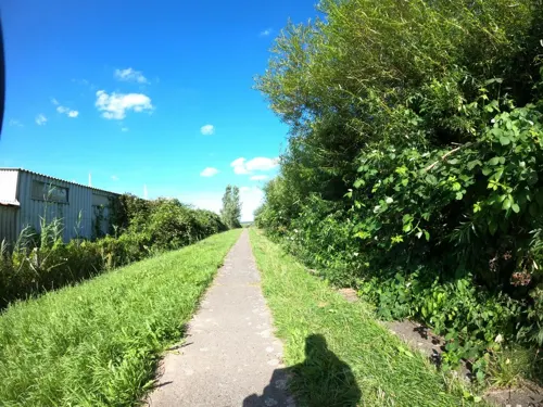

Wasserwanderrastplatz Menzlin "Naturhafen"
Marina and boat launch · 4.7 km
Langer Steg in einem Torfstich, auch größere Boote gesehen


Restaurants and cafes27
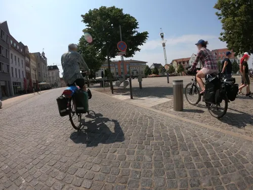
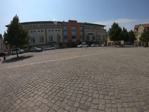
Junge - Die Bäckerei
Cafe · Sandwich
7 Markt, Anklam
Mo-Fr 07:00-17:30; Sa-Su 07:00-17:00; PH 07:00-17:30


Mr. Food
Restaurant · Indian
11 Steinstraße
Mo, We-Su 11:00-14:00, 17:00-22:00; Tu 17:00-22:00

Bierstube Duewell
Bar and pub
5 Kronwieckstraße
Mo-Fr 15:00-22:00; Sa-Su 15:00-23:00

Cupcrush Tea Bar
Cafe · Bubble Tea, Cake, Tea, Pastry, Ice Cream
Tu-Sa 11:00-19:00; Su 12:00-19:00


Eis Cafe
Ice cream
Markt, Anklam
Mo-Fr 10:00-17:00; Sa 12:00-17:00; Su 13:00-17:00
Hansekeller
Restaurant
1 Pelzerstraße, Anklam
Mo 17:00-22:00; Tu-Sa 12:00 -22:00; Su 12:00-16:00
15 more on the map.
History
In the early Middle Ages, there was an important Scandinavian and Wendish settlement in the area near the present town now known as Altes Lager Menzlin. Anklam proper began as an associated Wendish fortress.
In the Middle Ages the town was a part of the Duchy of Pomerania. During the German expansion eastwards, the abandoned fortress was developed into a settlement named Tanglim after its new founder. The site possesses importance as the head of navigation on the Peene. It was elevated to town status in 1244 and became a member of the Hanseatic League the same year or in 1483. The town remained small and non-influential, but achieved a measure of wealth and prosperity with its membership.
As a town of considerable military importance, it suffered greatly during the Thirty Years' War when Swedish and Imperial troops battled over it across a twenty-year span. Amid this and subsequent wars, it also endured repeated outbreaks of fire and plague. It was occupied by imperial forces from 1627 to 1630, and thereafter by Swedish forces. After the war, Anklam became part of Swedish Pomerania in 1648. In 1676, it was captured by Frederick William of Brandenburg.
From the History section of Anklam on Wikipedia, under CC BY-SA 4.0.
Where to stay10
Churches and places of worship9
Shopping17
Gas and EV charging5
Schools, colleges and libraries7
Healthcare7
Map of Anklam
109 places. The map loads OpenStreetMap tiles when you open it.
Getting there and nearby towns
Heringsdorf Airport (HDF) is the nearest airport with scheduled flights listed in OpenStreetMap, 30 km away.
- Wolgast 22 km north, about 22 min by car
- Ueckermünde 27 km southeast, about 27 min by car
- Universitäts- und Hansestadt Greifswald 32 km northwest, about 32 min by car
- Torgelow 33 km southeast, about 33 min by car
- Neubrandenburg 44 km southwest, about 44 min by car
- Demmin 44 km west, about 44 min by car
- Pasewalk 44 km southeast, about 44 min by car
- Grimmen 51 km northwest, about 51 min by car
- Prenzlau 61 km south, about 1 h by car
- Stralsund 64 km northwest, about 1 h by car
Drive times are estimates from straight-line distance, not routes.
Local news
Headlines from INDB.
Reviews, tips and questions
Loading what members have shared...
Sources and licences
- GeoNames (CC BY 4.0): population, coordinates, regions and time zone
- Mapillary (see each image): photos
- OpenStreetMap contributors (ODbL 1.0): places, airports, map data
- Wikidata (CC0 1.0): elevation, founding date, time zone, website, landmarks and historic places
- Wikimedia Commons (see each image): photos
- Wikipedia (CC BY-SA 4.0): overview and history text
Photo credits
- Anklam Luftaufnahme (2020), HaSe, CC BY-SA 4.0
- Nikolaikirche Anklam 15.04.2018 aktuell, Elisauer, CC BY-SA 4.0
- Zunft Wappenfenster in der Sakristei der Nikolaikirche Anklam, Elisauer, CC BY-SA 4.0
- Zunft Fenster Nikolaikirche Anklam, Elisauer, CC BY-SA 4.0
- Höhenmarke Anklam, Ulrich Kulle, CC BY 4.0
- Höhenmarke Anklam Nikolaikirche Stützpfeiler ONO, Ulrich Kulle, CC BY 4.0
- Anklam Nikolaikirche Südwest 2013-12-27, Erell, CC BY-SA 3.0
- Anklam Steinstrasse 7 Postamt Nordseite, Erell, CC BY-SA 3.0
- Anklam, das Rathaus, Dguendel, CC BY 4.0
- Anklam, die Nikolaikirche, Dguendel, CC BY 4.0
- Anklam Nikolaikirche Südseite 2013-12-27, Erell, CC BY-SA 3.0
- Anklam Steinstrasse 1-2, Erell, CC BY-SA 3.0
- Anklam Nikolaikirche Dez 2012, Lupi82, CC0
- Anklamer Marktplatz, Schafevormfenster, CC BY-SA 4.0
- Anklam, Häuserzeile am Markt, Dguendel, CC BY 4.0
- Anklam, Greifenbrunnen und Haus Burgstraße 4, Dguendel, CC BY 4.0
- Alte Post Anklam 2609,2021 mit Umfeld, Elisauer, CC BY-SA 4.0
- Anklam, das Steintor, Bild 1, Dguendel, CC BY 4.0
- Anklam, das Steintor, Bild 2, Dguendel, CC BY 4.0
- Brunnen Markt 6 (Anklam) Greifenbrunnen&Walther Preik&19882, OTFW , Berlin, CC BY-SA 3.0
- Brunnen Markt 6 (Anklam) Greifenbrunnen&Walther Preik&19886, OTFW , Berlin, CC BY-SA 3.0
- Brunnen Markt 6 (Anklam) Greifenbrunnen&Walther Preik&19887, OTFW , Berlin, CC BY-SA 3.0
- Brunnen Markt 6 (Anklam) Greifenbrunnen&Walther Preik&19884, OTFW , Berlin, CC BY-SA 3.0
- Brunnen Markt 6 (Anklam) Greifenbrunnen&Walther Preik&19885, OTFW , Berlin, CC BY-SA 3.0
- Brunnen Markt 6 (Anklam) Greifenbrunnen&Walther Preik&19883, OTFW , Berlin, CC BY-SA 3.0
- Brunnen Markt 6 (Anklam) Greifenbrunnen&Walther Preik&1988, OTFW , Berlin, CC BY-SA 3.0
- Anklam Marktplatz 2013-12-27, Erell, CC BY-SA 3.0
- Anklam, Badstüberstraße und Pulverturm, Dguendel, CC BY 4.0
- Schulstraße 3 Anklam 30.09.2021 aktuell, Elisauer, CC BY-SA 4.0
- Anklam, die Frauenstraße, Dguendel, CC BY 4.0
- Anklam, das Postamt, Dguendel, CC BY 4.0
- Stolperstein Markt 7 (Anklam) Erich Silbermann, OTFW , Berlin, CC BY-SA 3.0
- Stolperstein Markt 7 (Anklam) Cläre Klara Silbermann, OTFW , Berlin, CC BY-SA 3.0
- Anklam, der Markt, Dguendel, CC BY 4.0
- Anklam, Garnisonskirche und Häuser Heilige-Geist-Straße 2-4, Dguendel, CC BY 4.0
- Anklam, die Garnisonskirche, Dguendel, CC BY 4.0
- Anklam Garnisonskirche Südwest gesamt, Erell, CC BY-SA 3.0
- Anklam, die Marienkirche, Dguendel, CC BY 4.0
- Anklam Neuer Markt 4 2014-04-12, Erell, CC BY-SA 3.0
- Otto-Lilienthal-Museum, Dreizung, Public domain
- WalMenz, J. E. Walkowitz, CC BY-SA 3.0
- KreuzkircheAnklam, Lupi82, Public domain
- GarnisonskircheundHgsinAnklam, Lupi82 at German Wikipedia, Public domain
- St.MarienkircheinAnklam, Lupi82 at German Wikipedia ( Original text: Lupi82 ), Public domain
- Kirche Ziethen Vorpommern 1, Erell, CC BY-SA 3.0
- Anklam Leipziger Allee 22–25 Lilienthal-Gymnasium Ecke Südost, Erell, CC BY-SA 3.0
- NSG Peenetal Abends an der Peene bei Anklam 02, Elisauer, CC BY-SA 4.0
- PulvertumAnklam, Lupi82, Public domain
- Steintor Anklam, Michael Sander, CC BY-SA 3.0
- Anklam Wasserturm, Oberlausitzerin64, CC BY-SA 4.0
- SalvatorKircheAnklamAussen, Miwiesboeck, CC BY-SA 3.0
- Street-level photo, jacobbraeutigam, CC BY-SA 4.0
- Street-level photo, masterofnoroad, CC BY-SA 4.0
- Street-level photo, masterofnoroad, CC BY-SA 4.0
- Street-level photo, masterofnoroad, CC BY-SA 4.0
- Street-level photo, masterofnoroad, CC BY-SA 4.0
- Street-level photo, jacobbraeutigam, CC BY-SA 4.0
- Street-level photo, jacobbraeutigam, CC BY-SA 4.0
- Street-level photo, masterofnoroad, CC BY-SA 4.0
- Street-level photo, masterofnoroad, CC BY-SA 4.0
- Street-level photo, jacobbraeutigam, CC BY-SA 4.0
- Street-level photo, flormeow26, CC BY-SA 4.0
- Street-level photo, flormeow26, CC BY-SA 4.0
- Street-level photo, masterofnoroad, CC BY-SA 4.0
- Street-level photo, masterofnoroad, CC BY-SA 4.0
- Street-level photo, masterofnoroad, CC BY-SA 4.0
- Street-level photo, flormeow26, CC BY-SA 4.0
- Street-level photo, masterofnoroad, CC BY-SA 4.0
- Street-level photo, jacobbraeutigam, CC BY-SA 4.0


Page built November 8, 2026. Spotted a mistake? Tell us or suggest a place.