


Why visit Bad Salzungen
Townapedia lists 138 museums and landmarks, 31 parks and trails, 115 places to eat, 25 places to stay and 68 attractions in and around town.
Highlights include Bad Salzungen, Alte Warth, Erlebnisbergwerk Merkers and Altensteiner Höhle.
Weather in Bad Salzungen
Forecast from MET Norway (CC BY 4.0). Full forecast
About Bad Salzungen
Bad Salzungen (German: [baːt ˈzalt͡sʊŋən] ) is a town in Thuringia, Germany. It is the capital of the Wartburgkreis district.
From the Wikipedia article Bad Salzungen (this version), under CC BY-SA 4.0.
Things to do68





56 more on the map.
Museums and landmarks138


Altensteiner Höhle
Museum · 7.9 km
Älteste Schauhöhle Thüringens
Th,Su 14:00-15:00; Apr-Oct Th,Su 10:00-11:00

Alter Ringelstein
Monument and historic site · 8.2 km
Der Alte Ringelstein war eine kleine Anlage zur Kontrolle der Handelsstraßen vom Moorgrund / Salzungen kommend Richtung Eisenach. Noch...

Jagdhaus Kissel
Monument and historic site · 8.2 km
1 Forsthaus, Bad Salzungen


Marienthaler Schlösschen
Monument and historic site · 6.7 km
130 Altensteiner Straße, Bad Liebenstein


Schloss Leimbach
Monument and historic site · 2.5 km
3 Schloßweg, Leimbach


126 more on the map.
Parks, trails and playgrounds31

Freibad Tiefenort
Sports field and stadium · 5.7 km
May-Sep: Mo-Fr 12:00-19:00; May-Sep: Sa,Su,PH 10:00-20:00

Freibad Gumpelstadt
Sports field and stadium · 5.0 km
Mo-Fr 12:00-19:00; Sa,Su 10:00-20:00 "Je nach Witterung und Ferienzeit"


Piratenschiff
Playground
Zentrales Spielgerät ist das "Piratenschiff" Die Firma Spielart in 99880 Laucha hat sich auf die Herstellung von Spielplatz-Artikeln...


BioBad Glücksbrunn
Sports field and stadium · 7.7 km
68 Kisseler Straße, Bad Liebenstein

Kulturgarten
Park
Der Kulturgarten in Bad Salzungen ist 2023 als Freianlage für Veranstaltungen auf dem Gelände der Musikschule und Stadtbibliothek...

Salzspielplatz
Playground · 0.6 km
Der südwestliche Teil des Rathenauparks wurde als Abenteuerspielplatz umgestaltet. Es wurden fünf separate Flächen mit Klettergerüsten,...
19 more on the map.
Restaurants and cafes115
Cafe & Restaurant Logierhof
Restaurant · German · 8.1 km
3 Heinrich-Mann-Straße, Bad Liebenstein
PH,Th-Tu 11:00-18:00+

Chausseehaus Zur Einnahme
Restaurant · German · 8.0 km
10 Herzog-Georg-Straße, Bad Liebenstein
Mo-Su 11:00+
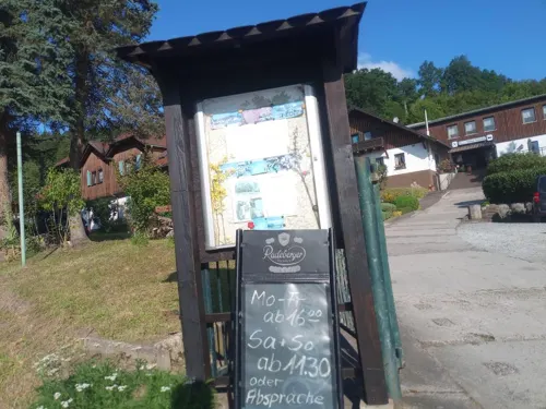
Hotel-Restaurant Waldhaus Wittgenthal
Restaurant · Regional · 7.2 km
1 Wittgenthal, Breitungen/Werra
Mo 19:00-22:00; Tu-Fr 11:30-22:00; Sa 11:30-23:00; Su 10:00-22:00
Backhaus Nahrstedt
Bakery · 4.7 km
25 Nürnberger Straße, Barchfeld-Immelborn
Mo-Fr 06:00-17:30; Sa 06:00-11:30

Backhaus Nahrstedt
Bakery · 8.0 km
6 Ruhlaer Straße, Bad Liebenstein
Mo-Sa 06:00-20:00; Su 07:00-11:00; PH 07:00-10:00

Bäckerei & Konditorei Leinweber
Cafe · 7.6 km
32 Herzog-Georg-Straße, Bad Liebenstein
Tu-Sa 07:00-18:00; Su 13:00-18:00; Mo off
Ferienwohnung Helene
Restaurant · German
Mo-Fr 11:00-14:30,17:00-22:00; Sa 11:00-22:00; Su 11:00-21:00


103 more on the map.
Where to stay25
Churches and places of worship28
Amalienkirche
Church · Lutheran · 3.9 km
Bergstraße, Barchfeld-Immelborn
Kirche Barchfeld
Church · Protestant · 4.6 km
58 Nürnberger Straße, Barchfeld-Immelborn
Georgskirche
Church · Lutheran · 4.8 km
46a Moorgrundstraße, Bad Salzungen
Lutherkirche
Church · Lutheran · 5.6 km
Heinrich-Hofmann-Straße, Bad Salzungen
Shopping35
Gas and EV charging13
Autohaus Frank Hermann L...
Gas station · 1.8 km
108 Langenfelder Straße, Bad Salzungen
Schools, colleges and libraries24
Erste Staatliche Regelschule Bad Salzungen
School
9 Rudolf-Breitscheid-Straße, Bad Salzungen
Staatliche Grundschule Parkschule
School · 1.0 km
133 Straße der Einheit, Bad Salzungen
Staatliche Regelschule Altensteiner Oberland
School · 8.2 km
32 Heinrich-Mann-Straße, Bad Liebenstein
Staatliche Regelschule Werratal
School · 1.4 km
18 Straße der Einheit, Bad Salzungen
3. Staatliche Grundschule An den Beeten
School · 1.3 km
8 Clara-Zetkin-Straße, Bad Salzungen
Berufsschulzentrum Bad Salzungen und Medizinische Fachschule
School · 1.3 km
1 Lindigallee, Bad Salzungen
Christian-Ludwig-Wucke-Schule
School · 0.9 km
10-12 Albert-Schweitzer-Straße, Bad Salzungen
Healthcare16
Stadion Apotheke
Clinic and pharmacy · 0.8 km
22 Albert-Schweitzer-Straße, Bad Salzungen
Map of Bad Salzungen
250 places. The map loads OpenStreetMap tiles when you open it.
Getting there and nearby towns
Flugplatz Eisenach-Kindel (EIB) is the nearest airport with scheduled flights listed in OpenStreetMap, 26 km away.
- Schmalkalden 18 km southeast, about 18 min by car
- Eisenach 19 km north, about 19 min by car
- Waltershausen 24 km northeast, about 24 min by car
- Meiningen 30 km southeast, about 30 min by car
- Zella-Mehlis 35 km southeast, about 35 min by car
- Gotha 36 km northeast, about 36 min by car
- Bebra 36 km northwest, about 36 min by car
- Hünfeld 36 km southwest, about 36 min by car
- Bad Hersfeld 38 km west, about 38 min by car
- Suhl 39 km southeast, about 39 min by car
Drive times are estimates from straight-line distance, not routes.
Local news
Headlines from INDB.
Reviews, tips and questions
Loading what members have shared...
Sources and licences
- GeoNames (CC BY 4.0): population, coordinates, regions and time zone
- Mapillary (see each image): photos
- OpenStreetMap contributors (ODbL 1.0): places, airports, map data
- Wikidata (CC0 1.0): elevation, founding date, time zone, website, landmarks and historic places
- Wikimedia Commons (see each image): photos
- Wikipedia (CC BY-SA 4.0): overview and history text
Photo credits
- Bad Salzungen 2011-by-RaBoe-142, © Ra Boe / Wikipedia Create the proper attribution for your usage by clicking on this button! This file is licensed under the Creative Commons Attribution-Share Alike 3.0 Germany license...., CC BY-SA 3.0 de
- Diverse Bushaltestellen - Bad Salzungen, Nappenplatz, EACC80, CC BY 3.0
- Bad Salzungen 2011-by-RaBoe-143, © Ra Boe / Wikipedia Create the proper attribution for your usage by clicking on this button! This file is licensed under the Creative Commons Attribution-Share Alike 3.0 Germany license...., CC BY-SA 3.0 de
- Bad Salzungen 2011-by-RaBoe-145, © Ra Boe / Wikipedia Create the proper attribution for your usage by clicking on this button! This file is licensed under the Creative Commons Attribution-Share Alike 3.0 Germany license...., CC BY-SA 3.0 de
- Bad Salzungen 2011-by-RaBoe-146, © Ra Boe / Wikipedia Create the proper attribution for your usage by clicking on this button! This file is licensed under the Creative Commons Attribution-Share Alike 3.0 Germany license...., CC BY-SA 3.0 de
- Bad Salzungen 2011-by-RaBoe-068, © Ra Boe / Wikipedia Create the proper attribution for your usage by clicking on this button! This file is licensed under the Creative Commons Attribution-Share Alike 3.0 Germany license...., CC BY-SA 3.0 de
- Bad Salzungen 2011-by-RaBoe-144, © Ra Boe / Wikipedia Create the proper attribution for your usage by clicking on this button! This file is licensed under the Creative Commons Attribution-Share Alike 3.0 Germany license...., CC BY-SA 3.0 de
- Bad Salzungen 2011-by-RaBoe-141, © Ra Boe / Wikipedia Create the proper attribution for your usage by clicking on this button! This file is licensed under the Creative Commons Attribution-Share Alike 3.0 Germany license...., CC BY-SA 3.0 de
- Bad Salzungen 2011-by-RaBoe-140, © Ra Boe / Wikipedia Create the proper attribution for your usage by clicking on this button! This file is licensed under the Creative Commons Attribution-Share Alike 3.0 Germany license...., CC BY-SA 3.0 de
- Bad Salzungen 2011-by-RaBoe-066, © Ra Boe / Wikipedia Create the proper attribution for your usage by clicking on this button! This file is licensed under the Creative Commons Attribution-Share Alike 3.0 Germany license...., CC BY-SA 3.0 de
- Bad Salzungen 2011-by-RaBoe-065, © Ra Boe / Wikipedia Create the proper attribution for your usage by clicking on this button! This file is licensed under the Creative Commons Attribution-Share Alike 3.0 Germany license...., CC BY-SA 3.0 de
- Bad Salzungen 2011-by-RaBoe-067, © Ra Boe / Wikipedia Create the proper attribution for your usage by clicking on this button! This file is licensed under the Creative Commons Attribution-Share Alike 3.0 Germany license...., CC BY-SA 3.0 de
- Bad Salzungen 2011-by-RaBoe-013, © Ra Boe / Wikipedia Create the proper attribution for your usage by clicking on this button! This file is licensed under the Creative Commons Attribution-Share Alike 3.0 Germany license...., CC BY-SA 3.0 de
- Bad Salzungen 2011-by-RaBoe-022, © Ra Boe / Wikipedia Create the proper attribution for your usage by clicking on this button! This file is licensed under the Creative Commons Attribution-Share Alike 3.0 Germany license...., CC BY-SA 3.0 de
- Bad Salzungen 2011-by-RaBoe-064, © Ra Boe / Wikipedia Create the proper attribution for your usage by clicking on this button! This file is licensed under the Creative Commons Attribution-Share Alike 3.0 Germany license...., CC BY-SA 3.0 de
- Bad Salzungen 2011 -Haunscher Hof- by-RaBoe 016, © Ra Boe / Wikipedia Create the proper attribution for your usage by clicking on this button! This file is licensed under the Creative Commons Attribution-Share Alike 3.0 Germany license...., CC BY-SA 3.0 de
- Bad Salzungen 2011-by-RaBoe-023, © Ra Boe / Wikipedia Create the proper attribution for your usage by clicking on this button! This file is licensed under the Creative Commons Attribution-Share Alike 3.0 Germany license...., CC BY-SA 3.0 de
- Bad Salzungen 2011-by-RaBoe-063, © Ra Boe / Wikipedia Create the proper attribution for your usage by clicking on this button! This file is licensed under the Creative Commons Attribution-Share Alike 3.0 Germany license...., CC BY-SA 3.0 de
- Bad Salzungen 2011-by-RaBoe-021, © Ra Boe / Wikipedia Create the proper attribution for your usage by clicking on this button! This file is licensed under the Creative Commons Attribution-Share Alike 3.0 Germany license...., CC BY-SA 3.0 de
- Bad Salzungen 2011-by-RaBoe-024, © Ra Boe / Wikipedia Create the proper attribution for your usage by clicking on this button! This file is licensed under the Creative Commons Attribution-Share Alike 3.0 Germany license...., CC BY-SA 3.0 de
- Bad Salzungen 2011 -Haunscher Hof- by-RaBoe 020, © Ra Boe / Wikipedia Create the proper attribution for your usage by clicking on this button! This file is licensed under the Creative Commons Attribution-Share Alike 3.0 Germany license...., CC BY-SA 3.0 de
- Bad Salzungen 2011-by-RaBoe-018, © Ra Boe / Wikipedia Create the proper attribution for your usage by clicking on this button! This file is licensed under the Creative Commons Attribution-Share Alike 3.0 Germany license...., CC BY-SA 3.0 de
- WAK BERGE Alte Warth, Metilsteiner, CC BY 3.0
- WAK MOORGR Alter Ringelst, Metilsteiner, CC BY-SA 3.0
- WAK BASA Kloster 02, Metilsteiner, CC BY 3.0
- WAK BASA HUSENKIRCHE, Metilsteiner, CC BY-SA 3.0
- WAK Meimers Dänischer Berg, Metilsteiner, CC BY 3.0
- WAK BERGE Eichkopf Kupfersuhl, Metilsteiner, CC BY 3.0
- WAK BERGE Herzeberg, Metilsteiner, CC BY 3.0
- BASA Kloster 17a, Metilsteiner ( talk ), CC BY-SA 3.0
- WAK FH KISSEL, Metilsteiner, CC BY-SA 3.0
- Blick auf den Palas der Krayenburg Tiefenort, Jens Murer, CC BY-SA 3.0
- WAK Waldfisch 040, Metilsteiner ( talk ), CC BY-SA 3.0
- WAK STADTLENGSFELD KIRCHE1, Metilsteiner, CC BY-SA 3.0
- Eingangsbereich nach Renovierung 2021, Friedrich WH, CC BY-SA 4.0
- Erlebnisbergwerk Merkers - salt mine Merkers - Thuringia - Germany - 05, Norbert Nagel, CC BY-SA 3.0
- WAK MÖHRA KIRCHE1, Metilsteiner, CC BY-SA 3.0
- Immelborn24 Kirche1, EACC80, CC BY 3.0
- WAK Weilar 02b, Metilsteiner ( talk ), CC BY-SA 3.0
- BASA Klinikum Bad Salzungen 06, Metilsteiner, CC BY-SA 3.0
- Salzungen Bild500, EACC80, CC BY 3.0
- Forstloch-Riedwiesen Panorama - Naturschutzgebiet - nature reserve - Thuringia - Germany, Norbert Nagel, CC BY-SA 3.0
- WAK Waldfisch 037, Metilsteiner ( talk ), CC BY-SA 3.0
- WAK Peterskirche Tiefenort 01, Metilsteiner, CC BY-SA 3.0
- WAK Gumpelstadt Kirche 01, Metilsteiner ( talk ), CC BY-SA 3.0
- Kirche Barchfeld, Benutzer:Hejkal, CC BY-SA 2.0 de
- Bad Salzungen 2011 -Gradierwerk- by-RaBoe 132, © Ra Boe / Wikipedia Create the proper attribution for your usage by clicking on this button! This file is licensed under the Creative Commons Attribution-Share Alike 3.0 Germany license...., CC BY-SA 3.0 de
- WAK WILDPRECHTR KIRCHE 5, Metilsteiner, CC BY-SA 3.0
- WAK LANGENFELD KIRCHE1, Metilsteiner, CC BY-SA 3.0
- WAK Leimbach 01, Metilsteiner ( talk ), CC BY-SA 3.0
- Gym-basa haus1, Politikundwirtschaft, CC BY-SA 4.0
- BASA Rathenaupark01, Metilsteiner, CC BY-SA 3.0
- Tiefenort24 Pic06, EACC80, CC BY 3.0
- Ehrenhain, Kriegerdenkmal 1. und 2. WK Bad Salzungen, Tiefenort 20250328 0001, Tilman2007, CC BY-SA 4.0
- WAK Jagdhaus Kissel 04, Metilsteiner ( talk ), CC BY-SA 3.0
- WAK KRAYENBURG1, Metilsteiner, CC BY-SA 3.0
- Schloss Leimbach Treppenturm, Metilsteiner, CC BY 3.0
- BASA Kloster 12d, Metilsteiner ( talk ), CC BY-SA 3.0
- Gumpelstadt Bild06, EACC80, CC BY 3.0
- BASA Pirateninsel (2), Metilsteiner, CC BY-SA 3.0
- WAK ETTENHSN SUHL KIRCHE2, Metilsteiner, CC BY-SA 3.0
- Salzungen24 ChrLWuckeSchule Pic03, EACC80, CC BY-SA 3.0
- WAK BALI 207, Metilsteiner, CC BY-SA 4.0
- Altensteiner Höhle, Rainer Lippert, CC0
- Bad Salzungen 2011-by-RaBoe-089, © Ra Boe / Wikipedia Create the proper attribution for your usage by clicking on this button! This file is licensed under the Creative Commons Attribution-Share Alike 3.0 Germany license...., CC BY-SA 3.0 de
- Teich mit Ente im Elisabethpark in Bad Liebenstein, Stephan van Helden, CC BY-SA 4.0
- Street-level photo, natura, CC BY-SA 4.0
- Street-level photo, fahrradfahrer, CC BY-SA 4.0
- Street-level photo, zoegglmeyr, CC BY-SA 4.0
- Street-level photo, zoegglmeyr, CC BY-SA 4.0
- Street-level photo, bahnpirat, CC BY-SA 4.0
- Street-level photo, zoegglmeyr, CC BY-SA 4.0
- Street-level photo, bct, CC BY-SA 4.0
- Street-level photo, ottor, CC BY-SA 4.0
- Street-level photo, ottor, CC BY-SA 4.0
- Street-level photo, ottor, CC BY-SA 4.0
- Street-level photo, fahrradfahrer, CC BY-SA 4.0
- Street-level photo, zoegglmeyr, CC BY-SA 4.0
- Street-level photo, zoegglmeyr1, CC BY-SA 4.0
- Street-level photo, zoegglmeyr1, CC BY-SA 4.0
- Street-level photo, zoegglmeyr1, CC BY-SA 4.0
- Street-level photo, bahnpirat, CC BY-SA 4.0
- Street-level photo, bct, CC BY-SA 4.0
- Street-level photo, zoegglmeyr1, CC BY-SA 4.0
- Street-level photo, natura, CC BY-SA 4.0
- Street-level photo, ottor, CC BY-SA 4.0
- Street-level photo, natura, CC BY-SA 4.0


Page built November 8, 2026. Spotted a mistake? Tell us or suggest a place.