


Why visit Gotha
Townapedia lists 160 museums and landmarks, 27 parks and trails, 117 places to eat, 23 places to stay and 24 attractions in and around town.
Highlights include Tierpark Gotha, Ekhof Theater, Jüdischer Friedhof and Wasserkunst.
Weather in Gotha
Forecast from MET Norway (CC BY 4.0). Full forecast
About Gotha
Gotha (German pronunciation: [ˈɡoːtaː] ) is the fifth-largest city in Thuringia, Germany, 20 kilometres (12 miles) west of Erfurt and 25 km (16 miles) east of Eisenach with a population of 46,400 (2024). The city is the capital of the district of Gotha and was also a residence of the Ernestine Wettins from 1640 until the end of monarchy in Germany in 1918. The House of Saxe-Coburg and Gotha originating here spawned many European rulers, including the royal houses of the United Kingdom, Belgium, Portugal (until 1910) and Bulgaria (until 1946).
From the Wikipedia article Gotha (this version), under CC BY-SA 4.0.
Travel tips from other travellers: Gotha on Wikivoyage (CC BY-SA 4.0).
Photos of Gotha


Things to do24

Tierpark Gotha
Zoo and aquarium · 2.0 km
2 Töpfleber Weg, Gotha
Apr-Oct PH,Mo-Su 09:00-18:00; Nov-Mar PH,Mo-Su 09:00-16:00

Ekhof-Theatre Gotha
Cinema and theater
Theatre in Friedenstein Palace in Gotha, Germany

Gotha State Theatre
Cinema and theater
Former theatre in Gotha, Germany



Kartoffelsack
Farm and orchard · 5.8 km
2 Oberer Goldbacher Weg, Nessetal
Mo-Fr 08:30-18:00; 08:30-12:30


12 more on the map.
Museums and landmarks160


Ducal Museum Gotha
Museum · 0.6 km
Museum at Friedenstein Castle in Gotha, Thuringia, Germany



148 more on the map.
Parks, trails and playgrounds27

Wasserburg Günthersleben
Park · 6.5 km
1 An der Wasserburg, Drei Gleichen
24/7



Maxxis Familien und Spieleparadies
Sports field and stadium · 6.2 km
8 Pfauseeallee, Emleben
We-Fr 14:00-18:30; Sa,Su 11:00-19:00; Mo,Tu off

Big Play
Playground · 1.0 km
Abenteuerspielplatz
Mo-Sa 08:00-20:00; PH,Su 09:00-13:00,15:00-20:00

15 more on the map.
Restaurants and cafes117
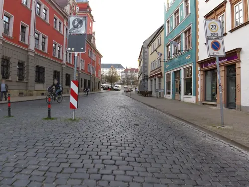
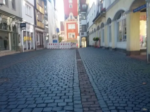
Cafe Kanne
Cafe · Ice Cream, Cake
14 Hünersdorfstraße, Gotha
Tu-Fr 10:00-17:00; Sa-Su 13:00-17:00; Mo closed
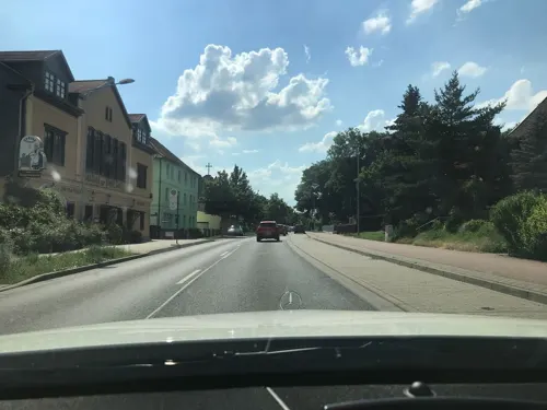
Café "Oma Plüsch"
Restaurant · German · 3.2 km
138 Weimarer Straße, Gotha
Tu-Th,Sa,PH 11:00-21:00; Su 11:00-15:00
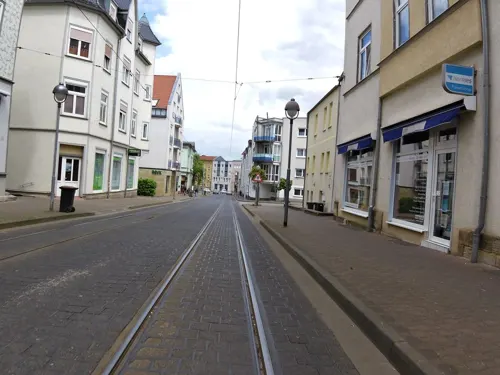
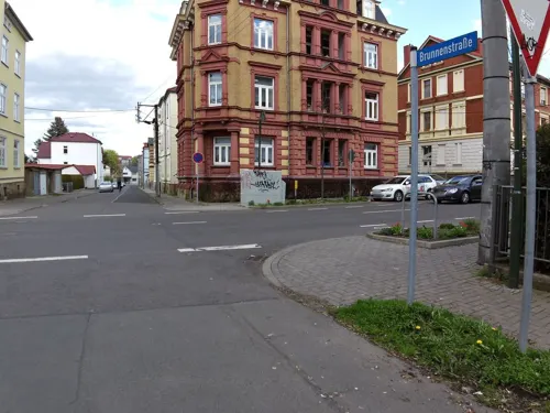
Osteria da Massimo
Restaurant · Italian · 0.6 km
31 18.-März-Straße, Gotha
Mo 18:00-22:30; Th-Sa 11:30-14:30, 18:00-22:30
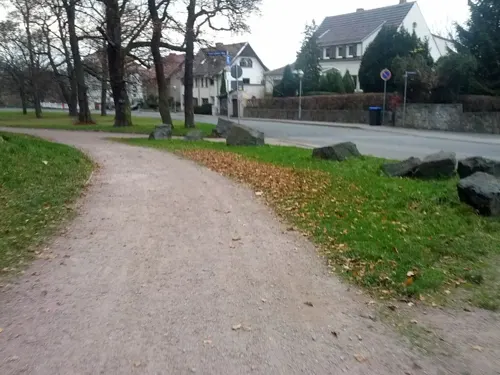
Pagenhaus
Restaurant · Regional, German
1 Schloss Platz, Gotha
Tu,We 11:30-17:00; Th 11:30-21:00; Fr,Sa 11:30-22:00
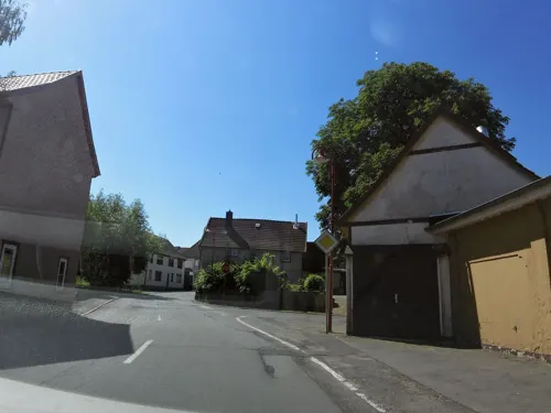
Restaurant Dionysos
Restaurant · Greek · 3.7 km
9 Ernst-Thälmann-Straße, Gotha
Tu-Sa 17:00-22:30; Su,PH 11:30-14:30,17:00-22:00; Mo off
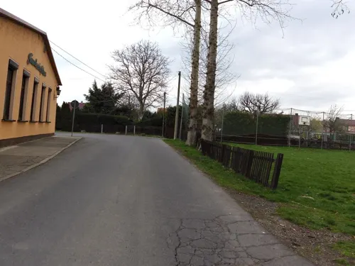
Restaurant Gemeinschaftshaus "G-Haus"
Restaurant · Regional · 1.7 km
44 Goldbacher Straße, Gotha
We-Fr 11:30-14:00,17:00-22:00; Sa 11:30-22:00; Su 11:30-15:00;...
Symposion Palast
Restaurant · Greek · 2.8 km
92 Salzgitterstraße, Gotha
Mo-Su 11:00-14:30; Mo-Su 17:00-24:00

Michelangelo
Restaurant · Italian, Italian Pizza, Mediterranean, Noodles, Pasta, Pizza
20, 21 Hauptmarkt, Gotha
Tu-Su 10:30-22:00
Restaurant Weinschänke
Restaurant · Regional
28 Gartenstraße, Gotha
Su 11:30-14:30; We-Sa 11:30-14:30,18:00+; Mo-Tu off
105 more on the map.
History
Gotha has existed at least since the 8th century, when it was mentioned in a document signed by Charlemagne as Villa Gotaha (Old High German gotaha meaning "good waters") in 775. The first settlement was probably located around today's Hersdorfplatz outside the north-eastern edge of the later city centre. During the 11th century, the nearby Ludowingians received the village and established the city in the late 12th century, as Gotha became their second most important city after Eisenach. The city generated wealth because it was conveniently located at the junction of two important long-distance trade routes: the Via Regia from Mainz and Frankfurt to Leipzig and Breslau and a north–south route from Mühlhausen over the Thuringian Forest to Franconia. One of the oldest pieces of evidence of busy trade in the city is the "Gotha cache of coins" with nearly 800 Bracteates, buried in 1185 in the central city. In 1180, Gotha was first mentioned as a city, when the area between Brühl and Jüdenstraße became the core of urban development, highlighting the early presence of Jews in this old trading town.
Read more of the history
The parish church of this first urban settlement was St. Mary's Church (demolished in 1530) at Schlossberg. The castle (at the site occupied today by Friedenstein Castle) was first mentioned in 1217. As the Ludowingians died out in 1247, Gotha became part of the Wettins' territories, where it remained until 1918. The new town east of Querstraße was established in the early 15th century (with the Neumarkt, first mentioned in 1428).
The monastery (first Cistercians, since 1258 Augustinians) was founded before 1251 and abandoned in 1525. Until 1665, the bourse of Gotha was located in the centre of Hauptmarkt square inside the Renaissance building, which hosts the town hall today. The medieval town hall was located on the north-eastern edge of Hauptmarkt, at the site of today's Innungshalle.
Water supply was a big problem, because Gotha is not located on a river. In 1369, Landgrave Balthasar had the Leinakanal built. This channel, over 25 kilometres long, brought fresh water from the Thuringian Forest (Hörsel and Apfelstädt rivers) to the city. The main businesses of medieval Gotha were cloth-making and the woad trade.
The Reformation was introduced in Gotha in 1524 and the castle was rebuilt as a larger fortress between 1530 and 1541. Gotha was already part of the Ernestine Wettins territory after the 1485 Treaty of Leipzig. However, the Ernestines' loss of power after the Schmalkaldic War in 1547, the Treaty of Erfurt in 1572, when the city became part of Saxe-Coburg, and the Thirty Years' War resulted in Gotha's decline. The local castle, Grimmenstein, was razed by Imperial troops in 1572.
The turnaround was brought about by the selection of Gotha as a ducal residence in the 1640 territorial partition, when Ernest the Pious founded the duchy of Saxe-Gotha. The strongly Protestant and absolutist sovereign quickly began to reorganize his small state (even before the war had ended) and in particular fostered the school system by introducing compulsory education up to the age of 12 in 1642. This was the origin of the often noted liberal education of the Gotha citizenry and the following cultural heyday.
Veit Ludwig von Seckendorff was one of numerous experienced and loyal civil servants employed by the duke. Seckendorff was considered one of the most able and influential thinkers on administration and public law of his time. His book Der teutsche Fürstenstaat (1656), written by order of Ernest, served for decades as a standard work in teaching political science at Protestant universities in Germany.
Friedenstein Castle was built between 1643 and 1654 and is one of the first large Baroque residence castles in Germany. Between 1657 and 1676, the city received a stronger fortification, which was demolished between 1772 and 1811. In their place, a park around Friedenstein and a boulevard around the city were established. Some important scientific institutions were the ducal library (today's Forschungsbibliothek Gotha as part of the University of Erfurt), founded in 1650, the "coin cabinet" (1712), the "art and natural collection", basis of today's museums, and the Gotha Observatory at Seeberg mountain, established 1788. The Gotha porcelain manufactory (established in 1767) was famous around 1800 for their faiences.
In 1774, the actor group led by Conrad (or Konrad) Ekhof, called "the father of German acting", came from Weimar to Gotha. He began working at the Schlosstheater and became Direktor of the first ever German court theatre (founded in 1683), while acting in many plays himself. Having turned it into one of the leading theatres in Germany, after his death in 1778 the fame of the theatre declined rapidly.
The Almanach de Gotha, a directory of European royalty and nobility, was first published in 1763 and Justus Perthes founded his science publishing company in 1785. Joseph Meyer followed in 1826 by founding the Bibliographisches Institut, one of the two leading encyclopedia publishers in the German language besides the Brockhaus and Adolf Stieler first published his Handatlas in Gotha in 1816. Johann Adam Weishaupt, the founder of the order of the Illuminati, died in Gotha in 1830. It was also during this time, that the city developed a sizeable Jewish population.
From 1826 to 1918, Gotha, along with Coburg, was one of the two capitals of the Duchy of Saxe-Coburg-Gotha. Under the rule of Duke Ernest II, Gotha was a centre of Germany's liberal movement, where the Gothaer Nachparlament took place in the aftermath of 1848 German Revolution. After 1851, Gustav Freytag, novelist, advocate of German unity, and, often harsh critic of Otto von Bismarck, made Siebleben (today part of Gotha) his summer home. Ernest II made Freytag Hofrat (privy councillor) in 1854, when the Prussian government had issued a warrant for his arrest.
From the History section of Gotha on Wikipedia, under CC BY-SA 4.0.
More about Gotha
Geography
Gotha is situated in a flat landscape within the fertile Thuringian Basin. A tectonic dislocation traverses the city from north-west to south-east. Thereby, it forms three prominent hills: the 431 m high Krahnberg with the Ratsholz forest in the north-west, the hill of Friedenstein Castle in the city centre and the 409 m high Seeberg in the south-east. The city itself lies at an elevation of 300 m and the municipal territory is nearly free of forest (with the two named mountains as exceptions) and is in intensive agricultural use. As one out of only very few ancient cities in Germany, Gotha is not situated on a river, so that water supply was already a problem in the Middle Ages. For that reason, the Leinakanal was built in the 14th century over a distance of more than 25 kilometres, which was at the time an enormous task. The Leinakanal brings water from Hörsel and Apfelstädt river to Gotha, overcoming the watershed between Elbe (Apfelstädt) and Weser (Gotha). The drain of Leinakanal is the Flutgraben, a tributary of Nesse. The Thuringian Forest is located 15 km (9 mi) south-west of Gotha.
Gotha borders the following municipalities, which are all part of Gotha district: Goldbach, Remstädt, Bufleben, Friemar, Tüttleben, Drei Gleichen, Günthersleben-Wechmar, Schwabhausen, Emleben, Leinatal and Hörsel.
Economy
During recent years, the economic situation of the city improved: the unemployment rate in the district declined from 17% in 2005 to 7% in 2013 with rates a bit higher in the city itself than in the other municipalities of the Gotha district.
Agriculture is still important in the region around Gotha with its fertile soil. More than 60% of the municipal territory is in agricultural use for growing maize, crops, vegetables and sugar beets.
Vehicle construction is still the most important industry in Gotha. The well-known Gothaer Waggonfabrik had two successors after 1990: the Gothaer Fahrzeugwerke, a Schmitz Cargobull factory with 800 workers and the Gothaer Fahrzeugtechnik, a crane manufacturer with 400 employees. The brewery belongs to the Paulaner Brewery and has 300 employees. In 2012, there were 28 companies with more than 20 workers in the industrial sector, employing 3,300 people and generating a turnover of more than €850 million. The old industrial district is situated in the east of Gotha, a new one developed after 1990 in the south. Further, the neighbouring small towns of Waltershausen and Ohrdruf have strong industrial cores, where many commuters from Gotha have found work.
Arts and culture
Gotha hosts various museums, which are – together with the ducal buildings – promoted as the Gothaer Barock-Universum ("Baroque universe of Gotha").
The Ekhof Theatre is a Baroque court theatre and the world's only 17th century theatre with original stage machinery still working.
The Historic Museum hosts an exhibition about municipal and regional history and culture of Gotha.
The Museum of Nature shows a natural history exhibition with animals, minerals and fossils.
The Castle Museum contains the former ducal living rooms and several items of cultural history.
The Ducal Museum opposite to the castle hosts the ducal collection of art, containing Egyptian antiques, Renaissance Old Masters paintings, Chinese and Meissen porcelaine and more.
The Insurance Museum at Bahnhofstraße is Germany's only museum on the history of the insurance business, which has been important in Gotha since 1820.
The Tivoli at Cosmarstraße is the place where the Social Democratic Party of Germany was founded and hosts a small exhibition on the party's history.
From the Wikipedia article Gotha, under CC BY-SA 4.0.
Notable people from Gotha
 Johann Friedrich BlumenbachGerman physician, naturalist, physiologist, and anthropologist (1752 – 1840)Photo: Ludwig Emil Grimm, Public domain
 Maria of YugoslaviaQueen Consort of Yugoslavia (1922 - 1934)Photo: Tonka Kulčar-Vajda, Public domain
 Hannah HöchGerman artist (1889–1978)Photo: HenriMichaux, CC BY-SA 4.0
 Princess Augusta of Saxe-GothaGerman princess (1719–1772); Princess of Wales as wife of Frederick, Prince of Wales; mother of George IIIPhoto: Thomas Hudson, Public domain
 Princess Louise of Saxe-Gotha-AltenburgGerman princess (1800-1831)Photo: Unknown author Unknown author, Public domain
 Frederick II, Duke of Saxe-Gotha-Altenburgduke of Saxe-Gotha-Altenburg (1676-1732)Photo: Christian Schilbach, Public domain
 Ernest Louis, Landgrave of Hesse-Darmstadtlandgrave (1667-1739)Photo: Johann Christian Fiedler, Public domain
 Augustus, Duke of Saxe-Gotha-AltenburgDuke of Saxe-Gotha-Altenburg (1772-1822)Photo: Ludwig Döll, Public domain
 Frederick I of Saxe-Gotha-AltenburgFirst Duke of Saxe-Gotha-Altenburg (1646-1691)Photo: Attributed to Christian Schilbach, Public domain
- Ernest II, Duke of Saxe-Gotha-AltenburgDuke of Saxe-Gotha-Altenburg
- Bernhard I of Saxe-MeiningenDuke of Saxe-Meiningen from 1691 to 1706
- Frederick III, Duke of Saxe-Gotha-AltenburgDuke of Saxe-Gotha-Altenburg (1699-1772)
Born in Gotha, according to Wikidata (CC0). Each name links to its Wikipedia article.
Where to stay23
Churches and places of worship30
Friedrichskirche
Church · Lutheran · 1.3 km
31 Erfurter Landstraße, Gotha
Shopping38
Gas and EV charging16
Schools, colleges and libraries36
Healthcare15
Map of Gotha
250 places. The map loads OpenStreetMap tiles when you open it.
Getting there and nearby towns
Flugplatz Eisenach-Kindel (EIB) is the nearest airport with scheduled flights listed in OpenStreetMap, 16 km away.
- Waltershausen 12 km southwest, about 12 min by car
- Bad Langensalza 18 km north, about 18 min by car
- Arnstadt 21 km southeast, about 21 min by car
- Erfurt 24 km east, about 24 min by car
- Eisenach 27 km west, about 27 min by car
- Schmalkalden 31 km southwest, about 31 min by car
- Zella-Mehlis 33 km south, about 33 min by car
- Ilmenau 33 km southeast, about 33 min by car
- Bad Salzungen 36 km southwest, about 36 min by car
- Suhl 38 km south, about 38 min by car
Drive times are estimates from straight-line distance, not routes.
Towns near Gotha


Keep exploring
Local news
Headlines from INDB.
Reviews, tips and questions
Loading what members have shared...
Sources and licences
- GeoNames (CC BY 4.0): population, coordinates, regions and time zone
- Mapillary (see each image): photos
- OpenStreetMap contributors (ODbL 1.0): places, airports, map data
- Wikidata (CC0 1.0): elevation, founding date, time zone, website, landmarks and historic places
- Wikimedia Commons (see each image): photos
- Wikipedia (CC BY-SA 4.0): overview and history text
Photo credits
- Gotha Blick vom Bürgerturm, Muelli24 at German Wikipedia, CC BY-SA 3.0
- Altes Rathaus Gotha 2026-06-26 01, Leonhard Lenz, CC BY 4.0
- Hauptmarkt Gotha at night 2026-06-27 03, Leonhard Lenz, CC BY 4.0
- GLAM Gotha Fischkeller-7279, GodeNehler, CC BY-SA 4.0
- GLAM Gotha Fischkeller-7293, GodeNehler, CC BY-SA 4.0
- GLAM Gotha Fischkeller-7285, GodeNehler, CC BY-SA 4.0
- GLAM Gotha Fischkeller-7280, GodeNehler, CC BY-SA 4.0
- GLAM Gotha Fischkeller-7277, GodeNehler, CC BY-SA 4.0
- GLAM Gotha Fischkeller-7281, GodeNehler, CC BY-SA 4.0
- GLAM Gotha Fischkeller-7282, GodeNehler, CC BY-SA 4.0
- GLAM Gotha Fischkeller-7288, GodeNehler, CC BY-SA 4.0
- GLAM Gotha Fischkeller-7271, GodeNehler, CC BY-SA 4.0
- GLAM Gotha Fischkeller-7278, GodeNehler, CC BY-SA 4.0
- GLAM Gotha Fischkeller-7273, GodeNehler, CC BY-SA 4.0
- GLAM Gotha Fischkeller-7291, GodeNehler, CC BY-SA 4.0
- GLAM Gotha Fischkeller-7294, GodeNehler, CC BY-SA 4.0
- GLAM Gotha Fischkeller-7287, GodeNehler, CC BY-SA 4.0
- GLAM Gotha Fischkeller-7289, GodeNehler, CC BY-SA 4.0
- GLAM Gotha Fischkeller-7286, GodeNehler, CC BY-SA 4.0
- GLAM Gotha Fischkeller-7276, GodeNehler, CC BY-SA 4.0
- GLAM Gotha Fischkeller-7274, GodeNehler, CC BY-SA 4.0
- GLAM Gotha Fischkeller-7290, GodeNehler, CC BY-SA 4.0
- GLAM Gotha Fischkeller-7283, GodeNehler, CC BY-SA 4.0
- GLAM Gotha Fischkeller-7272, GodeNehler, CC BY-SA 4.0
- GLAM Gotha Fischkeller-7275, GodeNehler, CC BY-SA 4.0
- GLAM Gotha Fischkeller-7295, GodeNehler, CC BY-SA 4.0
- GLAM Gotha Fischkeller-7292, GodeNehler, CC BY-SA 4.0
- Hauptmarkt Gotha 2026-06-27 01, Leonhard Lenz, CC BY 4.0
- Altes Rathaus Gotha 2026-06-27 01, Leonhard Lenz, CC BY 4.0
- Altes Rathaus and Hauptmarkt Gotha 2026-06-28 04, Leonhard Lenz, CC BY 4.0
- Old town hall of Gotha (6), Krzysztof Golik, CC BY-SA 4.0
- Old town hall of Gotha (9), Krzysztof Golik, CC BY-SA 4.0
- Old town hall of Gotha (7), Krzysztof Golik, CC BY-SA 4.0
- Old town hall of Gotha (8), Krzysztof Golik, CC BY-SA 4.0
- Altes Rathaus and Hauptmarkt Gotha 2026-06-28 03, Leonhard Lenz, CC BY 4.0
- Altes Rathaus Gotha 02, H.Helmlechner, CC BY-SA 4.0
- Altes Rathaus Gotha 2026-06-27 02, Leonhard Lenz, CC BY 4.0
- Altes Rathaus Gotha 2026-06-28 01, Leonhard Lenz, CC BY 4.0
- Gotha-Hauptmarkt 22-CTH, CTHOE, CC BY-SA 3.0
- Jüdenstraße Gotha 2026-06-26 01, Leonhard Lenz, CC BY 4.0
- Gotha Stadttheater Modell, Wikswat, CC BY-SA 3.0
- Ekhof-Theater Zuschauerraum, Stiftung Schloss Friedenstein Gotha, CC BY-SA 3.0
- Ducal Museum in Gotha 22, Krzysztof Golik, CC BY-SA 4.0
- Herzogliches Museum heute Kunstmuseum Stiftung Schloss Friedenstein Gotha vor 2010 Museum der Natur - Thüringen - Foto Wolfgang Pehlemann DSCN3016, Wolfgang Pehlemann, CC BY-SA 3.0 de
- Augustinian church in Gotha (4), Krzysztof Golik, CC BY-SA 4.0
- Ernestinum Gotha, Michael Sander, CC BY-SA 3.0
- Krahnberg bei Remstädt, Ilmtaler, CC BY-SA 4.0
- GLAM Gotha Fachhochschule-6526, GodeNehler, CC BY-SA 4.0
- Justus-Perthes-Block-CTH, CTHOE, CC BY-SA 3.0
- Thueringen-Tuettleben-Kirche-3, CTHOE, CC BY-SA 3.0
- Günthersleben-Schloss-Grundmauern, CTHOE, CC BY-SA 3.0
- Siebleben-Kirchturm, CTHOE, CC BY-SA 3.0
- Gotha Winterpalais, Stefan C. Hoja, CC BY-SA 4.0
- Tierpark Gotha 3, Giorno2, CC BY 4.0
- Gotha-Löfflerschule-CTH, CTHOE, CC BY-SA 3.0
- Pfullendorf-Kirche-1, CTHOE, CC BY-SA 3.0
- Gotha-Jüdischer-Friedhof-1-CTH, ADSUBIA, CC BY-SA 3.0
- GTH Hauptfriedhof 03, Metilsteiner, CC BY-SA 4.0
- Gotha Bonifatiuskirche2, Metilsteiner, CC BY 3.0
- Gotha Friedrichkirche1, Metilsteiner, CC BY 3.0
- Arnoldischule Gotha, Michael Sander, CC BY-SA 3.0
- Gotha-Stadtbad-2-CTH, CTHOE, CC BY-SA 3.0
- GLAM Gotha Bibliothek des Bildungszentrums-6529, GodeNehler, CC BY-SA 4.0
- Bad Lands 1, CTHOE, CC BY 3.0
- Friemar-Kirche-2-CTH, CTHOE, CC BY-SA 4.0
- Gotha-Christkönigskirche-1, CTHOE, CC BY-SA 3.0
- Boilstädt Zur Himmelspforte 01, ErwinMeier, CC BY-SA 3.0
- Gotha, Schlosskirche im Schloss Friedenstein, Hannibal34, CC BY-SA 3.0
- FFH-Gebiet Krahnberg Gotha 2, Jungsystems, CC BY-SA 4.0
- Gotha Hotel-Lindenhof 20240615 150747, Rigorius, CC BY-SA 4.0
- GLAM Gotha Volkspark-Stadion-7224, GodeNehler, CC BY-SA 4.0
- Siebleben-Friedhof-1-CTH, ADSUBIA, CC BY-SA 3.0
- Gotha-Schelihastraße 4-CTH, CTHOE, CC BY-SA 3.0
- Mönchpark Gotha (1), Vasilisa Fedorova, CC BY-SA 4.0
- Gotha-Orangerie-4, SchiDD, CC BY-SA 4.0
- Orangery in Gotha (3), Krzysztof Golik, CC BY-SA 4.0
- Gotha Kunszt Wodny 7, Andrzej Otrębski, CC BY-SA 4.0
- Schloss Friedenstein Gotha, Michael Sander, CC BY-SA 3.0
- Friedrichstraße 14, Gotha, Aschroet, CC0
- Gotha Park Merkurtempel 2, Michael Fiegle, CC BY-SA 3.0
- Gotha-Boxberg-1-CTH, CTHOE, CC BY-SA 4.0
- Orangerie Schlosspark Gotha Gotha 2026-06-27 03, Leonhard Lenz, CC BY 4.0
- Street-level photo, zoegglmeyr, CC BY-SA 4.0
- Street-level photo, zoegglmeyr, CC BY-SA 4.0
- Street-level photo, zoegglmeyr, CC BY-SA 4.0
- Street-level photo, zoegglmeyr, CC BY-SA 4.0
- Street-level photo, zoegglmeyr, CC BY-SA 4.0
- Street-level photo, zoegglmeyr, CC BY-SA 4.0
- Street-level photo, zoegglmeyr, CC BY-SA 4.0
- Street-level photo, zoegglmeyr, CC BY-SA 4.0
- Street-level photo, zoegglmeyr, CC BY-SA 4.0
- Street-level photo, zoegglmeyr, CC BY-SA 4.0
- Street-level photo, zoegglmeyr, CC BY-SA 4.0
- Street-level photo, zoegglmeyr, CC BY-SA 4.0
- Street-level photo, sennewald63, CC BY-SA 4.0
- Street-level photo, saschahaberkorn, CC BY-SA 4.0
- Street-level photo, zoegglmeyr, CC BY-SA 4.0
- Street-level photo, zoegglmeyr, CC BY-SA 4.0
- Street-level photo, ramap, CC BY-SA 4.0
- Street-level photo, zoegglmeyr, CC BY-SA 4.0
- Street-level photo, completegth, CC BY-SA 4.0
- Street-level photo, zoegglmeyr, CC BY-SA 4.0
- Street-level photo, zoegglmeyr, CC BY-SA 4.0
- Street-level photo, akovt, CC BY-SA 4.0
- Street-level photo, zoegglmeyr, CC BY-SA 4.0
- Street-level photo, zoegglmeyr, CC BY-SA 4.0
- Street-level photo, saschahaberkorn, CC BY-SA 4.0
- Street-level photo, completegth, CC BY-SA 4.0
- Street-level photo, zoegglmeyr, CC BY-SA 4.0


Page built November 9, 2026. Spotted a mistake? Tell us or suggest a place.