


Bad Sobernheim, Germany
Bad Sobernheim is a town of 6,479 people in Rheinland-Pfalz, Germany.
Why visit Bad Sobernheim
Townapedia lists 128 museums and landmarks, 32 parks and trails, 105 places to eat, 32 places to stay and 30 attractions in and around town.
Highlights include Distelberg, Dornberg, Kulturhaus Synagoge and Wehrfritz'sche Papiermühle.
Weather in Bad Sobernheim
Forecast from MET Norway (CC BY 4.0). Full forecast
About Bad Sobernheim
Bad Sobernheim (German pronunciation: [baːt ˈzoːbɐnˌhaɪm] ) is a town in the Bad Kreuznach district in Rhineland-Palatinate, Germany. It belongs to the Verbandsgemeinde Nahe-Glan, and is also its seat. It is a state-recognized spa town, and is well known for two fossil discovery sites and for the naturopath Emanuel Felke. Bad Sobernheim is also a winegrowing town.
From the Wikipedia article Bad Sobernheim (this version), under CC BY-SA 4.0.
Travel tips from other travellers: Bad Sobernheim on Wikivoyage (CC BY-SA 4.0).
Things to do30




Susis Bauernlädchen
Farm and orchard · 5.0 km
Hofladen mit regionalen Produkten
sunrise-sunset
18 more on the map.
Museums and landmarks128

Kulturhaus Synagoge
Monument and historic site
Ehemalige Synagoge; spätklassizistischer Walmdachbau, Sandsteinquader, bezeichnet 1859
9 Gymnasialstraße, Bad Sobernheim

Wehrfritz'sche Papiermühle
Monument and historic site · 0.6 km
Einheitliche Gruppe von Wohn- und Wirtschaftsgebäuden, teilweise Fachwerk, Krüppelwalmdächer mit abgeschleppten Lüftungszonen, eines...
20 Dornbachstraße, Bad Sobernheim

Haus zum kleinen Erker
Monument and historic site
Haus „Zum kleinen Erker“; reicher Renaissancebau, bezeichnet 1614 und 1622; zugehöriger Giebelbau, im Kern 16. Jahrhundert, im 19....
3 Wilhelmstraße, Bad Sobernheim

Heilpädagogische Einrichtungen Hüttenberg
Monument and historic site
Ehemaliges Krankenhaus; dreieinhalbgeschossiger villenartiger neugotischer Bruchsteinbau, bezeichnet 1893, Wirtschaftsgebäude
36 Ringstraße, Bad Sobernheim

Dorfgemeinschaftshaus
Monument and historic site · 4.8 km
Ehemalige Schule mit Lehrerwohnung; zweiflügeliger Krüppelwalmdachbau, Heimatstil, um 1910
5 Im Tal, Abtweiler
Ehemhof
Monument and historic site
Ehemaliger Adelshof; dreigeschossiger Bauteil mit Treppenturm, bezeichnet 1589, zweigeschossiger barocker Bauteil mit Torfahrt, 18. Jahrhundert
8 Igelsbachstraße, Bad Sobernheim

Kaisersaal
Monument and historic site
Evangelische Philippskirche und Kaisersaal; barocker Bruchsteinbau, 1737–41, 1901 Umbau zur Gaststätte, 1905 Anbau des neubarocken...
7 Kreuzstraße, Bad Sobernheim
Malteserhof
Monument and historic site
Barocker Mansardwalmdachbau; Torbogen mit Wappenstein, bezeichnet 1722; mit Saarstraße 30 der ehemalige Malteserhof; Scheune mit...
2 Kleine Kirchstraße, Bad Sobernheim

Obertor
Monument and historic site · 4.6 km
Walmdachbau, Bruchstein und Fachwerk, nach 1349, heutiges Erscheinungsbild spätbarock, bezeichnet 1763, 1924 und 1977/84; Wappenstein
42-43 Hauptstraße, Odernheim am Glan

Rheinland-Pfälzisches Freilichtmuseum Bad Sobernheim
Museum · 1.7 km
1 Nachtigallental, Bad Sobernheim
Russischer Hof
Monument and historic site
Dreigeschossiger ehemaliger Adelshof, teilweise Fachwerk, Treppenturm, bezeichnet 1597
55 Großstraße, Bad Sobernheim
116 more on the map.
Parks, trails and playgrounds32







20 more on the map.
Restaurants and cafes105

Brauereigasthof Hohe Burg
Restaurant · Regional
Ehemaliger Steinkallenfelser Hof und Gasthaus "Hohe Burg": Krüppelwalmdachbau, im Kern 16. Jahrhundert (bezeichnet 1532 und 1596);...
8 Wilhelmstraße, Bad Sobernheim
Mo 12:00-14:00; We-Fr 12:00-14:00,17:30-22:00; Sa 17:30-22:00; Su...

Denkmalz Kapellenbrauerei
Restaurant · Catholic
Ehemalige Disibodenberger Kapelle; spätgotischer gewölbter Bau, 1401 ff., 1566 Umbau zum Speicherhaus, Gewölbekeller
5 Kapellenstraße, Bad Sobernheim

Bella Türkiye
Restaurant · Kebab
Wohn- und Geschäftshaus; spätbarocker Fachwerkbau, teilweise massiv, bezeichnet 1754
35 Großstraße, Bad Sobernheim
Tu 17:00-22:00; We 17:00-22:00; Th 17:00-22:00; Fr 17:00-22:30; Sa...
das emils. kulinarik & friends.
Restaurant · German, Regional · 5.3 km
Reservierung dringend empfohlen
1 Nahemühle, Monzingen
08:00-11:00,16:00+; Su,PH 08:00+
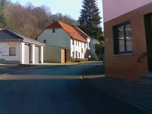
Kupferkanne
Restaurant · German
2 Berliner Straße, Bad Sobernheim
Mo-Sa 18:00-22:00; We off; Th off; Su 12:00-14:00,18:00-22:00
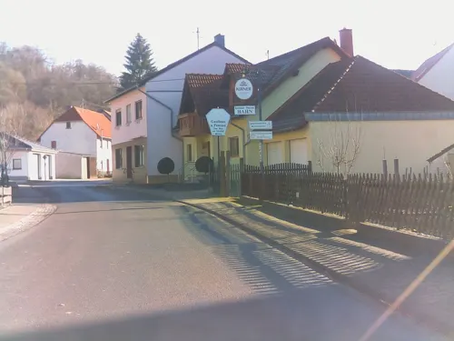
Landgasthof-Pension "Zum Jäger aus Kurpfalz"
Restaurant · German · 6.4 km
6 Zur Feuchten Ecke, Auen
We-Fr 17:00+; Sa,Su 12:00+
Museumsgaststätte
Restaurant · Regional · 1.9 km
1 Nachtigallental, Bad Sobernheim
Tu-Fr 11:00-17:00; Sa-Su 10:00-18:00; Mo off
Quellenpavillon
Restaurant · 1.0 km
86 Staudernheimer Straße, Bad Sobernheim
We-Su,PH 12:00-14:00, We-Sa 16:30-21:00, Su,PH 16:30-20:30; Mo,Tu off
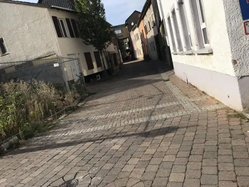
Ristorante Pizzeria La Dolce Vita
Restaurant · Italian, Pizza
10 Kreuzstraße, Bad Sobernheim
Mo-Su 11:30-14:00,17:30-22:00; Th off
Straußwirtschaft Dautermann
Restaurant · Buschenschank · 6.3 km
39 Naheweinstraße
May 01- Jun 17: Sa 18:00+; Su,PH 16:00+


Weingut Alt
Brewery and winery · 4.6 km
67 Hauptstraße, Monzingen
Mo-Sa 08:00-12:00,14:00-18:00; Su 09:00-11:30
93 more on the map.
History
In the New Stone Age (roughly 3000 to 1800 BC) and during the time of the Hunsrück-Eifel Culture (600 to 100 BC), the Bad Sobernheim area was settled, as it likewise was later in Roman times. Beginning about AD 450, the Franks set up a new settlement here. However, only in 1074 was this "villa" (that is, village) of Suberenheim first mentioned in a document, one made out to Ravengiersburg Abbey. The Sobernheim dwellers then were farmers (some of whom were townsmen) and craftsmen, and into modern times they earned their livelihoods mainly at agriculture, forestry and winegrowing. Businesses and trades existed, but they were often linked with farming.
From the History section of Bad Sobernheim on Wikipedia, under CC BY-SA 4.0.
Where to stay32
Churches and places of worship27
Neuapostolische Kirche Bad Sobernheim
Church · New Apostolic
21 Bahnhofstraße, Bad Sobernheim
Shopping12
Gas and EV charging10
Schools, colleges and libraries5
Healthcare3
Map of Bad Sobernheim
250 places. The map loads OpenStreetMap tiles when you open it.
Getting there and nearby towns
Hahn Airport (HHN) is the nearest airport with scheduled flights listed in OpenStreetMap, 33 km away.
- Bad Kreuznach 17 km east, about 17 min by car
- Idar-Oberstein 26 km west, about 26 min by car
- Bingen am Rhein 27 km northeast, about 27 min by car
- Rüdesheim am Rhein 29 km northeast, about 29 min by car
- Winnweiler 28 km southeast, about 28 min by car
- Aulhausen 29 km northeast, about 29 min by car
- Geisenheim 32 km northeast, about 32 min by car
- Alzey 34 km east, about 34 min by car
- Ingelheim am Rhein 36 km northeast, about 36 min by car
- Kaiserslautern 39 km south, about 39 min by car
Drive times are estimates from straight-line distance, not routes.
Local news
Headlines from INDB.
Reviews, tips and questions
Loading what members have shared...
Sources and licences
- GeoNames (CC BY 4.0): population, coordinates, regions and time zone
- Mapillary (see each image): photos
- OpenStreetMap contributors (ODbL 1.0): places, airports, map data
- Wikidata (CC0 1.0): elevation, founding date, time zone, website
- Wikimedia Commons (see each image): photos
- Wikipedia (CC BY-SA 4.0): overview and history text
Photo credits
- Bad Sobernheim – Kath. Kirche St. Matthäus - panoramio, Edgar El, CC BY 3.0
- Bad Sobernheim - Kath. Kirche St. Matthäus - panoramio, giggel, CC BY 3.0
- Bad Sobernheim - Kath. Malteserkapelle - panoramio, Edgar El, CC BY 3.0
- Bad Sobernheim, Gymnasialstraße, Malteeske kapel, RomkeHoekstra, CC BY-SA 4.0
- Bad Sobernheim - Kath. Malteserkapelle - panoramio (1), giggel, CC BY 3.0
- Bad Sobernheim - Das Kulturhaus Synagoge - panoramio, Edgar El, CC BY 3.0
- Amtsgericht Bad Sobernheim, Gymnasialstraße 11 - panoramio, giggel, CC BY 3.0
- Bad Sobernheim um 1600, Matthäus Merian, Public domain
- Bad Sobernheim, synagoge, tagong, RomkeHoekstra, CC BY-SA 4.0
- Bad Sobernheim, synagoge, RomkeHoekstra, CC BY-SA 4.0
- Bad Sobernheim, Haus "Hohe Burg" Wilhelmstr.8 - panoramio, giggel, CC BY 3.0
- Stolpersteine Bad Sobernheim Großstraße 45, Gmbo 2013, CC0
- Stolperstein Bad Sobernheim Großstraße 45 Moses Fried, Gmbo 2013, CC0
- Stolperstein Bad Sobernheim Großstraße 45 Bertha Fried, Gmbo 2013, CC0
- Stolperstein Bad Sobernheim Großstraße 45 Rosi Fried, Gmbo 2013, CC0
- Stolperstein Bad Sobernheim Großstraße 45 Arnold Fried, Gmbo 2013, CC0
- Stolperstein Bad Sobernheim Großstraße 45 Erhard Fried, Gmbo 2013, CC0
- Stolperstein Bad Sobernheim Großstraße 45 Therese Kahn, Gmbo 2013, CC0
- Stolperstein Bad Sobernheim Großstraße 45 Else Fried, Gmbo 2013, CC0
- Stolpersteinlage Bad Sobernheim Großstraße 45, Gmbo 2013, CC0
- Stolperstein Bad Sobernheim Wilhelmstraße 4 Henriette Ostermann, Gmbo 2013, CC0
- Stolperstein Bad Sobernheim Wilhelmstraße 4 Meta Ostermann, Gmbo 2013, CC0
- Stolperstein Bad Sobernheim Wilhelmstraße 4 Jakob Ostermann, Gmbo 2013, CC0
- Stolperstein Bad Sobernheim Wilhelmstraße 4 Johanna Ostermann, Gmbo 2013, CC0
- Stolperstein Bad Sobernheim Wilhelmstraße 4 Alfred Ostermann, Gmbo 2013, CC0
- Stolperstein Bad Sobernheim Wilhelmstraße 4 Wilhelm Ostermann, Gmbo 2013, CC0
- Stolperstein Bad Sobernheim Wilhelmstraße 4 Franziska Ostermann, Gmbo 2013, CC0
- Stolperstein Bad Sobernheim Wilhelmstraße 4 Käthe Ostermann, Gmbo 2013, CC0
- Stolperstein Bad Sobernheim Wilhelmstraße 4 Nathan Landau, Gmbo 2013, CC0
- Stolperstein Bad Sobernheim Wilhelmstraße 4 Emilie Landau, Gmbo 2013, CC0
- Stolpersteinlage Bad Sobernheim Wilhelmstraße 4, Gmbo 2013, CC0
- Stolpersteine Bad Sobernheim Wilhelmstraße 4, Gmbo 2013, CC0
- Bad Sobernheim - Großstraße - panoramio, giggel, CC BY 3.0
- Bad Sobernheim, Haus Kurz – Großstraße - Wilhelmstraße - panoramio, giggel, CC BY 3.0
- Bad Sobernheim – das Pförtnerhäuschen in der Wilhelmstraße - panoramio, giggel, CC BY 3.0
- Germany - Bad Sobernheim - Marktplatz - panoramio, giggel, CC BY 3.0
- Bad Sobernheim - Marktplatz mit Rathaus - panoramio, giggel, CC BY 3.0
- 2019 Bad Sobernheim Pfarrkirche St. Matthias 01, Derzno, CC BY-SA 4.0
- Heimbergturm, Jörg Braukmann, CC BY-SA 4.0
- Rheinland-Pfälzisches FREILICHTMUSEUM Bad Sobernheim - Haus Neuburg - panoramio, giggel, CC BY 3.0
- Katholische Pfarrkirche St. Matthäus Bad Sobernheim, Ea17 ( Diskussion ), CC BY-SA 3.0 de
- Gangelsberg, Tholis, CC BY-SA 4.0
- 2019 Bad Sobernheim Synagoge 01, Derzno, CC BY-SA 4.0
- Deutschland - Auen - Williges-Kapelle, Optimi4, CC BY-SA 4.0
- 2019 Bad Sobernheim Disibodenberger Kapelle 02, Derzno, CC BY-SA 4.0
- 2019 Bad Sobernheim Wilhelmstraße 3 02, Derzno, CC BY-SA 4.0
- 2019 Bad Sobernheim Philippskirche 01, Derzno, CC BY-SA 4.0
- 2019 Bad Sobernheim Ringstraße 36 02, Derzno, CC BY-SA 4.0
- 2019 Bad Sobernheim Malteserkapelle 01, Derzno, CC BY-SA 4.0
- Ev. Kirche Lauschied, Schneberger, CC BY-SA 4.0
- Merxheim - Ev. Kirche - panoramio, Edgar El, CC BY 3.0
- Katholische Kirche Lauschied, Malagus1, CC BY-SA 4.0
- Bad Sobernheim Stadtmühle 4074, Waluga Ich selbst, CC BY-SA 3.0
- Disibodenberg.Naturschutzgebiet., Waluga, CC BY-SA 3.0
- Naturschutzgebiet Hellersberger Weiher 02, AK-Bino, CC BY-SA 4.0
- Naturschutzgebiet- Maasberg, Waluga, CC BY-SA 3.0
- Bad Sobernheim – Ev. Matthiaskirche von Nordosten - panoramio, Edgar El, CC BY 3.0
- Bad-sobernheim ehem-steinkallenfelser-hof gaststätte-hohe-burg, Poppei, CC BY-SA 3.0
- Bad Sobernheim - Kaisersaal - panoramio, giggel, CC BY 3.0
- Odernheim Obertor Hauptstraße 42-43 003, Aidexxx, CC BY-SA 4.0
- Street-level photo, miguel_andrade, CC BY-SA 4.0
- Street-level photo, troher15, CC BY-SA 4.0
- Street-level photo, teddy73, CC BY-SA 4.0
- Street-level photo, ramap, CC BY-SA 4.0
- Street-level photo, marczoutendijk, CC BY-SA 4.0
- Street-level photo, ramap, CC BY-SA 4.0
- Street-level photo, ramap, CC BY-SA 4.0
- Street-level photo, marnfredklein, CC BY-SA 4.0
- Street-level photo, troher15, CC BY-SA 4.0
- Street-level photo, mrdonut261, CC BY-SA 4.0
- Street-level photo, mrdonut261, CC BY-SA 4.0
- Street-level photo, mrdonut261, CC BY-SA 4.0
- Street-level photo, mrdonut261, CC BY-SA 4.0
- Street-level photo, troher15, CC BY-SA 4.0
- Street-level photo, marnfredklein, CC BY-SA 4.0
- Street-level photo, troher15, CC BY-SA 4.0
- Street-level photo, ramap, CC BY-SA 4.0
- Street-level photo, ramap, CC BY-SA 4.0
- Street-level photo, marnfredklein, CC BY-SA 4.0
- Street-level photo, miguel_andrade, CC BY-SA 4.0
- Street-level photo, ramap, CC BY-SA 4.0
- Street-level photo, ramap, CC BY-SA 4.0
- Street-level photo, marczoutendijk, CC BY-SA 4.0
- Street-level photo, teddy73, CC BY-SA 4.0
- Street-level photo, ramap, CC BY-SA 4.0
- Street-level photo, ramap, CC BY-SA 4.0
- Street-level photo, ramap, CC BY-SA 4.0


Page built November 9, 2026. Spotted a mistake? Tell us or suggest a place.