


Kaiserslautern, Germany
Kaiserslautern is a town of 98,732 people in Rheinland-Pfalz, Germany.
Why visit Kaiserslautern
Townapedia lists 95 museums and landmarks, 22 parks and trails, 295 places to eat, 21 places to stay and 8 attractions in and around town.
Highlights include Union-Theater, Pfalztheater, Theodor-Zink-Museum and Wadgasserhof.
Weather in Kaiserslautern
Forecast from MET Norway (CC BY 4.0). Full forecast
About Kaiserslautern
Kaiserslautern (German pronunciation: [ˌkaɪzɐsˈlaʊtɐn] ; Palatine German: Lautre) is a city in southwest Germany, located in the state of Rhineland-Palatinate at the edge of the Palatinate Forest. The historic centre dates to the 9th century. It is 459 kilometres (285 miles) from Paris, 117 km (73 miles) from Frankfurt am Main, 666 km (414 miles) from Berlin, and 159 km (99 miles) from Luxembourg.
From the Wikipedia article Kaiserslautern (this version), under CC BY-SA 4.0.
Travel tips from other travellers: Kaiserslautern on Wikivoyage (CC BY-SA 4.0).
Photos of Kaiserslautern


Things to do8

Union-Theater
Cinema and theater
24 Kerststraße, Kaiserslautern
"immer dann wenn ein Film läuft offen"

Pfalztheater
Cinema and theater
Theater und Opernhaus in Kaiserslautern, Rheinland-Pfalz
4-5 Willy-Brandt-Platz, Kaiserslautern

Humberg Tower
Monument and historic site · 3.2 km
Observation tower in Kaiserslautern



Museums and landmarks95

Theodor-Zink-Museum
Museum · 0.6 km
48 Steinstraße, Kaiserslautern
Mo-Tu off; We-Fr 10:00-17:00; Sa-Su 11:00-18:00


Kaiserpfalz
Monument and historic site
Es stehen nur noch Teile davon



Princely Grave of Rodenbach
Monument and historic site · 9.7 km
Celtic burial site

Casimirsaal
Monument and historic site
Casimirschloss (Pfalzgrafensaal) mit unterirdischen Gängen
2 Willy-Brandt-Platz, Kaiserslautern
83 more on the map.
Parks, trails and playgrounds22


Betzenberg Wildlife Park
Park · 2.0 km
Zoo in Kaiserslautern, Germany


Karlstalschlucht
Park · 10.4 km
Nature reserve in Rheinland-Pfalz, Germany



Platz am Casimirschloss / Bouleplatz / Sandfläche
Park
Willy-Brandt-Platz, Kaiserslautern
24/7

Warmfreibad
Sports field and stadium · 1.9 km
1 Am Warmfreibad, Kaiserslautern
Mo 12:00-20:00; Tu-Su 08:00-20:00; We 07:00-20:00
10 more on the map.
Restaurants and cafes295

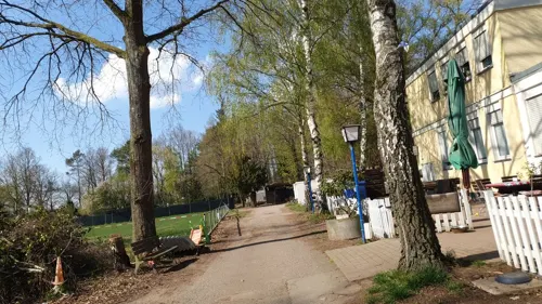
Gaststätte VfR Erbsenberg
Restaurant · German · 1.1 km
5 Erbsenberg, Kaiserslautern
Tu-Fr 11:30-14:00,16:00-22:00; Sa,Su 10:00-22:00
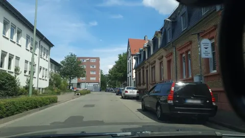
Villa Italiano
Restaurant · Italian · 1.3 km
4 Kniebrech, Kaiserslautern
Mo-Sa 17:00-22:00; We off; Su 11:00-22:00

A'pollo
Restaurant · Chicken · 1.0 km
12 Bremerstraße, Kaiserslautern
Mo,Tu,Th-Sa 17:00-22:00; Su 17:00-21:00
Bellini
Restaurant · Italian
1 Fabrikstraße, Kaiserslautern
Tu-Sa 11:30-14:00, 17:00-23:00; Su 11:30-14:00, 16:30-23:00
Brauhaus
Restaurant · German · 1.5 km
6 Forellenstraße, Kaiserslautern
Su-Th 11:00-23:00,Fr-Sa 11:00-00:00

Cafe Extrablatt
Cafe · Coffee Shop
26 Marktstraße, Kaiserslautern
Mo-Sa 08:30-24:00; Su,PH 09:00-24:00
Goodies Food Factory
Restaurant · Burger, Pizza · 0.7 km
93 Richard-Wagner-Straße, Kaiserslautern
Mo-Su 12:00-23:00
Pizzeria Napoli
Restaurant · Pizza · 0.6 km
19 Mühlstraße, Kaiserslautern
Mo off; Tu-Sa 11:00-14:00,17:00-23:00; Su,PH 11:00-14:00,16:00-23:00
Zur Burg
Restaurant · Steak House
18 Steinstraße, Kaiserslautern
Mo,We-Sa 17:00+; Su,PH 11:00-14:00,17:00+
283 more on the map.
History
Prehistoric settlement in the area of what is now Kaiserslautern has been traced to at least 800 BC. Some 2,500-year-old Celtic tombs were uncovered at Miesau, a town about 29 kilometres (18 miles) west of Kaiserslautern. The recovered relics are now in the Museum for Palatinate History at Speyer.
Kaiserslautern received its name from the favourite hunting retreat of Holy Roman Emperor Frederick Barbarossa who ruled the Holy Roman Empire from 1155 until 1190. The small river Lauter made the old section of Kaiserslautern an island in medieval times. Ruins of Frederick's original castle, built 1152–1160, can still be seen in front of the Rathaus (city hall). A second castle, Nanstein Castle, was built at Landstuhl to guard the western approach to the city. Barbarossa's influence on Kaiserslautern remains today, in its nickname as a "Barbarossa city". Local legends claim in 1497, a nearly 6 m long pike was caught in a lake, the Kaiserwoog, with a ring saying it was placed by Emperor Frederick II, personally in 1230, later finding its way onto the city's coat of arms.
Read more of the history
The Stiftkirche, Kaiserslautern's oldest church, was constructed between 1250 and 1350. As the population of Kaiserslautern grew, King Rudolf von Habsburg chartered the town as an imperial city in 1276. St. Martin's Church was built in the 14th century, originally as a Franciscan monastery church. Today a section of the original city wall still stands in the courtyard of the church.
By 1375, the city of Kaiserslautern was pledged to Electoral Palatinate and therefore became subsequently part of the Wittelsbach inheritance.
In 1519, Franz von Sickingen became the owner of Nanstein Castle. He became a Protestant, and in 1522, Nanstein was a stronghold for local nobles favouring the Reformation. Sickingen and the local nobles began their battle against the Archbishop of Trier, but the attack was unsuccessful, and they retreated to Nanstein. Nanstein was then besieged by cannon-armed German Catholic princes. Sickingen died after the castle surrendered, and the Protestant nobility of the Electoral Palatinate were subdued by the Catholic princes.
Count of the Electoral Palatinate Johann Casimir, came to Kaiserslautern during the Thirty Years' War (1618–1648). The Spanish occupation from 1621 to 1632 ended when Protestant Swedish armies liberated the area. The city would fall to invading forces again in an especially violent incident in 1635. Croatian troops within the Austrian emperor's army plundered the city, killing 3,000 of its 3,200 residents. It would not be repopulated for about another 160 years.
Conflict did not end with the Peace of Westphalia in 1648. The Elector of the Pfalz had difficulty with many of his subjects and ordered all castles, including Nanstein, destroyed. The French repeatedly invaded and occupied the area, residing in Kaiserslautern from 1686 to 1697. Nevertheless, after the Treaty of Utrecht, it was restored to be part of the Palatinate. During the unquiet episodes in the 18th century, the Palatinate was the scene of fighting between French and German troops of different states. In 1713, the French destroyed Barbarossa's castle and the city's wall towers. From 1793 until Napoleon's defeat at Waterloo in 1815, the area was under French administration.
As French power declined after 1815, Kaiserslautern and the Palatinate became a Bavarian province and remained so until 1918. After World War I, French troops again occupied the Palatinate for several years.
In World War II, Allied bombing destroyed more than 85% of Kaiserslautern. Today 25% of Kaiserslautern is made up of buildings from before 1945. The railway and several main roads were primary targets, with the heaviest attacks occurring on 7 January, 11 August, and 28 September 1944. On 20 March 1945, as part of Operation Undertone, as the last of the 1st Army crossed the Rhine at Remagen, the U.S. 80th Division, 319th Infantry, part of the 3rd US Army, seized Kaiserslautern without resistance. American forces would occupy the city until July 1945, when it was transferred to their French counterparts.
The city became part of the French occupation zone after the Second World War. The establishment of the state of Rhineland-Palatinate was ordered on 30 August 1946 as the last state in the western occupation zones by ordinance No. 57 of the French military government under General Marie-Pierre Kœnig. Little reconstruction took place until the currency reform of 1948. The pace of the economy remained slow until 1952, when construction for newly established garrisons of American troops, in particular the nearby Ramstein Air Base, brought economic growth to the area.
Unexploded ordnance from WWII continues to be discovered in and around Kaiserslautern. In May 2012, an unexploded 250-pound (110 kg) Allied bomb was found, buried deeply and reportedly covered by a water pipe, during a construction project in the downtown area of the city. On 5 September 2013, another WWII bomb was found during construction near the train station in Enkenbach-Alsenborn.
In the late 1940s, the Kaiserslautern area became the largest U.S. garrison outside the United States (Kaiserslautern Military Community). On 14 November 1956, a U.S. Air Force F-86 fighter jet crashed into the district office in the Burgstrasse / Maxstrasse area. In addition to the pilot, two civilians were killed, and numerous others were wounded.
With the incorporation of the previously independent communities of Dansenberg, Erfenbach, Erlenbach, Hohenecken, Mölschbach, Morlautern and Siegelbach on 7 June 1969, Kaiserslautern became a city. The University of Kaiserslautern was founded in 1970.
Industry flourished around the time of the first oil crisis (1973). In the 1970s, many industrial companies went through a crisis. In 1981, the spinning mill went bankrupt; Pfaff and Opel fired employees. The downsizing of the American garrison and the withdrawal of the French garrison cost more jobs.
From the History section of Kaiserslautern on Wikipedia, under CC BY-SA 4.0.
More about Kaiserslautern
Arts and culture
Modern-day Kaiserslautern is a centre of information and communications technology. It is home to RPTU University Kaiserslautern-Landau, a technical college, and many international research institutes located throughout the city. Kaiserslautern is a popular destination for tourists, offering a range of attractions and sites for tourists to visit.
Town Hall Kaiserslautern is one of the tallest buildings and is located in the city centre. The bar and coffee shop on the top floor provides a panoramic view of the city and the surrounding countryside.
The tallest building in the centre of Kaiserslautern is St. Mary's, a Roman Catholic church, whilst the highest structure in all Kaiserslautern is the television tower in the suburb of Dansenberg, southwest of the city centre.
Education
The Technical University of Kaiserslautern was founded on 13 July 1970. Earlier, it was part of the twin University of Trier/Kaiserslautern. It started with the departments of Mathematics, Physics and Technology. Later many more faculties were added.
University of Applied Sciences, Kaiserslautern was founded in 1971. The main departments include Applied Logistics & Polymer Sciences, Building and Design, Business Administration, Engineering and Computer Sciences / Microsystems Technology.
Fraunhofer Institute for Experimental Software Engineering IESE
Kaiserslautern has a broad-based commercial economy. Among the big companies located in the city are:
AMEC Earth & Environmental (environmental consulting and engineering)
General Dynamics European Land Systems-Germany (until 2002 Eisenwerke Kaiserslautern; amphibious vehicles, mobile bridges for military use)
From the Wikipedia article Kaiserslautern, under CC BY-SA 4.0.
Notable people from Kaiserslautern
 Hans-Peter BriegelGerman association football player and managerPhoto: Udo Grimberg, CC BY-SA 3.0 de
 Ottmar WalterGerman footballer (1924-2013)Photo: Benutzer:Smalltown Boy, CC BY-SA 3.0
 Willi OrbanGerman Hungarian footballerPhoto: mlsz.hu – the official website of..., Attribution
 Markus MerkGerman football refereePhoto: Reto Stauffer, www.hopp-schwiiz.ch, CC BY-SA 2.0 de
 Raphael HolzdeppeGerman pole vaulterPhoto: Ailura, CC BY-SA 3.0 at
 Mark ForsterGerman singerPhoto: Sven Mandel, CC BY-SA 4.0
 Ludwig FischerSA officer (1905-1947); Governor of Warsaw districtPhoto: Mieczysław Bilażewski-Bil, Public domain
 Miriam WelteGerman cyclistPhoto: Nicola, CC BY-SA 3.0
- Fritz WalterGerman association football player (1920–2002)
- Robin KochGerman association football player (born 1996)
- Werner LiebrichGerman footballer (1927–1995)
- Werner KohlmeyerGerman footballer (1924-1974)
Born in Kaiserslautern, according to Wikidata (CC0). Each name links to its Wikipedia article.
Where to stay21
Churches and places of worship27
Apostel-Kirche
Church · Protestant · 0.7 km
22 Pariser Straße, Kaiserslautern
Christuskirche
Church · Protestant · 1.3 km
11 Am Heiligenhäuschen, Kaiserslautern
Shopping60
Gas and EV charging13
Schools, colleges and libraries29
Healthcare23
Map of Kaiserslautern
250 places. The map loads OpenStreetMap tiles when you open it.
Getting there and nearby towns
Ramstein Air Base (RMS) is the nearest airport with scheduled flights listed in OpenStreetMap, 12 km away.
- Otterberg 7 km north, about 7 min by car
- Enkenbach-Alsenborn 10 km northeast, about 10 min by car
- Landstuhl 15 km west, about 15 min by car
- Winnweiler 15 km north, about 15 min by car
- Ramstein-Miesenbach 16 km west, about 16 min by car
- Waldfischbach-Burgalben 19 km southwest, about 19 min by car
- Rockenhausen 21 km north, about 21 min by car
- Rodalben 25 km southwest, about 25 min by car
- Eisenberg 25 km northeast, about 25 min by car
- Bruchmühlbach-Miesau 25 km west, about 25 min by car
Drive times are estimates from straight-line distance, not routes.
Towns near Kaiserslautern


Keep exploring
Local news
Headlines from INDB.
Reviews, tips and questions
Loading what members have shared...
Sources and licences
- GeoNames (CC BY 4.0): population, coordinates, regions and time zone
- Mapillary (see each image): photos
- OpenStreetMap contributors (ODbL 1.0): places, airports, map data
- Wikidata (CC0 1.0): elevation, founding date, time zone, website, landmarks and historic places
- Wikimedia Commons (see each image): photos
- Wikipedia (CC BY-SA 4.0): overview and history text
Photo credits
- Kaiserslautern 19, EPei, CC BY-SA 3.0
- Hermine Lacher, Geb. 1885. Stolperstein Kaiserslautern, Malagus1, CC0
- Kaiserslautern, die Marktstraße, Dguendel, CC BY 4.0
- Unionsdenkmal Kaiserslautern-Johannes Calvin, Nils E., Public domain
- Unionsdenkmal Kaiserslautern, Nils E., Public domain
- Unionsdenkmal Kaiserslautern-Martin Luther, Nils E., Public domain
- Stiftskirche Kaiserslautern, Nils E., Public domain
- Kaiserslautern - Stiftskirche - 2019-02-16 16-21-46, Photographs by Radosław Drożdżewski (User:Zwiadowca21), CC BY-SA 4.0
- Kaiserslautern, Germany - panoramio - Immanuel Giel, Immanuel Giel, CC BY 3.0
- Kaiserslautern, Germany - panoramio - Immanuel Giel (1), Immanuel Giel, CC BY 3.0
- Kaiserslautern - Pirmasener Strasse - 2019-02-16 14-46-27, Photographs by Radosław Drożdżewski (User:Zwiadowca21), CC BY-SA 4.0
- Kaiserslautern - Stiftsplatz 8 - 2019-02-16 16-15-30, Photographs by Radosław Drożdżewski (User:Zwiadowca21), CC BY-SA 4.0
- Kaiserslautern, die Stiftskirche, Dguendel, CC BY 4.0
- Pfalztheater panorama, Adam Schmalhofer ( Bluebirch, CC BY 2.5
- Humbergturm-Aussenansicht, Benjamin Reinhard, CC BY 2.5
- Karlstal Gedenktafel 1862 a, Altera levatur, CC BY-SA 4.0
- Wildpark KL Stein, Frank11NR on German Wikipedia, Public domain
- ZOO-KL-Eingang, TeKaBe, CC BY-SA 4.0
- Karlstal 102, Telford, CC BY-SA 3.0
- Otterberg-Abteikirche-02-Westfassade-2022-gje, Gerd Eichmann, CC BY-SA 4.0
- Uni kl verwaltung, The original uploader was Sansculotte at German Wikipedia ., CC BY-SA 3.0
- 2025-03-07 FCK-SVE (02), Simon Mannweiler, CC BY-SA 4.0
- Apostelkirche-Kaiserslautern, Sr. F at German Wikipedia ( Original text: Sr. F ), CC BY-SA 3.0
- Bach Japangarten Kaiserslautern 19, Immanuel Giel, CC BY-SA 4.0
- Marienkirche-Kaiserslautern-3, Sr. F, Public domain
- Kaiserslautern synagogue 1925 Reinhold Wilking, Reinhold Wilking, Public domain
- Fruchthalle Kaiserslautern 2013, E.K., CC BY-SA 3.0
- Albert-Schweitzer-Gymnasium Kaiserslautern, E.K., CC BY-SA 3.0
- Union-Theater, E.K., CC BY-SA 3.0
- Kapfaka3, Ulli1105, CC BY 3.0
- Das Kulturzentrum Kammgarn (Außenansicht), Patrick Asel, CC BY-SA 4.0
- Pfalzbibliothek Kaiserslautern, Marcus Leister, CC BY-SA 4.0
- Roehmschule-kaiserslautern, Sr. F, Public domain
- KaiserslauternStiftskirche-1, Ttog at de.wikipedia, CC BY-SA 3.0
- Kaiserslautern Volkspark, Immanuel Giel, CC BY-SA 3.0
- Wadgasserhof, E.K., CC BY-SA 3.0
- Theodor-Zink-Museum, E.K., CC BY-SA 3.0
- Kaiserslautern-Maria Schutz-02-gje, Gerd Eichmann, CC BY-SA 4.0
- Kinlautern-2015-06-25, Rmcharb, CC BY-SA 4.0
- Kleine Kirche Kaiserslautern, E.K., CC BY-SA 3.0
- Christuskirche in Kaiserslautern-0740, Zoppo59, CC BY-SA 4.0
- Rittersberg 14 Kaiserslautern 03, Marcus Leister, CC BY-SA 4.0
- Polizeipräsidium Kaiserslautern Ende Februar 2018, Leiflive, CC BY-SA 4.0
- Meisterschule Kaiserslautern 01, Malagus1, CC BY-SA 4.0
- Kaiserslautern - Hahnenbalz 38 Evangelische Pauluskirche, Parklife, CC BY-SA 3.0
- Pirmasenser Straße 20 Erich Werner Jakob, Kinimodre, CC BY-SA 4.0
- HNO Klinik in Kaiserslautern, Zoppo59, CC BY-SA 4.0
- Martinskirche-außen, Sr. F ., Public domain
- Gartenschau Kaiserslautern Dino, Kuehly at German Wikipedia, Public domain
- Kaiserslautern - Pfalzgalerie - 2019-02-16 15-29-41, Photographs by Radosław Drożdżewski (User:Zwiadowca21), CC BY-SA 4.0
- Street-level photo, b166er, CC BY-SA 4.0
- Street-level photo, b166er, CC BY-SA 4.0
- Street-level photo, b166er, CC BY-SA 4.0
- Street-level photo, b166er, CC BY-SA 4.0
- Street-level photo, b166er, CC BY-SA 4.0
- Street-level photo, edddy, CC BY-SA 4.0
- Street-level photo, b166er, CC BY-SA 4.0
- Street-level photo, b166er, CC BY-SA 4.0
- Street-level photo, edddy, CC BY-SA 4.0
- Street-level photo, teddy73, CC BY-SA 4.0
- Street-level photo, b166er, CC BY-SA 4.0
- Street-level photo, b166er, CC BY-SA 4.0
- Street-level photo, changchun1, CC BY-SA 4.0
- Street-level photo, b166er, CC BY-SA 4.0


Page built November 9, 2026. Spotted a mistake? Tell us or suggest a place.