


Ingelheim am Rhein, Germany
Ingelheim am Rhein is a town of 24,998 people in Rheinland-Pfalz, Germany, founded in April 1, 1939.
Why visit Ingelheim am Rhein
Townapedia lists 128 museums and landmarks, 62 parks and trails, 218 places to eat, 31 places to stay and 14 attractions in and around town.
Highlights include Obsthof Hemmes, Bismarckturm Ingelheim, Kaiserpfalz Museum and Rheinhessisches Fahrradmuseum Gau-Algesheim.
Weather in Ingelheim am Rhein
Forecast from MET Norway (CC BY 4.0). Full forecast
About Ingelheim am Rhein
Ingelheim (German pronunciation: [ˈɪŋəlhaɪm] ), officially Ingelheim am Rhein (German pronunciation: [ˈɪŋəlhaɪm ʔam ˈʁaɪn], lit. 'Ingelheim on the Rhine'), is a town in the Mainz-Bingen district in the Rhineland-Palatinate state of Germany and also the seat of the Mainz-Bingen district. The town sprawls along the Rhine's left bank. It has been Mainz-Bingen's district seat since 1996.
From the Wikipedia article Ingelheim am Rhein (this version), under CC BY-SA 4.0.
Travel tips from other travellers: Ingelheim am Rhein on Wikivoyage (CC BY-SA 4.0).
Things to do14


Bismarckturm Ingelheim
Scenic view · 2.1 km
Apr-Sep: 09:00-20:00; Oct-Mar: 10:00-16:00

Hindenburg Bridge
Bridge · 8.3 km
Former train bridge over the Rhine at Rüdesheim, Germany


Casablanca & Cadillac
Cinema and theater
75 Binger Straße, Ingelheim am Rhein

Johannisberger Türmchen
Scenic view · 5.7 km
Kombinierter Aussichtsturm mit Schutzhütte

2 more on the map.
Museums and landmarks128

Kaiserpfalz Museum
Museum · 1.1 km
5 Francois-Lachenal-Platz, Ingelheim am Rhein
Apr-Oct: Tu-Th 10:00-17:00, Fr-Su,PH 10:00-18:00; Nov-Mar:...
Rheinhessisches Fahrradmuseum Gau-Algesheim
Museum · 3.5 km
12 Schlossgasse, Gau-Algesheim
easter-Oct Su[2]: Su,PH 11:00-17:00 || "nach Vereinbarung"

Altes Rathaus
Monument and historic site · 0.8 km
Anspruchsvoller klassizistischer Walmdachbau, bezeichnet 1827, Architekt Friedrich Schneider
1 Marktplatz, Ingelheim am Rhein

Graues Haus
Monument and historic site · 4.7 km
Das Graue Haus in Oestrich-Winkel zählt zu den ältesten Steinhäusern Deutschlands.
8 Graugasse, Oestrich-Winkel
Aula Regia
Monument and historic site · 1.2 km
Kaiserpfalz
Mo-Fr 07:30-17:00; Sa,Su 10:00-17:00


Menhir von Wackernheim
Monument and historic site · 3.7 km
Wohl jungsteinzeitlicher Menhir


Roter Turm
Monument and historic site · 1.4 km
198 Binger Straße, Ingelheim am Rhein
116 more on the map.
Parks, trails and playgrounds62

Freibad Ingelheim
Sports field and stadium · 1.4 km
40 Im Blumengarten, Ingelheim am Rhein
Mo 13:00-20:30; Tu-Su 08:00-20:30; Sep,Oct Mo 13:00-19:30; Sep,Oct...



Kinder- und Jugendfarm Oestrich-Winkel e.V.
Playground · 5.1 km
15 Adalbert-Stifter-Straße, Oestrich-Winkel
Tu-Fr 15:00-18:00;Sa 11:00-15:00

50 more on the map.
Restaurants and cafes218

Zum Krug
Restaurant · Regional, Fine Dining, Wine · 4.8 km
34 Hauptstraße, Eltville am Rhein
We-Su 12:00-14:00, Tu-Sa 18:00-22:00
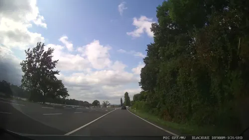
Kronenschlösschen
Restaurant · 4.7 km
1 Rheinallee, Eltville am Rhein
Mo-Sa 18:30-22:00; Su,PH 12:30-14:00,18:30-22:00
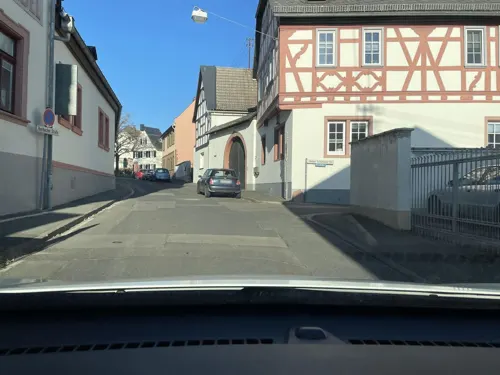
Weingut Georg Müller Stiftung
Brewery and winery · 4.9 km
7-9 Eberbacher Straße, Eltville am Rhein
Mo-Fr 10:00-13:00,14:00-17:00
Weinlokal Allendorf im Brentanohaus
Restaurant · 4.9 km
2 Am Lindenplatz, Oestrich-Winkel
Mo,Th,Fr 17:00+; Sa,Su,PH 12:00+; Tu,We off

Altes Rathaus
Restaurant · German · 4.3 km
Weinbistro
8 Markt, Oestrich-Winkel
Mo,Th-Fr 12:00-14:30,18:00-24:00; Sa 17:00-24:00; Su...

Landgasthof Engel
Restaurant · Regional · 5.2 km
Küche bis 22 Uhr. Im Sommer auch Samstags durchgehend geöffnet. Biergarten.
8 Markt
12:00-14:00,17:00-23:00; Sa,Su 12:00-23:00
Landgasthof Kirschgarten
Restaurant · International · 4.2 km
2 Kleine Hohl, Ingelheim am Rhein
Mo-Th 17:30-22:00; Fr-Sa 17:30-23:00, Su 11:30-14:00
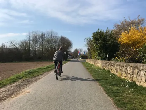
Margaretenhof
Restaurant · Regional · 5.8 km
Küchenzeiten 17:30-21:30, Sonntags zusätzlich 12:00-14:00
25 Am Sportfeld, Schwabenheim an der Selz
We-Fr 17:00-23:00; Su 12:00-23:00
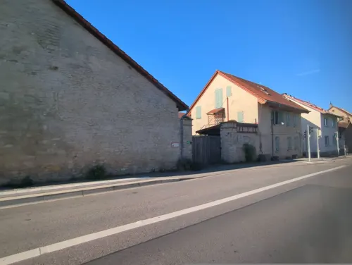
Wackernheimer Hof
Restaurant · Italian · 4.3 km
Ristorante Pizzeria
2 Mainzer Straße, Ingelheim am Rhein
11:00-14:30, 17:00-23:00; Mo off
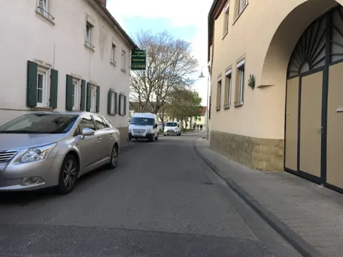


Zur Stadt Frankfurt
Bar and pub · German · 5.1 km
Weingut - Gasthaus - Vinothek
7 Marktplatz, Schwabenheim an der Selz
Su 12:00-24:00
Asia Express
Restaurant · Asian · 4.7 km
7 Binger Straße
Mo,Sa off; Tu-Fr 11:00-14:00,17:00-21:00; Su,PH 12:00-14:30,17:00-21:00
Open in Google Maps · +49 6132 434586; +49 1573 8151988; +49 1575 2737870
206 more on the map.
History
The Ingelheim area was already settled in prehistoric times. The place first earned itself particular importance, though, only under Charlemagne and his successors. Charlemagne had built the Ingelheim Imperial Palace (Ingelheimer Kaiserpfalz) here, where synods and Imperial diets were held in the time that followed. His son and successor, Emperor Louis the Pious, died on 20 June 840 in Ingelheim.
In the High and Late Middle Ages, the Palatinate's, and thereby also Ingelheim's, importance shrank.
For German justice history, the Ingelheimer Oberhof ("Ingelheim Upper Court") is of particular importance, as a unique collection of judgments from the 15th and 16th centuries that it handed down has been preserved.
Late 19th century Ingelheim was the residence of the Dutch writer Multatuli (Eduard Douwes Dekker).
In 1939, the formerly self-administering municipalities of Nieder-Ingelheim, Ober-Ingelheim and Frei-Weinheim were merged into the Town of Ingelheim am Rhein.
From the Second World War, Ingelheim emerged as the only unscathed town between Mainz and Koblenz. Today, Ingelheim is a middle centre in Rhineland-Palatinate, a Great District-Bound Town (Große kreisangehörige Stadt – a status deriving from the Rhineland-Palatinate Municipal Order) and the seat of district administration for Mainz-Bingen.
From the History section of Ingelheim am Rhein on Wikipedia, under CC BY-SA 4.0.
Where to stay31
Churches and places of worship42
Gustav-Adolf-Kirche
Church · Protestant · 3.4 km
1 Schubertstraße, Ingelheim am Rhein
Kath. Kirche St. Bartholomäus
Church · Roman Catholic · 5.3 km
34 Faltenstraße, Schwabenheim an der Selz
St. Remigius Kirche
Church · Catholic · 0.8 km
5 Belzerstraße, Ingelheim am Rhein
Evangelische Versöhnungskirche
Church · Protestant · 1.8 km
1 Dietrich-Bonhoeffer-Straße, Ingelheim am Rhein
Appenheim Evangelische Kirche
Church · Protestant · 4.8 km
8 Niedergasse, Appenheim
Shopping38
Gas and EV charging14
Heinz G. Haar GdbR
Gas station · 5.0 km
5 Ingelheimer Straße, Schwabenheim an der Selz
e-Bike Ladestation
EV charging · 3.5 km
1 Marktplatz / Eingang Kreuzhof, Gau-Algesheim
Elektroauto-Ladestation Bürgerzentrum
EV charging · 5.1 km
1 Paul-Gerhardt-Weg, Oestrich-Winkel
Schools, colleges and libraries25
Integrierte Gesamtschule Kurt Schumacher Ingelheim
School · 2.0 km
30 Albrecht-Dürer-Straße, Ingelheim am Rhein
Healthcare13
KfH-Nierenzentrum
Clinic and pharmacy · 1.0 km
6 Carolinenstraße, Ingelheim am Rhein
Map of Ingelheim am Rhein
250 places. The map loads OpenStreetMap tiles when you open it.
Getting there and nearby towns
Wiesbaden Army Airfield (WIE) is the nearest airport with scheduled flights listed in OpenStreetMap, 21 km away.
- Geisenheim 7 km west, about 7 min by car
- Mainz 16 km east, about 16 min by car
- Klarenthal 17 km northeast, about 17 min by car
- Wiesbaden 18 km northeast, about 18 min by car
- Bad Schwalbach 19 km north, about 19 min by car
- Taunusstein 21 km north, about 21 min by car
- Ginsheim-Gustavsburg 20 km east, about 20 min by car
- Hochheim am Main 22 km east, about 22 min by car
- Bischofsheim 22 km east, about 22 min by car
- Rüsselsheim am Main 26 km east, about 26 min by car
Drive times are estimates from straight-line distance, not routes.
Local news
Headlines from INDB.
Reviews, tips and questions
Loading what members have shared...
Sources and licences
- GeoNames (CC BY 4.0): population, coordinates, regions and time zone
- Mapillary (see each image): photos
- OpenStreetMap contributors (ODbL 1.0): places, airports, map data
- Wikidata (CC0 1.0): elevation, founding date, time zone, website, landmarks and historic places
- Wikimedia Commons (see each image): photos
- Wikipedia (CC BY-SA 4.0): overview and history text
Photo credits
- Burgkirche2010, Braveheart09, CC BY-SA 3.0
- Schloss und Campus der EBS Business School, IdaLovesStockholm, CC BY-SA 4.0
- Winkel Hauptstraße 89 Brentanohaus (1 ED 2015), Oliver Abels ( SBT ), CC BY-SA 3.0
- Heidesheim Burg Windeck 20100729, Rudolf Stricker, Attribution
- Stgeorgheidesheim1, No machine-readable author provided. Hagen Graebner assumed (based on copyright claims)., CC BY 3.0
- Gau-algesheim-3-begradigt, Gau-algesheim-3.jpg : Traveler100 derivative work: VinylVictim ( talk ), CC BY-SA 3.0
- GrauesHausOestrichWinkel, Marion Halft, CC BY-SA 3.0
- NI-Kaiserpfalz, Braveheart09, CC0
- Saalkirche Ingelheim quadrat, Felix König, CC BY 3.0
- SchlossReinhartshausenHauptstraßeTor, Brühl, Public domain
- Selztaldom2, Braveheart09, CC BY-SA 3.0
- St-Remigius-Ingelheim-2012, Braveheart09, CC BY-SA 3.0
- Monolith Nieder-Ingelheim, Nixnubix, CC BY-SA 4.0
- Schwabenheim Evangelische Kirche 20100709, Rudolf Stricker, Attribution
- Wackernheim Evangelische Kirche 20100910, Rudolf Stricker, Attribution
- Freiweinheim11, No machine-readable author provided. Hagen Graebner assumed (based on copyright claims)., CC BY 3.0
- 2024 Großwinternheim, katolike Sint-Jehannestsjerke, RomkeHoekstra, CC0
- Gau-algesheim-1, Traveler100, CC BY-SA 4.0
- IBB Hotel Ingelheim, ManuelB701, CC0
- Hotel Restaurant Zum Krug Eltville Hattenheim (01), Marion Halft, CC BY-SA 4.0
- 20230313 Altes Rathaus Ober-Ingelheim, Flocci Nivis, CC BY 4.0
- Appenheim Evangelische Kirche 20100830, Rudolf Stricker, Attribution
- IW-Versöhnungskirche, Braveheart09, CC0
- 2024 Schwabenheim an der Selz, roomsk-katolike Bartoloméustsjerke (2), RomkeHoekstra, CC BY 4.0
- Ingelheim-West - Rotes Türmchen, ManuelB701, CC0
- Bismarckturm-Ingelheim, Stefan Frerichs ( Stefan ), CC BY-SA 3.0
- HattenheimAussichtspunktHattenheimerFahne, Haffitt, CC BY-SA 3.0
- Rathaus-OberIngelheim3, No machine-readable author provided. Momo assumed (based on copyright claims)., CC BY-SA 3.0
- 55218-Karolingerstraße-Jüd-Frdhf, Astloch, CC BY-SA 3.0
- IW-Rotes-Türmchen, Braveheart09, CC0
- NSG Am Rothen Sand 2022-07-27 46, Leonhard Lenz, CC0
- Fulder Aue-Ilmen Aue- 02, Bodow, CC BY-SA 3.0
- NSG Gartenwiese 003, Aidexxx, CC BY-SA 3.0
- NSG Gau-Algesheimer Kopf 004, Aidexxx, CC BY-SA 3.0
- NSG Gau-Algesheimer Kopf - Erweiterung 004, Aidexxx, CC BY-SA 3.0
- NSG Hangflächen südöstlich Heidesheim from NSG Am Rothen Sand 2022-07-27 15, Leonhard Lenz, CC0
- Hangflächen um den Heidesheimer Weg11, Barbamz, CC BY-SA 4.0
- NSG Im Flößrich-Gänsklauer 001, Aidexxx, CC BY-SA 3.0
- 55218 Ingelheimer Dünen und Sande 3, Astloch, CC BY-SA 3.0
- NSG Nordausläufer Westerberg 017, Aidexxx, CC BY-SA 3.0
- Schwabenheim Gasthof Engel 20100709, Rudolf Stricker, Attribution
- Saalkirche Ingelheim, Forschungsstelle der Kaiserpfalz Ingelheim, CC BY-SA 3.0
- Kirchefreiweinheim, No machine-readable author provided. Hagen Graebner assumed (based on copyright claims)., CC BY-SA 2.5
- Freiweinheim10, No machine-readable author provided. Hagen Graebner assumed (based on copyright claims)., CC BY 3.0
- St Remigius Ingelheim, No machine-readable author provided. Momo assumed (based on copyright claims)., CC BY-SA 3.0
- Casablanca & Cadillac - Kino in Ingelheim, ManuelB701, CC0
- Street-level photo, chuck, CC BY-SA 4.0
- Street-level photo, user4245, CC BY-SA 4.0
- Street-level photo, miguel_andrade, CC BY-SA 4.0
- Street-level photo, miguel_andrade, CC BY-SA 4.0
- Street-level photo, miguel_andrade, CC BY-SA 4.0
- Street-level photo, miguel_andrade, CC BY-SA 4.0
- Street-level photo, addismap_alex, CC BY-SA 4.0
- Street-level photo, miguel_andrade, CC BY-SA 4.0
- Street-level photo, miguel_andrade, CC BY-SA 4.0
- Street-level photo, user4245, CC BY-SA 4.0
- Street-level photo, user4245, CC BY-SA 4.0
- Street-level photo, miguel_andrade, CC BY-SA 4.0
- Street-level photo, user4245, CC BY-SA 4.0
- Street-level photo, ziltoidium, CC BY-SA 4.0
- Street-level photo, user4245, CC BY-SA 4.0
- Street-level photo, user4245, CC BY-SA 4.0
- Street-level photo, chuck, CC BY-SA 4.0
- Street-level photo, miguel_andrade, CC BY-SA 4.0
- Street-level photo, jurgenweighardt, CC BY-SA 4.0
- Street-level photo, ziltoidium, CC BY-SA 4.0
- Street-level photo, mapcreator, CC BY-SA 4.0
- Street-level photo, miguel_andrade, CC BY-SA 4.0
- Street-level photo, miguel_andrade, CC BY-SA 4.0
- Street-level photo, miguel_andrade, CC BY-SA 4.0
- Street-level photo, miguel_andrade, CC BY-SA 4.0
- Street-level photo, miguel_andrade, CC BY-SA 4.0
- Street-level photo, miguel_andrade, CC BY-SA 4.0
- Street-level photo, miguel_andrade, CC BY-SA 4.0
- Street-level photo, miguel_andrade, CC BY-SA 4.0


Page built November 8, 2026. Spotted a mistake? Tell us or suggest a place.