


Idar-Oberstein, Germany
Idar-Oberstein is a town of 29,158 people in Rheinland-Pfalz, Germany.
Why visit Idar-Oberstein
Townapedia lists 34 museums and landmarks, 24 parks and trails, 100 places to eat, 22 places to stay and 33 attractions in and around town.
Highlights include Wildfreigehege Wildenburg, Wildenburg Castle, Deutsches Edelsteinmuseum and Historisches Kupferbergwerk Fischbach.
Weather in Idar-Oberstein
Forecast from MET Norway (CC BY 4.0). Full forecast
About Idar-Oberstein
Idar-Oberstein (German: [ˌiːdaːɐ̯ ˈʔoːbɐˌʃtaɪn] ) is a town in the Birkenfeld district in Rhineland-Palatinate, Germany. As a Große kreisangehörige Stadt (large city belonging to a district), it assumes some of the responsibilities that for smaller municipalities in the district are assumed by the district administration. Today's town of Idar-Oberstein is the product of two rounds of administrative reform, one in 1933 and the other in 1969, which saw many municipalities amalgamated into one. The various Stadtteile have, however, retained their original identities, which, aside from the somewhat more urban character encountered in Idar and Oberstein, tend to hark back to each centre's history as a rural village.
From the Wikipedia article Idar-Oberstein (this version), under CC BY-SA 4.0.
Travel tips from other travellers: Idar-Oberstein on Wikivoyage (CC BY-SA 4.0).
Things to do33

Wildfreigehege Wildenburg
Zoo and aquarium · 7.6 km
22 Wildenburger Straße, Kempfeld
Mo-Su,PH 09:00-17:30+





21 more on the map.
Museums and landmarks34

Historisches Kupferbergwerk Fischbach
Monument and historic site · 7.0 km
Mar-Oct 10:00-16:15; Nov-Feb 11:30-12:30; Nov-Feb 13:30-14:30; Dec...

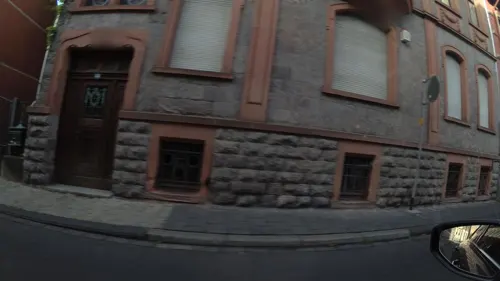

Heimatkundliches Museum
Monument and historic site · 7.7 km
46 Hauptstraße, Herrstein
Su 10:00-17:00, Mo-Su "Nach Absprache mit Tourist-Info"

Schloss Oberstein
Monument and historic site · 1.7 km
4 Schloß, Idar-Oberstein


Weiherschleife
Monument and historic site · 2.2 km
87 Tiefensteiner Straße, Idar-Oberstein
Gedenkstein für deportierte und ermordete Juden
Monument and historic site · 1.8 km
Inschrift links: "Zum Gedenken an die deportierten und ermordeten jüdischen Bürger der Stadt Idar-Oberstein 1933 – 1945 Die Bürger der...
22 more on the map.
Parks, trails and playgrounds24
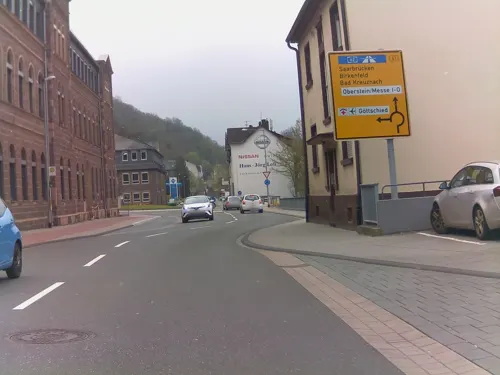
Hallenbad Idar-Oberstein
Sports field and stadium
213 Hauptstraße, Idar-Oberstein
Mo-Fr 10:00-21:00; Sa,Su,PH 10:00-17:00






12 more on the map.
Restaurants and cafes100
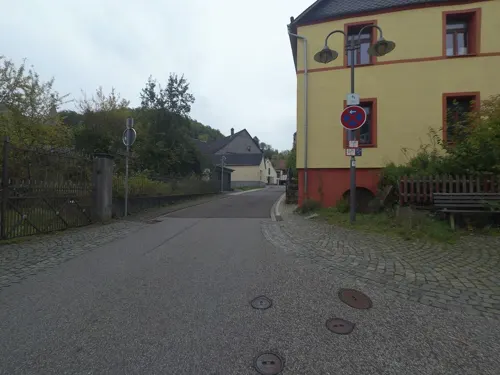

Flugplatzrestaurant Göttschied
Restaurant · Steak House · 2.9 km
Durchgehend geöffnet. "Hier gibt es den original Idar-Obersteiner Spießbraten. Er wird zu jeder Jahreszeit auf offenem Feuer gebraten."
20 Flugplatzstraße, Idar-Oberstein
Tu-Su,PH 12:00-22:00
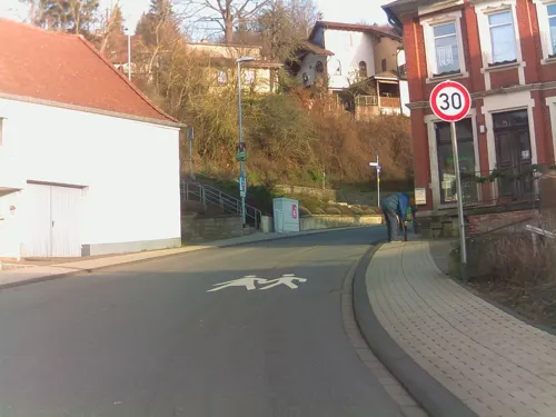
Artemis
Restaurant · Greek · 4.4 km
2 Oberdorfstraße, Idar-Oberstein
Mo-Sa 17:00-22:00; Su,PH 11:30-14:00,17:00-21:00
Poseidon
Restaurant · Greek · 1.2 km
2 A;2a Auf dem Bilzacker, Idar-Oberstein
We-Mo 18:00-23:00; PH,Su 11:30-14:30
Pulverloch Schänke
Restaurant · Indian · 4.4 km
47 Hauptstraße, Hintertiefenbach
We-Fr 17:00-22:00; Sa,Su 11:00-14:00, 17:00-22:00; Mo 17:00-22:00
WOK Idar
Restaurant · Asian · 1.0 km
51 Hauptstraße, Idar-Oberstein
Mo,We-Fr 11:30-15:00,17:00-22:00; Sa 14:00-22:00; Su 11:30-21:00; Tu off
maje - café and store
Cafe · Coffee Shop, Breakfast, Cake, Bistro, Brunch · 1.8 km
390 Hauptstraße, Idar-Oberstein
We-Su 09:00-17:00
Brasserie
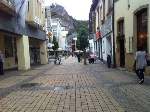
Restaurant · 0.8 km
89-91 Hauptstraße, Idar-Oberstein
Su-Th 08:30-22:00; Fr 08:30-23:00; Sa 09:30-23:00


Sonnenhof
Restaurant · Regional · 4.6 km
Küche nur zwischen 12 und 14, sowie 18 und 21 Uhr.
17:00+; Su 11:00-15:00,17:00+; Mo off
88 more on the map.
History
The territorial history of Idar-Oberstein's individual centres is marked by a considerable splintering of lordly domains in the local area. Only in Napoleonic times, beginning in 1794, with its reorganization and merging of various territorial units, was some order brought to the traditional mishmash of local lordships. However, shortly thereafter, the Congress of Vienna brought the future town division once again, as the river Nahe became a border, and the centres on its north bank were thereby grouped into the Principality of Birkenfeld, an exclave of the Grand Duchy of Oldenburg, most of whose territory was in what is now northwest Germany, with a coastline on the North Sea.
The towns of Idar and Oberstein belonged to the Barons of Daun-Oberstein (who later became the Counts of Falkenstein) until 1670. In 1865, both Idar and Oberstein were granted town rights, and finally in 1933, they were forcibly united (along with the municipalities of Algenrodt and Tiefenstein) by the Nazis to form the modern town of Idar-Oberstein.
From the History section of Idar-Oberstein on Wikipedia, under CC BY-SA 4.0.
Where to stay22
Churches and places of worship23
Evangelische Kirchengemeinde Fischbach-Kirn-Sulzbach
Church · Protestant · 6.9 km
93 Hauptstraße, Fischbach
Evangelische Abteikirche Göttschied
Church · Protestant · 2.2 km
43 Göttschieder Straße, Idar-Oberstein
Evangelische Kirche
Church · Protestant · 6.5 km
Obere Kirchstraße, Idar-Oberstein
Kirchengemeinde Idar Bez. Tiefenstein
Church · Protestant · 3.9 km
3 Granatweg, Idar-Oberstein
Shopping27
Bastel- und Geschenkestübchen
Shop · 1.7 km
51 Algenrodter Straße, Idar-Oberstein
Gas and EV charging7
Schools, colleges and libraries13
Berufsbildende Schule Technik (Harald-Fissler-Schule)
School · 0.7 km
53 Vollmersbachstraße, Idar-Oberstein
Berufsbildende Schule Wirtschaft Idar-Oberstein
School · 0.6 km
50 Vollmersbachstraße, Idar-Oberstein
Grundschule Göttschied Idar-Oberstein
School · 2.0 km
1 Eichenwaldstraße, Idar-Oberstein
Healthcare13
Achat-Apotheke
Clinic and pharmacy · 4.1 km
286 Tiefensteiner Straße, Idar-Oberstein
Map of Idar-Oberstein
250 places. The map loads OpenStreetMap tiles when you open it.
Getting there and nearby towns
Hahn Airport (HHN) is the nearest airport with scheduled flights listed in OpenStreetMap, 26 km away.
- Morbach 17 km northwest, about 17 min by car
- Nohfelden 18 km southwest, about 18 min by car
- Tholey 32 km southwest, about 32 min by car
- Marpingen 34 km southwest, about 34 min by car
- Wadern 36 km southwest, about 36 min by car
- Ottweiler 36 km south, about 36 min by car
- Schiffweiler 41 km south, about 41 min by car
- Illingen 42 km southwest, about 42 min by car
- Wittlich 42 km northwest, about 42 min by car
- Kaiserslautern 45 km southeast, about 45 min by car
Drive times are estimates from straight-line distance, not routes.
Local news
Headlines from INDB.
Reviews, tips and questions
Loading what members have shared...
Sources and licences
- GeoNames (CC BY 4.0): population, coordinates, regions and time zone
- Mapillary (see each image): photos
- OpenStreetMap contributors (ODbL 1.0): places, airports, map data
- Wikidata (CC0 1.0): elevation, founding date, time zone, website, landmarks and historic places
- Wikimedia Commons (see each image): photos
- Wikipedia (CC BY-SA 4.0): overview and history text
Photo credits
- Zentrale der OIE Idar-Oberstein RWE, Marco Loch, CC BY-SA 4.0
- Idar-Oberstein, Johanniskirche - geo.hlipp.de - 27190, Paul L on geo.hlipp.de, CC BY-SA 2.0
- Finanzamt Idar-Oberstein 2, Tohma ( talk ), CC BY-SA 4.0
- Kirchenkreis Obere Nahe Idar-Oberstein, Marco Loch, CC BY-SA 4.0
- Oie-ag idar-oberstein, Tohma ( talk ), CC BY-SA 4.0
- Idar-Oberstein – Ev. Johanneskirche, Kindertagesstätte - panoramio, Edgar El, CC BY 3.0
- Aerial image of the Idar-Oberstein-Göttschied airfield, Carsten Steger, CC BY-SA 4.0
- Zollamt Idar-Oberstein, Tohma ( talk ), CC BY-SA 4.0
- Idar-Oberstein – katholische Garnisonskirche St. Barbara - panoramio (1), giggel, CC BY 3.0
- Idar-Oberstein – katholische Garnisonskirche St. Barbara - panoramio, Edgar El, CC BY 3.0
- Idar-Oberstein, das Deutsche Edelsteinmuseum, Dguendel, CC BY 4.0
- BBS Technik Harald-Fissler-Schule Idar-Oberstein Abteilung Wirtschaft, Tohma ( talk ), CC BY-SA 4.0
- BBS Technik Harald-Fissler-Schule Idar-Oberstein Abteilung Wirtschaft 2, Tohma ( talk ), CC BY-SA 4.0
- Idar-Oberstein, Haus Hauptstraße 114, Dguendel, CC BY 4.0
- Idar-Oberstein Schleiferplatz von Börsenhochhaus 2024, SMESH, CC BY-SA 4.0
- Idar-Oberstein, Ortsansicht Idar, Dguendel, CC BY 4.0
- Edelsteinbörse Idar-Oberstein, Tohma ( talk ), CC BY-SA 4.0
- Boerse Idar-Oberstein, Tohma ( talk ), CC BY-SA 4.0
- Schloss Oberstein, User Rkal on de.wikipedia, CC BY-SA 3.0
- Burg bosselsteirp, own work, CC BY-SA 3.0
- Burg Frauenburg-1, Muck, CC BY-SA 4.0
- Heinzenwies2, Benjamin Fries, CC BY-SA 2.5
- Niederbrombach-Church02, Bueckler, CC BY-SA 3.0
- Felsenkirche (Idar-Oberstein) 2023, Jörg Braukmann, CC BY-SA 4.0
- Wildenburger Kopf, Jörg Braukmann, CC BY-SA 3.0
- Idar-Oberstein – Ev. Gemeindezentrum Christuskirche - panoramio (1), Edgar El, CC BY 3.0
- Evangelische Kirche Weierbach, Thomas Fillmann, CC BY-SA 4.0
- Stummorgel Herrstein, Max Mustermann ( Leif von Speyer ( talk )), CC BY-SA 3.0
- Herrstein BW 1, Berthold Werner, CC BY-SA 3.0
- Deutsches Edelsteinmuseum IO, Unknown author, CC BY-SA 3.0
- Krechelsfels2, Jbndr, CC BY-SA 4.0
- Kirschweiler Festung im Herbst, Frank Garland, CC BY-SA 3.0
- In der Rosselhalde, Frank Garland, CC BY-SA 3.0
- Kempfeld - Die Wildenburg - 08.10.08 - panoramio, giggel, CC BY 3.0
- Schleiferplatz Idar-Oberstein, Tohma ( talk ), CC BY-SA 4.0
- Deutsches Edelsteinmuseum Idar-Oberstein bei Tageslicht, Deutsches Edelsteinmuseum (Jürgen Cullmann), CC BY-SA 3.0 de
- Stolperstein Hans Willi Güntzburger, Bueckler, CC0
- Stolperstein Georg Maus, Bueckler, CC0
- Stolperstein Berty Neuhäuser, Bueckler, CC0
- Stolperstein Richard Neuhäuser, Bueckler, CC0
- Kirschweiler, Naturschutzgebiet Silberich – Kirschweiler Festung - panoramio (2), Edgar El, CC BY 3.0
- Street-level photo, VIA_CH, CC BY-SA 4.0
- Street-level photo, ramap, CC BY-SA 4.0
- Street-level photo, VIA_CH, CC BY-SA 4.0
- Street-level photo, VIA_CH, CC BY-SA 4.0
- Street-level photo, ramap, CC BY-SA 4.0
- Street-level photo, miguel_andrade, CC BY-SA 4.0
- Street-level photo, VIA_CH, CC BY-SA 4.0
- Street-level photo, ramap, CC BY-SA 4.0
- Street-level photo, postgelb, CC BY-SA 4.0
- Street-level photo, miguel_andrade, CC BY-SA 4.0
- Street-level photo, ramap, CC BY-SA 4.0
- Street-level photo, ramap, CC BY-SA 4.0
- Street-level photo, miguel_andrade, CC BY-SA 4.0
- Street-level photo, miguel_andrade, CC BY-SA 4.0
- Street-level photo, miguel_andrade, CC BY-SA 4.0
- Street-level photo, VIA_CH, CC BY-SA 4.0
- Street-level photo, ramap, CC BY-SA 4.0
- Street-level photo, ramap, CC BY-SA 4.0
- Street-level photo, VIA_CH, CC BY-SA 4.0
- Street-level photo, VIA_CH, CC BY-SA 4.0
- Street-level photo, miguel_andrade, CC BY-SA 4.0
- Street-level photo, VIA_CH, CC BY-SA 4.0
- Street-level photo, miguel_andrade, CC BY-SA 4.0
- Street-level photo, VIA_CH, CC BY-SA 4.0
- Street-level photo, ramap, CC BY-SA 4.0
- Street-level photo, teddy73, CC BY-SA 4.0
- Street-level photo, teddy73, CC BY-SA 4.0
- Street-level photo, miguel_andrade, CC BY-SA 4.0
- Street-level photo, VIA_CH, CC BY-SA 4.0
- Street-level photo, VIA_CH, CC BY-SA 4.0


Page built November 8, 2026. Spotted a mistake? Tell us or suggest a place.