


Why visit Bienenbüttel
Townapedia lists 23 museums and landmarks, 15 parks and trails, 29 places to eat, 9 places to stay and 5 attractions in and around town.
Highlights include Timeloberg, Grabhügel Bornsen 6, Großsteingrab Rohstorf 5 and Waldbad Bienenbüttel.
Weather in Bienenbüttel
Forecast from MET Norway (CC BY 4.0). Full forecast
About Bienenbüttel
Bienenbüttel is a free municipality in the district of Uelzen, in Lower Saxony, Germany. It is situated on the river Ilmenau, approximately 20 kilometres (12 mi) north of Uelzen, and 13 kilometres (8 mi) southeast of Lüneburg. Bienenbüttel is a part of the Hamburg Metropolitan Region and of the Lüneburg Heath (German: Lüneburger Heide).
From the Wikipedia article Bienenbüttel (this version), under CC BY-SA 4.0.
Things to do5



Museums and landmarks23

Grabhügel Bornsen 6
Monument and historic site · 5.7 km
Hügelschüttung eines zerstörten Großsteingrabes

Großsteingrab Rohstorf 5
Monument and historic site · 8.1 km
Neolithischer Grabhügel, der vermutlich eine Steinkammer enthält

Kloster Medingen
Monument and historic site · Lutheran (High Church) · 7.6 km
1 Klosterweg, Bad Bevensen


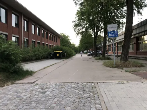
Kunstraum of Lüneburg University
Museum · 11.1 km
Contemporary art gallery in Germany

Medingen Abbey
Museum · 7.6 km
Convent in Bad Bevensen, Lower Saxony, Germany

Gräberfeld in der Addenstorfer Heide
Monument and historic site · 4.6 km
Addenstorfer Hügelgräber
11 more on the map.
Parks, trails and playgrounds15

Waldbad Bienenbüttel
Sports field and stadium · 0.9 km
1 Badweg, Bienenbüttel
Mo 13:00-20:00; Th-Sa 06:30-20:00; Su,PH 07:30-20:00



Lüneburger Ilmenauniederung mit Tiergarten
Hiking and trails · 7.1 km




3 more on the map.
Restaurants and cafes29

Takumi
Restaurant · Japanese · 2.5 km
4 Lüneburger Straße, Bienenbüttel
Mo-Su 11:30-15:00,16:30-22:00; Fr,Sa 11:30-15:00,16:30-22:30
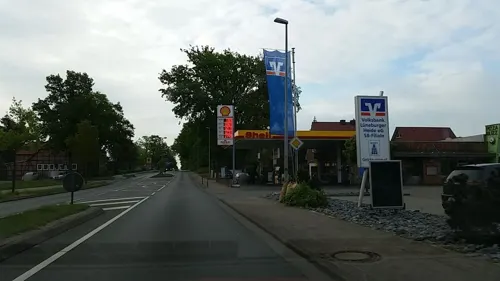
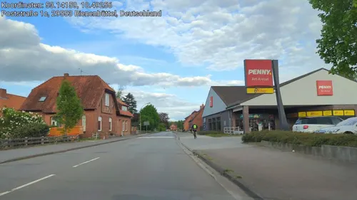
Kruse - Der Lecker Bäcker
Bakery
2a Poststraße, Bienenbüttel
Mo-Fr 06:00-19:00; Sa 06:00-18:00; Su 07:30-10:30
Kruse - Der Lecker Bäcker
Bakery · 7.6 km
1a Tiergartenstraße, Deutsch Evern
Mo-Sa 06:15-19:00; Su 08:00-11:00


17 more on the map.
Where to stay9
Zur Eiche - Gasthaus, Pension
Motel and hotel · 4.5 km
2 Hufeisenstraße, Bienenbüttel
Churches and places of worship10
Shopping9
Gas and EV charging8
Schools, colleges and libraries8
Healthcare2
Map of Bienenbüttel
118 places. The map loads OpenStreetMap tiles when you open it.
Getting there and nearby towns
Hamburg Finkenwerder Airport (XFW) is the nearest airport with scheduled flights listed in OpenStreetMap, 62 km away.
- Lüneburg 13 km north, about 13 min by car
- Ebstorf 13 km south, about 13 min by car
- Reppenstedt 15 km northwest, about 15 min by car
- Uelzen 20 km south, about 20 min by car
- Bleckede 23 km northeast, about 23 min by car
- Wulfsen 29 km northwest, about 29 min by car
- Winsen 30 km northwest, about 30 min by car
- Wieren 31 km south, about 31 min by car
- Boizenburg 31 km northeast, about 31 min by car
- Geesthacht 34 km north, about 34 min by car
Drive times are estimates from straight-line distance, not routes.
Local news
Headlines from INDB.
Reviews, tips and questions
Loading what members have shared...
Sources and licences
- GeoNames (CC BY 4.0): population, coordinates, regions and time zone
- Mapillary (see each image): photos
- OpenStreetMap contributors (ODbL 1.0): places, airports, map data
- Wikidata (CC0 1.0): elevation, founding date, time zone, website, landmarks and historic places
- Wikimedia Commons (see each image): photos
- Wikipedia (CC BY-SA 4.0): overview and history text
Photo credits
- Bienenbüttel - Bahnhofstraße 10 ies, Frank Vincentz, CC BY-SA 3.0
- Bienenbüttel - Ladestraße - Bahnhof 05 ies, Frank Vincentz, CC BY-SA 3.0
- Bienenbüttel - Ladestraße - Bahnhof 07 ies, Frank Vincentz, CC BY-SA 3.0
- Bienenbüttel - Ladestraße - Bahnhof 06 ies, Frank Vincentz, CC BY-SA 3.0
- Barum-Bienenbütteler Mühlenbach (Ilmenau) 002, Smarties, CC BY-SA 4.0
- Barum-Bienenbütteler Mühlenbach (Ilmenau) 003, Smarties, CC BY-SA 4.0
- Barum-Bienenbütteler Mühlenbach (Ilmenau), Smarties, CC BY-SA 4.0
- Ilmenau bei Bienenbüttel, FriedrichFrisch, CC BY-SA 4.0
- Leuphana Building, Gerrit Gutzeit, CC BY-SA 4.0
- Bad Bevensen Medingen - Klosterweg - Kloster 11 ies, Frank Vincentz, CC BY-SA 3.0
- Dieksbach im Naturschutzgebiet Dieksbeck, Jens Mattke, CC BY-SA 4.0
- Ilmenautal, Eco-mus, CC BY-SA 3.0
- Deutsch Evern Martinuskirche 9711, Torsten Bätge, CC BY-SA 3.0
- Forellenbachtal 01, Eco-mus, CC BY-SA 4.0
- Vierenbach 2, Hermann Nauer, CC BY 4.0
- Bornsen Langbett 2 d, Holger rix, CC BY-SA 3.0
- Bienenbüttel - Niendorfer Straße - St Michaelis 05 ies, Frank Vincentz, CC BY-SA 3.0
- St. Nikolaus Kapelle (Vastorf) 1, FriedrichFrisch, CC BY-SA 4.0
- Church of Natendorf view from north east, FriedrichFrisch, CC BY-SA 4.0
- Mauritiuskirche Altenmedingen, FriedrichFrisch, CC BY-SA 4.0
- Burial mound Bornsen 6, Stefan Ahlswede, CC BY 4.0
- NLD Großsteingrab Rohstorf 5 01, Wiebers, Niedersächsisches Landesamt für Denkmalpflege, CC BY-SA 4.0
- Großsteingrab Rohstorf 4 p1, Stefan Ahlswede, CC BY 4.0
- Natendorf - Dorfkirche, Oxfordian Kissuth, CC BY-SA 3.0
- Kirche Altenmedingen, Shelka belka & dianka bianka, CC BY-SA 3.0
- Fahrrad Ladestation bei Claudia's, Hazedgru, CC0
- Addenstorfer Heide Huegelgraeberfeld 9, Holger rix, CC BY-SA 3.0
- Großsteingrab Rohstorf 3 p3, Stefan Ahlswede, CC BY 4.0
- Großsteingrab Bornsen Bienenbüttel 1, Stefan Ahlswede, CC BY 4.0
- Großsteingrab Edendorf 1 p3, Stefan Ahlswede, CC BY 4.0
- Großsteingrab Bruchtorf 1 p1, Stefan Ahlswede, CC BY 4.0
- Großsteingrab Solchstorf 2 p1, Stefan Ahlswede, CC BY 4.0
- Wichmannsburg- St.Georg church, Dguendel, CC BY 3.0
- Vierenbach (Ilmenau), Smarties, CC BY-SA 4.0
- Krummbach (Ilmenau), Smarties, CC BY-SA 4.0
- Hatgenbeck (Vierenbach), Smarties, CC BY-SA 4.0
- North facade of St. George's Church Wichmannsburg, FriedrichFrisch, CC BY-SA 4.0
- Wichmannsburg - St.-Georgs-Kirche - geo.hlipp.de - 37776, Oxfordian Kissuth on geo.hlipp.de, CC BY-SA 2.0
- Wichmannsburg-, St.Georg church, the altar, Dguendel, CC BY 3.0
- Wichmannsburg- brick houses, Dguendel, CC BY 3.0
- Timeloberg 08.23, Tine, CC BY-SA 4.0
- Street-level photo, hotteliene, CC BY-SA 4.0
- Street-level photo, hotteliene, CC BY-SA 4.0
- Street-level photo, tian, CC BY-SA 4.0
- Street-level photo, hotteliene, CC BY-SA 4.0
- Street-level photo, hotteliene, CC BY-SA 4.0
- Street-level photo, hotteliene, CC BY-SA 4.0
- Street-level photo, hotteliene, CC BY-SA 4.0
- Street-level photo, hotteliene, CC BY-SA 4.0
- Street-level photo, hotteliene, CC BY-SA 4.0
- Street-level photo, hotteliene, CC BY-SA 4.0
- Street-level photo, LuisaSch, CC BY-SA 4.0
- Street-level photo, hotteliene, CC BY-SA 4.0
- Street-level photo, hotteliene, CC BY-SA 4.0
- Street-level photo, hotteliene, CC BY-SA 4.0
- Street-level photo, hotteliene, CC BY-SA 4.0
- Street-level photo, tian, CC BY-SA 4.0
- Street-level photo, hotteliene, CC BY-SA 4.0


Page built November 9, 2026. Spotted a mistake? Tell us or suggest a place.