


Why visit Ebstorf
Townapedia lists 4 museums and landmarks, 8 parks and trails, 15 places to eat, 3 places to stay and 4 attractions in and around town.
Highlights include Domänenhof Alms, Eschenberg, Ebstorf Abbey and Opferstein Melzingen.
Weather in Ebstorf
Forecast from MET Norway (CC BY 4.0). Full forecast
About Ebstorf
Ebstorf is a municipality in the district of Uelzen, in Lower Saxony, Germany. It is situated approximately 12 kilometres (7.5 mi) northwest of Uelzen, and 25 kilometres (16 mi) south of Lüneburg.
From the Wikipedia article Ebstorf (this version), under CC BY-SA 4.0.
Things to do4

Domänenhof Alms
Farm and orchard
1 Domänenplatz, Ebstorf
Mo-Sa 08:00-18:00; Su 09:00-18:00

Museums and landmarks4

Ebstorf Abbey
Monument and historic site · Lutheran
Lutheran convent of nuns in Uelzen, Lower Saxony, Germany
12 Kirchplatz, Ebstorf


Parks, trails and playgrounds8

waldemar
Sports field and stadium · 0.8 km
1 Hans-Rasch-Weg, Ebstorf
Mo 13:00-20:00; Tu-Fr 10:00-20:00; Sa-Su 09:00-19:00



Restaurants and cafes15
Café am Kloster
Cafe · Regional, Coffee Shop, German, Cake, Pasta
14 Lüneburger Straße, Ebstorf
Tu-Sa 06:00-18:00; Su 07:30-18:00

Zum Unteren Krug
Restaurant · German
42 Hauptstraße, Ebstorf
We-Sa 17:00-20:30; Su 11:30-13:30,17:00-21:00; Mo,Tu off
Eiscafé Aldo
Cafe · Italian, Ice Cream, Pizza
5 Lüneburger Straße, Ebstorf
Mo-Th 12:00-21:00; Fr 10:00-21:00

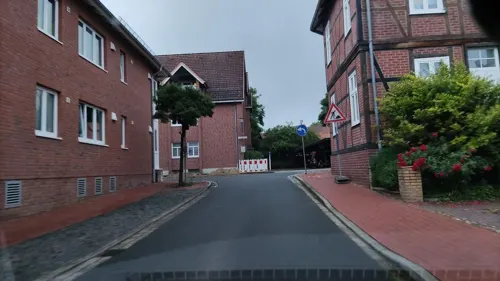
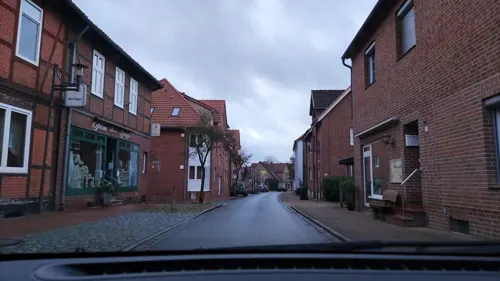


Gasthaus Lüllau
Restaurant
15 Lüneburger Straße, Ebstorf
Mo-Su 10:00-13:00,16:00-24:00; Tu off
3 more on the map.
Where to stay3
Churches and places of worship4
Shopping6
Gas and EV charging2
Schools, colleges and libraries2
Healthcare2
Map of Ebstorf
50 places. The map loads OpenStreetMap tiles when you open it.
Getting there and nearby towns
Hamburg Finkenwerder Airport (XFW) is the nearest airport with scheduled flights listed in OpenStreetMap, 69 km away.
- Uelzen 12 km southeast, about 12 min by car
- Stadensen 19 km southeast, about 19 min by car
- Faßberg 22 km southwest, about 22 min by car
- Unterlüß 23 km south, about 23 min by car
- Wieren 23 km southeast, about 23 min by car
- Lüneburg 25 km north, about 25 min by car
- Reppenstedt 25 km north, about 25 min by car
- Hermannsburg 31 km southwest, about 31 min by car
- Winsen 39 km north, about 39 min by car
- Soltau 39 km west, about 39 min by car
Drive times are estimates from straight-line distance, not routes.
Local news
Headlines from INDB.
Reviews, tips and questions
Loading what members have shared...
Sources and licences
- GeoNames (CC BY 4.0): population, coordinates, regions and time zone
- Mapillary (see each image): photos
- OpenStreetMap contributors (ODbL 1.0): places, airports, map data
- Wikidata (CC0 1.0): elevation, founding date, time zone, website
- Wikimedia Commons (see each image): photos
- Wikipedia (CC BY-SA 4.0): overview and history text
Photo credits
- Ebstorf by-RaBoe 2012 4, © Ra Boe / Wikipedia, CC BY-SA 3.0 de
- Monastery Ebstorf, UResas, Public domain
- Ebstorf Kirche kath, Kirchenfan, CC0
- Hanstedt Hanstedt I - St Jakobi ex 10 ies, Frank Vincentz, CC BY-SA 3.0
- Schwienau Melzingen - Opferstein 06 ies, Frank Vincentz, CC BY-SA 3.0
- Bobenwald 01, Puusterke, CC BY-SA 4.0
- Kirche Ebstorf, Shelka belka & dianka bianka, CC BY-SA 3.0
- Bobenwald 02, Puusterke, CC BY-SA 4.0
- Street-level photo, hotteliene, CC BY-SA 4.0
- Street-level photo, hotteliene, CC BY-SA 4.0
- Street-level photo, hotteliene, CC BY-SA 4.0
- Street-level photo, hotteliene, CC BY-SA 4.0
- Street-level photo, hotteliene, CC BY-SA 4.0
- Street-level photo, hotteliene, CC BY-SA 4.0
- Street-level photo, tian, CC BY-SA 4.0
- Street-level photo, hotteliene, CC BY-SA 4.0
- Street-level photo, hotteliene, CC BY-SA 4.0
- Street-level photo, hotteliene, CC BY-SA 4.0
- Street-level photo, hotteliene, CC BY-SA 4.0
- Street-level photo, hotteliene, CC BY-SA 4.0
- Street-level photo, hotteliene, CC BY-SA 4.0
- Street-level photo, hotteliene, CC BY-SA 4.0
- Street-level photo, hotteliene, CC BY-SA 4.0
- Street-level photo, hotteliene, CC BY-SA 4.0
- Street-level photo, hotteliene, CC BY-SA 4.0
- Street-level photo, hotteliene, CC BY-SA 4.0
- Street-level photo, hotteliene, CC BY-SA 4.0
- Street-level photo, hotteliene, CC BY-SA 4.0
- Street-level photo, hotteliene, CC BY-SA 4.0


Page built November 9, 2026. Spotted a mistake? Tell us or suggest a place.