


Why visit Bleckede
Townapedia lists 31 museums and landmarks, 8 parks and trails, 33 places to eat, 16 places to stay and 17 attractions in and around town.
Highlights include Bostelmanns Hof, Spargelhof Strampe Hofladen, Fliesenmuseum and Biosphaerium Elbtalaue.
Weather in Bleckede
Forecast from MET Norway (CC BY 4.0). Full forecast
About Bleckede
Bleckede (German pronunciation: [ˈbleːkədə]; Polabian Bleketsa) is a town in the district of Lüneburg, in Lower Saxony, in northern Germany. It is situated mostly on the left bank of the Elbe, approx. 20 kilometres (12 mi) east of Lüneburg.
From the Wikipedia article Bleckede (this version), under CC BY-SA 4.0.
Things to do17




5 more on the map.
Museums and landmarks31

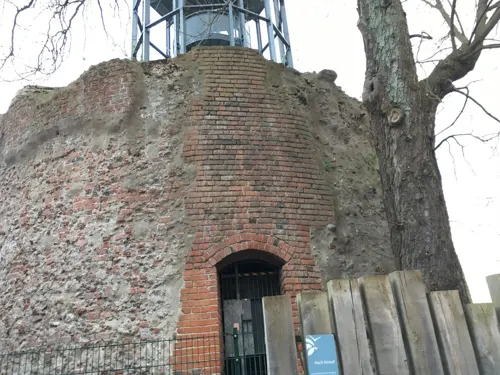
Biosphaerium Elbtalaue
Monument and historic site · 1.1 km
10 Schloßstraße, Bleckede
Mo-Su 10:00-17:00

Großsteingrab Holzen 2
Monument and historic site · 8.9 km
Erdhügel als Rest eines Großsteingrabes mit Hünenbett


Elbschloss Bleckede
Monument and historic site · 1.1 km
10 Schloßstraße, Bleckede

Großsteingrab Barskamp 6
Monument and historic site · 7.7 km
Kammerloses Hünenbett

Hünenbett ohne Kammer von Boltersen
Monument and historic site · 9.4 km
Langgrab

ehem. Beobachtungsbunker FB-3
Monument and historic site · 1.6 km
Ehemaliger Beobachtungsbunker FB-3 der innerdeutschen Grenze mit Ausstellung


19 more on the map.
Parks, trails and playgrounds8

Waldbad Alt Garge
Sports field and stadium · 5.7 km
25 Am Waldbad, Bleckede
Mo 14:00-20:00; Tu-Su 11:00-20:00




Restaurants and cafes33
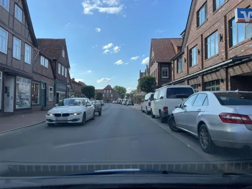
Bleckeder Brauhaus
Restaurant · German · 0.6 km
20 Breite Straße, Bleckede
We-Sa 16:00-22:00; Su 11:00-22:00

Restaurant Kavala
Restaurant · Greek · 0.6 km
16 Breite Straße, Bleckede
Mo-Sa 12:00-14:30, 17:00-22:00; Su12:00-22:00
Räucherkate Stiepelse
Restaurant · Regional · 4.5 km
Tu-Th 11:00-15:00; Tu-Th 17:00-20:00; Fr, Sa 11:00-20:00; Su 11:00-18:00
Café Mancini
Cafe · Cake · 0.7 km
40 Breite Straße, Bleckede
Mo-Su 09:00-22:00; Oct-Feb: Tu-We off



Restaurant No. 16
Restaurant · German · 9.7 km
We-Su,PH 11:00-22:00
21 more on the map.
Where to stay16
Radlerherberge "Alte Schule"
Motel and hotel · 3.6 km
6 Neu Bleckeder Straße, Bleckede
Churches and places of worship13
Bauernkapelle Krusendorf
Church · Lutheran · 8.1 km
14 Sumter Straße, Amt Neuhaus
Shopping15
Gas and EV charging5
Schools, colleges and libraries10
Healthcare3
Map of Bleckede
151 places. The map loads OpenStreetMap tiles when you open it.
Getting there and nearby towns
Lübeck Airport (LBC) is the nearest airport with scheduled flights listed in OpenStreetMap, 58 km away.
- Boizenburg 10 km north, about 10 min by car
- Lüneburg 22 km west, about 22 min by car
- Reppenstedt 26 km west, about 26 min by car
- Hitzacker 25 km southeast, about 25 min by car
- Geesthacht 29 km northwest, about 29 min by car
- Schwarzenbek 29 km northwest, about 29 min by car
- Dannenberg 32 km southeast, about 32 min by car
- Hagenow 34 km northeast, about 34 min by car
- Winsen 36 km west, about 36 min by car
- Uelzen 38 km south, about 38 min by car
Drive times are estimates from straight-line distance, not routes.
Local news
Headlines from INDB.
Reviews, tips and questions
Loading what members have shared...
Sources and licences
- GeoNames (CC BY 4.0): population, coordinates, regions and time zone
- Mapillary (see each image): photos
- OpenStreetMap contributors (ODbL 1.0): places, airports, map data
- Wikidata (CC0 1.0): elevation, founding date, time zone, website
- Wikimedia Commons (see each image): photos
- Wikipedia (CC BY-SA 4.0): overview and history text
Photo credits
- Bleckede Breite Straße 03, ClausNe, CC BY-SA 4.0
- Bleckede Breite Straße 05, ClausNe, CC BY-SA 4.0
- Ausbesserungswerk Bleckede 2019-06 Foto 9, Gerd Fahrenhorst, CC BY 4.0
- Ausbesserungswerk Bleckede 2019-06 Foto 8, Gerd Fahrenhorst, CC BY 4.0
- Bleckede Hafen 2019-06 Foto 3580, Gerd Fahrenhorst, CC BY 4.0
- Bleckede Hafen 2019-06 Foto 3579, Gerd Fahrenhorst, CC BY 4.0
- Bleckede Hafen 2019-06 Foto 3578, Gerd Fahrenhorst, CC BY 4.0
- Bleckede Breite Straße 15, ClausNe, CC BY-SA 4.0
- Bleckede Hafen 2019-06 Foto 3577, Gerd Fahrenhorst, CC BY 4.0
- Betsaal-bleckede, Emma7stern, CC BY-SA 3.0
- Bleckede Breite Straße 17, ClausNe, CC BY-SA 4.0
- Bleckede Breite Straße 12, ClausNe, CC BY-SA 4.0
- Ausbesserungswerk Bleckede 2019-06 Foto 7, Gerd Fahrenhorst, CC BY 4.0
- Ausbesserungswerk Bleckede 2019-06 Foto 6, Gerd Fahrenhorst, CC BY 4.0
- Bleckede Breite Straße 23, ClausNe, CC BY-SA 4.0
- Ausbesserungswerk Bleckede 2019-06 Foto 5, Gerd Fahrenhorst, CC BY 4.0
- Ausbesserungswerk Bleckede 2019-06 Foto 4, Gerd Fahrenhorst, CC BY 4.0
- Bleckede Breite Straße 20, ClausNe, CC BY-SA 4.0
- Haustür - Bleckede 03, James Steakley, CC BY-SA 4.0
- Bleckede Breite Straße 27, ClausNe, CC BY-SA 4.0
- Bleckede Zollstraße 02, ClausNe, CC BY-SA 4.0
- Bleckede Breite Straße 29, ClausNe, CC BY-SA 4.0
- Bleckede Bahnhof Busstation, Gerd Fahrenhorst, CC BY 4.0
- Bleckede Breite Straße 31, ClausNe, CC BY-SA 4.0
- Bleckede Zollstraße 10b, ClausNe, CC BY-SA 4.0
- Bleckede Zollstraße 10, ClausNe, CC BY-SA 4.0
- Bleckede Breite Straße 35, ClausNe, CC BY-SA 4.0
- Bleckede Zollstraße 05, ClausNe, CC BY-SA 4.0
- Bleckede Breite Straße 28, ClausNe, CC BY-SA 4.0
- Ausbesserungswerk Bleckede 2019-06 Foto 3, Gerd Fahrenhorst, CC BY 4.0
- Bleckede Breite Straße 30, ClausNe, CC BY-SA 4.0
- Ausbesserungswerk Bleckede 2019-06 Foto 2, Gerd Fahrenhorst, CC BY 4.0
- Bahnhof Bleckede 2019-06, Gerd Fahrenhorst, CC BY 4.0
- Bleckede Breite Straße 32, ClausNe, CC BY-SA 4.0
- Bleckede Zollstraße 09, ClausNe, CC BY-SA 4.0
- Bleckede Breite Straße 36, ClausNe, CC BY-SA 4.0
- Bleckede Breite Straße 38, ClausNe, CC BY-SA 4.0
- Buckelgräberfeld von Boltersen p2, Stefan Ahlswede, CC BY 4.0
- NLD Großsteingrab Boltersen 01, A. Wiebers, Niedersächsisches Landesamt für Denkmalpflege, CC BY-SA 4.0
- ElbSchloss Bleckede (2814473890), Ronald Preuß, CC BY-SA 2.0
- Boizenburg-Fliesenmuseum1-Bubo, Bubo, CC BY-SA 3.0
- Barskamp Steingrab 7d, Holger rix, CC BY-SA 3.0
- St.-Willibrord-Kirche (Neetze), FriedrichFrisch, CC BY-SA 4.0
- Bleckede, Kath. Kirche, Rückseite, Kirchenfan, CC0
- Peter-und-Paul-Kirche Nordansicht (Thomasburg), FriedrichFrisch, CC BY-SA 4.0
- Großsteingrab Holzen 2 p1, Stefan Ahlswede, CC BY 4.0
- Großsteingrab Barskamp 2 p1, Stefan Ahlswede, CC BY 4.0
- Großsteingrab Barskamp 6 p1, Stefan Ahlswede, CC BY 4.0
- Bleckede-Radegast mod Timm, Bleckede-Radegast.jpg : Mussklprozz derivative work: Timm B. Busshaus ( talk ), CC BY-SA 3.0
- Sankt Jakobikirche, Bleckede, James Steakley, CC BY-SA 4.0
- St-Vitus-Kirche Barskamp, Abubiju, CC BY-SA 3.0
- Chapel of Stiepelse, Christian Fischer, CC BY-SA 3.0
- Chapel of Krusendorf, Christian Fischer, CC BY-SA 3.0
- Sprockhoff706, Matchcut2001, CC BY-SA 4.0
- Alte Apotheke Bleckede Aktuell, AlteApoBleckede, CC BY-SA 3.0
- Aussichtsturm (vyhlídková věž), Bleckede-Wendischthun, Bleckede, Zemský okres Lüneburg, spolková země Dolní Sasko, Německo 01, Fry72 (Karel Frydrýšek), CC BY-SA 4.0
- Street-level photo, hotteliene, CC BY-SA 4.0
- Street-level photo, hotteliene, CC BY-SA 4.0
- Street-level photo, hotteliene, CC BY-SA 4.0
- Street-level photo, hotteliene, CC BY-SA 4.0
- Street-level photo, hotteliene, CC BY-SA 4.0
- Street-level photo, hotteliene, CC BY-SA 4.0
- Street-level photo, hotteliene, CC BY-SA 4.0
- Street-level photo, hotteliene, CC BY-SA 4.0
- Street-level photo, hotteliene, CC BY-SA 4.0
- Street-level photo, hotteliene, CC BY-SA 4.0
- Street-level photo, MapJola, CC BY-SA 4.0
- Street-level photo, hierdadort, CC BY-SA 4.0
- Street-level photo, ramap, CC BY-SA 4.0
- Street-level photo, hotteliene, CC BY-SA 4.0
- Street-level photo, hotteliene, CC BY-SA 4.0
- Street-level photo, nobbym, CC BY-SA 4.0
- Street-level photo, hotteliene, CC BY-SA 4.0
- Street-level photo, hotteliene, CC BY-SA 4.0
- Street-level photo, hotteliene, CC BY-SA 4.0
- Street-level photo, hotteliene, CC BY-SA 4.0
- Street-level photo, hotteliene, CC BY-SA 4.0


Page built November 9, 2026. Spotted a mistake? Tell us or suggest a place.