


Brechten, Germany
Brechten is a town of 9,635 people in North Rhine-Westphalia, Germany.
Why visit Brechten
Townapedia lists 17 museums and landmarks, 10 parks and trails, 38 places to eat and 1 attraction in and around town.
Highlights include Bergarbeiter-Wohnmuseum, Gedenkstein für die Kolonie Kirdorf, Auf dem Brink and Grävingholz.
Weather in Brechten
Forecast from MET Norway (CC BY 4.0). Full forecast
Things to do1

Museums and landmarks17
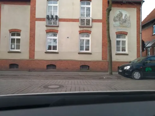
Bergarbeiter-Wohnmuseum
Museum · 2.6 km
10 Rudolfstraße, Lünen
Th 17:00-19:00; Tu,Su 15:00-17:00

Gedenkstein für die Kolonie Kirdorf
Monument and historic site · 2.9 km



Ehren- und Grabmal für die Opfer des Grubenunglücks am 21. Dezember 1882 auf Zeche Fürst Hardenberg
Monument and historic site · 2.8 km
Kriegerdenkmal in Brechten, Gefallene 1866, 1870-71, 1914-1918 und 1939-1945
Monument and historic site
Teufenzeiger für Schacht VI (Industriedenkmal)
Monument and historic site · 0.6 km
Max Schild
Monument and historic site · 0.6 km
Hier wohnte Max Schild * 21.5.1881 in Schwerte - Im Rahmen der Kristallnacht 1938 in der „Steinwache“ inhaftiert. Deportiert 1944 nach...
5 more on the map.
Parks, trails and playgrounds10


Pflanzenland Dahlke
Playground · 1.9 km
Mo-Fr 08:30-18:30; Sa 08:30-14:00; Su 11:00-13:00



Restaurants and cafes38

Kuhbar Eiscafé Dortmund-Brechten
Ice cream · Ice Cream
15 Rauher Dorn, Dortmund
Mo-Fr 13:00-20:00; Sa; Su 12:00-20:00
Westermann's
Restaurant · 2.2 km
120 An der Wethmarheide, Lünen
Mo-Su 12:00-22:00 || "Unsere Küche ist täglich geöffnet, außer...
El Greco
Restaurant · Greek · 2.7 km
59 Königsheide, Lünen
Tu-Th 16:00-21:00; Sa 13:00-22:00; Fr 16:00-22:00; Su,PH 13:00-21:00

Am Pütt
Bar and pub · 2.9 km
Die Bistro Kneipe in Brambauer
15 Friedhofstraße, Lünen
Mo-Th 10:00-22:00; Fr-Sa 10:00-24:00
Malzers
Bakery · 3.0 km
5 Mengeder Straße, Lünen
Mo-Sa 06:00-20:00; Su 07:30-16:00




26 more on the map.
Churches and places of worship11
Neuapostolische Kirche
Church · New Apostolic · 2.7 km
247 Evinger Straße, Dortmund
Verein zur Förderung der Intergration und Bildung in Dortmund Eving e.V.
Place of worship · 3.0 km
33 Bergstraße, Dortmund
Shopping15
Gas and EV charging5
Schools, colleges and libraries14
Healthcare8
MVZ LÜNEN Dialysezentrum
Clinic and pharmacy · 2.8 km
18 Brechtener Straße, Lünen
Map of Brechten
119 places. The map loads OpenStreetMap tiles when you open it.
Getting there and nearby towns
Dortmund Airport (DTM) is the nearest airport with scheduled flights listed in OpenStreetMap, 12 km away.
- Lindenhorst 3 km south, about 3 min by car
- Derne 4 km east, about 4 min by car
- Lünen 6 km northeast, about 6 min by car
- Dortmund 7 km south, about 7 min by car
- Mengede 6 km west, about 6 min by car
- Waltrop 7 km northwest, about 7 min by car
- Oestrich 7 km west, about 7 min by car
- Lanstrop 7 km east, about 7 min by car
- Brackel 8 km southeast, about 8 min by car
- Westerfilde 7 km southwest, about 7 min by car
Drive times are estimates from straight-line distance, not routes.
Local news
Headlines from INDB.
Reviews, tips and questions
Loading what members have shared...
Sources and licences
- GeoNames (CC BY 4.0): population, coordinates, regions and time zone
- Mapillary (see each image): photos
- OpenStreetMap contributors (ODbL 1.0): places, airports, map data
- Wikidata (CC0 1.0): elevation, founding date, time zone, website
- Wikimedia Commons (see each image): photos
Photo credits
- St. Antonius von Padua (Dortmund-Brechten) Dortmund-1744, User:Creosoph, CC BY-SA 4.0
- Ev. Kindergarten Brechten - panoramio, alpenzoo, CC BY-SA 3.0
- Widumer Straße, Dortmund Brechten, Germany - panoramio, alpenzoo, CC BY-SA 3.0
- Johannes Baptist Brechten Dortmund-1742, User:Creosoph, CC BY-SA 4.0
- Brechtener Straße 246, Mirko Klotz (Klotzi), CC BY-SA 3.0 de
- Alte Kolonie Eving IMGP3798 wp, smial, CC BY-SA 2.0 de
- St.Barbara Dortmund Eving, Tbachner, CC BY 3.0
- Naturschutzgebiet Auf dem Brink02, Helfmann, CC BY-SA 3.0
- Napoleonsbuche, Potupin, Public domain
- Naturschutzgebiet Auf dem Brink01, Helfmann, CC BY-SA 3.0
- Forest in Brechten, Dortmund, Germany - panoramio, alpenzoo, CC BY-SA 3.0
- Naturschutzgebiet Herrentheyer Wald (Holzkamp) 002, Itti, CC BY-SA 3.0
- Sueggel3, Potupin, Public domain
- Alte Kolonie Eving Dortmund typisches Haus, Mario Fischer, CC BY-SA 3.0
- Hammerkopfturm, Frank Hommes, CC BY-SA 3.0
- Kolonie Kirdorf - Siedlungseckhaus Gitschiner Straße, Günter Schmitz, CC BY-SA 3.0 de
- Im Dorfe 16, Mirko Klotz (Klotzi), CC BY-SA 3.0 de
- Spielplatz "Am Birkenbaum", Dortmund - panoramio, alpenzoo, CC BY 3.0
- Spielplatz "Am Birkenbaum", Dortmund - panoramio (1), alpenzoo, CC BY 3.0
- Auf dem Gummel 69, Mirko Klotz (Klotzi), CC BY-SA 3.0 de
- Ruhe nach dem Sturm (14387877312), Rainer Klute, CC BY 2.0
- Widumer Straße 31, Mirko Klotz (Klotzi), CC BY-SA 3.0 de
- Dortmund Baudenkmal A 0868 W Str 33 Dortmund-1734, User:Creosoph, CC BY-SA 4.0
- Ruhe nach dem Sturm (14202634809), Rainer Klute, CC BY 2.0
- Dortmund Baudenkmal A 0188 WP 34.jpg Dortmund-1743, User:Creosoph, CC BY-SA 4.0
- Street-level photo, m1map, CC BY-SA 4.0
- Street-level photo, nesshof, CC BY-SA 4.0
- Street-level photo, saschahaberkorn, CC BY-SA 4.0
- Street-level photo, saschahaberkorn, CC BY-SA 4.0
- Street-level photo, saschahaberkorn, CC BY-SA 4.0
- Street-level photo, awaya, CC BY-SA 4.0
- Street-level photo, ptks, CC BY-SA 4.0
- Street-level photo, awaya, CC BY-SA 4.0
- Street-level photo, awaya, CC BY-SA 4.0
- Street-level photo, mongognom, CC BY-SA 4.0
- Street-level photo, saschahaberkorn, CC BY-SA 4.0
- Street-level photo, mongognom, CC BY-SA 4.0
- Street-level photo, dmolitor, CC BY-SA 4.0
- Street-level photo, saschahaberkorn, CC BY-SA 4.0
- Street-level photo, saschahaberkorn, CC BY-SA 4.0
- Street-level photo, MoppiE, CC BY-SA 4.0
- Street-level photo, dmolitor, CC BY-SA 4.0
- Street-level photo, dmolitor, CC BY-SA 4.0
- Street-level photo, ptks, CC BY-SA 4.0
- Street-level photo, saschahaberkorn, CC BY-SA 4.0
- Street-level photo, lednerb, CC BY-SA 4.0
- Street-level photo, MoppiE, CC BY-SA 4.0
- Street-level photo, mongognom, CC BY-SA 4.0
- Street-level photo, awaya, CC BY-SA 4.0
- Street-level photo, ptks, CC BY-SA 4.0
- Street-level photo, uwekoch, CC BY-SA 4.0


Page built November 9, 2026. Spotted a mistake? Tell us or suggest a place.