


Drensteinfurt, Germany
Drensteinfurt is a town of 15,260 people in North Rhine-Westphalia, Germany.
Why visit Drensteinfurt
Townapedia lists 52 museums and landmarks, 59 parks and trails, 72 places to eat, 17 places to stay and 7 attractions in and around town.
Highlights include Hofladen "Leonie's Land", Krümels Hofstübchen, Dat kleine Immenhuisken and Villa Schmidt.
Weather in Drensteinfurt
Forecast from MET Norway (CC BY 4.0). Full forecast
About Drensteinfurt
Drensteinfurt (German pronunciation: [dʁɛnˈʃtaɪnfʊʁt] ; Low German: Stewwert) is a town in the district of Warendorf, in North Rhine-Westphalia, Germany. It is situated approximately 15 km north of Hamm and 20 km south of Münster. The villages Rinkerode in the north and Walstedde in the south are part of Drensteinfurt.
From the Wikipedia article Drensteinfurt (this version), under CC BY-SA 4.0.
Things to do7

Hofladen "Leonie's Land"
Farm and orchard · 5.9 km
Selbstbedienungs-Hofladen (Milch, Eier, Kartoffeln, Käse, Nudeln, Getränke)
2 Altendorf, Drensteinfurt
Mo-Su 06:00-21:00
Krümels Hofstübchen
Farm and orchard · 8.2 km
We-Fr 08:00-13:00,14:30-18:00; Sa 08:00-16:30; Su-Tu off

Ameker Hofladen & Hofmetzgerei May
Farm and orchard · 4.5 km
71 Ameke, Drensteinfurt
Museums and landmarks52

Dat kleine Immenhuisken
Museum · 0.8 km
Bienenmuseum. Lebendiges Bienenvolk. Alte Imker- und Bienengeräte
Th 14:00-18:00


Haus Venne
Monument and historic site · 3.8 km
84 Mersch, Drensteinfurt




Ehrenmal
Monument and historic site · 7.6 km
Ehrenmal für die Kriegsopfer des örtllichen Sportvereins
40 more on the map.
Parks, trails and playgrounds59





47 more on the map.
Restaurants and cafes72
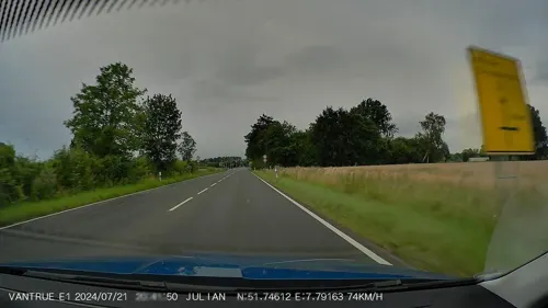

Schulze Rötering
Cafe · Regional · 7.4 km
115 Prozessionsweg, Ahlen
We-Fr 14:00-18:00; Sa 12:00-18:00; Su 09:00-18:00

Costa Smeralda
Restaurant · Italian · 6.7 km
1 Alte Dorfstraße, Drensteinfurt
Tu-Fr 17:00-23:00; Sa,Su,PH 12:00-23:00
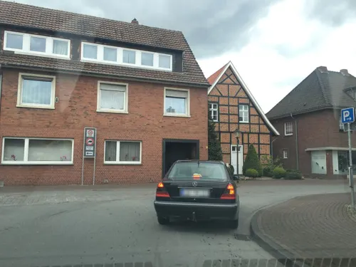
Lüningmeyer
Bakery · 8.3 km
38 Sandstraße, Ascheberg
Mo-Fr 07:00-17:00; Sa 07:00-13:00; Su 08:00-16:00
Pizzeria Antica Fattoria
Restaurant · Italian · 8.1 km
2 Benediktus-Kirchplatz, Ascheberg
Tu-Sa 17:30-23:30; Su 12:00-14:00,17:30-23:30

Bäckerei Röwekamp
Bakery · 8.1 km
21 Südstraße, Ascheberg
Mo-Fr 06:00-18:00; Sa 06:00-12:30; Su 08:00-12:00,14:30-17:00
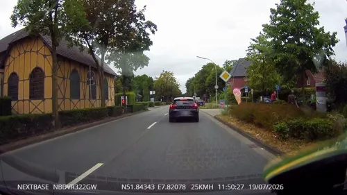
Essmann's Backstube
Bakery · 7.8 km
22 Westtor, Sendenhorst
Mo-Fr 06:00-18:00; Sa 06:00-17:00; Su,PH 07:00-17:00
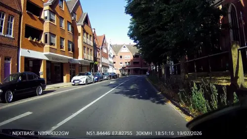


Kiepenkerl
Bakery · 8.2 km
15 Kirchstraße, Sendenhorst
Mo-Fr 06:00-18:00; Sa 06:00-13:00; Su 08:00-12:30,14:00-17:00
Landgasthaus Thiemann
Restaurant · German · 5.0 km
Tu-Sa 17:00-23:00; Su 11:00-23:00; PH 11:00-23:00; Mo,Tu off
BAB Snack Eichengrund
Restaurant · German · 7.2 km
An der A1, Ascheberg
Mo-Su 06:00-22:00; PH 07:00-22:00
Gasthof Deitermann
Restaurant · 8.1 km
We-Sa 17:00+; Su 11:30-13:30,17:00+; PH 11:30-13:30; Mo-Tu off
60 more on the map.
History
The first documentary mention of the town is from the year 851.
At the beginning of the 19th century Drensteinfurt obtained some wealth through Strontianite mining. Today some old buildings which reflect this prosperous period still can be seen in the town.
On March 23, 1944 a bombing raid by the British Royal Air Force hit the town and some 80 residents died. Most of the historical buildings in the Old Town were destroyed.
From the History section of Drensteinfurt on Wikipedia, under CC BY-SA 4.0.
Where to stay17
Churches and places of worship22
Shopping31
Gas and EV charging13
Raiffeisen Albersloh-Everswinkel e.G.
Gas station · 8.5 km
24 Wolbecker Straße, Sendenhorst
Aral-Tankstelle L. Höwelhans
Gas station · 6.1 km
72 Steinfurter Straße, Ascheberg
Schools, colleges and libraries20
Katholische öffentliche Bücherei
Library · 8.2 km
3 Lambertus-Kirchplatz, Ascheberg
Kardinal-von-Galen-Grundschule
School · 7.9 km
6 Kardinal-von-Galen-Straße, Sendenhorst
Healthcare15
Apotheke Rinkerode
Clinic and pharmacy · 6.7 km
6 Albersloher Straße, Drensteinfurt
Map of Drensteinfurt
250 places. The map loads OpenStreetMap tiles when you open it.
Getting there and nearby towns
Dortmund Airport (DTM) is the nearest airport with scheduled flights listed in OpenStreetMap, 32 km away.
- Sendenhorst 8 km northeast, about 8 min by car
- Hamm 14 km southeast, about 14 min by car
- Werne 16 km southwest, about 16 min by car
- Nordkirchen 16 km southwest, about 16 min by car
- Münster 20 km northwest, about 20 min by car
- Lüdinghausen 20 km west, about 20 min by car
- Ennigerloh 21 km east, about 21 min by car
- Telgte 21 km north, about 21 min by car
- Selm 22 km southwest, about 22 min by car
- Kamen 23 km south, about 23 min by car
Drive times are estimates from straight-line distance, not routes.
Local news
Headlines from INDB.
Reviews, tips and questions
Loading what members have shared...
Sources and licences
- GeoNames (CC BY 4.0): population, coordinates, regions and time zone
- Mapillary (see each image): photos
- OpenStreetMap contributors (ODbL 1.0): places, airports, map data
- Wikidata (CC0 1.0): elevation, founding date, time zone, website
- Wikimedia Commons (see each image): photos
- Wikipedia (CC BY-SA 4.0): overview and history text
Photo credits
- Drensteinfurt Walbraht, Corradox, CC BY-SA 3.0
- Stolpersteine Drensteinfurt Hammer Straße, Tomtom10, CC BY-SA 4.0
- Stolperstein Drensteinfurt Hammer Straße Rudolf Seelig, Tomtom10, CC BY-SA 4.0
- Stolperstein Drensteinfurt Hammer Straße Jenny Seelig, Tomtom10, CC BY-SA 4.0
- Stolperstein Drensteinfurt Hammer Straße Frieda Salomon, Tomtom10, CC BY-SA 4.0
- Stolperstein Drensteinfurt Hammer Straße Johanna Salomon, Tomtom10, CC BY-SA 4.0
- Stolperstein Drensteinfurt Südwall 5 Else Salomon, Tomtom10, CC BY-SA 4.0
- Stolperstein Drensteinfurt Südwall 5 Fanny Irma Salomon, Tomtom10, CC BY-SA 4.0
- Stolpersteine Drensteinfurt Südwall 5, Tomtom10, CC BY-SA 4.0
- Stolperstein Drensteinfurt Südwall 5 Siegmund Salomon, Tomtom10, CC BY-SA 4.0
- Öffentliches Bücherregal Drensteinfurt, Lunabaerin, CC BY-SA 3.0
- Drensteinfurt, Germany - panoramio, Foto Fitti, CC BY-SA 3.0
- Drensteinfurt, Germany - panoramio (1), Foto Fitti, CC BY-SA 3.0
- Drensteinfurt, Germany - panoramio (2), Foto Fitti, CC BY-SA 3.0
- Drensteinfurt, Germany - panoramio (3), Foto Fitti, CC BY-SA 3.0
- Drensteinfurt, Germany - panoramio (4), Foto Fitti, CC BY-SA 3.0
- Drensteinfurt, Germany - panoramio (9), Foto Fitti, CC BY-SA 3.0
- Drensteinfurt, Germany - panoramio (8), Foto Fitti, CC BY-SA 3.0
- Bahnhof Drensteinfurt, Bildsymbol123, CC BY-SA 4.0
- Drensteinfurt, Germany - panoramio (5), Foto Fitti, CC BY-SA 3.0
- Drensteinfurt, Germany - panoramio (10), Foto Fitti, CC BY-SA 3.0
- Drensteinfurt, Germany - panoramio (6), Foto Fitti, CC BY-SA 3.0
- Drensteinfurt, Germany - panoramio (7), Foto Fitti, CC BY-SA 3.0
- Drensteinfurt, Germany - panoramio (13), Foto Fitti, CC BY-SA 3.0
- Drensteinfurt, Germany - panoramio (16), Foto Fitti, CC BY-SA 3.0
- Drensteinfurt, Germany - panoramio (15), Foto Fitti, CC BY-SA 3.0
- Drensteinfurt, Germany - panoramio (14), Foto Fitti, CC BY-SA 3.0
- Drensteinfurt, Germany - panoramio (17), Foto Fitti, CC BY-SA 3.0
- Drensteinfurt, Germany - panoramio (18), Foto Fitti, CC BY-SA 3.0
- Drensteinfurt, Germany - panoramio (19), Foto Fitti, CC BY-SA 3.0
- Drensteinfurt, Germany - panoramio (22), Foto Fitti, CC BY-SA 3.0
- Drensteinfurt, Germany - panoramio (20), Foto Fitti, CC BY-SA 3.0
- Drensteinfurt, Germany - panoramio (11), Foto Fitti, CC BY-SA 3.0
- Drensteinfurt, Germany - panoramio (23), Foto Fitti, CC BY-SA 3.0
- Drensteinfurt, Germany - panoramio (12), Foto Fitti, CC BY-SA 3.0
- Schlosspark Haus Steinfurt (Drensteinfurt) (3), DiAuras, CC BY-SA 4.0
- Drensteinfurt, Germany - panoramio (27), Foto Fitti, CC BY-SA 3.0
- Drensteinfurt, Germany - panoramio (25), Foto Fitti, CC BY-SA 3.0
- Drensteinfurt, Germany - panoramio (21), Foto Fitti, CC BY-SA 3.0
- Drensteinfurt, Haus Steinfurt -- 2014 -- 3891 -- Ausschnitt, Dietmar Rabich, CC BY-SA 4.0
- Gnadenkapelle Ascheberg 03, Derbrauni, CC BY-SA 3.0
- 20141101 Haus Bisping, Drensteinfurt (07084), Günter Seggebäing, Coesfeld, CC BY-SA 3.0
- Haus Borg (Rinkerode) 2011, Stefan Didam - Schmallenberg, CC BY-SA 3.0
- Ascheberg, Herbern, Haus Itlingen -- 2014 -- 3871 -- Ausschnitt, Dietmar Rabich, CC BY-SA 4.0
- Haus venne 01, Begede, CC BY-SA 3.0
- Haus Küchen.2.nnw, NordNordWest, CC BY-SA 3.0 de
- EhrenmalDrensteinfurtVorderseiteganz, Phillsox, Public domain
- Drensteinfurt Loretokapelle, Unknown author, CC BY-SA 3.0
- Pfarrkirche St. Benedikt Herbern 21.11.2010 15-30-07, BangertNo, CC BY-SA 3.0
- Kirche und Turm St. Martin, Sendenhorst, Gerd Friedrich, CC BY-SA 3.0
- Drensteinfurt St Pankratius, Unknown author, CC BY-SA 3.0
- Drensteinfurt Pfarrkirche St Regina, Unknown author, CC BY-SA 3.0
- Alte Post, Drensteinfurt (DSC01990), Günter Seggebäing, CC BY-SA 3.0
- Vila.Schmidt.Drensteinfurt, Khbennemann, CC BY-SA 4.0
- Kirchturm st. josef-stift, Gerd Friedrich, CC BY-SA 3.0
- Drensteinfurt evangelische Kirche, Unknown author, CC BY-SA 3.0
- Drensteinfurt Kapelle Ameke, Unknown author, CC BY-SA 3.0
- Street-level photo, nrailuj, CC BY-SA 4.0
- Street-level photo, descilla, CC BY-SA 4.0
- Street-level photo, derlipper, CC BY-SA 4.0
- Street-level photo, sunufatarungo, CC BY-SA 4.0
- Street-level photo, descilla, CC BY-SA 4.0
- Street-level photo, derlipper, CC BY-SA 4.0
- Street-level photo, descilla, CC BY-SA 4.0
- Street-level photo, sunufatarungo, CC BY-SA 4.0
- Street-level photo, derlipper, CC BY-SA 4.0
- Street-level photo, mpw, CC BY-SA 4.0
- Street-level photo, hotteliene, CC BY-SA 4.0
- Street-level photo, derlipper, CC BY-SA 4.0
- Street-level photo, derlipper, CC BY-SA 4.0
- Street-level photo, peewee32, CC BY-SA 4.0


Page built November 8, 2026. Spotted a mistake? Tell us or suggest a place.