


Ennigerloh, Germany
Ennigerloh is a town of 20,713 people in North Rhine-Westphalia, Germany.
Why visit Ennigerloh
Townapedia lists 64 museums and landmarks, 50 parks and trails, 151 places to eat, 15 places to stay and 15 attractions in and around town.
Highlights include Kino am Rathaus Oelde, Flimmerberg, Spannbetonbrücke and Windmühle Ennigerloh.
Weather in Ennigerloh
Forecast from MET Norway (CC BY 4.0). Full forecast
About Ennigerloh
Ennigerloh (German pronunciation: [ˈɛnɪɡɐˌloː] ; Low German: Iännigerlau) is a town in the district of Warendorf, in North Rhine-Westphalia, Germany. It is situated approximately 25 km northeast of Hamm and 30 km southeast of Münster.
From the Wikipedia article Ennigerloh (this version), under CC BY-SA 4.0.
Things to do15




3 more on the map.
Museums and landmarks64

Spannbetonbrücke
Monument and historic site · 6.1 km
Erste deutsche Spannbetonbrücke


Haus Vorhelm
Monument and historic site · 6.8 km
10-14 Droste-zu-Vischering-Weg, Ahlen

Haus Geist
Monument and historic site · 4.9 km
10 Haus-Geist-Weg, Oelde

Haus Vornholz
Monument and historic site · 5.0 km
11 Steinpatt, Ennigerloh

Kindermuseum KLIPP KLAPP
Museum · 8.0 km
Eintrittspreis im Parkeintritt enthalten
15 Zum Mühlenteich, Oelde



52 more on the map.
Parks, trails and playgrounds50





Parkbad Oelde
Sports field and stadium · 8.1 km
Eintrittspreis im Parkeintritt enthalten
Mo 12:00-21:00; Tu,We,Fr 06:30-20:00; Th 06:30-21:00; Sa...



38 more on the map.
Restaurants and cafes151

Aroma
Restaurant · Italian · 0.6 km
2 Im Drubbel, Ennigerloh
Mo,We,Fr,Sa 17:30-23:00; Th,Su 11:30-14:00,17:30-23:00
Fischrestaurant Jungmann
Restaurant · Seafood · 8.9 km
25 Lentrup, Warendorf
Mo,Tu off; We-Sa 17:00+; Su,PH 11:45-14:00,17:00+
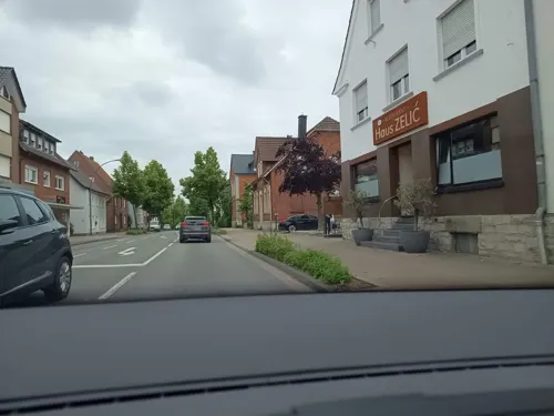
Hotel Restaurant Alt Vellern
Restaurant · Regional · 6.5 km
21 Dorfstraße, Beckum
Mo-Fr 11:30-14:30; Sa-Th 17:30+
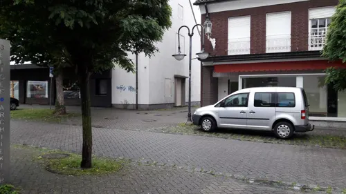
Kreta
Restaurant · Greek, Pizza
12 Kurze Straße, Ennigerloh
Mo-Tu 16:00-22:00; Fr-Sa 16:00-23:00; Su 11:30-22:00
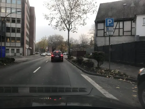
La Fucina Oelde
Restaurant · Italian · 8.0 km
25 Eickhoff, Oelde
Tu 17:00-22:00; We, Th 12:00-14:30, 17:00-22:00; Fr 12:00-14:30,...
Landgasthaus Hohenhagen
Restaurant · Regional, Breakfast · 4.3 km
4 Zum Hohen Hagen, Ennigerloh
Su 09:00-13:00
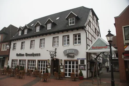
Oelder Brauhaus
Restaurant · German · 7.8 km
3 Am Markt, Oelde
Mo-Su 12:00-14:00,18:00-23:00; Tu,Fr 09:30-14:00,18:00-23:00
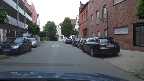
Pinocchio
Restaurant · Pizza
6 Bahnhofstraße, Ennigerloh
Mo-Sa 11:30-14:30, 17:00-23:00; Su, PH 11:30-23:00
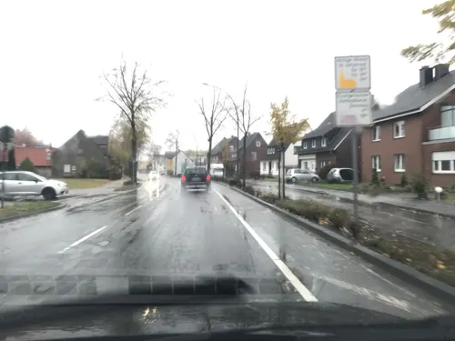
Pizzahaus Piccola Giovanni
Restaurant · Pizza, Pasta, Salad, Italian · 7.8 km
61 In der Geist, Oelde
Mo-Fr 17:00-22:00, Sa-Su 12:00-14:00
Restaurant Hubertus
Restaurant · German · 0.6 km
2 Ennigerstraße, Ennigerloh
Mo-Su 11:30-14:00, 17:00-23:00; Tu off


Restaurant Safi
Restaurant · Italian, Pizza · 4.0 km
7 Wiesenstraße, Beckum
Mo-Fr 11:00-14:00,17:00-22:00; Sa 15:00-24:00; Su 15:00-22:00
139 more on the map.
Where to stay15
Churches and places of worship33
Sankt Antonius
Church · Roman Catholic · 8.1 km
12 Tönnishäuschen, Ahlen
St.-Pankratius-Kirche
Church · Catholic · 6.7 km
22 Pankratiusstraße, Ahlen
Shopping42
Gas and EV charging22
Schools, colleges and libraries32
Healthcare15
Map of Ennigerloh
250 places. The map loads OpenStreetMap tiles when you open it.
Getting there and nearby towns
Flugplatz Bielefeld (BFE) is the nearest airport with scheduled flights listed in OpenStreetMap, 38 km away.
- Oelde 8 km east, about 8 min by car
- Warendorf 13 km north, about 13 min by car
- Sendenhorst 14 km west, about 14 min by car
- Sassenberg 17 km north, about 17 min by car
- Rheda-Wiedenbrück 19 km east, about 19 min by car
- Harsewinkel 19 km northeast, about 19 min by car
- Hamm 23 km southwest, about 23 min by car
- Telgte 23 km northwest, about 23 min by car
- Versmold 24 km north, about 24 min by car
- Gütersloh 25 km east, about 25 min by car
Drive times are estimates from straight-line distance, not routes.
Local news
Headlines from INDB.
Reviews, tips and questions
Loading what members have shared...
Sources and licences
- GeoNames (CC BY 4.0): population, coordinates, regions and time zone
- Mapillary (see each image): photos
- OpenStreetMap contributors (ODbL 1.0): places, airports, map data
- Wikidata (CC0 1.0): elevation, founding date, time zone, website
- Wikimedia Commons (see each image): photos
- Wikipedia (CC BY-SA 4.0): overview and history text
Photo credits
- Panorama Ennigerloh von Süd, Stilzchen, Public domain
- Evangelische Kirche in Ennigerloh - panoramio, qwesy qwesy, CC BY 3.0
- Kirche St. Ludgerus, Ennigerloh - panoramio, qwesy qwesy, CC BY 3.0
- Wein- und Getränke-Therme in Ennigerloh - panoramio, qwesy qwesy, CC BY 3.0
- Ennigerloh - panoramio, qwesy qwesy, CC BY 3.0
- Rathaus Ennigerloh - panoramio, qwesy qwesy, CC BY 3.0
- Der Marktplatz in Ennigerloh - panoramio, qwesy qwesy, CC BY 3.0
- Alleestraße in Ennigerloh mit Cafè am Markt - panoramio, qwesy qwesy, CC BY 3.0
- Heidelberger Zement, Ennigerloh - panoramio, qwesy qwesy, CC BY 3.0
- St. Ludgerus, Ennigerloh, Peter Lampen, CC BY-SA 3.0 de
- Haus in Ennigerloh - panoramio, qwesy qwesy, CC BY 3.0
- Essmann´s Backstube in Ennigerloh - panoramio, qwesy qwesy, CC BY 3.0
- Marktplatz in Ennigerloh - panoramio, qwesy qwesy, CC BY 3.0
- Bronder in Ennigerloh - panoramio, qwesy qwesy, CC BY 3.0
- Fachwerkhaus (Neustr. 3, Ennigerloh, Deutschland), Yannik Bloscheck, CC BY-SA 4.0
- AWO-Haus (Ennigerloh, Deutschland), Yannik Bloscheck, CC BY-SA 4.0
- Rattay in Ennigerloh - panoramio, qwesy qwesy, CC BY 3.0
- Pizzaria Aroma in Ennigerloh - panoramio, qwesy qwesy, CC BY 3.0
- Fachwerkhaus (Haferknapp 11, Ennigerloh, Deutschland), Yannik Bloscheck, CC BY-SA 4.0
- 2-Rad Hunkenschröder in Ennigerloh - panoramio, qwesy qwesy, CC BY 3.0
- 20140601 130348 Gewerbegebiet, Ennigerloh (DSC02239), Günter Seggebäing, Coesfeld, CC BY-SA 3.0
- Ennigerloh, Zementwerk HeidelbergCement -- 2014 -- 8673, Dietmar Rabich, CC BY-SA 4.0
- Friedhof in Ennigerloh - panoramio, qwesy qwesy, CC BY 3.0
- Ennigerloh, Zementwerk HeidelbergCement -- 2014 -- 8674, Dietmar Rabich, CC BY-SA 4.0
- Friedhof Ennigerloh - panoramio, qwesy qwesy, CC BY 3.0
- Ennigerloh, Zementwerk HeidelbergCement -- 2014 -- 8672, Dietmar Rabich, CC BY-SA 4.0
- 20140601 130422 Zementwerk Anneliese II, Ennigerloh (DSC02240), Günter Seggebäing, Coesfeld, CC BY-SA 3.0
- Wallfahrtskapelle buddenbaum exterior, Matthäus Wander, CC BY 3.0
- Überführung Weg Hesseler von Süden 01, Elke Wetzig, CC BY-SA 3.0
- Alte Brennerei Schwake mit Infotafel, Stilzchen, Public domain
- Ruine Nienburg 9, Haferflockentüte, CC BY-SA 3.0
- Ostenfelde Schloss Vornholz 2 Einfahrt, Haferflockentüte, CC BY-SA 3.0
- Haus Geist, 2019, Wik FGK, CC BY-SA 4.0
- St. Johannes der Täufer (Kirche in Oelde), Kanada2000, CC BY-SA 3.0
- St Jakobus Kirche Ennigerloh-2, St_Jakobus_Kirche_Ennigerloh.jpg : Stilzchen derivative work: Rabanus Flavus ( talk ), Public domain
- Ostenfelde - St. Margaretha - 4, Ath, CC0
- St. Antonius Tönnishäuschen.nnw, NordNordWest, CC BY-SA 3.0 de
- Haus Enniger Ostseite, M-K-B_WC, Public domain
- St. Pankratius Vorhelm Südseite.nnw, NordNordWest, CC BY-SA 3.0 de
- Ennigerloh P1020832 07, Muehlenbernd, CC BY-SA 4.0
- Neubeckum, Christuskirche -- 2014 -- 8690 -- Ausschnitt, Dietmar Rabich, CC BY-SA 4.0
- Haus Vorhelm 02, H.Helmlechner, CC BY-SA 4.0
- Aktivpark Phönix Beckum, Kryptonit, CC0
- Evangelische Kirche in Ostenfelde, Haferflockentüte, CC BY-SA 3.0
- 8 Lichtung NSG WAF052 Geisterholz, Rudi346, CC BY-SA 4.0
- Freckenhorst - NSG Mirlenbrink-Holtrup-Vohrener Mark - 02, Ath, CC0
- 20140601 130544 NSG Steinbruch Vellern, Beckum (DSC02243), Günter Seggebäing, Coesfeld, CC BY-SA 3.0
- Naturschutzgebiet Vellerner Brook, Toxilly, CC BY-SA 4.0
- Street-level photo, alucardo, CC BY-SA 4.0
- Street-level photo, alucardo, CC BY-SA 4.0
- Street-level photo, alucardo, CC BY-SA 4.0
- Street-level photo, mac_do, CC BY-SA 4.0
- Street-level photo, sunufatarungo, CC BY-SA 4.0
- Street-level photo, derlipper, CC BY-SA 4.0
- Street-level photo, sunufatarungo, CC BY-SA 4.0
- Street-level photo, cm_hamburg, CC BY-SA 4.0
- Street-level photo, zuse, CC BY-SA 4.0
- Street-level photo, sunufatarungo, CC BY-SA 4.0
- Street-level photo, sunufatarungo, CC BY-SA 4.0
- Street-level photo, elgolfo, CC BY-SA 4.0
- Street-level photo, nrailuj, CC BY-SA 4.0
- Street-level photo, mac_do, CC BY-SA 4.0
- Street-level photo, alucardo, CC BY-SA 4.0
- Street-level photo, alucardo, CC BY-SA 4.0
- Street-level photo, nrailuj, CC BY-SA 4.0
- Street-level photo, flohoff, CC BY-SA 4.0
- Street-level photo, sunufatarungo, CC BY-SA 4.0
- Street-level photo, sunufatarungo, CC BY-SA 4.0
- Street-level photo, alucardo, CC BY-SA 4.0
- Street-level photo, alucardo, CC BY-SA 4.0


Page built November 8, 2026. Spotted a mistake? Tell us or suggest a place.