


Why visit Düren
Townapedia lists 99 museums and landmarks, 35 parks and trails, 220 places to eat, 11 places to stay and 7 attractions in and around town.
Highlights include Das Lumen, Biolandhof Gerden, Leopold-Hoesch-Museum and Papiermuseum Düren.
Weather in Düren
Forecast from MET Norway (CC BY 4.0). Full forecast
About Düren
Düren (German pronunciation: [ˈdyːʁən]; Ripuarian: Düre) is a town in North Rhine-Westphalia, Germany, between Aachen and Cologne, on the river Rur.
From the Wikipedia article Düren (this version), under CC BY-SA 4.0.
Photos of Düren


Things to do7


Biolandhof Gerden
Farm and orchard · 1.2 km
301 Binsfelder Straße, Düren
Mo-Fr 08:30-18:00; Th-Fr 08:30-18:30; Sa 08:30-13:00
Spargel-Hof Lövenich
Farm and orchard · 3.4 km
72 Schillingsstraße, Düren
Mo-Fr 09:00-18:30; Sa 08:00-14:00; Su,PH 10:00-12:00

Stadttheater Düren
Cinema and theater · 0.9 km
Former theatre building in Düren,Germany, destroyed in World War II

Museums and landmarks99


Historische Drehscheibe
Monument and historic site · 1.0 km
2015 restauriert.

Alter Wasserturm
Monument and historic site · 3.6 km
Eigentlich man_made wind_mill und building:use water_tower - siehe wikipedia :-)


Cafe International
Museum · 0.9 km
1 Wilhelm-Wester-Weg, Düren
Tu-Fr 13:30-19:00
87 more on the map.
Parks, trails and playgrounds35


Play Arena
Sports field and stadium · 1.9 km
107 Veldener Straße, Düren
Mo-Th 14:00-20:00; Fr,Sa,PH,SH 10:00-20:00

Teilbereiche der Ruraue im Stadtgebiet Düren
Hiking and trails · 2.3 km



23 more on the map.
Restaurants and cafes220
Masala Dabba
Restaurant · Indian
Indisches Restaurant
53 Kölnstraße
Tu-Su 11:30-14:30, Tu-Sa 17:00-22:00
Breuer's Häuschen
Restaurant · German · 2.5 km
98 Valencienner Straße, Düren
Tu-Su 11:30-14:00,17:30-22:00
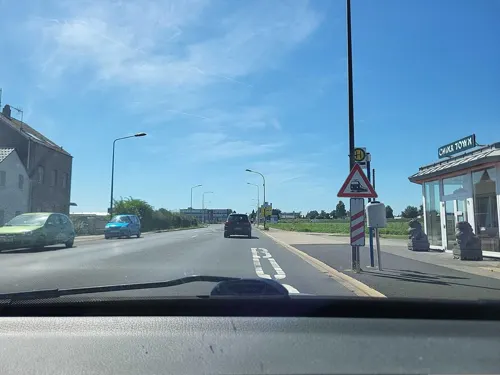
China Town
Restaurant · Chinese · 2.0 km
415 Kölner Landstraße
Mo,We-Sa 11:30-15:00, 17:30-22:30; Su,PH 11:30-22:30; Tu off
Cusina Aktuell
Restaurant · Italian · 0.6 km
54 Bonner Straße, Düren
We-Sa 17:00-22:00; Su 12:00-22:00
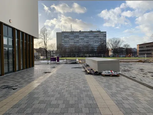
Duron Bar - Grill
Restaurant · Breakfast, Fine Dining, International, Local, Regional, Steak House
35 Moltkestraße, Düren
Mo-Su 06:30-10:30, 12:30-24:00
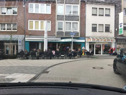
Eiscafe Dolomiti
Cafe · Ice Cream
Nach dem Dürener Weihnachtsmarkt über den Winter geschlossen
33 Kölnstraße
Mo-Sa 09:00-21:00; Su 11:00-21:00


208 more on the map.
History
Before Roman conquest, the area of Düren had been settled by the Eburones, a people who were described as both Celts and Germani. Gaius Julius Caesar described it as part of Gallia Belgica.
It was conquered by the Roman Republic under Julius Caesar and became part of Germania inferior. The Romans encouraged the settlement of loyal Ubii in the Jülich-Zülpich Börde. May be, the name "Düren" refers to the hamlet "Marcodurum", situated 4 km north of nowadays downtown Düren.
The Jülich-Zülpicher Börde (nowadays the Düren area) became a supply area for the rapidly growing Roman city of Cologne (Roman name Colonia Claudia Ara Agrippinensium). Furthermore, a few important Roman roads skirt Düren (including the road from Cologne to Jülich and Tongeren and the road from Cologne to Zülpich and Trier).
During the Migration Period in the 4th and 5th centuries, Rhenish Franks, also called Ripuarian Franks invaded the Jülich-Zülpich Börde and took control.
The name villa duria occurred the first time in the Frankish Annals in the year 747.
Read more of the history
Frankish king Pippin the Short often visited Düren in the 8th century and held a few important conventions there. The Franks made of Düren a Königspfalz/royal palace (part time residence), from which the name Palatine (Pfalz in German) is derived. Charlemagne sojourned a few times there. Due to the frequent visits of Charlemagne, a few markets sprang up, such as the Grain, cattle, wood, chicken, and butter markets, all of which contributed to Düren's development. The castle was built at the place where, since 1991, the Saint Anne Church is located.
Düren obtained city rights in the early 13th century. Around 1200, the construction of the city wall was started, which includes 12 towers and 5 gates. But it lost its status as a free imperial city 1242 and become secondary main town of the County of Juelich. The gates faced all directions: in the north, the Philippstor and the Wirteltor, in the east the Kölntor (Cologne gate), in the south the Obertor and in the west the Holztor (wooden gate). There are still ruins of the gates today.
The chiseler Leonhard stole a small box with the relic of Saint Anne out of the Mainzer Stiftskirche St. Stephan in 1501 and brought it to Düren. Pope Julius II decided on March 18, 1506, that Düren could keep the remains. They were kept in the Martinskirche (church of Saint Martin) which was renamed the Annakirche (church of Saint Anne) in 1505. (Probably the church was renamed much later, because in the 19th century it was still called sometimes parish church of the holy Martinus). Saint Anne became the patron saint of Düren. Every year, the saint's day of Saint Anne (July 26) is celebrated for one week with the Anna octavos and the Anna parish fair, one of the biggest folk festivals of Germany.
During the Thirty Years' War, Wolfgang Wilhelm, Count Palatine of Neuburg was Duke of Jülich. The Duchy of Jülich tried to keep neutrality, but it wasn't recognized by the belligerents. The Duchy of Jülich had to accept Spanish occupation. In 1642, Düren was embroiled in the Battle of Kempen. Opposing troops destroyed the city. After the war has finally ended in 1648, plague broke out and caused many lives to be lost. A second plague epidemic broke out in 1665. Due to the various attacks on the debilitated city, Düren was destroyed again in 1689 while Nine Years' War. In this time, the settlement Miesheim was destroyed, never to be rebuilt.
Towards the end of the year 1755 in the area around Düren and Aachen began a series of earthquakes, which reached its peak on February 18, 1756 with an earthquake with the strength 8 on the Mercalli scale. The series of earthquakes affected all of Europe, most famously the 1755 Lisbon earthquake.
The businesses in the area of Düren was affected since the 15th century by the drapery and metal industry. Since the beginning of the 17th century, paper industry had settled here, advantaged by the exceptionally soft water of the Rur. Rütger von Scheven built the first paper mill in Düren. In 1812, there were already 17 paper factories, 11 cloth- and blanket factories, an iron rolling mill or slitting mill and two iron foundries.
In the year 1794, Düren was occupied by French revolutionary troops, while Battle of Aldenhoven. From 1798 until 1814, Düren was the main city of the same named canton in the arrondissement Aachen of the French Roerdepartements (from the name of the River Rur (Roer) and département). After the Congress of Vienna in 1815, Düren was ceded to the Kingdom of Prussia and was subsequently administered within the Rhine Province.
By 1900, Düren was among Germany's richest cities (with 42 millionaires and 93 factories) and had a population of 27,168. By comparison, fewer than 5,000 people had lived in Düren a century earlier.
The city of Düren was located on the main fighting front during the Allied invasion of Germany in World War II. During 1944 and 1945, the protracted and bloody Battle for Hürtgenwald was fought on Düren's district area, and on November 16, 1944, Düren was completely destroyed by Allied air bombings. Approximately 22,000 people lived in Düren at that time, and 3,000 of them died during the bombing. Those who survived were evacuated to central Germany. Destroyed buildings included the Stadttheater Düren (1907), designed in Jugendstil by Carl Moritz.
By 1939, the population had risen to over 45,000, but then fell to just 3,806 by June 1945 due to the effects of World War II. After the bombing of November 16, 1944, on March 1, 1945, only four German residents lived in the city, including forced laborers etc. there were 21 people. On April 1, the number of inhabitants had risen to 180 and on May 1, 1945, there were already 1,218 people. In December 1945 the number increased to 25,000 inhabitants and in 1958 it was 45,000, the same number as before the war. Due to the incorporation of several places in the area, the city's population grew on January 1, 1972, by 35,522 to 89,087.
From the History section of Düren on Wikipedia, under CC BY-SA 4.0.
More about Düren
Geography
Düren is situated in the Jülich-Zülpich Börde at the north end of the Eifel, within the lowland of the Roer. The south east reaches the north end of the Drover Heath.
Arnoldsweiler, a rural village 3 km north of Düren down town, mentioned in 10th century.
Merken, a rural village 4 km northwest of Düren down town, mentioned about 1300, situated at the Roer below Düren main city area
Echtz-Konzendorf, originally two villages, both mentioned before the year 1000, 3 km northwest of Düren down town
Derichsweiler, a rural village 3 km west of Düren down town, is also mentioned before the year 1000.
Lendersdorf, 2 km south of Düren down town, situated at the Roer above Düren main city area.
Arts and culture
The most famous museum of Düren is the Leopold Hoesch Museum. The Baroque Revival style building erected in 1905 presents changing exhibitions of contemporary art. Since 1986, it also displays artworks from the international Biennale PaperArt. Since 2006, the former nurses' home of the St. Augustinus Hospital Lendersdorf has housed the Düren Carnival Museum. The most recent museum is the Stadtmuseum Düren local history museum, founded in 2009.
From the Wikipedia article Düren, under CC BY-SA 4.0.
Notable people from Düren
 Toni SchumacherGerman association football playerPhoto: Raimond Spekking, CC BY-SA 4.0
 Karl-Heinz SchnellingerGerman footballer (1939–2024)Photo: Jack de Nijs for Anefo , Den Haag,..., CC BY-SA 3.0 nl
 Karl LauterbachGerman politician and former Federal Minister of HealthPhoto: Martin Kraft, CC BY-SA 4.0
 Leo WildenGerman footballer (1936–2022)Photo: Fredymutz, CC BY-SA 4.0
 Lars VogtGerman pianist (1970–2022)Photo: Wggw ( Diskussion ), CC BY-SA 3.0 de
 Deniz NakiTurkish-German association football player of Kurdish ancestry (born 1989)Photo: xtranews.de, CC BY 2.0
- Johann Peter Gustav Lejeune DirichletGerman mathematician (1805–1859)
- Hermann Heinrich GossenPrussian economist (1810–1858)
- Sybille SchmitzGerman film and stage actress (1909-1955)
- Max von SchillingsGerman conductor, composer and theatre director (1868–1933)
- Georg StollenwerkGerman footballer (1930-2014)
- Margot EskensGerman singer (1936–2022)
Born in Düren, according to Wikidata (CC0). Each name links to its Wikipedia article.
Where to stay11
Churches and places of worship50
Groß St. Arnold
Church · Roman Catholic · 3.8 km
2 Vikar-Klein-Straße, Düren
Karmel Heiligen Familie
Church · Roman Catholic · 1.2 km
261 Kölner Landstraße, Düren
Muttergotteshäuschen (neu)
Church · Roman Catholic · 1.8 km
231 Zülpicher Straße, Düren
St. Amandus
Church · Roman Catholic · 4.4 km
31 Hauptstraße, Merzenich
St. Gertrudis
Church · Roman Catholic · 3.6 km
3 Frauwüllesheimer Straße, Nörvenich
Shopping60
Gas and EV charging32
Schools, colleges and libraries44
Healthcare23
Map of Düren
250 places. The map loads OpenStreetMap tiles when you open it.
Getting there and nearby towns
Flugplatz Würselen-Aachen (AAH) is the nearest airport with scheduled flights listed in OpenStreetMap, 22 km away.
- Kreuzau 6 km south, about 6 min by car
- Jüngersdorf 8 km west, about 8 min by car
- Niederzier 9 km north, about 9 min by car
- Langerwehe 10 km west, about 10 min by car
- Nörvenich 10 km east, about 10 min by car
- Inden 10 km northwest, about 10 min by car
- Vettweiß 11 km southeast, about 11 min by car
- Nideggen 12 km south, about 12 min by car
- Eschweiler 16 km west, about 16 min by car
- Kerpen 16 km northeast, about 16 min by car
Drive times are estimates from straight-line distance, not routes.
Towns near Düren


Keep exploring
Local news
Headlines from INDB.
Reviews, tips and questions
Loading what members have shared...
Sources and licences
- GeoNames (CC BY 4.0): population, coordinates, regions and time zone
- Mapillary (see each image): photos
- OpenStreetMap contributors (ODbL 1.0): places, airports, map data
- Wikidata (CC0 1.0): elevation, founding date, time zone, website, landmarks and historic places
- Wikimedia Commons (see each image): photos
- Wikipedia (CC BY-SA 4.0): overview and history text
Photo credits
- Rathaus Düren-5502, Raimond Spekking, CC BY-SA 4.0
- Eucharistinerkloster Düren, Talb, CC BY-SA 4.0
- Gedenktafel zur Synagoge Düren, Schützenstraße, Düren-5498, Raimond Spekking, CC BY-SA 4.0
- Gedenktafel zur Synagoge Düren, Schützenstraße, Düren-5499, Raimond Spekking, CC BY-SA 4.0
- Neubau des Dorint Hotels in Düren, Marbus1966, CC BY-SA 4.0
- Stolpersteine Düren Schützenstraße 20, Gmbo 2013, CC0
- Stolperstein Düren Schützenstraße 20 Ester Holländer, Gmbo 2013, CC0
- Stolperstein Düren Schützenstraße 20 Ludwig Holländer, Gmbo 2013, CC0
- Stolpersteinlage Düren Schützenstraße 20, Gmbo 2013, CC0
- Stolperstein Düren Hohenzollernstraße 13 Mirjam Charlotte Leven, Gmbo 2013, CC0
- Stolperstein Düren Hohenzollernstraße 13 Jona Leven, Gmbo 2013, CC0
- Stolperstein Düren Hohenzollernstraße 13 Hans Hermann Leven, Gmbo 2013, CC0
- Stolperstein Düren Hohenzollernstraße 13 Sara Leven, Gmbo 2013, CC0
- Stolperstein Düren Hohenzollernstraße 13 Else Leven, Gmbo 2013, CC0
- Stolperstein Düren Hohenzollernstraße 13 Dr Karl Leven, Gmbo 2013, CC0
- Stolpersteine Düren Hohenzollernstraße 13, Gmbo 2013, CC0
- Stolpersteinlage Düren Hohenzollernstraße 13, Gmbo 2013, CC0
- Stolpersteine Düren Wirteltorplatz 2, Gmbo 2013, CC0
- Stolperstein Düren Wirteltorplatz 2 Dr Karl Marx, Gmbo 2013, CC0
- Stolperstein Düren Wirteltorplatz 2 Auguste Marx, Gmbo 2013, CC0
- Stolperstein Düren Wirteltorplatz 2 Berthold Bender, Gmbo 2013, CC0
- Stolperstein Düren Wirteltorplatz 2 Clementine Bender, Gmbo 2013, CC0
- Stolpersteinlage Düren Wirteltorplatz 2, Gmbo 2013, CC0
- St Anna Düren 03, Rudolf Schwarz, CC BY-SA 3.0
- Dueren leopold-hoesch-museum, Unknown author, CC BY-SA 3.0
- St. Antonius-Kapelle Düren-Lendersdorf, Gregor H., CC0
- Burgau-gymn, A.Savin, CC BY-SA 3.0
- Karmel Dueren, No machine-readable author provided. Papa1234 assumed (based on copyright claims)., Public domain
- Choldwigplatz Dueren, Braegel, CC BY-SA 3.0
- Düren Christuskirche, Norbert Schnitzler, CC BY-SA 3.0
- Dueren Dicker Turm, Karl-Heinz Meurer (-- Charlie1965nrw ), CC BY-SA 3.0
- Arnoldsweiler Groß St. Arnold 706, GFreihalter, CC BY-SA 3.0
- Dueren Stadtturm, Karl-Heinz Meurer (-- Charlie1965nrw ), CC BY-SA 3.0
- Muttergotteshäuschen, Zauberfee88 at German Wikipedia, Public domain
- Stiftisches-gymn, A.Savin, CC BY-SA 3.0
- St. Michael (Lendersdorf) 01, Thomas Hummel, CC BY-SA 4.0
- Hbg, papa1234, Public domain
- Merzenich Denkmal-Nr. 16, Bergstraße 1 (1232), Käthe und Bernd Limburg, www.limburg-bernd.de, CC BY-SA 3.0 de
- Düren Denkmal-Nr. 1-010, Hohenzollernstraße-Waisenhausstraße (120), Käthe und Bernd Limburg, www.limburg-bernd.de, CC BY-SA 3.0 de
- Dn-stadtcenter, A.Savin, CC BY-SA 3.0
- StadtmuseumDuerenDE, Braegel, CC BY-SA 3.0
- Düren Denkmal-Nr. 1-008, Kämmergasse (Spießenturm), papa1234, Public domain
- Antoniusdueren, papa1234, CC BY-SA 3.0
- St. Gertrud (Binsfeld)1, Chris06, CC BY-SA 4.0
- Violengassedüren, Papa1234, CC BY-SA 3.0
- Girbelsrath Pfarrkirche, Karl-Heinz Meurer, CC BY-SA 3.0
- Drehscheibe Düren, Papa1234, CC BY-SA 3.0
- Düren Denkmal-Nr. 1-001b, Meckerstraße (84), Käthe und Bernd Limburg, www.limburg-bernd.de, CC BY-SA 3.0 de
- Merzenich Windmühle Wasserturm HDR, Karl-Heinz Meurer, CC BY-SA 3.0
- Gymn-wirteltor, A.Savin, CC BY-SA 3.0
- Das Lumen, DasLumen, CC BY-SA 4.0
- Papiermuseum Düren, Architektur Klaus Hollenbeck, Leopold2019, CC BY-SA 4.0
- Street-level photo, noel, CC BY-SA 4.0
- Street-level photo, noel, CC BY-SA 4.0
- Street-level photo, noel, CC BY-SA 4.0
- Street-level photo, noel, CC BY-SA 4.0
- Street-level photo, noel, CC BY-SA 4.0
- Street-level photo, walldi222, CC BY-SA 4.0
- Street-level photo, rasenderrolli, CC BY-SA 4.0
- Street-level photo, rasenderrolli, CC BY-SA 4.0
- Street-level photo, tyomox, CC BY-SA 4.0
- Street-level photo, noel, CC BY-SA 4.0
- Street-level photo, noel, CC BY-SA 4.0
- Street-level photo, tyomox, CC BY-SA 4.0
- Street-level photo, rasenderrolli, CC BY-SA 4.0
- Street-level photo, noel, CC BY-SA 4.0
- Street-level photo, walldi222, CC BY-SA 4.0
- Street-level photo, noel, CC BY-SA 4.0
- Street-level photo, dekarl, CC BY-SA 4.0
- Street-level photo, tobiasreg, CC BY-SA 4.0
- Street-level photo, noel, CC BY-SA 4.0
- Street-level photo, mi123456, CC BY-SA 4.0
- Street-level photo, noel, CC BY-SA 4.0
- Street-level photo, noel, CC BY-SA 4.0
- Street-level photo, noel, CC BY-SA 4.0
- Street-level photo, hirschkauz, CC BY-SA 4.0
- Street-level photo, walldi222, CC BY-SA 4.0
- Street-level photo, noel, CC BY-SA 4.0
- Street-level photo, walldi222, CC BY-SA 4.0


Page built November 9, 2026. Spotted a mistake? Tell us or suggest a place.