


Eschweiler, Germany
Eschweiler is a town of 55,778 people in North Rhine-Westphalia, Germany.
Why visit Eschweiler
Townapedia lists 210 museums and landmarks, 49 parks and trails, 144 places to eat, 6 places to stay and 11 attractions in and around town.
Highlights include Halde Nierchen, Hülsenberg, Töpfereimuseum and Jüdischer Friedhof Weisweiler.
Weather in Eschweiler
Forecast from MET Norway (CC BY 4.0). Full forecast
About Eschweiler
Eschweiler (German pronunciation: [ˈɛʃvaɪlɐ], Ripuarian: Eischwiele) is a municipality in the district of Aachen in North Rhine-Westphalia in Germany on the river Inde, near the German-Dutch-Belgian border, and about 15 kilometres (9 mi) east of Aachen and 50 kilometres (31 mi) west of Cologne.
From the Wikipedia article Eschweiler (this version), under CC BY-SA 4.0.
Photos of Eschweiler


Things to do11



Hofladen Gut Merzbrück
Farm and orchard · 4.7 km
2 Merzbrück, Eschweiler
Mo-Fr 09:00-18:00; Sa 09:00-15:00


Museums and landmarks210


Burg Röthgen
Monument and historic site · 1.1 km
71 Burgstraße, Eschweiler

Jüdischer Friedhof Eschweiler
Cemetery · 0.7 km
52249 Eschweiler; Talstraße Ecke Grachtstraße




Langweiler
Monument and historic site · 7.1 km
Archaeological site in the Merzbach Valley of Western Germany
198 more on the map.
Parks, trails and playgrounds49


Schlangenberg
Park · 9.3 km
Nature reserve in Stolberg, North Rhine-Westphalia, Germany


Rocolinos Kinderwelt
Playground · 1.5 km
ACHTUNG!!! Runtergekommen und teils gefährlich ungewartet!
Mo-Fr 14:00-18:30; Sa,Su,PH 10:30-18:30
37 more on the map.
Restaurants and cafes144

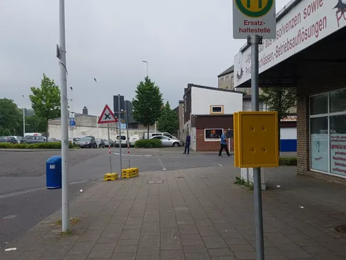
Imbiss-Stube Le
Restaurant · Chinese, Asian · 6.0 km
Chinesische und asiatische Küche.
1 Blaustraße, Stolberg (Rhld.)
Su-Fr 11:30-20:00
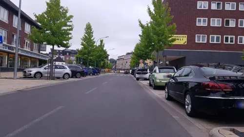
Artemis
Restaurant · Greek · 5.8 km
94 Rathausstraße, Stolberg
Mo off; Tu-Fr 12:00-14:30,18:00-23:00; Sa 18:00-23:00; Su...
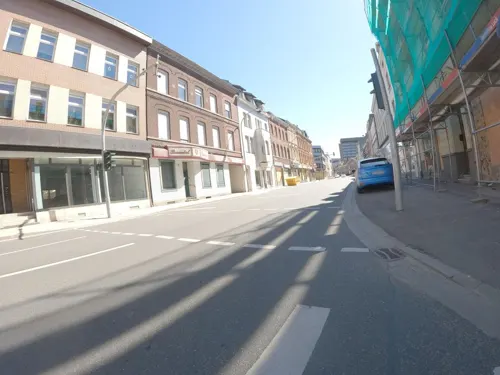
Bäckerei und Café Prishtina
Bakery · 6.1 km
Kosovarische Bäckerei Prishtina Stolberg.
45 Rathausstraße, Stolberg (Rhld.)
Mo-Su 06:00-21:00, Su 08:00-21:00
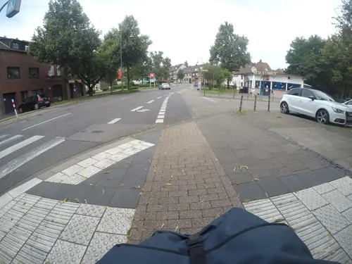

Berlin Kebap
Restaurant · Turkish, Pizza · 6.2 km
1 Rathausstraße, Stolberg (Rhld.)
Mo-Sa 11:00-22:20; Su 11:30-22:30

Café Steinbachshochwald
Cafe · Regional · 5.7 km
3 Steinbachshochwald, Stolberg
Sa 14:00-sunset; Su,PH 10:00-sunset
Grillstübchen Weisweiler
Restaurant · German, Regional · 3.4 km
12 Hauptstraße, Eschweiler
Mo-Fr 11:00-14:00,17:00-21:00; Sa off; Su 12:00-21:00
Ventinove
Restaurant · Burger, Pasta, Pizza · 6.1 km
7 Kaiserplatz, Stolberg (Rhld.)
Su-Th 09:00-22:00; Fr,Sa 09:00-23:00

132 more on the map.
History
Celts (first ore mining) and Romans (roads and villae rusticae).
828: First mentioned by Einhard, the biographer of Charlemagne.
1678: Almost completely destroyed by troops of King Louis XIV of France; nearly all dwellings in the town centre were burned to the ground, and the church of St. Peter und Paul heavily damaged. The valuable leather Pietà was rescued from the flames.
1800: French municipal rights and capital of the Canton of Eschweiler in the French Département de la Roer.
1816: Given to Prussia. The French Cantons of Burtscheid and Eschweiler are put together to form the Prussian Kreis Aachen.
1838: The Eschweiler Bergwerksverein (EBV; Eschweiler Mining Company) was formally constituted, becoming the first mining joint-stock company in the Kingdom of Prussia.
1858: Prussian municipal rights. Its quarters Hehlrath, Kinzweiler and St. Jöris are released in order to form the new municipality of Kinzweiler.
1944: Heavily destroyed in World War II; the last coal mine was flooded during the war and never reopened.
1960s: Complete modernization of Eschweiler's downtown and regulation of the Inde to prevent regular flooding.
1972: Reorganization of administration in North Rhine-Westphalia: Eschweiler increases overnight from some 38,000 inhabitants to about 55,000 by receiving the villages Dürwiß, Laurenzberg, Lohn and Weisweiler. Kinzweiler, after 114 years, comes back.
Read more of the history
1970s: Eschweiler loses seven quarters because of brown-coal opencast mining: Erberich, Hausen, Langendorf, Laurenzberg, Lohn, Lürken and Pützlohn.
From the History section of Eschweiler on Wikipedia, under CC BY-SA 4.0.
More about Eschweiler
Arts and culture
Eschweiler has three municipal halls (Dürwiß, Kinzweiler and Weisweiler), a cinema, a municipal art collection and the so-called Culture Centre Talbahnhof for cabaret and music events. Every summer the Eschweiler Music Festival EMF takes place. People go to the numerous pubs around the Market Place and in the old-town alley Schnellengasse.
Eschweiler is a centre of Rhineland carnival. It has more than 20 active carnival clubs, and every Monday before Lent it hosts the third-longest carnival procession in Germany.
Potato fritters (Reibekuchen) with black bread, apple syrup, sugar beet syrup or stewed apples
Hemmel on Äed (i.e. Heaven and Earth) mashed potatoes with stewed apples and fried blood pudding or fried panhas
Rice pies, apricot pies, pear pies ("Schwatze Flaam") – 20 cm in diameter; the pear pies, also called black pies, are traditionally served at funerals
From the Wikipedia article Eschweiler, under CC BY-SA 4.0.
Notable people from Eschweiler
 Franz ReuleauxGerman mechanical engineer (1829–1905)Photo: Unknown author Unknown author, Public domain
 Wilhelm LexisGerman statistician and economist (1837–1914)Photo: August Schmidt, Public domain
 Sascha KleindiverPhoto: Martin Rulsch, CC BY-SA 4.0
 August ThyssenGerman industrialist (1842-1926)Photo: Internet Archive Book Images, No restrictions
 Kevin KratzGerman association football player and managerPhoto: Northside, CC BY-SA 3.0
 Elena WassenGerman diverPhoto: Sandro Halank , Wikimedia Commons, CC BY-SA 4.0
 Christina WassenGerman diverPhoto: Власність Міністерства молоді та..., CC BY 4.0
 Ralf SouquetGerman pool playerPhoto: Sebastian Voigt; upload by Tmv23, CC BY 3.0
 Claudia MollGerman politician (SPD)Photo: Steffen Prößdorf, CC BY-SA 4.0
 Stefan KämmerlingGerman politicianPhoto: Foto-AG Melle, CC BY-SA 3.0 de
- Michaela SchaffrathGerman television actress and pornographic actress
- Heinrich BoereDutch SS officer (1921–2013)
Born in Eschweiler, according to Wikidata (CC0). Each name links to its Wikipedia article.
Where to stay6
Churches and places of worship58
St. Mariä Himmelfahrt
Church · Roman Catholic · 5.8 km
8 Salmstraße, Stolberg (Rhld.)
St. Antonius
Church · Roman Catholic · 1.6 km
8 Pfarrer-Kleinermanns-Straße, Eschweiler
St. Cäcillia
Church · Roman Catholic · 3.1 km
19 Velauer Straße, Eschweiler
St. Lucia
Church · Roman Catholic · 6.3 km
3 Luciaweg, Stolberg (Rhld.)
St. Sebastianus
Church · Roman Catholic · 5.6 km
31-33 Sebastianusstraße, Stolberg (Rhld.)
Shopping45
Gas and EV charging16
Schools, colleges and libraries37
Healthcare23
Map of Eschweiler
250 places. The map loads OpenStreetMap tiles when you open it.
Getting there and nearby towns
Flugplatz Würselen-Aachen (AAH) is the nearest airport with scheduled flights listed in OpenStreetMap, 6 km away.
- Langerwehe 5 km east, about 5 min by car
- Stolberg 6 km southwest, about 6 min by car
- Inden 7 km northeast, about 7 min by car
- Jüngersdorf 7 km east, about 7 min by car
- Niedermerz 7 km north, about 7 min by car
- Würselen 10 km west, about 10 min by car
- Alsdorf 10 km northwest, about 10 min by car
- Aldenhoven 9 km north, about 9 min by car
- Baesweiler 12 km northwest, about 12 min by car
- Aachen 14 km west, about 14 min by car
Drive times are estimates from straight-line distance, not routes.
Towns near Eschweiler


Keep exploring
Local news
Headlines from INDB.
Reviews, tips and questions
Loading what members have shared...
Sources and licences
- GeoNames (CC BY 4.0): population, coordinates, regions and time zone
- Mapillary (see each image): photos
- OpenStreetMap contributors (ODbL 1.0): places, airports, map data
- Wikidata (CC0 1.0): elevation, founding date, time zone, website, landmarks and historic places
- Wikimedia Commons (see each image): photos
- Wikipedia (CC BY-SA 4.0): overview and history text
Photo credits
- Eschweiler Indestraße, GDelhey, CC BY-SA 3.0
- Eschweiler neues-Rathaus, Norbert Schnitzler, CC BY-SA 3.0
- Buecherschrank-Eschweiler-03a, Photoblitz, CC BY-SA 4.0
- Buecherschrank-Eschweiler-02a, Photoblitz, CC BY-SA 4.0
- Buecherschrank-Eschweiler-04a, Photoblitz, CC BY-SA 4.0
- Buecherschrank-Eschweiler-05a, Photoblitz, CC BY-SA 4.0
- Eschweiler St. Peter & Paul mit Wochenmarkt, Roswitha Eichberg, CC BY-SA 3.0
- Eschweiler markt nacht, Sascha Faber, CC BY-SA 3.0
- Eschweiler, Bergrather Straße, Brücke über Inde (1), Eschweiler, Public domain
- Sonnenwagen (Eschweiler) 3, Gerd Fahrenhorst, CC BY 4.0
- Sonnenwagen (Eschweiler) 2, Gerd Fahrenhorst, CC BY 4.0
- Sonnenwagen (Eschweiler) 1, Gerd Fahrenhorst, CC BY 4.0
- ErzengelMichaelEschweiler, Sascha Faber, CC BY-SA 4.0
- Eschweiler St. Peter und Paul (2), EveryPicture, Public domain
- Eschweiler, Kirschenhof, Eschweiler at German Wikipedia, Public domain
- AdlerApotheke-Eschweiler, Sascha Faber, CC BY-SA 4.0
- Mercedes-Benz Evobus ~ Koppenrath ~ Eschweiler Indestraße (1), EveryPicture, Public domain
- Iveco Eurocargo ~ Holz Wicht ~ Eschweiler Indestraße, EveryPicture, Public domain
- Schlangenberg im Monat Juni, BBKurt, Public domain
- Luftaufnahme Betlehem Gesundheitszentrum Stolberg 2025-08-09 (cropped), NDG, CC BY-SA 4.0
- NSG Korkus, Eschweiler (5), ArthurMcGill, CC BY-SA 4.0
- Eschweiler-Weisweiler, Burg Weisweiler, Eschweiler, Public domain
- NSG Bergbauwüstungszone im Eschweiler Wald (2), ArthurMcGill, CC BY-SA 4.0
- Jüdischer Friedhof Weisweiler 02, Papa1234, CC BY 3.0
- Gymnasium Peter Paul Ansicht Ecke Peter Paul Str. , Parkstr., Wilhelm Reinartz, CC BY-SA 3.0
- St. Lucia, Stolberg (6), ArthurMcGill, CC BY 3.0
- Jüdischer Friedhof Eschweiler 02, Papa1234, CC BY 3.0
- Vogelsangkirche Stolberg-Oberstadt (2), ArthurMcGill, CC BY 3.0
- Zinkhütter Hof, Stolberg (8), ArthurMcGill, CC BY 3.0
- Luftaufnahme Burg Nothberg 2025-08-10-07, NDG, CC BY-SA 4.0
- Schwarzer Berg, AC-Eschweiler (4), ArthurMcGill, CC BY-SA 4.0
- Eschweiler St Peter und Paul mit Mittelalter-Markt, Roswitha Eichberg, CC BY-SA 3.0
- Langerwehe Denkmal-Nr. 3, Pastoratsweg 1 (1119), Käthe und Bernd Limburg, www.limburg-bernd.de, CC BY-SA 3.0 de
- St. Katharina (Wenau)06, Chris06, CC BY-SA 4.0
- Halde Nierchen Gesamtsicht, EveryPicture, CC BY-SA 3.0
- Ritzefeld-Gymnasium, UBettscheider, CC BY-SA 4.0
- Eschweiler, kerk1 foto4 2011-03-24 14.38, Michielverbeek, CC BY-SA 3.0
- St. Sebastian, Stolberg-Atsch, ArthurMcGill, CC BY-SA 4.0
- NSG Heidegebiet Steinfurt (6), ArthurMcGill, CC BY-SA 4.0
- NSG Hastenrather Kalksteinbrüche - Albertsgrube (7), ArthurMcGill, CC BY-SA 4.0
- NSG Ehemalige Kieswäsche Kinzweiler (1), ArthurMcGill, CC BY-SA 4.0
- Kalkofen NSG östl. Schönthal, Langerwehe, ArthurMcGill, CC BY-SA 4.0
- Alsdorf Stolperstein Jakobstr1 Abraham Lucas, GregPit83, CC BY-SA 4.0
- Schwarzer Berg, AC-Eschweiler (2), ArthurMcGill, CC BY-SA 4.0
- BurgRoethgen01, Unknown author, CC BY-SA 2.0 de
- BurgKinzweiler02, Unknown author, CC BY-SA 2.0 de
- Eschweiler Stadtwald 4, Ahoerstemeier, CC BY-SA 4.0
- NSG Hastenrather Kalksteinbrüche - Albertsgrube (3), ArthurMcGill, CC BY-SA 4.0
- Blausteinsee Segler, Bernd Brägelmann Braegel ., CC BY-SA 3.0
- NSG Saubach-Lehmsiefen, nord, Stolberg (9), ArthurMcGill, CC BY-SA 4.0
- Lehmsief 2, Ahoerstemeier, CC BY-SA 4.0
- Haus Kambach Haupthaus S, Sir Gawain, CC BY-SA 4.0
- Eschweiler, kerk4 foto10 2011-03-24 14.29, Michielverbeek, CC BY-SA 3.0
- Dreieinigkeitskirche Eschweiler 2018, Pistorius67, CC BY-SA 3.0
- Stolberg Franziskuskirche 1, Norbert Schnitzler, CC BY-SA 3.0
- Mariae Himmelfahrt, Stolberg, ArthurMcGill, CC BY 3.0
- Eschweiler Antoniuskirche, Norbert Schnitzler, CC BY-SA 3.0
- Roehe-kirche, Eschweiler, CC BY-SA 3.0
- St. Cäcilia (Hehlrath) (1), Chris06, CC BY-SA 4.0
- Auferstehungskirche Weisweiler, EveryPicture, CC BY-SA 3.0
- Ew-hospital, Eschweiler at German Wikipedia, Public domain
- Langerwehe Denkmal-Nr. 11, An Gut Kammerbusch (1137), Käthe und Bernd Limburg, www.limburg-bernd.de, CC BY-SA 3.0 de
- Street-level photo, trockennasenaffe, CC BY-SA 4.0
- Street-level photo, mfa, CC BY-SA 4.0
- Street-level photo, changchun1, CC BY-SA 4.0
- Street-level photo, FahrradstadtAachen, CC BY-SA 4.0
- Street-level photo, FahrradstadtAachen, CC BY-SA 4.0
- Street-level photo, noel, CC BY-SA 4.0
- Street-level photo, mfa, CC BY-SA 4.0
- Street-level photo, mfa, CC BY-SA 4.0
- Street-level photo, hektor1989, CC BY-SA 4.0
- Street-level photo, mfa, CC BY-SA 4.0
- Street-level photo, FahrradstadtAachen, CC BY-SA 4.0
- Street-level photo, FahrradstadtAachen, CC BY-SA 4.0
- Street-level photo, hektor1989, CC BY-SA 4.0
- Street-level photo, hektor1989, CC BY-SA 4.0


Page built November 9, 2026. Spotted a mistake? Tell us or suggest a place.