


Why visit Ebensfeld
Townapedia lists 44 museums and landmarks, 12 parks and trails, 98 places to eat, 21 places to stay and 22 attractions in and around town.
Highlights include Hofladen Familie Hümmer, Bad Staffelstein, Bildstock and Hl. Nepomuk.
Weather in Ebensfeld
Forecast from MET Norway (CC BY 4.0). Full forecast
About Ebensfeld
Ebensfeld (German pronunciation: [ˈeːbn̩sˌfɛlt]) is a municipality in the district of Lichtenfels in Bavaria in Germany. It lies on the river Main.
From the Wikipedia article Ebensfeld (this version), under CC BY-SA 4.0.
Things to do22

Hofladen Familie Hümmer
Farm and orchard · 4.7 km
36 Horsdorfer Straße, Bad Staffelstein
Tu-Fr 09:00-12:30,14:00-18:00; Sa 08:00-13:00; Mo,Su,PH off

Bad Staffelstein
Monument and historic site · 4.5 km
Municipality of Germany


Bad Staffelsteiner WanderHühner
Farm and orchard · 5.4 km
Bei uns erhaltet Ihr täglich nestfrische Freiland-Eier aus dem Hühnermobil in unserem VerkaufsHäuschen.
Mo-Su 08:00-21:00




10 more on the map.
Museums and landmarks44

Bildstock
Monument and historic site · 4.4 km
Sandstein, Säule mit ionischem Kapitell, vierseitiger Aufsatz, bez. 1712


Schloß Unterleiterbach
Monument and historic site · 3.4 km
1 Schloßstraße, Zapfendorf

Vierzehn Nothelfer
Monument and historic site · 6.9 km
Barockmarter; hochrechteck. Sockel mit Engelsköpfen und Blütenornam.; Säule mit Weinranken; Laterne mit vier Reliefs, v. Gottvater mit...


Menosgada
Monument and historic site · 5.5 km
Iron Age Celtic settlement



Pfründner Marter
Monument and historic site · 3.9 km
Sock: 4 gefl. Engelsk.; kor. Säule mit Weinl. & Trau.; 4s. Auf., 4 bem. Alut. (hl. Laurentius, hl. Wendelin, Chr. a.d. Geißelsäule,...

Weißes Kreuz
Monument and historic site · 4.3 km
Dreistufiger Sockel; Altarmensa; Kruzifix; INRI-Tafel; Marien-und Johannesfigur; Besitzer: Familie Kunigunde Schneider

32 more on the map.
Parks, trails and playgrounds12

Obermain Therme
Sports field and stadium · 5.3 km
1 Am Kurpark, Bad Staffelstein
Su-We 08:00-21:00; Th-Sa 08:00-23:00





Restaurants and cafes98
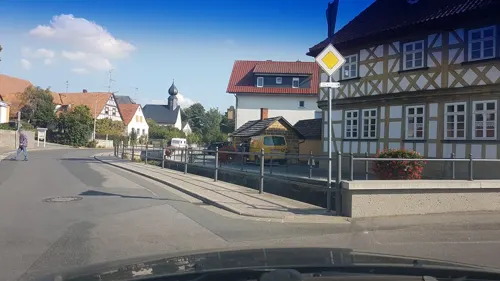
Bräustübl
Restaurant · Regional · 4.9 km
7 Mühlteich, Bad Staffelstein
Tu-Th,Sa,Su 11:00-22:00; Mo,Fr off
Landgasthof Hummel
Restaurant · Regional · 2.6 km
6 Prächtinger Hauptstraße, Ebensfeld
We,Th 16:00-22:00; Su,PH 11:00-15:00,16:00-22:00; Fr,Sa...

Am Stadtturm
Restaurant · Regional · 4.7 km
7 Angerstraße, Bad Staffelstein
Tu-Sa 11:00-14:00,17:00-23:00; Su 11:00-14:00
Berggasthof Banzer Wald
Restaurant · Regional · 7.1 km
1 Am Banzer Wald, Bad Staffelstein
Th-Sa 16:00-22:00; Su 11:00-14:00; Mo,Tu,We off
Brauerei-Gasthof Hellmuth
Restaurant · Regional · 3.4 km
14 Wiesen, Bad Staffelstein
Th-Fr 16:00-22:00; Sa-Su 11:00-22:00
Brauerei-Gasthof Hennemann
Restaurant · Regional · 6.2 km
13 Am Dorfbrunnen, Bad Staffelstein
We,Th 16:30-22:00; Fr-Su 11:00-14:00,17:00-20:00
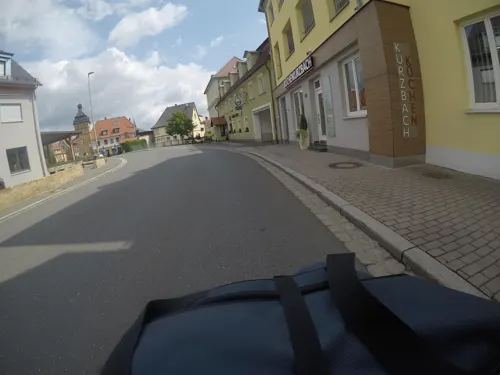
Das Vogelhaus - Cafébar & Lounge
Cafe · Coffee Shop, Sandwich, Breakfast, Ice Cream, Pastry, Salad · 4.7 km
35 Bamberger Straße, Bad Staffelstein
Th-Tu 09:00-20:00
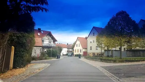
Gasthof Dinkel
Restaurant · Regional · 6.5 km
18 Frauendorfer Straße, Bad Staffelstein
Th-Tu 11:30-21:00


Gasthof zum Anker
Restaurant · Regional · 6.4 km
3 Am Main, Bad Staffelstein
Mo-Fr, Su 17:00-22:00; Mo, Fr, Su 11:30-14:00
86 more on the map.
Where to stay21
Churches and places of worship51
Friedhofskapelle St. Valentin
Church · Roman Catholic · 2.9 km
6 Michael-Küchel-Straße, Zapfendorf
Kreuzkapelle
Church · Roman Catholic · 4.5 km
43 Bamberger Straße, Bad Staffelstein
Sankt Peter und Paul
Church · Roman Catholic · 5.7 km
2 Hauptstraße, Zapfendorf
St. Andreas
Church · Roman Catholic · 3.2 km
5 Am Dorfanger, Bad Staffelstein
St. Anna
Church · Roman Catholic · 4.8 km
7 Bamberger Straße, Bad Staffelstein
St. Kilian und Georg
Church · Roman Catholic · 5.0 km
12 Kirchgasse, Bad Staffelstein
St. Maria Magdalena
Church · Roman Catholic · 3.4 km
9 Maßdorfer Straße, Zapfendorf
Shopping22
Gas and EV charging5
Schools, colleges and libraries8
Healthcare11
Adam-Riese-Apotheke
Clinic and pharmacy · 5.3 km
5 Untere Gartenstraße, Bad Staffelstein
THERAmed Zentrum für Therapie und Gesundheit
Clinic and pharmacy · 5.1 km
26 Lichtenfelser Straße, Bad Staffelstein
Map of Ebensfeld
250 places. The map loads OpenStreetMap tiles when you open it.
Getting there and nearby towns
Verkehrslandeplatz Burg Feuerstein (URD) is the nearest airport with scheduled flights listed in OpenStreetMap, 33 km away.
- Bad Staffelstein 5 km northeast, about 5 min by car
- Zapfendorf 6 km south, about 6 min by car
- Rattelsdorf 8 km southwest, about 8 min by car
- Lichtenfels 11 km northeast, about 11 min by car
- Litzendorf 17 km south, about 17 min by car
- Stadelhofen 18 km east, about 18 min by car
- Bamberg 19 km south, about 19 min by car
- Coburg 21 km north, about 21 min by car
- Sonnefeld 21 km northeast, about 21 min by car
- Weitramsdorf 22 km north, about 22 min by car
Drive times are estimates from straight-line distance, not routes.
Local news
Headlines from INDB.
Reviews, tips and questions
Loading what members have shared...
Sources and licences
- GeoNames (CC BY 4.0): population, coordinates, regions and time zone
- Mapillary (see each image): photos
- OpenStreetMap contributors (ODbL 1.0): places, airports, map data
- Wikidata (CC0 1.0): elevation, founding date, time zone, website, landmarks and historic places
- Wikimedia Commons (see each image): photos
- Wikipedia (CC BY-SA 4.0): overview and history text
Photo credits
- Ebensfeld Hauptstraße 2015, Benreis, CC BY 3.0
- Ebensfeld-Brauereigaststätte, Störfix, CC BY-SA 3.0 de
- Ebensfeld-Hauptstr51, Störfix, CC BY-SA 3.0 de
- Ebensfeld-Wohnhaus-14, Störfix, CC BY-SA 3.0 de
- Ebensfeld-ehem-Apotheke, Störfix, CC BY-SA 3.0 de
- Ebensfeld-Hauptstr46, Störfix, CC BY-SA 3.0 de
- Ebensfeld-Marter-12, Störfix, CC BY-SA 3.0 de
- Ebensfeld-Hauptstr47, Störfix, CC BY-SA 3.0 de
- Ebensfeld-Kirchgasse1, Störfix, CC BY-SA 3.0 de
- Ebensfeld-Brauerei, Störfix, CC BY-SA 3.0 de
- Ebensfeld-Pfarrkirche-Mariä-Verkündigung01, Störfix, CC BY-SA 3.0 de
- Ebensfeld-Heiligenfigur-7, Störfix, CC BY-SA 3.0 de
- Ebensfeld-Wohnhaus-6, Störfix, CC BY-SA 3.0 de
- Ebensfeld-Hauptstr41, Störfix, CC BY-SA 3.0 de
- Ebensfeld-Wappen-Kirche-9040208-PS, Ermell, CC BY-SA 4.0
- Ebensfeld-Wappen-Kirche-9040207-PS, Ermell, CC BY-SA 4.0
- Ebensfeld-Kirche-9040147-HDR-PS, ermell, CC BY-SA 4.0
- Ebensfeld-Pfarrkirche-Mariä-Verkündigung, Störfix, CC BY-SA 3.0 de
- Ebensfeld-Pfarrkirche-Mariä-Verkündigung02, Störfix, CC BY-SA 3.0 de
- Ebensfeld-Kirche-9040154-HDR-PS, Ermell, CC BY-SA 4.0
- Ebensfeld-Grabstein-9040159-PS, Ermell, CC BY-SA 4.0
- Ebensfeld-church-9040173-HDR, Ermell, CC BY-SA 4.0
- Ebensfeld-tuba-angel-9040196, Ermell, CC BY-SA 4.0
- Ebensfeld-Kirchenschiff-9040178-HDR, Ermell, CC BY-SA 4.0
- Ebensfeld-Pieta-War-Memorial-9040167-PS, Ermell, CC BY-SA 4.0
- Ebensfeld-Wohnhaus-19, Störfix, CC BY-SA 3.0 de
- Ebensfeld-Kriegerdenkmal, Störfix, CC BY-SA 3.0 de
- Ebensfeld-Wohnhaus-18, Störfix, CC BY-SA 3.0 de
- Ebensfeld-Wohnstallhaus-22, Störfix, CC BY-SA 3.0 de
- Ebensfeld-Wohnhaus-20, Störfix, CC BY-SA 3.0 de
- Ebensfeld-Wohnhaus-23, Störfix, CC BY-SA 3.0 de
- Ebensfeld house P8297669, Ermell, CC BY-SA 4.0
- Ebensfeld-Scheune-28, Störfix, CC BY-SA 3.0 de
- Ebensfeld-Kirche-9040204, Ermell, CC BY-SA 4.0
- Ebensfeld-Wohnhaus-3, Störfix, CC BY-SA 3.0 de
- Ebensfeld-Wohnhaus-27, Störfix, CC BY-SA 3.0 de
- Ebensfeld Fachwerkhaus P8297667, Ermell, CC BY-SA 4.0
- Ebensfeld-Wohnhaus-4, Störfix, CC BY-SA 3.0 de
- Ebensfeld-Kapelle-8155653, ermell, CC BY-SA 4.0
- Ebensfeld-Kapelle-8155650, ermell, CC BY-SA 4.0
- Rathaus Staffelstein, Michael Sander, CC BY-SA 3.0
- Staffelberg Hochplateau 006, Janericloebe, Public domain
- Ansberg Nordansicht II, Trollhead, CC BY-SA 3.0
- Ummersberg-01, Störfix, CC BY-SA 3.0 de
- column shrine label QS:Lde,"Bildstock" label QS:Len,"column shrine", Benreis, CC BY 3.0
- Hankirche bei Prächting, Birgid Röder, CC BY-SA 3.0
- Kirchschletten Kirche-20210601-RM-172447, Ermell, CC BY-SA 4.0
- Roschlaub-06, Immanuel Giel, CC BY-SA 3.0
- Mürsbach, St. Sebastian (70) (cropped), Subbass1, CC BY-SA 4.0
- Staffelberg, Schrodian, CC BY-SA 3.0
- Bad Staffelstein, Angerstraße, Hl. Nepomuk-001, Tilman2007, CC BY-SA 3.0
- Unterleiterbach 216793, ermell, CC BY-SA 3.0
- Bad Staffelstein, Kirchgasse, Kriegerdenkmal-001, Tilman2007, CC BY-SA 3.0
- Bad Staffelstein, Marktplatz, Brunnen-001, Tilman2007, CC BY-SA 3.0
- Oberleiterbach-Bildstock-1012153, ermell, CC BY-SA 4.0
- Adam Ries, Bad Staffelstein, Richard Huber, CC BY-SA 3.0
- Oberau Mainaue P5050427, Ermell, CC BY-SA 4.0
- Valentini-Kapelle Unterleiterbach, Birgid Röder, CC BY-SA 3.0
- Rattelsdorf in Oberfranken 14, Aarp65, CC BY-SA 3.0
- Bamberger Straße 43 (Bad Staffelstein), Gliwi, CC BY-SA 3.0
- Zapfendorf, St. Peter und Paul (08), Subbass1, CC BY-SA 4.0
- Wiesen-Filialkirche-St-Andreas, Störfix, CC BY-SA 3.0 de
- Bad Staffelstein, St. Anna Kapelle-001, Tilman2007, CC BY-SA 3.0
- Bad Staffelstein, Kirchgasse, St. Kilian-001, Tilman2007, CC BY-SA 3.0
- Unterleiterbach Kirche, Birgid Röder, CC BY-SA 3.0
- Staffelberg Adelgundiskapelle, Tors, Public domain
- Spitzberg neben Staffelberg P8145638-PSD, Ermell, CC BY-SA 4.0
- Obermain Therme Bad Staffelstein - SaunaLand, Obermain Therme, CC BY-SA 4.0
- Street-level photo, r66, CC BY-SA 4.0
- Street-level photo, r66, CC BY-SA 4.0
- Street-level photo, r66, CC BY-SA 4.0
- Street-level photo, r66, CC BY-SA 4.0
- Street-level photo, mfa, CC BY-SA 4.0
- Street-level photo, mfa, CC BY-SA 4.0
- Street-level photo, ramap, CC BY-SA 4.0
- Street-level photo, r66, CC BY-SA 4.0
- Street-level photo, svhelden, CC BY-SA 4.0
- Street-level photo, ramap, CC BY-SA 4.0
- Street-level photo, ramap, CC BY-SA 4.0
- Street-level photo, r66, CC BY-SA 4.0
- Street-level photo, svhelden, CC BY-SA 4.0
- Street-level photo, mfa, CC BY-SA 4.0
- Street-level photo, mfa, CC BY-SA 4.0
- Street-level photo, changchun1, CC BY-SA 4.0
- Street-level photo, BerndGo64, CC BY-SA 4.0
- Street-level photo, mfa, CC BY-SA 4.0
- Street-level photo, mfa, CC BY-SA 4.0
- Street-level photo, r66, CC BY-SA 4.0
- Street-level photo, r66, CC BY-SA 4.0


Page built November 9, 2026. Spotted a mistake? Tell us or suggest a place.