


Why visit Sonnefeld
Townapedia lists 4 parks and trails, 31 places to eat, 2 places to stay and 11 attractions in and around town.
Highlights include Hohe Aßlitz and Hummelsberg.
Weather in Sonnefeld
Forecast from MET Norway (CC BY 4.0). Full forecast
About Sonnefeld
Sonnefeld (German pronunciation: [ˈzɔnəfɛlt]) is a municipality in the district of Coburg in Bavaria in Germany.
From the Wikipedia article Sonnefeld (this version), under CC BY-SA 4.0.
Things to do11
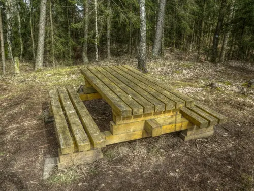

Parks, trails and playgrounds4



Restaurants and cafes31
Main Genuss Städtla
Cafe · Coffee Shop, Brotzeit · 4.9 km
19 Maintalstraße, Michelau-Neuensee
We-Sa 15:00-21:00


Bäckerei Heimann
Cafe · 4.1 km
1 Rathausplatz, Ebersdorf b.Coburg
Mo-Fr 06:00-18:00; Sa 06:00-12:00; Su 07:00-17:00

Gasthaus Hans-Peter Heymann
Restaurant · Regional · 3.0 km
Tu 10:30-22:00;Th,Sa 17:00-22:00;Su 15:30-22:00
Dötschel
Restaurant · Regional · 4.2 km
5 Waldstraße, Schneckenlohe
Bei Pio
Restaurant · Italian · 1.3 km
5 Sportplatzstraße, Weidhausen b.Coburg

19 more on the map.
Where to stay2


History
The first documented mention of Sonnefeld was in the year 1252. In 1260, a Cistercian nunnery was founded in Ebersdorf bei Coburg by Henry II von Sonneberg with the help from the nuns from Maidbronn. Three years later, in 1263, the nearby hamlet of Hofstädten became the property of the nunnery. When it burned to the ground in 1287, a new abbey was built and consecrated in Hofstädten for the nuns. In 1299, the villages of Weidhausen and Trübenbach were given to Sonnefeld Abbey in an exchange of properties with Bamberg. A church was added between 1330 and 1349 in the High Gothic style and became the Klosterkirche (monastery church).
In 1526, the abbey was dissolved as a result of the Reformation. Since then, Sonnefeld has been an Evangelical Lutheran parish. The Thirty Years' War destroyed most of the houses and buildings in Sonnefeld and Hofstädten so the reconstruction was slow but steady. It got a big boost from the grant of market privileges by Duke Albert V, Duke of Saxe-Coburg. In 1705, the district of Sonnefeld came to the Duchy of Saxe-Hildburghausen. In 1769, the parish church was rebuilt. In 1826, the district of Sonnefeld was given to the Duchy of Saxe Coburg and Gotha in the redistribution of lands between the surviving Saxon duchies.
From the History section of Sonnefeld on Wikipedia, under CC BY-SA 4.0.
Churches and places of worship11
St. Laurentius
Church · Lutheran · 4.5 km
39 Canterstraße, Ebersdorf b.Coburg
St. Laurenzius
Church · Catholic · 4.9 km
10 Weidhausener Straße, Michelau i.OFr.
Freie Christengemeinde Sonnefeld
Church · Pentecostal · 1.0 km
19 Zeppelinstraße, Sonnefeld
Shopping10
Gas and EV charging3
Schools, colleges and libraries5
Healthcare4
Map of Sonnefeld
81 places. The map loads OpenStreetMap tiles when you open it.
Getting there and nearby towns
Verkehrslandeplatz Bayreuth (BYU) is the nearest airport with scheduled flights listed in OpenStreetMap, 44 km away.
- Lichtenfels 9 km southwest, about 9 min by car
- Rödental 11 km northwest, about 11 min by car
- Coburg 13 km west, about 13 min by car
- Neustadt bei Coburg 13 km north, about 13 min by car
- Kronach 14 km east, about 14 min by car
- Stockheim 15 km northeast, about 15 min by car
- Sonneberg 16 km north, about 16 min by car
- Bad Staffelstein 16 km southwest, about 16 min by car
- Weitramsdorf 19 km west, about 19 min by car
- Kulmbach 26 km southeast, about 26 min by car
Drive times are estimates from straight-line distance, not routes.
Local news
Headlines from INDB.
Reviews, tips and questions
Loading what members have shared...
Sources and licences
- GeoNames (CC BY 4.0): population, coordinates, regions and time zone
- Mapillary (see each image): photos
- OpenStreetMap contributors (ODbL 1.0): places, airports, map data
- Wikidata (CC0 1.0): elevation, founding date, time zone, website, landmarks and historic places
- Wikimedia Commons (see each image): photos
- Wikipedia (CC BY-SA 4.0): overview and history text
Photo credits
- Sonnefeld-Rathaus, Störfix, CC BY-SA 3.0
- Sonnefeld Kloster Luftbild-20230908-RM-155339, Ermell, CC BY-SA 4.0
- Sonnefeld-Klosterkirche-Südseite, Störfix, CC BY-SA 3.0 de
- Sonnefeld Kloster Luftbild-20230908-RM-155301, Ermell, CC BY-SA 4.0
- Sonnefeld Kloster Luftbild-20230908-RM-154957, Ermell, CC BY-SA 4.0
- Sonnefeld Kloster Luftbild-20230908-RM-154854, Ermell, CC BY-SA 4.0
- Sonnefeld St. Moritz-20230908-RM-160526, Ermell, CC BY-SA 4.0
- Sonnefeld St. Moritz-20230908-RM-160557, Ermell, CC BY-SA 4.0
- Sonnefeld St. Moritz-20230908-RM-160414, Ermell, CC BY-SA 4.0
- Sonnefeld-Klosterkirche-04, Störfix, CC BY-SA 3.0 de
- Sonnefeld Klosterhof-20230827-RM-155943, Reinhold Möller Ermell, CC BY-SA 4.0
- Sonnefeld Klosterkirche-20230827-RM-155611, Reinhold Möller Ermell, CC BY-SA 4.0
- Sonnefeld-Klosterhof-3, Störfix, CC BY-SA 3.0 de
- Sonnefeld Klosterhof-20230827-RM-160009, Reinhold Möller Ermell, CC BY-SA 4.0
- Sonnefeld Kloster Luftbild-20230908-RM-155042, Ermell, CC BY-SA 4.0
- Sonnefeld-Klosterkirche-05, Störfix, CC BY-SA 3.0 de
- Sonnefeld Glocken-20230827-RM-155439, Reinhold Möller Ermell, CC BY-SA 4.0
- Sonnefeld Klosterkirche Tür-20230827-RM-155355, Reinhold Möller Ermell, CC BY-SA 4.0
- Sonnefeld Klosterkirche Tür-20230827-RM-155309, Reinhold Möller Ermell, CC BY-SA 4.0
- Sonnefeld-Klosterkirche-Orgel, Störfix, CC BY-SA 3.0 de
- Sonnefeld-Klosterkirche-Sakristei, Störfix, CC BY-SA 3.0 de
- Sonnefeld Kirche Ölgemälde-20230827-RM-152934, Reinhold Möller Ermell, CC BY-SA 4.0
- Sonnefeld-Klosterkirche-02, Störfix, CC BY-SA 3.0 de
- Sonnefeld-Klosterkirche-Grabstein-Herren-von-Schaumberg, Störfix, CC BY-SA 3.0 de
- Sonnefeld Kirche Altarraum HDR-20230827-RM-154116, Ermell, CC BY-SA 4.0
- Sonnefeld Epitaph Kirche HRS-20230827-RM-153148, Ermell, CC BY-SA 4.0
- Sonnefeld Kirche Orgel HRS-20230827-RM-154647, Ermell, CC BY-SA 4.0
- Sonnefeld Kirche Innenraum HDR-20230827-RM-154344, Ermell, CC BY-SA 4.0
- Sonnefeld-Klosterkirche-03, Störfix, CC BY-SA 3.0 de
- Sonnefeld Kirche Buntglasfenster HRS-20230827-RM-153718, Reinhold Möller Ermell, CC BY-SA 4.0
- Sonnefeld Kirche Taufstein-20230827-RM-153611, Ermell, CC BY-SA 4.0
- Sonnefeld Epitaph Kirche HRS-20230827-RM-153203, Ermell, CC BY-SA 4.0
- Sonnefeld-Klosterkirche-Grabplatten, Störfix, CC BY-SA 3.0 de
- Sonnefeld Epitaph Kirche HRS-20230827-RM-153213, Ermell, CC BY-SA 4.0
- Sonnefeld Klosterkirche Liegefigur HRS-20230827-RM-153444, Ermell, CC BY-SA 4.0
- Sonnefeld Epitaph Kirche HRS-20230827-RM-153225, Ermell, CC BY-SA 4.0
- Lettenreuth-St-Laurentius-01, Störfix, CC BY-SA 3.0 de
- Großgarnstadt-St-Nikolaus, Störfix, CC BY-SA 3.0 de
- Ebersdorf-St-Otto1, Störfix, CC BY-SA 3.0 de
- Sonnefeld-Klosterkirche, Störfix, CC BY-SA 3.0 de
- Ebersdorf-St-Laurentius, Störfix, CC BY-SA 3.0
- Neuensee Zum Herzen Mariä(1), Benreis, CC BY 3.0
- Schneckenlohe-Martin-Luther-Gemeindezentrum, Störfix, CC BY-SA 3.0 de
- Street-level photo, fabchim, CC BY-SA 4.0
- Street-level photo, derzornigemarkus, CC BY-SA 4.0
- Street-level photo, qso4you_com, CC BY-SA 4.0
- Street-level photo, svhelden, CC BY-SA 4.0
- Street-level photo, fabchim, CC BY-SA 4.0
- Street-level photo, fabchim, CC BY-SA 4.0
- Street-level photo, qso4you_com, CC BY-SA 4.0
- Street-level photo, qso4you_com, CC BY-SA 4.0
- Street-level photo, su1dakra, CC BY-SA 4.0


Page built November 9, 2026. Spotted a mistake? Tell us or suggest a place.