


Why visit Unterlüß
Townapedia lists 6 museums and landmarks, 4 parks and trails, 3 places to eat, 2 places to stay and 3 attractions in and around town.
Highlights include Breitehorn, Lüßberg, Gedenkstätte Unterlüß and Albert König Museum.
Weather in Unterlüß
Forecast from MET Norway (CC BY 4.0). Full forecast
About Unterlüß
Unterlüß (German pronunciation: [ˈʊntɐˌlyːs]) is a village and former municipality in the district of Celle in Lower Saxony, Germany. It became part of the municipality of Südheide on 1 January 2015. It is about 30 km north-east of Celle and 25 km south-west of Uelzen. It is a station on the railway between Hanover and Hamburg.
From the Wikipedia article Unterlüß (this version), under CC BY-SA 4.0.
Things to do3


Museums and landmarks6

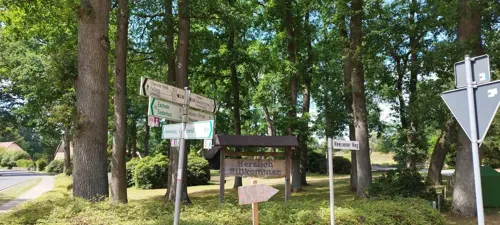
Gedenkstätte Unterlüß
Monument and historic site · 1.8 km
Stolperschwelle, Infotafel zu Gedenken an das Leid der Zwangsarbeiterinnen im KZ-Außenlager Tannenberg.



Parks, trails and playgrounds4

Heideflächen mittleres Lüßplateau
Park · 9.3 km
Nature reserve in Lower Saxony, Germany


Quell- und Durchströmungsmoor mit Kleingewässern bei Dalle
Hiking and trails · 5.5 km

Restaurants and cafes3

Heide-Bäckerei Meyer
Bakery
1b Müdener Straße, Südheide
Mo-Fr 05:30-18:00; Sa 06:00-17:00; Su 08:00-11:00
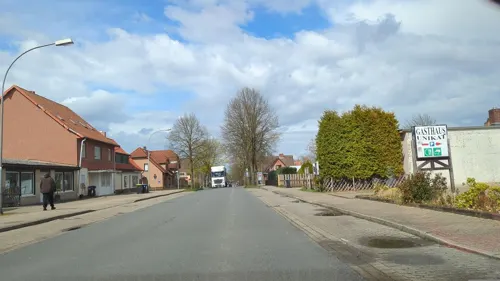


Istanbul Grill
Restaurant · Greek
2 Am Bahnhof, Südheide
Mo-Th 11:00-22:00; PH,Fr-Su 11:00-23:00
History
The name Lüß was documented in 1569 for a forest, which was probably the source for the name.
In 1847, the railroad was built, eventually becoming part of the line between Hanover and Hamburg, and a station Unterlüß was created, causing a settlement around it. In 1899, the company Rheinmetall (then Rheinische Metallwaren- und Maschinenfabrik Aktiengesellschaft) first installed a shooting range and then began manufacturing weapons. The settlement became a municipality in 1910. After World War I, Rheinmetall had to turn to civil production. They managed a model estate. Some labourers found work in the kieselgur industry.
During the German re-armament, the production was expanded starting in 1934. Rheinmetall and Borsig became nationalised as Rheinmetall-Borsig. Housing for workers was built in Hohenrieth, now also part of Südheide, in 1936. When World War II began, Polish forced labourers were used, and from 1941 also Soviet ones (and finally Jewish deportees).
As allied forces approached, the prisoners were forced to dig their own graves in mock execution. Once the SS guards fled, most of the prisoners (except a few who escaped) were forcibly removed back to Bergen Belsen by local civilians.
From the History section of Unterlüß on Wikipedia, under CC BY-SA 4.0.
Where to stay2
Churches and places of worship3
Shopping3
Gas and EV charging1
Schools, colleges and libraries1
Healthcare1
Map of Unterlüß
27 places. The map loads OpenStreetMap tiles when you open it.
Getting there and nearby towns
Hannover Airport (HAJ) is the nearest airport with scheduled flights listed in OpenStreetMap, 59 km away.
- Uelzen 23 km northeast, about 23 min by car
- Bergen 23 km west, about 23 min by car
- Wieren 25 km east, about 25 min by car
- Celle 28 km southwest, about 28 min by car
- Wittingen 32 km east, about 32 min by car
- Hambühren 32 km southwest, about 32 min by car
- Soltau 35 km northwest, about 35 min by car
- Wathlingen 35 km south, about 35 min by car
- Wietze 37 km southwest, about 37 min by car
- Gifhorn 43 km southeast, about 43 min by car
Drive times are estimates from straight-line distance, not routes.
Local news
Headlines from INDB.
Reviews, tips and questions
Loading what members have shared...
Sources and licences
- GeoNames (CC BY 4.0): population, coordinates, regions and time zone
- Mapillary (see each image): photos
- OpenStreetMap contributors (ODbL 1.0): places, airports, map data
- Wikidata (CC0 1.0): elevation, founding date, time zone, website, landmarks and historic places
- Wikimedia Commons (see each image): photos
- Wikipedia (CC BY-SA 4.0): overview and history text
Photo credits
- Hermannsburger Str. 25, Unterlüß (2), Hajotthu, CC BY 3.0
- Albert-König-Museum Unterlüß, Hajotthu, CC BY-SA 3.0
- Friedenskirche Unterlüß Seitenansicht, Gerd Fahrenhorst, CC BY 4.0
- Albert-König-Museum Unterlüß 02, Hajotthu, CC BY-SA 3.0
- Brunnen am Rathaus Unterlüß, Gerd Fahrenhorst, CC BY 4.0
- St. Paulus Unterlüß Südseite, Gerd Fahrenhorst, CC BY 4.0
- Unterlüß Rathausbrunnen, Hajotthu 09:43, 11. Apr. 2009 (CEST), CC BY-SA 3.0
- Kruzifix an St. Paulus Unterlüß, Gerd Fahrenhorst, CC BY 4.0
- St. Paulus Unterlüß Westseite, Gerd Fahrenhorst, CC BY 4.0
- Lüßwaldhalle und Grundschule Unterlüß, Gerd Fahrenhorst, CC BY 4.0
- Grundschule Unterlüß, Gerd Fahrenhorst, CC BY 4.0
- Podest oder Tisch in Unterlüß, Gerd Fahrenhorst, CC BY 4.0
- HeideblueteTiefental, Hajotthu, CC BY-SA 3.0
- Baptistenkapelle Unterlüß, GregorHelms, CC BY-SA 3.0
- Teichufer Moor Dalle-20200412-(2), Hajotthu, CC BY-SA 3.0
- Lüßwald Unterlüß52, Hajotthu, CC BY-SA 3.0
- Gedenkstätte Lager-Unterlüß, Photographer and uploader was Hajotthu at de.wikipedia, CC BY-SA 3.0
- Unterluess Kirche Paulus, Kirchenfan, CC0
- Bruchwald Moor Dalle -20200412- (1), Hajotthu, CC BY-SA 3.0
- Friedenskirche in Unterlüss IMG 2326, losch, CC BY-SA 3.0
- Friedhofskapelle in Eschede IMG 5520, Losch, CC BY-SA 3.0
- Friedhofskapelle in Eschede IMG 5517, Losch, CC BY-SA 3.0
- Friedhofskapelle in Eschede IMG 5515, Losch, CC BY-SA 3.0
- Friedhofskapelle in Eschede IMG 5518, Losch, CC BY-SA 3.0
- Friedhofskapelle in Eschede IMG 5519, Losch, CC BY-SA 3.0
- -i---i- (50370627037), Thomas Woodtli from Zürich, Switzerland, CC BY-SA 2.0
- Forsthaus Lüß, Hajotthu, CC BY-SA 3.0
- St. Paulus-Kirche in Unterlüss IMG 2320, losch, CC BY-SA 3.0
- St. Paulus-Kirche in Unterlüss IMG 2317, losch, CC BY-SA 3.0
- St. Paulus-Kirche in Unterlüss IMG 2319, losch, CC BY-SA 3.0
- Friedenskirche in Unterlüss IMG 2324, losch, CC BY-SA 3.0
- Rathaus in Unterlüss IMG 2321, losch, CC BY-SA 3.0
- Gaußstein Breitehorn Unterlüß (1), Hajotthu, CC BY-SA 3.0
- Lüßberg im Naturpark Südheide, Puusterke, CC BY-SA 3.0
- Street-level photo, hotteliene, CC BY-SA 4.0
- Street-level photo, hotteliene, CC BY-SA 4.0
- Street-level photo, hotteliene, CC BY-SA 4.0
- Street-level photo, bufonto, CC BY-SA 4.0
- Street-level photo, hotteliene, CC BY-SA 4.0
- Street-level photo, hotteliene, CC BY-SA 4.0
- Street-level photo, tian, CC BY-SA 4.0
- Street-level photo, ber319, CC BY-SA 4.0


Page built November 9, 2026. Spotted a mistake? Tell us or suggest a place.