


Why visit Hermannsburg
Townapedia lists 38 museums and landmarks, 19 parks and trails, 56 places to eat, 32 places to stay and 11 attractions in and around town.
Highlights include Wildpark Müden, Rabehof, Großsteingrab Siddernhausen and Museum Römstedthaus.
Weather in Hermannsburg
Forecast from MET Norway (CC BY 4.0). Full forecast
About Hermannsburg
Hermannsburg (German pronunciation: [ˈhɛʁmansˌbʊʁk]) is a village and a former municipality in the Celle district, in Lower Saxony, Germany. Since 1 January 2015 it is part of the municipality Südheide. It has been a state-recognised resort town since 1971. It is situated on the river Örtze, about 15 kilometres east of Bergen and 30 kilometres north of Celle.
From the Wikipedia article Hermannsburg (this version), under CC BY-SA 4.0.
Travel tips from other travellers: Hermannsburg on Wikivoyage (CC BY-SA 4.0).
Things to do11

Wildpark Müden
Zoo and aquarium · 4.6 km
Wildpark auf einer Fläche von über 10 Hektar. Die meist einheimischen Tiere präsentieren sich in naturbelassenen und mit Bächen und...
23 Heuweg, Faßberg
Mo-Su 09:00-18:00
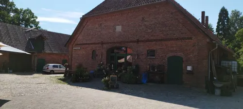

Hofladen Drewes
Farm and orchard · 1.8 km
Mo-Fr 08:00-12:30,14:00-18:00; We 08:00-12:30,14:00-18:30; Sa...



Museums and landmarks38

Großsteingrab Siddernhausen
Monument and historic site · 4.3 km
Rekonstruiertes Großsteingrab. Die ursprüngliche Lage war 500 m nördlich.







Bikbank
Monument and historic site · 5.2 km
Historische Waschbank, die Plattdeutsch Bikbank genannt wird
Wassertretstelle
Monument and historic site · 1.4 km
Wassertretstelle am Mitternacht
26 more on the map.
Parks, trails and playgrounds19


Großes Moor bei Becklingen
Park · 9.8 km
Nature reserve in Lower Saxony, Germany

Heideflächen mittleres Lüßplateau
Park · 5.3 km
Nature reserve in Lower Saxony, Germany




7 more on the map.
Restaurants and cafes56
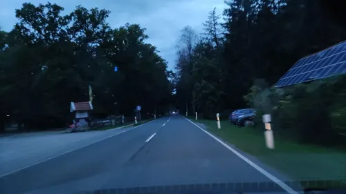
Misselhorner Hof
Restaurant · Regional · 2.2 km
1 Misselhorn, Südheide
We-Fr 18:00-22:00; Sa,Su,PH 12:00-14:00,18:00-22:00
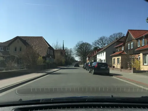
Anderer's Taverna
Restaurant · Italian · 0.6 km
27 Lotharstraße, Südheide
Mo-Tu 17:00-22:00; Fr-Sa 17:00-22:00; Su 11:30-14:30,17:00-22:00;...
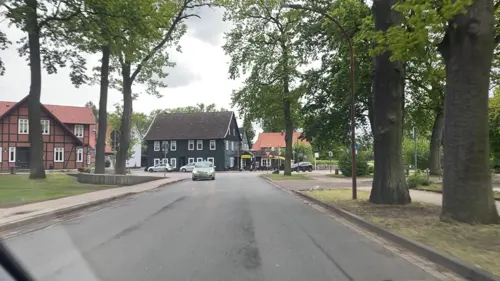
Café & Restaurant Candance
Restaurant · German, Regional, Coffee Shop, Fish
2 Harmsstraße, Südheide
Tu-Su 11:30-18:00
Café Bacio
Cafe · Ice Cream, Coffee Shop, Tea, Pizza, Breakfast, Sandwich
12 Billingstraße, Südheide
Mo-Sa 09:30-21:00; Su 10:00-21:00
May Mei
Restaurant · Asian
1 Junkernstraße, Südheide
Tu-Su 11:45-14:30,17:30-21:30; PH Mo 11:45-14:30,17:30-21:30
Ohlendorfs Gasthaus
Restaurant · International
2 Welfenstraße, Südheide
Mo,We,Th,Fr 17:30-21:00; Sa,Su 11:30-14:00,17:30-21:00; PH 17:30-21:00

Heide-Bäckerei Meyer
Cafe · 8.4 km
17–19 Müdener Weg
Mo-Fr 05:30-18:00; Sa 05:30-17:00; Su 07:30-18:00
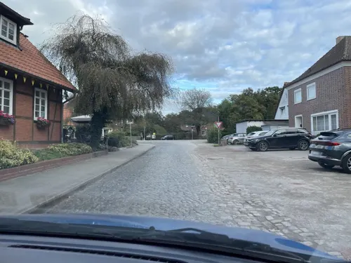
Hoffmann's Backhus
Bakery · 5.2 km
11 Alte Dorfstraße, Faßberg
Mo,Sa 06:15-12:00; Tu-Fr 06:15-18:00; Su 07:30-10:00
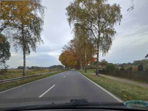

Ole Müller'n Schün
Cafe · 5.1 km
6 Alte Dorfstraße, Faßberg
Mo-Sa 14:00-18:00; Su,PH 13:30-18:00; Nov-May Mo-Tu off


44 more on the map.
Where to stay32
Churches and places of worship13
Shopping22
Gas and EV charging10
Schools, colleges and libraries13
Fachhochschule für Interkulturelle Theologie Hermannsburg
School · 0.8 km
Healthcare4
Map of Hermannsburg
218 places. The map loads OpenStreetMap tiles when you open it.
Getting there and nearby towns
Hannover Airport (HAJ) is the nearest airport with scheduled flights listed in OpenStreetMap, 50 km away.
- Bergen 9 km west, about 9 min by car
- Unterlüß 14 km east, about 14 min by car
- Celle 23 km south, about 23 min by car
- Soltau 24 km northwest, about 24 min by car
- Hambühren 24 km south, about 24 min by car
- Wietze 26 km southwest, about 26 min by car
- Lachendorf 26 km southeast, about 26 min by car
- Bad Fallingbostel 27 km west, about 27 min by car
- Walsrode 34 km west, about 34 min by car
- Uelzen 35 km northeast, about 35 min by car
Drive times are estimates from straight-line distance, not routes.
Local news
Headlines from INDB.
Reviews, tips and questions
Loading what members have shared...
Sources and licences
- GeoNames (CC BY 4.0): population, coordinates, regions and time zone
- Mapillary (see each image): photos
- OpenStreetMap contributors (ODbL 1.0): places, airports, map data
- Wikidata (CC0 1.0): elevation, founding date, time zone, website, landmarks and historic places
- Wikimedia Commons (see each image): photos
- Wikipedia (CC BY-SA 4.0): overview and history text
Photo credits
- Rathaus in Hermannsburg IMG 1559, losch, CC BY-SA 3.0
- GrosseKreuzkircheHermannsburg, Hajotthu 11:57, 25. Feb. 2008 (CET), CC BY-SA 3.0
- St.-Peter-Paul-Kirche von 1450 in Hermannsburg IMG 1538, Losch, CC BY-SA 3.0
- St.-Peter-Paul-Kirche von 1450 in Hermannsburg IMG 1540, Losch, CC BY-SA 3.0
- St.-Peter-Paul-Kirche von 1450 in Hermannsburg IMG 1535, Losch, CC BY-SA 3.0
- St.-Peter-Paul-Kirche von 1450 in Hermannsburg IMG 1541, Losch, CC BY-SA 3.0
- St.-Peter-Paul-Kirche von 1450 in Hermannsburg IMG 1536, Losch, CC BY-SA 3.0
- Kriegerdenkmal vor St.-Peter-Paul-Kirche von 1450 in Hermannsburg IMG 1537, Losch, CC BY-SA 3.0
- PeterPaulKircheHermannsburg, Hajotthu 13:40, 29. Feb. 2008 (CET), CC BY-SA 3.0
- Ortsblick in Hermannsburg IMG 1533, losch, CC BY-SA 3.0
- Ortsblick in Hermannsburg IMG 1534, losch, CC BY-SA 3.0
- Hermannsburg (Pfarrhaus Billingstr.)@20150731 02, Hajotthu, CC BY-SA 3.0
- Rathausplatz Hermannsburg 01, Hajotthu, CC BY 3.0
- Hermannsburg Rathaus@20160128, Hajotthu, CC BY-SA 3.0
- Ortsblick in Hermannsburg IMG 1546, losch, CC BY-SA 3.0
- Große Kreuzkirche von 1878 in Hermannsburg IMG 1550, Losch, CC BY-SA 3.0
- Große Kreuzkirche von 1878 in Hermannsburg IMG 1548, Losch, CC BY-SA 3.0
- Große Kreuzkirche von 1878 in Hermannsburg IMG 1556, Losch, CC BY-SA 3.0
- Große Kreuzkirche von 1878 in Hermannsburg IMG 1554, Losch, CC BY-SA 3.0
- Große Kreuzkirche von 1878 in Hermannsburg IMG 1553, Losch, CC BY-SA 3.0
- Große Kreuzkirche von 1878 in Hermannsburg IMG 1545, Losch, CC BY-SA 3.0
- Große Kreuzkirche von 1878 in Hermannsburg IMG 1555, Losch, CC BY-SA 3.0
- Ortsblick in Hermannsburg IMG 1547, losch, CC BY-SA 3.0
- Örtzebrücke Hermannsburg, Hajotthu, CC BY-SA 3.0
- Ortsblick in Hermannsburg IMG 1509, losch, CC BY-SA 3.0
- Skulpturenweg Wasserkunst 6 in Hermannsburg IMG 1507, losch, CC BY-SA 3.0
- Kriegsdenkmal in Hermannsburg IMG 1549, Losch, CC BY-SA 3.0
- NABU Schwalbenhaus Hermannsburg, Hajotthu, CC BY-SA 3.0
- NABU Insektenhaus Hermannsburg, Hajotthu, CC BY-SA 3.0
- Hermannsburg Örtze Wehrsteg, Hajotthu, CC BY 3.0
- Gedenkstein Auterive Hermannsburg IMG 1532, losch, CC BY-SA 3.0
- GagelstrauchbestandBornriethmoor, Hajotthu, CC BY 3.0
- BecklgMoorFläche, Hajotthu 11:36, 16. Aug. 2009 (CEST), CC BY-SA 3.0
- HeideblueteTiefental, Hajotthu, CC BY-SA 3.0
- Bergen St. Lamberti-Kirche, Hajotthu, CC BY 3.0
- Bonstorf Hügelgräberfeld 03, Hajotthu, CC BY-SA 3.0
- Siddernhausen Dolmen end view, Bermicourt, CC BY-SA 3.0
- Teich Gerdehauser Moor, Hajotthu, CC BY-SA 3.0
- Muedenkirche, Muggmag, Public domain
- Heidefläche, Hajotthu 12:16, 10. Dez. 2007 (CET), CC BY-SA 3.0
- Wietzer Berg, Bermicourt, CC BY-SA 3.0
- Weesener Bach@20150408 05, Hajotthu, CC BY-SA 3.0
- Heideflächen am Nordhang des Hausselberges 01, Puusterke, CC BY-SA 4.0
- Bergen Römstedthaus, Hajotthu, CC BY 3.0
- Kleine Kreuzkirche Hermannsburg Aug.2012, Hajotthu, CC BY-SA 3.0
- Stolperstein Hermannsburg Lutterweg 16 Agnes Timme, Tomtom10, CC BY-SA 4.0
- Stolperstein Hermannsburg Lotharstraße 14 Irmgard Ruschenbusch, Tomtom10, CC BY-SA 4.0
- Waschbank - Bikbank, Oxfordian Kissuth, CC BY-SA 3.0
- Hermannsburg Auferstehungskirche, Kirchenfan, CC0
- Fabian-und-Sebastian-Kirche Sülze 3, Hajotthu, CC BY-SA 3.0
- Bergen Suehnekirche, Kirchenfan, CC0
- Außenanlage des Heimatmuseum Hermannsburg IMG 1531, Losch, CC BY-SA 3.0
- Street-level photo, hotteliene, CC BY-SA 4.0
- Street-level photo, hotteliene, CC BY-SA 4.0
- Street-level photo, hotteliene, CC BY-SA 4.0
- Street-level photo, hotteliene, CC BY-SA 4.0
- Street-level photo, hotteliene, CC BY-SA 4.0
- Street-level photo, hotteliene, CC BY-SA 4.0
- Street-level photo, hotteliene, CC BY-SA 4.0
- Street-level photo, hotteliene, CC BY-SA 4.0
- Street-level photo, hotteliene, CC BY-SA 4.0
- Street-level photo, hotteliene, CC BY-SA 4.0
- Street-level photo, ber319, CC BY-SA 4.0
- Street-level photo, hotteliene, CC BY-SA 4.0
- Street-level photo, hotteliene, CC BY-SA 4.0
- Street-level photo, hotteliene, CC BY-SA 4.0
- Street-level photo, hotteliene, CC BY-SA 4.0
- Street-level photo, hotteliene, CC BY-SA 4.0
- Street-level photo, hotteliene, CC BY-SA 4.0
- Street-level photo, hotteliene, CC BY-SA 4.0
- Street-level photo, hotteliene, CC BY-SA 4.0
- Street-level photo, hotteliene, CC BY-SA 4.0
- Street-level photo, hotteliene, CC BY-SA 4.0
- Street-level photo, hotteliene, CC BY-SA 4.0
- Street-level photo, hotteliene, CC BY-SA 4.0
- Street-level photo, hotteliene, CC BY-SA 4.0
- Street-level photo, hotteliene, CC BY-SA 4.0


Page built November 9, 2026. Spotted a mistake? Tell us or suggest a place.