


Why visit Worms
Townapedia lists 98 museums and landmarks, 37 parks and trails, 244 places to eat, 21 places to stay and 12 attractions in and around town.
Highlights include Tiergarten Worms, Börschingers Nudeln, Museum der Stadt Worms im Andreasstift and Museum Heylshof.
Weather in Worms
Forecast from MET Norway (CC BY 4.0). Full forecast
About Worms
Worms (; German pronunciation: [vɔʁms] ) is a city in Rhineland-Palatinate, Germany, situated on the Upper Rhine about 60 km (40 mi) south-southwest of Frankfurt am Main. It had about 84,646 inhabitants as of 2022.
From the Wikipedia article Worms, Germany (this version), under CC BY-SA 4.0.
Travel tips from other travellers: Worms on Wikivoyage (CC BY-SA 4.0).
Photos of Worms


Things to do12

Tiergarten Worms
Zoo and aquarium · 2.2 km
Apr-Sep: Mo-Su,PH 09:00-19:00; Mar-Oct: Mo-Su,PH 09:00-18:00;...

Börschingers Nudeln
Farm and orchard · 3.9 km
87a Neubachstraße, Worms
Mo-Fr 10:00-12:30,16:00-18:30; Th off; Sa 10:00-13:00





Museums and landmarks98

Museum der Stadt Worms im Andreasstift
Museum
Weckerlingplatz, Worms
Tu-Su 10:00-17:00; Mo off


Luther monument Worms
Monument and historic site
Large group monument for Martin Luther in Worms, often copied


Wasserturm ehem. Schlachthof Worms
Monument and historic site · 1.3 km
86 more on the map.
Parks, trails and playgrounds37




25 more on the map.
Restaurants and cafes244
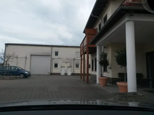
Bistro Jäger am TÜV
Restaurant · Regional, Breakfast, Coffee Shop · 1.8 km
14 August-Horch-Straße, Worms
Mo-Fr 08:00-14:00
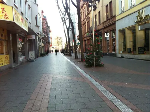
Gourmet Lin
Restaurant · Chinese
16 Wilhelm-Leuschner-Straße, Worms
Tu-Fr 11:30-14:30,17:30-22:00; Sa,Su,PH 11:30-22:30
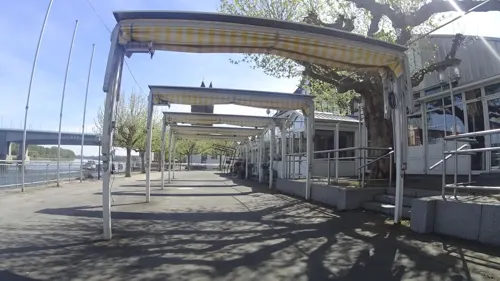
Hagenbräu
Restaurant · German · 1.3 km
3 Am Rhein, Worms
Mar-Oct Mo-Fr 10:00-23:00; Mar-Oct Sa,Su 09:00-23:00; Nov-Feb...


Coffee Brothers
Cafe · Coffee Shop
8 Obermarkt, Worms
Mo-Th 09:00-20:00; Fr-Sa 09:00-22:00; Su 12:00-18:00

ComMami
Restaurant · Sushi, Indochine, Asian
5 Ludwigsplatz, Worms
Tu-Th 11:00-15:00,16:30-22:00; Fr,Sa 11:00-15:00,16:30-23:00; Su...
Horchheimer Scheune
Cafe · Chocolate · 3.8 km
9 Turnhallenstraße, Worms
Tu-Fr 10:00-18:00; Sa 10:00-13:00; Su 09:30-12:00
232 more on the map.
History
Worms was in ancient times a Celtic city named Borbetomagus, perhaps meaning "water meadow". Later it was conquered by the Germanic Vangiones tribe. In 14 BC, Romans under the command of Drusus captured and fortified the city, and from that time onwards, a small troop of infantry and cavalry was garrisoned there. The Romans renamed the city as Augusta Vangionum, after the then-emperor and the local tribe. The name does not seem to have taken hold, however, and from Borbetomagus developed the German Worms and Latin Wormatia; as late as the modern period, the city name was written as Wormbs. The garrison grew into a small town with a regular Roman street plan, a forum, and temples for the main gods Jupiter, Juno, Minerva (whose temple was the site of the later cathedral), and Mars.
Roman inscriptions, altars, and votive offerings can be seen in the archaeological museum, along with one of Europe's largest collections of Roman glass. Local potters worked in the town's south quarter. Fragments of amphorae contain traces of olive oil from Hispania Baetica, doubtless transported by sea and then up the Rhine by ship.
Read more of the history
During the disorders of 411–413 AD, Roman usurper Jovinus established himself in Borbetomagus as a puppet-emperor with the help of King Gunther of the Burgundians, who had settled in the area between the Rhine and Moselle some years before. The city became the capital of the Burgundian kingdom under Gunther (also known as Gundicar). Few remains of this early Burgundian kingdom survive, because in 436, it was all but destroyed by a combined army of Romans (led by Aëtius) and Huns (led by Attila); a belt clasp found at Worms-Abenheim is a museum treasure. Provoked by Burgundian raids against Roman settlements, the combined Romano-Hunnic army destroyed the Burgundian army at the Battle of Worms (436), killing King Gunther. About 20,000 are said to have been killed. The Romans led the survivors southwards to the Roman district of Sapaudia (modern-day Savoy). The story of this war later inspired the Nibelungenlied. The city appears on the Peutinger Map, dated to the fourth century.
The bishopric of Worms existed by at least 614. In the Frankish Empire, the city was the location of an important palace of Charlemagne. The bishops administered the city and its territory. The most famous of the early medieval bishops was Burchard of Worms. In 868, an important synod was held in Worms. Around 900, the circuit wall was rebuilt according to the wall-building ordinance of Bishop Thietlach.
Worms prospered in the High Middle Ages. Having received far-reaching privileges from King Henry IV as early as 1074, the city became an imperial free city. The bishops resided at Ladenburg and only had jurisdiction over Worms Cathedral itself. During the People's Crusade, more precisely during the Rhineland massacres, 800 to 1000 jews were massacred by the army of Count Emich. In 1122, the Concordat of Worms was signed; the 1495 imperial diet met here and made an attempt at reforming the disintegrating Imperial Circle Estates by the Imperial Reform. Most important, among more than 100 imperial diets held at Worms, that of 1521 (commonly known as the Diet of Worms) ended with the Edict of Worms, in which Martin Luther was declared a heretic after refusing to recant his religious beliefs. Worms was also the birthplace of the first Bibles of the Reformation, both Martin Luther's German Bible and William Tyndale's first complete English New Testament by 1526.
In 1689 during the Nine Years' War, Worms (like the nearby towns and cities of Heidelberg, Mannheim, Oppenheim, Speyer, and Bingen) was sacked by troops of Louis XIV of France, though the French only held the city for a few weeks. In 1743, the Treaty of Worms was signed, forming a political alliance between Great Britain, Austria, and the Kingdom of Sardinia. In 1792, the city was occupied by troops of the First French Republic during the French Revolutionary Wars. The Bishopric of Worms was secularized in 1801, with the city being annexed into the First French Empire. In 1815, Worms passed to the Grand Duchy of Hesse in accordance with the Congress of Vienna, and the city was subsequently administered within Rhenish Hesse.
After the Battle of the Bulge in early 1945, Allied armies advanced into the Rhineland in preparation for a massive assault into the heart of the Reich. Worms was a German strongpoint on the west bank of the Rhine, and the forces there resisted the Allied advance tenaciously. Worms was, thus, heavily bombed by the Royal Air Force and the U.S. Army Air Forces in two attacks on 21 February and 18 March 1945, respectively. A postwar survey estimated that 39% of the town's developed area was destroyed. The RAF attack on 21 February was aimed at the main railway station on the edge of the inner city, and at chemical plants southwest of the inner city, but also destroyed large areas of the city centre. Carried out by 334 bombers, the attack in a few minutes rained 1,100 tons of bombs on the inner city, and Worms Cathedral was among the buildings set on fire. The Americans did not enter the city until the Rhine crossings began after the seizure of the Remagen Bridge.
In the attacks, 239 inhabitants were killed in the first and 141 in the second; 35,000 (60% of the population of 58,000) were made homeless. In all, 6490 buildings were severely damaged or destroyed. After the war, the inner city was rebuilt, mostly in modern style. Around a third of Worms's buildings are from before 1950. Postwar Worms became part of the new state of Rhineland-Palatinate; the borough Rosengarten, on the east bank of the Rhine, was lost to Hesse.
Worms today fiercely vies with the cities Trier and Cologne for the title of "Oldest City in Germany". A multimedia Nibelungenmuseum was opened in 2001, and a yearly festival in front of the Dom, the Worms Cathedral, attempts to recapture the atmosphere of the pre-Christian period.
From the History section of Worms, Germany on Wikipedia, under CC BY-SA 4.0.
More about Worms
Geography
Worms is located on the west bank of the River Rhine between the cities of Ludwigshafen and Mainz. On the northern edge of the city, the Pfrimm flows into the Rhine, and on the southern edge, the Eisbach flows into the Rhine.
Worms has 13 boroughs (or "quarters") around the city centre. They are:
The climate in the Rhine Valley is cool in winter and very warm in summer. Rainfall is below average for the surrounding areas. Winter snow accumulation is low and often melts quickly.
From the Wikipedia article Worms, Germany, under CC BY-SA 4.0.
Notable people from Worms
 Hermann StaudingerGerman chemist, winner of the 1953 Nobel Prize in Chemistry (1881–1965)Photo: Nobel Foundation, Public domain
 Timo HildebrandGerman association football playerPhoto: Frank Schwichtenberg, CC BY-SA 3.0
 Beatrice of SwabiaHoly Roman Empress (1198-1212)Photo: Anonymous Unknown author, Public domain
 Rudolf KargusGerman footballerPhoto: Hans Peters for Anefo, CC0
 Ida StrausTitanic victim (1849–1912)Photo: Pach Brothers, Public domain
 Heribert of CologneArchbishop of ColognePhoto: Raimond Spekking, CC BY-SA 4.0
 Johann Nikolaus GötzGerman poet (1721–1781)Photo: Johann David Schleuen, Public domain
- Rupert of SalzburgFrankish bishop
- Curtis BernhardtGerman film director (1899–1981)
- Friedrich GernsheimGerman composer, conductor, pianist and teacher (1839–1916)
- Richard HildebrandtSS General; RuSHA chief (1897-1952)
- Anne CibisGerman sprinter
Born in Worms, according to Wikidata (CC0). Each name links to its Wikipedia article.
Where to stay21
Churches and places of worship41
Shopping57
Gas and EV charging13
Schools, colleges and libraries31
Healthcare21
Apotheke im Wormser Einkaufs-Park
Clinic and pharmacy · 0.8 km
8 Schönauer Straße, Worms
Map of Worms
250 places. The map loads OpenStreetMap tiles when you open it.
Getting there and nearby towns
City-Airport Mannheim (MHG) is the nearest airport with scheduled flights listed in OpenStreetMap, 21 km away.
- Bobenheim-Roxheim 5 km south, about 5 min by car
- Bürstadt 7 km east, about 7 min by car
- Osthofen 8 km north, about 8 min by car
- Lampertheim 9 km southeast, about 9 min by car
- Biblis 10 km northeast, about 10 min by car
- Frankenthal 11 km south, about 11 min by car
- Lambsheim 14 km south, about 14 min by car
- Lorsch 15 km east, about 15 min by car
- Einhausen 14 km east, about 14 min by car
- Mannheim 18 km southeast, about 18 min by car
Drive times are estimates from straight-line distance, not routes.
Towns near Worms


Keep exploring
Local news
Headlines from INDB.
Reviews, tips and questions
Loading what members have shared...
Sources and licences
- GeoNames (CC BY 4.0): population, coordinates, regions and time zone
- Mapillary (see each image): photos
- OpenStreetMap contributors (ODbL 1.0): places, airports, map data
- Wikidata (CC0 1.0): elevation, founding date, time zone, website, landmarks and historic places
- Wikimedia Commons (see each image): photos
- Wikipedia (CC BY-SA 4.0): overview and history text
Photo credits
- Wormser Türme, Pratz53, CC BY-SA 4.0
- Lutherdenkmal Worms, protestierende Speyer 2, Chattus, CC BY-SA 4.0
- Lutherdenkmal Worms, Augsburger Religionsfriede, Chattus, CC BY-SA 4.0
- Worms, Karmeliterstraße 1 (1), Karsten Ratzke, CC0
- Karmeliter Grundschule Worms Front 03, Tonialsa, CC BY-SA 4.0
- Karmeliter Grundschule Worms Front 01, Tonialsa, CC BY-SA 4.0
- Karmeliter Grundschule Worms Rückseite, Tonialsa, CC BY-SA 4.0
- Worms- Lutherdenkmal (Martin Luther Memorial, WOrms) - geo.hlipp.de - 21404, eirian evans on geo.hlipp.de, CC BY-SA 2.0
- Lutherdenkmal Worms, Justus Jonas und Johann Bugenhagen, Chattus, CC BY-SA 4.0
- Lutherdenkmal Worms, Thesenanschlag in Wittenberg, Chattus, CC BY-SA 4.0
- Worms, Karmeliterstraße 2, Karsten Ratzke, CC0
- Worms, das Lutherdenkmal, Dguendel, CC BY 4.0
- Worms, Häuser am Lutherplatz, Dguendel, CC BY 4.0
- Worms Lutherdenkmal Petrus Waldus 2012-02-21-18-24-52, Alexander Hoernigk, CC BY 3.0
- Worms Lutherdenkmal Girolamo Savonarola 2012-02-21-18-20-15, Alexander Hoernigk, CC BY 3.0
- Worms, das Lutherdenkmal, Statue von Philipp Melanchthon, Dguendel, CC BY 4.0
- Worms, das Lutherdenkmal, Statue von Philipp der Großmütige, Landgraf von Hessen, Dguendel, CC BY 4.0
- Worms, das Lutherdenkmal, Statue von Friedrich der Weise, Dguendel, CC BY 4.0
- Worms, das Lutherdenkmal, Statue von Jan Huss, Dguendel, CC BY 4.0
- Worms, das Lutherdenkmal, Statue von Hieronymus Savonarola, Dguendel, CC BY 4.0
- Lutherdenkmal Worms 2022-09-07 2, Z thomas, CC BY-SA 4.0
- Lutherdenkmal Worms 2022-09-07 7, Z thomas, CC BY-SA 4.0
- Lutherdenkmal Worms 2022-09-07 1, Z thomas, CC BY-SA 4.0
- Lutherplatz worms 20150704, Saliwo, CC BY-SA 4.0
- Lutherdenkmal Worms, Protestierende Speyer, Chattus, CC BY-SA 4.0
- Lutherdenkmal Worms, Johannes Hus 3, Chattus, CC BY-SA 4.0
- Lutherdenkmal Worms, Johannes Hus 2, Chattus, CC BY-SA 4.0
- Briefkasten Rathenaustraße Worms 2, Hausmuffel, CC BY 4.0
- Briefkasten Rathenaustraße Worms, Emilius123, CC BY-SA 4.0
- Lutherdenkmal Worms, Chattus, CC BY-SA 4.0
- Worms Stolpersteine Karmeliterstraße 1, Alfons Tewes, CC BY-SA 4.0
- Worms Stolperstein Karmeliterstraße 1 Jenny Katz, Alfons Tewes, CC BY-SA 4.0
- Worms Stolperstein Karmeliterstraße 1 Manuel Katz, Alfons Tewes, CC BY-SA 4.0
- Lutherdenkmal Worms, Ansicht von seitlich hinten, Chattus, CC BY-SA 4.0
- Worms Wohnhauslage Karmeliterstraße 1, Alfons Tewes, CC BY-SA 4.0
- Worms Stolperstein Karmeliterstraße 1 Alfred Katz, Alfons Tewes, CC BY-SA 4.0
- Worms Bruecke 02, Armin Kübelbeck -- Kuebi 16:55, 27 May 2007 (UTC), CC BY-SA 3.0
- 2026-04-08 Achim-Lammerts D500-97379M Theodor-Heuss-Brücke, Achim Lammerts (Syntaxys), CC BY-SA 4.0
- Lutherdenkmal Worms 01, Immanuel Giel, Public domain
- Hochschule Worms Campus mit A-Gebäude, HochschuleWorms, CC0
- Raschi-Haus, Buercky, CC BY-SA 3.0
- St. Andreas Worms 4, Altera levatur, CC BY-SA 4.0
- Jewish cemetery Worms, No machine-readable author provided. PanchoS assumed (based on copyright claims)., Public domain
- Worms Dom Ostfassade Vierung2005-05-27a, Unknown author, CC BY-SA 3.0
- Worms- Klinikum Worms- Hauptgebäude 6.7.2010, Wikimedia-User Jivee Blau, CC BY-SA 3.0
- Worms-Dreifaltigkeitskirche, Immanuel Giel, Public domain
- Wormatia-Stadion Hauptribuene, DeArchivBub, CC BY-SA 3.0
- Worms- Eleonoren-Gymnasium- von Friedrich-Ebert-Straße aus 27.9.2009, Wikimedia-User Jivee Blau, CC BY-SA 3.0
- Ansicht 6, Pratz53, CC BY-SA 3.0
- Worms Friedrichskirche 2, Norbert Schnitzler, CC BY-SA 3.0
- Schloss herrnsheim, Ulli1105, CC BY 3.0
- Worms- Karl-Bittel-Park 29.5.2010, Wikimedia-User Jivee Blau, CC BY-SA 3.0
- Worms- Stadtbibliothek- von Marktplatz aus 10.12.2009, Wikimedia-User Jivee Blau, CC BY-SA 3.0
- Worms Lukaskirche Südwest, Tonialsa, CC BY-SA 4.0
- Martinskirche Worms IMG4530, Robert Scarth, CC BY-SA 2.0
- Worms- RSG- Haupteingang- von BIZ-Lehrer-Parkplatz aus 27.9.2009, Wikimedia-User Jivee Blau, CC BY-SA 3.0
- Ev kirche neuhausen, Goldener Käfer, CC BY-SA 4.0
- Worms Heylshofgarten 2005-05-27a, Unknown author, CC BY-SA 3.0
- Worms, Bergkirche (1), Jörg Bürgis, CC BY-SA 3.0
- Neusatz-Schule, Tonialsa, CC BY-SA 4.0
- HVB Front, Tonialsa, CC BY-SA 4.0
- Nibelungenschule Worms Osten, Tonialsa, CC BY-SA 4.0
- Ernst-Ludwig-Schule Worms, Hauptgebäude mit Direktorenhaus, Affegass, CC BY-SA 4.0
- Heyls Schlößchen, Schloßplatz 1, 2016-03, Norbert 53, CC BY-SA 4.0
- Kunsthaus Heylshof in Worms 1, Sciencia58, CC BY-SA 4.0
- Worms Festhaus, Tonialsa, CC BY-SA 4.0
- St. Peter Worms-Herrnsheim 03, Immanuel Giel, CC BY-SA 4.0
- Worms-Horchheim-04, Immanuel Giel, CC BY-SA 3.0
- Brückenturm der Nibelungenbrücke in Worms (Ostseite), Jörg Braukmann, CC BY-SA 4.0
- Worms, Landgrafenstraße 64, Jörg Bürgis, CC BY-SA 3.0
- Börschingers Nudeln Hofladen, Emilius123, CC BY-SA 4.0
- Worms Schlachthof Wasserturm, Oberlausitzerin64, CC BY-SA 4.0
- Rheinland-Pfalz, Worms, Wormser Ried 7319-019 82944, Herdsoft, CC BY-SA 4.0
- Rewe Horchheim, Emilius123, CC BY-SA 4.0
- Horchheim bft, Emilius123, CC BY-SA 4.0
- Tiergarten Worms Besuchereingang 2011, 4028mdk09, CC BY-SA 3.0
- Die Nibelungen-Museum in Worms (The Nibelungen Museum, just inside the city walls of Worms) - geo.hlipp.de - 21377, eirian evans on geo.hlipp.de, CC BY-SA 2.0
- Briefkasten Barbarossaplatz Worms, Emilius123, CC BY-SA 4.0
- Worms Albert-Schulte-Park Pergola, Affegass, CC BY-SA 4.0
- Annelore-und-Karl-Schlösser-Platz 2024, Greyowl, CC BY 4.0
- Street-level photo, rausk, CC BY-SA 4.0
- Street-level photo, miguel_andrade, CC BY-SA 4.0
- Street-level photo, miguel_andrade, CC BY-SA 4.0
- Street-level photo, changchun1, CC BY-SA 4.0
- Street-level photo, miguel_andrade, CC BY-SA 4.0
- Street-level photo, changchun1, CC BY-SA 4.0
- Street-level photo, slashme, CC BY-SA 4.0
- Street-level photo, teddy73, CC BY-SA 4.0
- Street-level photo, wegavision, CC BY-SA 4.0
- Street-level photo, mfa, CC BY-SA 4.0
- Street-level photo, mfa, CC BY-SA 4.0
- Street-level photo, ramap, CC BY-SA 4.0
- Street-level photo, wegavision, CC BY-SA 4.0
- Street-level photo, ValhallaUser, CC BY-SA 4.0
- Street-level photo, wegavision, CC BY-SA 4.0
- Street-level photo, wegavision, CC BY-SA 4.0
- Street-level photo, ValhallaUser, CC BY-SA 4.0
- Street-level photo, wegavision, CC BY-SA 4.0
- Street-level photo, wegavision, CC BY-SA 4.0
- Street-level photo, mfa, CC BY-SA 4.0
- Street-level photo, wegavision, CC BY-SA 4.0
- Street-level photo, ValhallaUser, CC BY-SA 4.0
- Street-level photo, ValhallaUser, CC BY-SA 4.0


Page built November 9, 2026. Spotted a mistake? Tell us or suggest a place.