


Why visit Eitorf
Townapedia lists 80 museums and landmarks, 29 parks and trails, 66 places to eat, 17 places to stay and 11 attractions in and around town.
Highlights include Bioladen Hüsgen, Appelhof Hofladen, Burg Blankenberg and Alter Friedhof.
Weather in Eitorf
Forecast from MET Norway (CC BY 4.0). Full forecast
About Eitorf
Eitorf (German pronunciation: [ˈaɪtɔʁf]) is a municipality in the Rhein-Sieg district, in North Rhine-Westphalia, Germany. It is situated on the river Sieg, approx. 25 km east of Bonn city.
From the Wikipedia article Eitorf (this version), under CC BY-SA 4.0.
Things to do11

Bioladen Hüsgen
Farm and orchard · 5.3 km
13 Auf der Sandkaule, Hennef
Mo 11:00-13:00,14:00-18:30; Tu-Fr 09:00-13:00,14:00-18:30; Th off;...

Hofladen Blumenhof
Farm and orchard · 0.8 km
1-3 Blumenhof, Eitorf
Th-Fr 09:00-18:00, Sa 08:00-13:00
Hofladen Strack
Farm and orchard · 6.9 km
Selbstbedienungshofladen
Mo-Su 08:00-21:00



Museums and landmarks80

Burg Blankenberg
Monument and historic site · 6.3 km
Residenz der Grafen von Sayn 12 und 13. Jhd Verwaltung Blankenberg bis 17. Jhd
Feb-Oct: Tu-Su 10:00-18:00; Nov-Jan: Tu-Su 10:00-16:00



Burg Ravenstein
Monument and historic site · 4.8 km
Der Koordinaten-Link aus Wikipedia führt nicht zu dieser genauen Position, sondern zu einem benachbarten Gebäude.



68 more on the map.
Parks, trails and playgrounds29




Siegaue in den Gemeinden Windeck, Eitorf und der Stadt Hennef
Hiking and trails · 3.5 km

17 more on the map.
Restaurants and cafes66
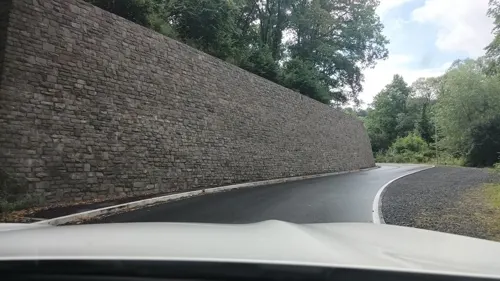
Cafekränzchen
Cafe · Breakfast, Cake, Pasta, Bakery · 7.0 km
151 Westerwaldstraße
Mo-Fr 05:30-18:00; Sa 05:30-17:00; Su 07:00-17:00
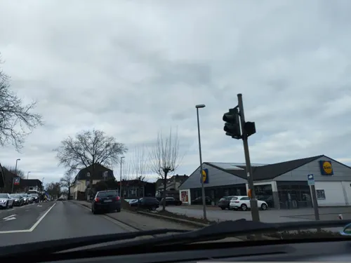
Weetschaff
Restaurant · German, Regional · 7.0 km
213 Westerwaldstraße, Hennef (Sieg)
Th-Sa 17:00-00:00; Su 11:30-14:00,17:00-23:00

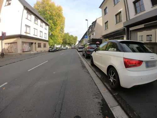
Balkanhaus
Restaurant · Balkan · 4.6 km
48 Hofstraße, Eitorf
Mo 17:00-22:00;We-Fr 17:00-22:00;Su,PH 12:00+;Oct-Mar Sa 16:00+
Bella Casa
Restaurant · Italian, International
14 Asbacher Straße, Eitorf
Mo-Fr 11:30-14:15,17:30-22:30; PH,Sa,Su 15:00-22:30

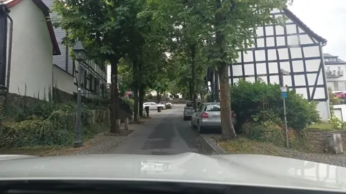
Café Sieben Sachen
Cafe · 2.6 km
57 Dorfstraße, Eitorf
Tu-Fr 10:00-18:00, Sa-Su 09:30-18:00; Mo-We off
Siegtaler Hof
Restaurant · German · 4.6 km
1 Im Klosterhof, Windeck
Mo off; Tu off; We off; Th-Fr 18:30-22:30; Sa off; Su 11:00-22:00
Zorlu Feine Kost
Restaurant
33 Schoellerstraße, Eitorf
We-Fr 12:00-22:00; Sa,Su 13:00-22:00; Mo,Tu off


54 more on the map.
Where to stay17
Churches and places of worship31
Antoniuskapelle Herchen
Church · Roman Catholic · 4.6 km
13 Im Klosterhof, Windeck
Wallfahrtskirche "Zum heiligen Kreuz"
Church · Catholic · 4.9 km
2 Mühlental, Hennef (Sieg)
Shopping16
Gas and EV charging9
Schools, colleges and libraries15
Peter-Patt-Gemeinschaftsgrundschule
School · 3.7 km
13 Linkenbacher Straße, Eitorf
Healthcare8
LVR-Klinik Bonn Abt.Psychiatrie III
Clinic and pharmacy
13 Hospitalstraße, Eitorf
Map of Eitorf
250 places. The map loads OpenStreetMap tiles when you open it.
Getting there and nearby towns
Cologne Bonn Airport (CGN) is the nearest airport with scheduled flights listed in OpenStreetMap, 24 km away.
- Ruppichteroth 9 km north, about 9 min by car
- Hennef (Sieg) 12 km west, about 12 min by car
- Much 16 km north, about 16 min by car
- Nümbrecht 17 km northeast, about 17 min by car
- Waldbröl 17 km northeast, about 17 min by car
- Siegburg 17 km west, about 17 min by car
- Sankt Augustin 18 km west, about 18 min by car
- Lohmar 18 km northwest, about 18 min by car
- Königswinter 21 km southwest, about 21 min by car
- Troisdorf 22 km west, about 22 min by car
Drive times are estimates from straight-line distance, not routes.
Local news
Headlines from INDB.
Reviews, tips and questions
Loading what members have shared...
Sources and licences
- GeoNames (CC BY 4.0): population, coordinates, regions and time zone
- Mapillary (see each image): photos
- OpenStreetMap contributors (ODbL 1.0): places, airports, map data
- Wikidata (CC0 1.0): elevation, founding date, time zone, website
- Wikimedia Commons (see each image): photos
- Wikipedia (CC BY-SA 4.0): overview and history text
Photo credits
- Eitorf Ortszentrum, Wolkenkratzer, CC BY-SA 3.0
- Stolpersteine Eitorf Bergstraße 1, Tomtom10, CC BY-SA 4.0
- Stolpersteinlage Eitorf Bergstraße 1, Tomtom10, CC BY-SA 4.0
- Stolpersteinlage Eitorf Asbacher Straße 23, Tomtom10, CC BY-SA 4.0
- Stolpersteine Eitorf Asbacher Straße 23, Tomtom10, CC BY-SA 4.0
- Eitorf, Markt, Duhon, CC BY 3.0
- Bücherschrank in Eitorf, Mercur, CC BY-SA 4.0
- Eitorf, Posthof mit Eipbach, Duhon, CC BY 3.0
- Stolperstein Eitorf Siegstraße 28 Rola Rebekka Menkel, Tomtom10, CC BY-SA 4.0
- Stolperstein Eitorf Siegstraße 28 Hans Menkel, Tomtom10, CC BY-SA 4.0
- Stolpersteine Eitorf Siegstraße 28, Tomtom10, CC BY-SA 4.0
- Stolpersteinlage Eitorf Siegstraße 28, Tomtom10, CC BY-SA 4.0
- Stolpersteinlage Eitorf Maibergstraße 27, Tomtom10, CC BY-SA 4.0
- Stolperstein Eitorf Maibergstraße 27 Karoline Hirschberg, Tomtom10, CC BY-SA 4.0
- Stolpersteine Eitorf Maibergstraße 27, Tomtom10, CC BY-SA 4.0
- Stolperstein Eitorf Maibergstraße 27 Siegfried Hirschberg, Tomtom10, CC BY-SA 4.0
- Stolperstein Eitorf Maibergstraße 27 Hanna Hirschberg, Tomtom10, CC BY-SA 4.0
- Stolperstein Eitorf Maibergstraße 27 Lieselotte Hirschberg, Tomtom10, CC BY-SA 4.0
- Stolperstein Eitorf Maibergstraße 27 Ilse Grete Hirschberg, Tomtom10, CC BY-SA 4.0
- Luftaufnahme Eitorf Winter 2019, Qwertzl00, CC BY-SA 4.0
- Stolpersteinlage Eitorf Siegstraße 72, Tomtom10, CC BY-SA 4.0
- Stolpersteine Eitorf Siegstraße 72, Tomtom10, CC BY-SA 4.0
- Stolperstein Eitorf Siegstraße 72 Nathan Seligmann, Tomtom10, CC BY-SA 4.0
- Stolperstein Eitorf Siegstraße 72 Rosa Seligmann, Tomtom10, CC BY-SA 4.0
- Stolpersteine Eitorf Bahnhofstraße 11-13, Tomtom10, CC BY-SA 4.0
- Stolpersteine Eitorf Bahnhofstraße 7-9, Tomtom10, CC BY-SA 4.0
- Stellwerk Eitorf Ef, Tohma ( talk ), CC BY-SA 4.0
- Stolpersteine Eitorf Siegstraße 83, Tomtom10, CC BY-SA 4.0
- Stolpersteinlage Eitorf Siegstraße 83, Tomtom10, CC BY-SA 4.0
- Stolperstein Eitorf Siegstraße 83 Julius Simon, Tomtom10, CC BY-SA 4.0
- Stolperstein Eitorf Siegstraße 83 Toni Simon, Tomtom10, CC BY-SA 4.0
- Burg Blankenberg Hennef Luftbild, Neuwieser, CC BY-SA 2.0
- Eitorf, Burg Welterode, Wolkenkratzer, CC BY-SA 3.0
- Evangelische Kirche Eitorf, Olbertz at German Wikipedia, CC BY-SA 3.0
- GutBettringenMauer2, Dieter Clasen, CC BY-SA 2.0 de
- Hoher Schaden, Olbertz, CC BY-SA 3.0
- Sankt Peter Herchen, Tohma ( talk ), CC BY-SA 4.0
- St Agnes (Merten), Chris06, CC0
- Silikatfelsen an der Sieg, Olbertz, CC BY-SA 3.0
- Sankt Patricius Eitorf, Olbertz 17:02, 15. Jul. 2011 (CEST), CC BY-SA 3.0
- Gleitschirmflieger Ruppichteroth, Olbertz, CC BY-SA 3.0
- Evangelische Kirche Herchen, Olbertz, CC BY-SA 3.0
- Dreiherrenstein Meisenbach, stone (from inscription): Westerwald-Verein Buchholz e.V., Heimatverein Eitorf e.V., Bürgergemeinschaft Uckerath photograph: Olbertz, CC BY-SA 3.0
- Stromberg, Kapelle, Duhon, CC BY 3.0
- Ahrenbachtal1, Olbertz, CC BY-SA 3.0
- Wallfahrtskirche Zum Heiligen Kreuz (Süchterscheid) (01), Chris06, CC BY-SA 4.0
- Kirche Muehleip1, Olbertz at German Wikipedia, CC BY-SA 3.0
- Kapelle Sankt Franziskus Xaverius Obereip, Olbertz at German Wikipedia, CC BY-SA 3.0
- Antoniuskapelle Herchen, Olbertz, CC BY-SA 3.0
- Apolloniakapelle Hennef-Stein, Olbertz, CC BY-SA 3.0
- V1NutscheidStützen, Dieter Clasen (user Majortom7 at de.wikipedia ), CC BY-SA 2.0 de
- Die Sieg bei Eitorf, Frank Brehm, CC BY-SA 4.0
- Grabstaette Boetticher, Olbertz at German Wikipedia, CC BY-SA 3.0
- Street-level photo, Feuerundwasser, CC BY-SA 4.0
- Street-level photo, bernd1960, CC BY-SA 4.0
- Street-level photo, slp_gho, CC BY-SA 4.0
- Street-level photo, poxonline, CC BY-SA 4.0
- Street-level photo, koewimm, CC BY-SA 4.0
- Street-level photo, bernd1960, CC BY-SA 4.0
- Street-level photo, bernd1960, CC BY-SA 4.0
- Street-level photo, bernd1960, CC BY-SA 4.0
- Street-level photo, bernd1960, CC BY-SA 4.0
- Street-level photo, Feuerundwasser, CC BY-SA 4.0
- Street-level photo, Feuerundwasser, CC BY-SA 4.0
- Street-level photo, Feuerundwasser, CC BY-SA 4.0
- Street-level photo, Feuerundwasser, CC BY-SA 4.0
- Street-level photo, bernd1960, CC BY-SA 4.0
- Street-level photo, bernd1960, CC BY-SA 4.0
- Street-level photo, bernd1960, CC BY-SA 4.0
- Street-level photo, bernd1960, CC BY-SA 4.0
- Street-level photo, Feuerundwasser, CC BY-SA 4.0
- Street-level photo, Feuerundwasser, CC BY-SA 4.0
- Street-level photo, deleted_user, CC BY-SA 4.0
- Street-level photo, changchun1, CC BY-SA 4.0
- Street-level photo, changchun1, CC BY-SA 4.0
- Street-level photo, deleted_user, CC BY-SA 4.0
- Street-level photo, bernd1960, CC BY-SA 4.0
- Street-level photo, troher15, CC BY-SA 4.0


Page built November 8, 2026. Spotted a mistake? Tell us or suggest a place.