


Why visit Much
Townapedia lists 23 museums and landmarks, 29 parks and trails, 55 places to eat, 14 places to stay and 11 attractions in and around town.
Highlights include Calentina Kräuter & Duftpflanzen, Kunsthaus Seelscheid, Technik- und Bauernmuseum Berzbach and Kraftwerk Ermen & Engels.
Weather in Much
Forecast from MET Norway (CC BY 4.0). Full forecast
About Much
Much (German pronunciation: [ˈmuːx]) is a municipality in the Rhein-Sieg district, in North Rhine-Westphalia, Germany. It is situated approximately 30 kilometres (19 mi) north-east of Bonn, and 20 kilometres (12 mi) south-west of Gummersbach.
From the Wikipedia article Much, North Rhine-Westphalia (this version), under CC BY-SA 4.0.
Things to do11

Calentina Kräuter & Duftpflanzen
Farm and orchard · 1.5 km
25 Tillinghausen, Much
Apr-Aug: Mo-Th off; Fr 09:00-13:00, 15:00-18:00; Sa 09:00-13:00; Su off


Rathshof Henn
Farm and orchard · 1.6 km
6-8 Tillinghausen, Much
Mo-Th off; Fr 09:30-17:00; Sa 09:30-13:00; Su off

Museums and landmarks23

Technik- und Bauernmuseum Berzbach
Museum · 2.7 km
Zus. Termine telef.; Auf Anfrage Bewirtung
30 Berzbach, Much
We 13:00-16:00; Fr 14:00-17:00; Sa 10:00-13:00

Kraftwerk Ermen & Engels
Museum · 8.9 km
Industry Museum in a former energy plant of a cotton mill in Germany's Rhine area



Kreuzweg Overath-Marialinden von 1741
Monument and historic site · Roman Catholic · 7.4 km
Für einzelne Pilger geeignet. Für Pilgergruppen wegen Straßenverkehr nur an Ausnahmetagen (Ostern)
5. Fußfall Kreuzweg
Monument and historic site · 7.4 km
5. Fußfall: Jesus trägt sein Kreuz. Zugehörige Infotafel F steht beim 6. Fußfall

6. Fußfall Kreuzweg
Monument and historic site · 7.1 km
6. Fußfall: Das Kreuz wird aufgerichtet. Zugehörige Infotafel G steht beim 7. Fußfall
7. Fußfall Kreuzweg
Monument and historic site · 6.8 km
7. Fußfall: Der Gekreuzigte mit Maria und Johannes. Zugehörige Infotafel H steht bei Kirche in Marialinden
11 more on the map.
Parks, trails and playgrounds29


Waldfreibad Much
Sports field and stadium · 0.8 km
7 Bockemsweg, Much
Mo-Su 10:00-19:00; Tu,Th 06:30-19:00


17 more on the map.
Restaurants and cafes55
Alexis Grill
Restaurant · Greek, Fast Food · 6.2 km
171 Zeithstraße, Neunkirchen-Seelscheid
Tu-Su 11:30-22:00
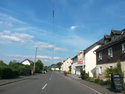
Bergischer Hof
Restaurant · German · 6.2 km
64 Pilgerstraße, Overath
Tu-Fr 17:00-22:00; Sa,Su,PH 11:00-22:00; Mo off
Bäckerei-Konditorei Müller
Cafe · Coffee Shop, Breakfast, Cake · 6.6 km
142 Zeithstraße, Neunkirchen-Seelscheid
Mo-Sa 06:30-19:00; Su, PH 07:30-16:00

Haus am Berg
Restaurant · German · 6.6 km
56 Bergstraße, Neunkirchen-Seelscheid
Tu-Sa 17:00-22:00; Su 11:00-22:00
Pizza Pan
Restaurant · Pizza · 5.7 km
1 Drabenderhöher Straße, Wiehl
Tu-Fr 11:00-22:00; Sa-Su 12:00-22:00
Bauernschänke Bröleck
Restaurant · 7.2 km
10 Felderhoferbrücke, Ruppichteroth
Tu-Fr 17:00+; Sa 14:00+; Su,PH 11:30+

Bäckerei Funken
Bakery · 3.5 km
4 Dorfstraße, Much
Tu-Fr 05:30-13:00,15:00-17:00,Sa 05:30-12:00,Su 07:00-11:00


43 more on the map.
Where to stay14
Churches and places of worship25
St. Georg
Church · Roman Catholic · 6.7 km
8 Pastor-Franz-Steden-Platz, Neunkirchen-Seelscheid
Evangelische Dorfkirche Seelscheid
Church · Protestant · 6.9 km
1 Pfarrer-Julius-Smend-Platz, Neunkirchen-Seelscheid
Shopping15
Gas and EV charging2
Schools, colleges and libraries13
Healthcare6
Map of Much
193 places. The map loads OpenStreetMap tiles when you open it.
Getting there and nearby towns
Cologne Bonn Airport (CGN) is the nearest airport with scheduled flights listed in OpenStreetMap, 19 km away.
- Ruppichteroth 9 km southeast, about 9 min by car
- Overath 9 km west, about 9 min by car
- Nümbrecht 10 km east, about 10 min by car
- Rösrath 16 km west, about 16 min by car
- Waldbröl 15 km east, about 15 min by car
- Siegburg 18 km southwest, about 18 min by car
- Bergisch Gladbach 21 km northwest, about 21 min by car
- Sankt Augustin 20 km southwest, about 20 min by car
- Troisdorf 21 km southwest, about 21 min by car
- Wipperfürth 24 km north, about 24 min by car
Drive times are estimates from straight-line distance, not routes.
Local news
Headlines from INDB.
Reviews, tips and questions
Loading what members have shared...
Sources and licences
- GeoNames (CC BY 4.0): population, coordinates, regions and time zone
- Mapillary (see each image): photos
- OpenStreetMap contributors (ODbL 1.0): places, airports, map data
- Wikidata (CC0 1.0): elevation, founding date, time zone, website, landmarks and historic places
- Wikimedia Commons (see each image): photos
- Wikipedia (CC BY-SA 4.0): overview and history text
Photo credits
- Much Hauptstrasse, The original uploader was Olbertz at German Wikipedia . ( Original text: Olbertz ), CC BY-SA 3.0
- Much Friedhof Denkmal, MoSchle, CC BY-SA 4.0
- Berliner Mauer in Much, MoSchle, CC BY 4.0
- Much Wegekreuz Liste 46 (2), Duschan1944, CC BY-SA 4.0
- Much Wegekreuz Engel Liste 46, Duschan1944, CC BY-SA 4.0
- Weihershagen, Jörg Kopp at de.wikipedia, CC BY-SA 3.0
- Industriemuseum Engelskirchen, Pingsjong, GFDL
- St. Martinus (Much)5, Chris06, CC0
- Burg Overbach Front, Olbertz at German Wikipedia, CC BY-SA 3.0
- Federath, Marialinden, Duhon, CC BY 3.0
- Marialinden St. Mariae Heimsuchung, Tohma ( talk ), CC BY-SA 4.0
- Mundloch Grube Penny, Drelm, CC BY-SA 3.0
- Ehemaliger Steinbruch bei Schönenberg an der B 478, heute Naturschutzgebiet - panoramio - Hatti1, Hatti1, CC BY-SA 3.0
- Evangelische Kirche (Drabenderhöhe) (01), Chris06, CC BY-SA 4.0
- St. Georg (Seelscheid) (01), Chris06, CC BY-SA 4.0
- St. Michael (Federath) (3), Chris06, CC BY-SA 4.0
- Evangelische Kirche (Marienberghausen) (01) 06, Chris06, CC BY-SA 4.0
- Kreuzweg-marialinden-station-6, Yvesklein111, CC BY-SA 4.0
- St.-Theresien-Gymnasium, Schambis2, CC BY-SA 4.0
- Grube Silberkaule.3, Pingsjong, GFDL
- St. Martinus (Much)1, Chris06, CC0
- Chirurg Solo, MoSchle, CC BY 3.0
- ISS066-E-172676 - View of Earth, Earth Science and Remote Sensing Unit , Lyndon B. Johnson Space Center, Public domain
- ISS060-E-79667 - View of Earth, Earth Science and Remote Sensing Unit, NASA Johnson Space Center, Public domain
- ISS066-E-172675 - View of Earth, Earth Science and Remote Sensing Unit , Lyndon B. Johnson Space Center, Public domain
- ISS066-E-168797 - View of Earth, Earth Science and Remote Sensing Unit , Lyndon B. Johnson Space Center, Public domain
- ISS064-E-5212 - View of Earth, Earth Science and Remote Sensing Unit, NASA Johnson Space Center, Public domain
- ISS066-E-168798 - View of Earth, Earth Science and Remote Sensing Unit , Lyndon B. Johnson Space Center, Public domain
- ISS060-E-79666 - View of Earth, Earth Science and Remote Sensing Unit, NASA Johnson Space Center, Public domain
- ISS031-E-66463 - View of Earth, Earth Science and Remote Sensing Unit , Lyndon B. Johnson Space Center, Public domain
- ISS065-E-391565 - View of Earth, Earth Science and Remote Sensing Unit , Lyndon B. Johnson Space Center, Public domain
- ISS050-E-13198 - View of Earth, Earth Science and Remote Sensing Unit , Lyndon B. Johnson Space Center, Public domain
- ISS030-E-160489 - View of Earth, Earth Science and Remote Sensing Unit , Lyndon B. Johnson Space Center, Public domain
- ISS065-E-396139 - View of Earth, Earth Science and Remote Sensing Unit , Lyndon B. Johnson Space Center, Public domain
- ISS066-E-171338 - View of Earth, Earth Science and Remote Sensing Unit , Lyndon B. Johnson Space Center, Public domain
- ISS066-E-171339 - View of Earth, Earth Science and Remote Sensing Unit , Lyndon B. Johnson Space Center, Public domain
- Tillinghausen (1), MoSchle, CC BY-SA 4.0
- Street-level photo, uwekoch, CC BY-SA 4.0
- Street-level photo, uwekoch, CC BY-SA 4.0
- Street-level photo, uwekoch, CC BY-SA 4.0
- Street-level photo, uwekoch, CC BY-SA 4.0
- Street-level photo, uwekoch, CC BY-SA 4.0
- Street-level photo, uwekoch, CC BY-SA 4.0
- Street-level photo, uwekoch, CC BY-SA 4.0
- Street-level photo, uwekoch, CC BY-SA 4.0
- Street-level photo, uwekoch, CC BY-SA 4.0
- Street-level photo, uwekoch, CC BY-SA 4.0
- Street-level photo, uwekoch, CC BY-SA 4.0
- Street-level photo, uwekoch, CC BY-SA 4.0
- Street-level photo, uwekoch, CC BY-SA 4.0
- Street-level photo, uwekoch, CC BY-SA 4.0
- Street-level photo, uwekoch, CC BY-SA 4.0
- Street-level photo, uwekoch, CC BY-SA 4.0
- Street-level photo, uwekoch, CC BY-SA 4.0


Page built November 8, 2026. Spotted a mistake? Tell us or suggest a place.