


Ruppichteroth, Germany
Ruppichteroth is a town of 10,749 people in North Rhine-Westphalia, Germany.
Why visit Ruppichteroth
Townapedia lists 35 museums and landmarks, 19 parks and trails, 27 places to eat, 6 places to stay and 9 attractions in and around town.
Highlights include Appelhof Hofladen, Hohes Wäldchen, Technik- und Bauernmuseum Berzbach and Pulvermühle Pferdebahn.
Weather in Ruppichteroth
Forecast from MET Norway (CC BY 4.0). Full forecast
About Ruppichteroth
Ruppichteroth is a municipality in the Rhein-Sieg district, in the southern part of North Rhine-Westphalia, Germany. It is located approximately 30 kilometers east of Bonn.
From the Wikipedia article Ruppichteroth (this version), under CC BY-SA 4.0.
Things to do9



Museums and landmarks35

Technik- und Bauernmuseum Berzbach
Museum · 6.4 km
Zus. Termine telef.; Auf Anfrage Bewirtung
30 Berzbach, Much
We 13:00-16:00; Fr 14:00-17:00; Sa 10:00-13:00



Burg Dattenfeld
Monument and historic site · 6.6 km
8 Burgstraße, Windeck


23 more on the map.
Parks, trails and playgrounds19


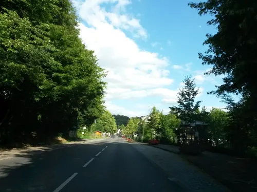
Feuchtgebiet Harscheider Bach-Tal bei Geringhauser Mühle
Hiking and trails · 5.8 km


Siegaue in den Gemeinden Windeck, Eitorf und der Stadt Hennef
Hiking and trails · 6.4 km
7 more on the map.
Restaurants and cafes27
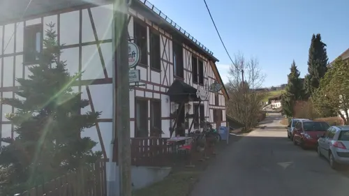
Kräutercafé
Cafe · Breakfast, Regional · 4.2 km
12 Geilenkausener Straße, Waldbröl
PH,Fr-Su 10:00-18:30

Balkanhaus
Restaurant · Balkan · 4.3 km
48 Hofstraße, Eitorf
Mo 17:00-22:00;We-Fr 17:00-22:00;Su,PH 12:00+;Oct-Mar Sa 16:00+
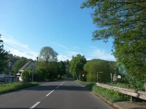
Bauernschänke Bröleck
Restaurant · 4.9 km
10 Felderhoferbrücke, Ruppichteroth
Tu-Fr 17:00+; Sa 14:00+; Su,PH 11:30+

Bäckerei Funken
Bakery · 5.4 km
4 Dorfstraße, Much
Tu-Fr 05:30-13:00,15:00-17:00,Sa 05:30-12:00,Su 07:00-11:00
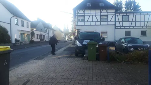
Blumen Café
Cafe · Coffee Shop · 6.7 km
120 Hauptstraße, Windeck
Mo, Th-Su 10:00-18:00
Eis Café Tormen
Ice cream
12 Brölstraße, Ruppichteroth
Mo-Su 11:30-20:30
Gaststätte Stommel
Restaurant · 5.8 km
2 Müllerhof, Much
We-Sa 17:00+, Su 10:00-14:30, 17:00+



15 more on the map.
Where to stay6
Churches and places of worship23
St. Maria Magdalena
Church · Catholic · 3.4 km
2 Am Kirchberg, Ruppichteroth
Kath. Kirche St. Konrad von Parzham
Church · Catholic · 5.7 km
3 Kirchweg, Waldbröl
Maria Hilfe der Christen
Church · Roman Catholic · 3.3 km
2 Sankt-Vinzenz-Straße, Ruppichteroth
Shopping7
Gas and EV charging3
Schools, colleges and libraries5
Healthcare1
Map of Ruppichteroth
135 places. The map loads OpenStreetMap tiles when you open it.
Getting there and nearby towns
Cologne Bonn Airport (CGN) is the nearest airport with scheduled flights listed in OpenStreetMap, 24 km away.
- Waldbröl 10 km east, about 10 min by car
- Siegburg 20 km west, about 20 min by car
- Sankt Augustin 22 km west, about 22 min by car
- Troisdorf 24 km west, about 24 min by car
- Bergisch Gladbach 29 km northwest, about 29 min by car
- Bonn 30 km southwest, about 30 min by car
- Wipperfürth 31 km north, about 31 min by car
- Zündorf 31 km west, about 31 min by car
- Köln 39 km west, about 39 min by car
- Siegen 38 km east, about 38 min by car
Drive times are estimates from straight-line distance, not routes.
Local news
Headlines from INDB.
Reviews, tips and questions
Loading what members have shared...
Sources and licences
- GeoNames (CC BY 4.0): population, coordinates, regions and time zone
- Mapillary (see each image): photos
- OpenStreetMap contributors (ODbL 1.0): places, airports, map data
- Wikidata (CC0 1.0): elevation, founding date, time zone, website
- Wikimedia Commons (see each image): photos
- Wikipedia (CC BY-SA 4.0): overview and history text
Photo credits
- Luftaufnahme Ruppichteroth, Wolkenkratzer, CC BY-SA 3.0
- Ruppichteroth, Mauer Burgstraße (2022), Rheinlausitzer, CC BY-SA 4.0
- Ruppichteroth, Burgstraße 28 (2022) 3, Rheinlausitzer, CC BY-SA 4.0
- Ruppichteroth, Burgstraße 28 (2022) 2, Rheinlausitzer, CC BY-SA 4.0
- Gaststätte "Wirtshaus an St. Severin" im Oberdorf Ruppichteroth - panoramio, Hatti1, CC BY-SA 3.0
- Ruppichteroth, Burgstraße 28 (2022) 1, Rheinlausitzer, CC BY-SA 4.0
- Ruppichteroth, Schustergasse 1 (2022), Rheinlausitzer, CC BY-SA 4.0
- Ruppichteroth, Haus Schorn (2022), Rheinlausitzer, CC BY-SA 4.0
- Marktstrasse in Ruppichteroth - panoramio, Hatti1, CC BY-SA 3.0
- Ruppichteroth, Marktstraße 6 (2022), Rheinlausitzer, CC BY-SA 4.0
- Ruppichteroth, Burgstraße 20 (2022), Rheinlausitzer, CC BY-SA 4.0
- Ruppichteroth, Zum Sperber 1 (2022) 2, Rheinlausitzer, CC BY-SA 4.0
- Ruppichteroth, Evangelisches Pfarrhaus (2022), Rheinlausitzer, CC BY-SA 4.0
- Ruppichteroth, Alte evangelische Schule (2022), Rheinlausitzer, CC BY-SA 4.0
- Ruppichteroth, Zum Sperber 1 (2022) 1, Rheinlausitzer, CC BY-SA 4.0
- Ruppichteroth, Zum Sperber 1 (2022) 3, Rheinlausitzer, CC BY-SA 4.0
- Ruppichteroth, St. Severin (2022), Rheinlausitzer, CC BY-SA 4.0
- Ruppichteroth, Alte Synagoge (2022) 1, Rheinlausitzer, CC BY-SA 4.0
- Ruppichteroth, Alte Synagoge (2022) 2, Rheinlausitzer, CC BY-SA 4.0
- Burg Dattenfeld 024, Wolkenkratzer, CC BY-SA 4.0
- Burg Herrnstein Auffahrt, Dieter Clasen (user Majortom7 at de.wikipedia ), CC BY-SA 2.0 de
- BurgruineHerrenbrölKeller, Dieter Clasen, CC BY-SA 2.0 de
- BlickvomHohenWäldchen, Dieter Clasen ( Benutzer:Majortom7 ), CC BY-SA 3.0 de
- St. Maria Magdalena, Dieter Clasen, CC BY-SA 2.0 de
- Ehemaliger Steinbruch bei Schönenberg an der B 478, heute Naturschutzgebiet - panoramio - Hatti1, Hatti1, CC BY-SA 3.0
- Siegaue SU-026 29.09.07, Ökologix, CC BY-SA 3.0
- Naturschutzgebiet Neuenhähnen photo-11, Velopilger, CC0
- Berkenroth, evangelische Kirche, Rauenstein, CC BY-SA 3.0
- Harscheid, Evangelische Kirche 1, Rauenstein, CC BY-SA 3.0
- V1NutscheidStützen, Dieter Clasen (user Majortom7 at de.wikipedia ), CC BY-SA 2.0 de
- Stolperstein Windeck Gutmannseichen Zum Wochenend 6 Josef Gauchel, Tomtom10, CC BY-SA 4.0
- Nordrhein-Westfalen, Windeck, Naturschutzgebiet SU-084, Hohes Wäldchen, David Dallmann, CC BY-SA 4.0
- Naturschutzgebiet Neuenhähnen photo-05, Velopilger, CC0
- Die Sieg bei Eitorf, Frank Brehm, CC BY-SA 4.0
- Wilberhofen Kapelle, Olbertz, CC BY-SA 3.0
- St.-Theresien-Gymnasium, Schambis2, CC BY-SA 4.0
- Burg Dattenfeld, Unknown author Unknown author, Public domain
- Schülerhilfe Rupp. - panoramio, Hatti1, CC BY-SA 3.0
- Kath. Kirche "St. Severin" - panoramio (1), Hatti1, CC BY-SA 3.0
- Kath. Kirche "St. Severin" - panoramio, Hatti1, CC BY-SA 3.0
- Street-level photo, uwekoch, CC BY-SA 4.0
- Street-level photo, raymond, CC BY-SA 4.0
- Street-level photo, uwekoch, CC BY-SA 4.0
- Street-level photo, changchun1, CC BY-SA 4.0
- Street-level photo, changchun1, CC BY-SA 4.0
- Street-level photo, uwekoch, CC BY-SA 4.0
- Street-level photo, uwekoch, CC BY-SA 4.0
- Street-level photo, uwekoch, CC BY-SA 4.0
- Street-level photo, uwekoch, CC BY-SA 4.0
- Street-level photo, uwekoch, CC BY-SA 4.0
- Street-level photo, changchun1, CC BY-SA 4.0
- Street-level photo, uwekoch, CC BY-SA 4.0
- Street-level photo, uwekoch, CC BY-SA 4.0
- Street-level photo, uwekoch, CC BY-SA 4.0


Page built November 8, 2026. Spotted a mistake? Tell us or suggest a place.