


Why visit Lohmar
Townapedia lists 167 museums and landmarks, 42 parks and trails, 183 places to eat, 17 places to stay and 31 attractions in and around town.
Highlights include Studiobühne Siegburg, Burg Lohmar, Bilderbuchmuseum and Siegessäule.
Weather in Lohmar
Forecast from MET Norway (CC BY 4.0). Full forecast
About Lohmar
Lohmar (German pronunciation: [ˈloːmaʁ] ; Ripuarian: Luhme) is a municipality and a town in the Rhein-Sieg district, in North Rhine-Westphalia, Germany.
From the Wikipedia article Lohmar (this version), under CC BY-SA 4.0.
Photos of Lohmar


Things to do31



Bauernlädchen Schiefelbusch
Farm and orchard · 4.1 km
Hofladen Bauerngut Schiefelbusch
1 Sülzaue, Lohmar
Tu-Fr 08:30-19:00, Sa 08:30-14:00; PH off



19 more on the map.
Museums and landmarks167



Atelier und Galerie Jürgen Schmitz
Museum · 4.6 km
21 Ringstraße, Siegburg
"Besichtigung nach telefonischer Vereinbarung"
Museum für Stadt- und Industriegeschichte (MUSIT)
Museum · 4.1 km
3 Burgallee, Troisdorf
Tu-Fr 11:00-17:00; Sa,Su 10:00-18:00

19 Hochbehälter Troisdorf 03
Monument and historic site · 4.5 km
Hochbehälter Gem.: Sieglar, Flur 19, Flurst. 143/13, Baujahr: 1903
155 more on the map.
Parks, trails and playgrounds42





30 more on the map.
Restaurants and cafes183
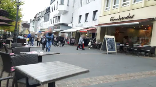
Capablanca (Zz. außen nur Getränke)
Restaurant · Italian, International · 4.6 km
16-19 Markt, Siegburg
Mo-We 09:00-24:00, Fr-Sa 09:00-02:00, Su 11:00-23:00
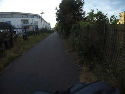
Latino im Nordbahnhof
Restaurant · Regional · 4.2 km
Bar/Café/Restaurant im ehem. Bahnhofsgebäude von 1887
4c Kronprinzenstraße, Siegburg
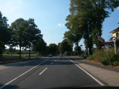
Touch down
Restaurant · American, Steak House, Mexican · 3.4 km
4 Bach
Mo-Th 15:00-23:30, Fr 15:00-02:00, Sa 14:00-02:00, Su 11:00-23:00
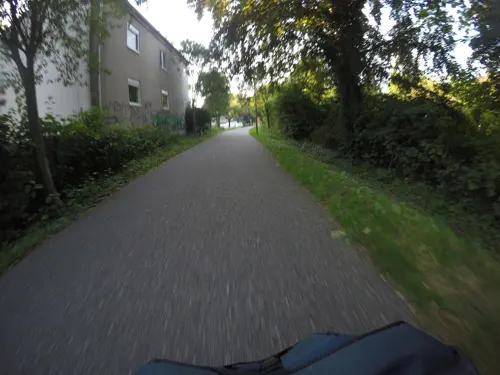
Zum Griechen
Restaurant · Greek · 4.1 km
Imbiss
111 Kaiserstraße, Siegburg
We-Fr,Su,Mo 12:00-14:00,16:30-21:00
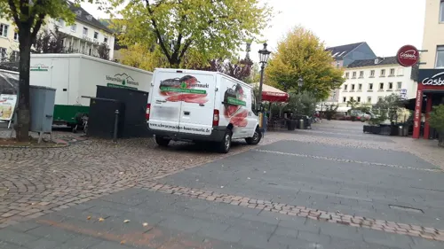
Casbah
Restaurant · Mediterranean, Burger · 4.7 km
37 Markt, Siegburg
Su-Th,PH 12:00-22:00; Fr-Sa 12:00-24:00
Chinesische Mauer
Restaurant · Chinese · 4.1 km
83-87 Zeithstraße, Siegburg
Mo-Sa 11:30-15:00,17:30-23:00; Su,PH 11:30-23:00
Eiscafé Teatro
Ice cream · Ice Cream · 4.6 km
30 Markt, Siegburg
Mo 09:00-21:00; Tu-Sa 09:00-23:00; Su 10:00-23:00

Kasserolle
Restaurant · German · 4.2 km
Hotel u. Restaurant
64 Seidenbergstraße, Siegburg
Mo-Sa 17:30-24:00, Su,PH 11:30-15:00

Bonjour
Cafe · Breakfast, Ice Cream, Cake · 4.4 km
50 Kaiserstraße, Siegburg
Mo-Fr 09:00-18:00, Sa 09:00-17:00
171 more on the map.
History
Lohmar was first mentioned as a donation of archbishop Sigewid to the church of Cologne. A farmyard in Lomereis mentioned.
Lohmar is also mentioned on the Arc de Triomphe in Paris as a place of Napoleon's visit. While his inspection of the army positioned in the Rhineland in 1811 he lived in Schloss Auel in Lohmar.
From the History section of Lohmar on Wikipedia, under CC BY-SA 4.0.
More about Lohmar
Geography
Lohmar is located about 20 km east of Cologne and 15 km north-east of Bonn in the Bergisches Land area. Because it is only 20 minutes by car to Cologne or Bonn, Lohmar is a popular place for commuters.
The municipality of Lohmar is divided into two parts: Lohmar itself and Wahlscheid 7 km to the north. About a third of the total population lives in Wahlscheid (a separate municipality until 1969). In total Lohmar comprises 30 districts. The most important are Lohmar itself (est. population approx. 9500), Donrath (2200), Heide (2100) and Birk (1400) in the south, as well as Wahlscheid (3200), Neuhonrath (2000), Honrath (1500) and Agger (1000) in the north.
Lohmar, Donrath, Wahlscheid, Neuhonrath and Agger are located in the Agger valley, the other villages in the uplands.
From the Wikipedia article Lohmar, under CC BY-SA 4.0.
Notable people from Lohmar
- Kelsang WangmoGerman-born Buddhist nun
Born in Lohmar, according to Wikidata (CC0). Each name links to its Wikipedia article.
Where to stay17
Churches and places of worship32
Shopping46
Gas and EV charging16
Schools, colleges and libraries28
Healthcare15
Map of Lohmar
250 places. The map loads OpenStreetMap tiles when you open it.
Getting there and nearby towns
Cologne Bonn Airport (CGN) is the nearest airport with scheduled flights listed in OpenStreetMap, 6 km away.
- Siegburg 4 km south, about 4 min by car
- Troisdorf 6 km southwest, about 6 min by car
- Rösrath 7 km north, about 7 min by car
- Sankt Augustin 7 km south, about 7 min by car
- Hennef (Sieg) 9 km southeast, about 9 min by car
- Wahn-Heide 8 km west, about 8 min by car
- Overath 12 km northeast, about 12 min by car
- Eil 11 km northwest, about 11 min by car
- Niederkassel 13 km west, about 13 min by car
- Bonn 14 km southwest, about 14 min by car
Drive times are estimates from straight-line distance, not routes.
Towns near Lohmar


Keep exploring
Local news
Headlines from INDB.
Reviews, tips and questions
Loading what members have shared...
Sources and licences
- GeoNames (CC BY 4.0): population, coordinates, regions and time zone
- Mapillary (see each image): photos
- OpenStreetMap contributors (ODbL 1.0): places, airports, map data
- Wikidata (CC0 1.0): elevation, founding date, time zone, website, landmarks and historic places
- Wikimedia Commons (see each image): photos
- Wikipedia (CC BY-SA 4.0): overview and history text
Photo credits
- Honrath2007, Bodes, Public domain
- NRW NSG Aggeraue bei Lohmar CDDA 378139 am Scharfeberg, Bagheera-mine, CC BY-SA 4.0
- Lohmar - Öffentlicher Bücherschrank Frouardplatz 2022-03-19, Svencb, CC BY-SA 4.0
- Pedal St. Johannes Lohmar, BigOrganFox, CC0
- Spieltisch St. Johannes Lohmar, BigOrganFox, CC0
- Spieltisch St. Johannes Enthauptung Lohmar, BigOrganFox, CC0
- Klais-Orgel St. Johannes Lohmar, BigOrganFox, CC0
- Lohmar Fachwerkhof Neuhof street view, May 2022, Corbeau~dewiki, CC BY-SA 4.0
- Kreuz 30b (A3) - Lohmar Nord (1000 m) - geo.hlipp.de - 6102, Sebastian und Kari on geo.hlipp.de, CC BY-SA 2.0
- A3 - Kreuz 30b - Lohmar-Nord (500m) - geo-en.hlipp.de - 11082, Sebastian und Kari, CC BY-SA 2.0
- Wegkreuz Lohmar Hauptstraße 2022-03-19, Svencb, CC0
- Ausfahrt 500 m - A484 bei Lohmar Nord - geo.hlipp.de - 6103, Sebastian und Kari on geo.hlipp.de, CC BY-SA 2.0
- A3 - Kreuz 30b, Lohmar-Nord - geo-en.hlipp.de - 12241, Sebastian und Kari, CC BY-SA 2.0
- Wegkreuz Lohmar O Crux Ave Spes Unica, Svencb, CC BY-SA 4.0
- A3 bei Lohmar - geo.hlipp.de - 6106, Sebastian und Kari on geo.hlipp.de, CC BY-SA 2.0
- A3 - Ausfahrt - A484 bei Lohmar Nord - geo-en.hlipp.de - 12242, Sebastian und Kari, CC BY-SA 2.0
- Ausfahrt - A484 bei Lohmar Nord - geo.hlipp.de - 6104, Sebastian und Kari on geo.hlipp.de, CC BY-SA 2.0
- Aggeraue zwischen Lohmar und Siegburg-5497, Raimond Spekking, CC BY-SA 4.0
- Studiobuehne-su01, A.Savin, CC BY-SA 3.0
- 2020-04-22-sankt-augustin-skulpturenweg-grantham-allee-20-induktion-02, Axel Kirch, CC BY-SA 4.0
- Burg Wissem, Tohma ( talk ) / Marcus Bentfeld, CC BY-SA 3.0
- Burg Lohmar Herrenhaus Südwestgiebel, Dieter Clasen (user Majortom7 at de.wikipedia ), CC BY-SA 2.0 de
- Haus Sülz, Dieter Clasen (user Majortom7 at de.wikipedia ), CC BY-SA 2.0 de
- Siegburg Siegessaeule, Olbertz, CC BY-SA 3.0
- Sankt Servatius Siegburg 2, Olbertz 19:39, 10. Jul. 2011 (CEST), CC BY-SA 3.0
- Stallenberger-Fischteicherp, Travus, CC BY-SA 3.0
- Trerichsweiher1, Olbertz, CC BY-SA 3.0
- St. Johannes Enthauptung (Lohmar) (04a), Chris06, CC BY-SA 4.0
- Anno Gymnasium Siegburg, Irgendwer Irgendwie, CC BY-SA 4.0
- Gymnasium Siegburg Alleestraße-2703, Raimond Spekking, CC BY-SA 4.0
- Totholz in der Wahner Heide, Reuleke, CC BY-SA 4.0
- Im Wald 2, Olli1188, CC BY-SA 3.0
- Christuskirche (Lohmar) (1) 01, Chris06, CC BY-SA 4.0
- Stadtkapelle Königin des Friedens, Siegburg-3194, Raimond Spekking, CC BY-SA 4.0
- Troisdorf-Mitte St. Gerhard Nordwestansicht 20220226 cropped, Glewe, CC BY-SA 4.0
- Im Wald 3, Olli1188, CC BY-SA 3.0
- Wahner Heide 2, Olbertz, CC BY-SA 3.0
- Siegburg, St. Servatius, 080b - K, Wolkenkratzer, CC BY-SA 4.0
- Stolperstein Siegburg Brauhof Salomon Seelig, Tomtom10, CC BY-SA 4.0
- A380 - panoramio, aachim3, CC BY 3.0
- Street-level photo, mfa, CC BY-SA 4.0
- Street-level photo, mfa, CC BY-SA 4.0
- Street-level photo, uwekoch, CC BY-SA 4.0
- Street-level photo, changchun1, CC BY-SA 4.0
- Street-level photo, uwekoch, CC BY-SA 4.0
- Street-level photo, uwekoch, CC BY-SA 4.0
- Street-level photo, uwekoch, CC BY-SA 4.0
- Street-level photo, poxonline, CC BY-SA 4.0
- Street-level photo, changchun1, CC BY-SA 4.0
- Street-level photo, mfa, CC BY-SA 4.0
- Street-level photo, poxonline, CC BY-SA 4.0
- Street-level photo, mfa, CC BY-SA 4.0
- Street-level photo, zuse, CC BY-SA 4.0
- Street-level photo, uwekoch, CC BY-SA 4.0
- Street-level photo, uwekoch, CC BY-SA 4.0
- Street-level photo, uwekoch, CC BY-SA 4.0
- Street-level photo, uwekoch, CC BY-SA 4.0
- Street-level photo, changchun1, CC BY-SA 4.0
- Street-level photo, changchun1, CC BY-SA 4.0
- Street-level photo, poxonline, CC BY-SA 4.0
- Street-level photo, uwekoch, CC BY-SA 4.0


Page built November 9, 2026. Spotted a mistake? Tell us or suggest a place.