


Why visit Elsdorf
Townapedia lists 65 museums and landmarks, 30 parks and trails, 145 places to eat, 12 places to stay and 13 attractions in and around town.
Highlights include Medio.Rhein.Erft, Obsthof Rainer Jobs, Pianomuseum Haus Eller and Burg Grouven.
Weather in Elsdorf
Forecast from MET Norway (CC BY 4.0). Full forecast
About Elsdorf
Elsdorf (German pronunciation: [ˈɛlsˌdɔʁf]) is a town in the Rhein-Erft-Kreis, in North Rhine-Westphalia, Germany. It is situated approximately 5 km south-west of Bergheim and 27 km west of Cologne.
From the Wikipedia article Elsdorf (this version), under CC BY-SA 4.0.
Things to do13


Obsthof Rainer Jobs
Farm and orchard · 5.3 km
41 Zur Gaulshütte, Bedburg
Sa 10:00-13:00

Hofladen Fam. Rüttgers
Farm and orchard · 3.7 km
Hähnsaler Hof, Bergheim
Tu 09:00-12:00; Fr 15:00-18:00; Sa 09:00-12:00; PH off

1 more on the map.
Museums and landmarks65


Burg Grouven
Monument and historic site · 2.5 km
48 Römerstraße, Elsdorf

Dresens Fahrradhaus
Monument and historic site · 5.3 km
39 Hauptstraße, Bergheim

Schloss Bedburg
Monument and historic site · 6.6 km
34 Graf-Salm-Straße, Bedburg



Energieausstellung
Museum · 4.2 km
Schließzeiten Weihnachten/Neujahr 19/20 und Karneval 2020 sind ergänzt
Sa,Su,PH 10:00-17:00


St. Albanus und Leonhardus
Monument and historic site · Roman Catholic · 6.7 km
7 Buirer Straße, Kerpen
Bergheimat
Museum · 5.2 km
55 Hauptstraße, Bergheim
Apr-Oct: Fr 14:00-16:00; Sa 11:00-13:00; Su 14:00-16:00
53 more on the map.
Parks, trails and playgrounds30

Bürgewald Blatzheimer Bürge
Hiking and trails · 5.0 km
Https://nsg.naturschutzinformationen.nrw.de/nsg/de/fachinfo/gebiete/gesamt/BM_026#tabs-4




Schlosspark Paffendorf
Park · 4.2 km
Apr-Sep: Mo-Su,PH 10:00-19:00; Oct: Mo-Su,PH 10:00-17:00; Nov-Mar:...
Am Anger
Playground · 6.9 km
Sandkasten mit Spielhäuschen, Rutsche, Holzwippe, Drehkreuz, Schaukel "Öffnungszeiten" 8-12 und 14-20Uhr, der Platz ist aber dauerhaft zugänglich
18 more on the map.
Restaurants and cafes145

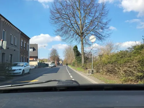
ICI
Restaurant · Steak House · 5.8 km
Argentinisches Steakhaus
7-9 Adolf-Silverberg-Straße, Bedburg
Tu-Th 19:00-24:00; Fr 18:00-24:00; Sa 00:00-01:00, 18:00-24:00; Su...

Alt Giesendorf
Restaurant · Regional · 1.3 km
91 Etzweilerstraße, Elsdorf
We-Sa 17:00-23:00; Su 11:30-14:30, 17:00-22:00; Mo off
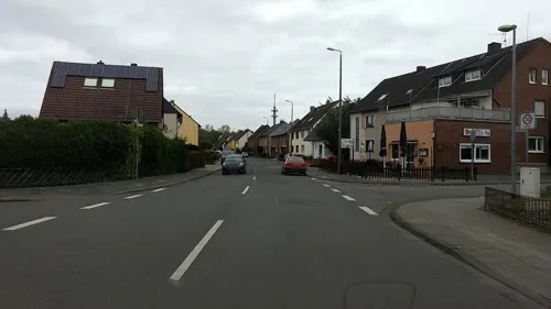
Brauhaus zur Krone
Restaurant · Regional · 5.1 km
78 Hauptstraße, Bergheim
Tu-Sa 11:30-14:30,17:00-24:00; Su, PH 12:00-21:00

Cafe Extrablatt
Cafe · Regional · 5.4 km
3 Hubert-Rheinfeld-Platz, Bergheim
Mo-Sa 08:30-23:30; Su 09:30-23:30
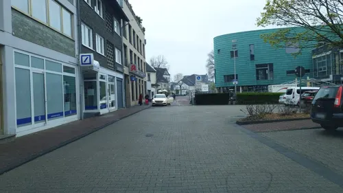
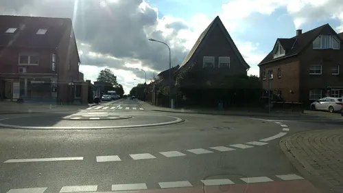
Da Pizza Boys
Restaurant · Pizza · 6.5 km
10 Wiedenaustraße, Bergheim
Mo-Sa 11:30-22:30; Th 12:00-22:30; Su 15:00-22:30
Eiscafe Cucco's
Ice cream · Ice Cream, Cake, Coffee
106 Köln-Aachener Straße, Elsdorf
Feb-Sep Mo-Sa 12:30-20:00; Feb-Sep Su 12:00-20:00; Feb-Sep Th off;...

Em Pittermännche
Bar and pub · Regional · 5.2 km
7 Zeiss-Straße, Bergheim
Mo-Fr 15:00-22:00; Sa 15:00-23:00; Su 13:00-22:00; Tu off; PH off


Empore
Restaurant · Turkish · 4.6 km
72A Bedburger Straße, Bergheim
Tu-Fr 16:00-22:00; Sa-Su 09:00-22:00
133 more on the map.
Where to stay12
Churches and places of worship38
Sankt Martinus
Church · Roman Catholic · 3.7 km
2 Kirchstraße, Elsdorf
Sankt Simon und Judas Thaddäus
Church · Roman Catholic · 5.5 km
6 Jülicher Straße, Elsdorf
St. Laurentius
Church · Roman Catholic · 1.8 km
2 Laurentiusstraße, Elsdorf
St. Luzia
Church · Roman Catholic · 1.0 km
2 Wilhelm-Sommer-Straße, Elsdorf
Alte St. Willibrord Kirche
Church · Catholic · 4.1 km
46 Theodor-Heuss-Straße, Bedburg
St. Cosmas und Damianus
Church · Catholic · 4.4 km
1 Pfarrer-Piel-Straße, Bergheim
St. Pankratius
Church · Catholic · 4.0 km
52 Glescher Straße, Bergheim
Shopping39
Gas and EV charging16
Schools, colleges and libraries27
Healthcare19
Medizinisches Versorgungszentrum der Cellitinnen
Clinic and pharmacy · 5.1 km
2 Klosterstraße, Bergheim
Praxis für Mund-, Kiefer- und Gesichtschirurgie
Clinic and pharmacy · 5.9 km
15 Blumenstraße, Bergheim
Map of Elsdorf
250 places. The map loads OpenStreetMap tiles when you open it.
Getting there and nearby towns
Flugplatz Würselen-Aachen (AAH) is the nearest airport with scheduled flights listed in OpenStreetMap, 30 km away.
- Niederzier 9 km southwest, about 9 min by car
- Kerpen 12 km southeast, about 12 min by car
- Jülich 15 km west, about 15 min by car
- Nörvenich 15 km south, about 15 min by car
- Grevenbroich 17 km north, about 17 min by car
- Frechen 17 km east, about 17 min by car
- Pulheim 18 km northeast, about 18 min by car
- Jüchen 19 km north, about 19 min by car
- Erftstadt 21 km southeast, about 21 min by car
- Langerwehe 20 km southwest, about 20 min by car
Drive times are estimates from straight-line distance, not routes.
Local news
Headlines from INDB.
Reviews, tips and questions
Loading what members have shared...
Sources and licences
- GeoNames (CC BY 4.0): population, coordinates, regions and time zone
- Mapillary (see each image): photos
- OpenStreetMap contributors (ODbL 1.0): places, airports, map data
- Wikidata (CC0 1.0): elevation, founding date, time zone, website
- Wikimedia Commons (see each image): photos
- Wikipedia (CC BY-SA 4.0): overview and history text
Photo credits
- Burg stammeln elsdorf, Klaus Graf, CC BY-SA 3.0
- Erftgymnasium, A.Savin, CC BY-SA 3.0
- Para-cycling German championships and Europe Cup 2016 08, Nicola, CC BY-SA 4.0
- Ahe Sindorfer Straße 19 02, Achim Raschka ( talk ), CC BY-SA 4.0
- Denkmal 018 - Haus Laach, DaRealFox, CC BY-SA 3.0
- Denkmal 005 - Burg Thorr, DaRealFox, CC BY-SA 3.0
- Medio.Rhein.Erft, Tohma, CC BY-SA 4.0
- Sankt-Pankratius-Kirche (Paffendorf) (1), Chris06, CC BY-SA 4.0
- Schloss Bedburg 6, Tohma ( talk ), CC BY-SA 4.0
- St. Remigius (Bergheim)1, Chris06, CC0
- St. Kosmas und Damian (Glesch) (1), Chris06, CC BY-SA 4.0
- St. Albanus und Leonhardus (Manheim) (01), Chris06, CC BY-SA 4.0
- Oberembt - Simon en Judas Thaddäuskerk 1, Hoebele, CC BY-SA 4.0
- Heppendorf Katholische Kirche 01, Achim Raschka ( talk ), CC BY-SA 4.0
- Kirdorf - Theodor-Heuss-Straße 46 Kirche, Alt-Sankt-Willibrordus III, NoRud, CC BY-SA 4.0
- Burg-grouven, A.Savin, CC BY-SA 3.0
- Schloss Bedburg 3, Tohma ( talk ), CC BY-SA 4.0
- Aachener Tor, Tohma ( talk ), CC BY-SA 4.0
- Burg Thorr; (4) Gesamtansicht, Denkmal-Nr. 5, Bergheim, Horst Schmitz, CC BY-SA 3.0
- Bedburg-Werwolfweg-Kasterer See 01, Dat doris, CC BY-SA 4.0
- Kirche Esch, Wickie37, CC BY-SA 3.0
- Kirche Angelsdorf, Wickie37, CC BY-SA 3.0
- Titz-Bettenhoven Denkmal-Nr. 16, Weidenstraße 4 (1640), Käthe und Bernd Limburg, www.limburg-bernd.de, CC BY-SA 3.0 de
- Ahe Kirche 01, Achim Raschka ( talk ), CC BY-SA 4.0
- SchlossPaffendorf, Bert, CC BY 2.0
- St. Pankratius, Paffendorf-0176, Raimond Spekking, CC BY-SA 4.0
- Kirchherten Am alten Kirchhof 103 Hahnsches Wegekreuz, NoRud, CC BY-SA 4.0
- Street-level photo, noel, CC BY-SA 4.0
- Street-level photo, walldi222, CC BY-SA 4.0
- Street-level photo, bigpapa2908, CC BY-SA 4.0
- Street-level photo, bigpapa2908, CC BY-SA 4.0
- Street-level photo, hektor1989, CC BY-SA 4.0
- Street-level photo, noel, CC BY-SA 4.0
- Street-level photo, etlam, CC BY-SA 4.0
- Street-level photo, mfa, CC BY-SA 4.0
- Street-level photo, noel, CC BY-SA 4.0
- Street-level photo, hirschkauz, CC BY-SA 4.0
- Street-level photo, Joshingalu, CC BY-SA 4.0
- Street-level photo, walldi222, CC BY-SA 4.0
- Street-level photo, hirschkauz, CC BY-SA 4.0
- Street-level photo, hirschkauz, CC BY-SA 4.0
- Street-level photo, etlam, CC BY-SA 4.0
- Street-level photo, noel, CC BY-SA 4.0
- Street-level photo, etlam, CC BY-SA 4.0
- Street-level photo, etlam, CC BY-SA 4.0
- Street-level photo, bigpapa2908, CC BY-SA 4.0
- Street-level photo, etlam, CC BY-SA 4.0
- Street-level photo, bigpapa2908, CC BY-SA 4.0
- Street-level photo, bigpapa2908, CC BY-SA 4.0
- Street-level photo, hirschkauz, CC BY-SA 4.0
- Street-level photo, asturksever, CC BY-SA 4.0
- Street-level photo, hirschkauz, CC BY-SA 4.0
- Street-level photo, walldi222, CC BY-SA 4.0
- Street-level photo, walldi222, CC BY-SA 4.0


Page built November 8, 2026. Spotted a mistake? Tell us or suggest a place.