


Erftstadt, Germany
Erftstadt is a town of 51,207 people in North Rhine-Westphalia, Germany.
Why visit Erftstadt
Townapedia lists 87 museums and landmarks, 70 parks and trails, 192 places to eat, 18 places to stay and 12 attractions in and around town.
Highlights include Wilhelmshöhe, Neocaridina & Co, Feierabendhaus and Burg Konradsheim.
Weather in Erftstadt
Forecast from MET Norway (CC BY 4.0). Full forecast
About Erftstadt
Erftstadt (German pronunciation: [ˈɛʁftˌʃtat] ) is a town located about 20 km south-west of Cologne in the Rhein-Erft-Kreis, state of North Rhine-Westphalia, Germany. It was created in July 1969 by the merger of the town Lechenich and the municipalities Dorweiler, Erp, Pingsheim, Bliesheim, Kierdorf, Liblar, Dirmerzheim, Gymnich, Borr, Friesheim, Niederberg and Wissersheim. The name of the town derives from the river that flows through it, the Erft.
From the Wikipedia article Erftstadt (this version), under CC BY-SA 4.0.
Photos of Erftstadt


Things to do12


Neocaridina & Co
Zoo and aquarium · 1.6 km
Online-Shop mit Abholoption für Wirbellose wie Garnelen, Schnecken und Aquaristikzubehör.
13 Hubert-Rüttger-Straße, Erftstadt
Mo-Sa 18:30-21:00

Berli
Cinema and theater · 6.8 km
Kann auch als Veranstaltungsort gemietet werden (amenity=event_location)
45-49 Wendelinusstraße, Hürth

Spargelhof Wolf
Farm and orchard · 4.9 km
Verkauf von Spargel, Erdbeeren und Freilandrosen aus dem Vorgebirge (Bornheim).
11 Vorpforte, Erftstadt
Museums and landmarks87


Gymnicher Mühle
Monument and historic site · Ice Cream · 6.2 km
8 Gymnicher Mühle, Erftstadt


75 more on the map.
Parks, trails and playgrounds70

Phantasialand
Sports field and stadium · 6.3 km
Amusement park
31-41 Berggeiststraße, Brühl
PH,Mo-Su 09:00-18:00


Naturparkzentrum Gymnicher Mühle
Sports field and stadium · 6.2 km
1 Gymnicher Mühle, Erftstadt
Th,Fr 14:00-18:00; Sa,Su,PH 11:00-17:00; May-Sep Sa,Su,PH 11:00-17:00



Ehemalige Kiesgrube bei Türnich
Hiking and trails · 6.4 km
Das Gebiet wird geschuetzt a) gemäß § 23 Absatz 1 Nr. 1 BNatschG zur Erhaltung, Entwicklung, Herstellung und Wieder- herstellung von...
Ehemaliges Munitionsdepot im Friesheimer Busch
Hiking and trails · 5.2 km
58 more on the map.
Restaurants and cafes192
Arnolds Schönes Leben Restaurant
Restaurant · German, Regional · 1.8 km
1 Haesstraße, Erftstadt
Mo-Su 12:00-14:00
Butcha
Restaurant · Burger · 2.6 km
28 Markt, Erftstadt
Mo off; Tu-Th 12:00-15:00,17:30-22:00; Fr 12:00-15:00,17:30-00:00;...
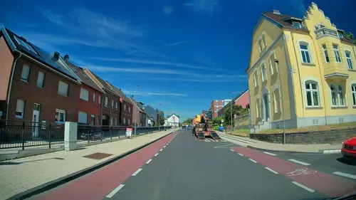
Böörner
Restaurant · German · 1.6 km
2 Brühler Straße, Erftstadt
Su-Th 17:00-23:00; Fr-Sa 17:00+; Tu off
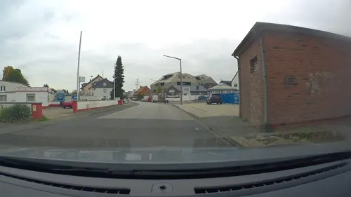
China Restaurant Ling
Restaurant · Chinese · 2.2 km
29 Bonner Ring, Erftstadt
Mo,We-Sa 11:30-15:00,17:30-22:30; Su,PH 11:30-22:30; Tu off
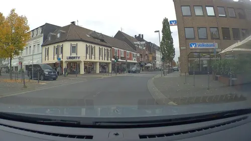

Bliesheimer Dorfgemeinschaftshaus "Em Dörp"
Restaurant · German · 4.1 km
63 Frankenstraße, Erftstadt
Th 18:00-21:00, Fr 18:00-22:00, Sa 12:30-21:00, Su 13:00-19:00

Haus Kreisch
Restaurant · Regional · 7.1 km
38 Rodderweg, Brühl
Mo, Tu, We, Fr 17:00-01:00; Sa 11:00-15:00, 17:00-01:00; Su...
Mamma Leone
Restaurant · Italian · 1.9 km
2c Holzdamm, Erftstadt
Tu-Fr 11:00-15:00,17:30-23:00; Sa,Su,PH 10:00-23:00
180 more on the map.
More about Erftstadt
Geography
Erftstadt is located 25 km north-west of Bonn. Its height ranges from 81 to 151 metres above sea level.
The town of Erftstadt consists of the following 14 Stadtbezirke (in brackets: population, 2023/03/01)
Most of the town administration is in Liblar, the most populous Stadtbezirk. The second-most populous Stadtbezirk is Lechenich.
Education
In Erftstadt are five further schools: two gymnasiums, two Realschulen and one Hauptschule. In Lechenich are the Theodor-Heuss-Schule, the only Hauptschule in Erftstadt. There also are the Realschule Lechenich and the Gymnasium Lechenich. The Realschule "Gottfried-Kinkel-Realschule" and the Gymnasium Ville-Gymnasium are located in Liblar. The only private school in Erftstadt, the Freie Waldorfschule Erftstadt, can be found in Liblar too. It is a primary and a secondary school.
The TH Köln plans to have a new faculty for Spatial development and infrastructure systems in Erftstadt.
There is one music school called Bernd-Alois-Zimmermann-Musikschule in Liblar.
From the Wikipedia article Erftstadt, under CC BY-SA 4.0.
Notable people from Erftstadt
 Carl SchurzUnion Army general, politician (1829-1906)Photo: Brady-Handy photograph collection, Public domain
- Manfred DonikeGerman racing cyclist and chemist (1933-95)
- Manfred DonikeGerman bicycle racer (1960-2003)
Born in Erftstadt, according to Wikidata (CC0). Each name links to its Wikipedia article.
Where to stay18
Churches and places of worship47
Shopping49
Gas and EV charging21
Schools, colleges and libraries44
Healthcare24
Map of Erftstadt
250 places. The map loads OpenStreetMap tiles when you open it.
Getting there and nearby towns
Cologne Bonn Airport (CGN) is the nearest airport with scheduled flights listed in OpenStreetMap, 25 km away.
- Türnich 6 km northwest, about 6 min by car
- Brühl 8 km east, about 8 min by car
- Hürth 8 km northeast, about 8 min by car
- Weilerswist 8 km southeast, about 8 min by car
- Kerpen 9 km northwest, about 9 min by car
- Frechen 11 km north, about 11 min by car
- Nörvenich 11 km west, about 11 min by car
- Sechtem 11 km east, about 11 min by car
- Wesseling 13 km east, about 13 min by car
- Köln 17 km northeast, about 17 min by car
Drive times are estimates from straight-line distance, not routes.
Towns near Erftstadt


Keep exploring
Local news
Headlines from INDB.
Reviews, tips and questions
Loading what members have shared...
Sources and licences
- GeoNames (CC BY 4.0): population, coordinates, regions and time zone
- Mapillary (see each image): photos
- OpenStreetMap contributors (ODbL 1.0): places, airports, map data
- Wikidata (CC0 1.0): elevation, founding date, time zone, website, landmarks and historic places
- Wikimedia Commons (see each image): photos
- Wikipedia (CC BY-SA 4.0): overview and history text
Photo credits
- Erftstadt-Rathaus-Liblar-1978, HOWI - Horsch, Willy, CC BY 3.0
- Phantasialand Brühl, Wolkenkratzer, CC BY-SA 3.0
- Erftstadt Konradsheim01, Achim Raschka ( talk ), CC BY-SA 3.0
- Ingang Maus au Chocolat, Wim Strijbosch, CC BY 3.0
- Erftstadt Bliesheim Sankt Lambertuskirche, HOWI - Horsch, Willy, CC BY 3.0
- Hürth-Knapsack Germany Feierabendhaus-03, CEphoto, Uwe Aranas, CC BY-SA 3.0
- FH-Bund, Wo st 01 (There are 682 Pictures in my Category ) See also Toolserver, CC BY-SA 3.0 de
- Schloss Tuernich Herrenhaus 2016, Sir Gawain, CC BY-SA 4.0
- Geister Rikscha - Phantasialand, JZ85, CC BY-SA 3.0
- Liblar Friedenskirche 03, Achim Raschka, CC BY-SA 4.0
- Max-Ernst-Gymnasium Brühl (1), ToLo46, CC BY-SA 4.0
- Hotel Tartüff (1), Mw007, CC BY-SA 4.0
- Feng Ju Palace - Phantasialand, JZ85, CC BY-SA 3.0
- Lechenich Markt Rathaus von Nordwesten, Hanna Stommel, CC BY 3.0
- Erftstadt Liblar evangelische Friedenskirche, HOWI - Horsch, Willy, CC BY 3.0
- Kierdorf Martinusplatz 11 Sankt Martinus, HOWI - Horsch, Willy, CC BY 3.0
- Erftstadt-Köttingen Otto-Hue-Straße 2 Pfarrkirche Sankt Josef, HOWI - Horsch, Willy, CC BY 3.0
- Kerpen-Brueggen Lukaskirche 01, Achim Raschka, CC BY-SA 3.0
- Raik-3, Stefan Scheer, CC BY-SA 4.0
- Friesheimer Busch im Nebel, Tulio K., CC BY-SA 4.0
- Naturschutzgebiet Ententeich BM-023 in Brühl, Rhein-Erft-Kreis, bedroht durch Freizeitpark-Erweiterung, Leucorrhinia, CC BY-SA 4.0
- 2024 Emmauskirche (Erftstadt-Gymnich) (1), Chris06, CC BY-SA 4.0
- Feierabendhaus Knapsack, bodoklecksel, CC BY-SA 3.0
- FLY-Phantasialand-1, Stefan Senger, CC BY-SA 4.0
- Phantasialand MysteryCastle, Stefan Scheer, CC BY 2.5
- Berggeistweiher Herbst 2018, Bornheim-Walberberg, UlrikeBrühl, CC BY-SA 4.0
- Altwald Bodenbewuchs001 fi8, Greenshooter, CC BY-SA 3.0
- HD - DSE00489 - Binsenweiher - 03, PWaeg, CC BY-SA 4.0
- Entenweiher 3, Michael Wittwer, CC BY-SA 4.0
- Muehle gymnich, Superbass, CC BY-SA 3.0
- Mystery Castle Tower, Tobiasi0, CC BY-SA 4.0
- Lechenich Kirche der Versöhnung, Achim Raschka, CC BY-SA 4.0
- Wilhelmshöhe-Hürth, Gelli63, CC BY-SA 4.0
- Berggeistweiher 2020, Michael Wittwer, CC BY-SA 4.0
- Burg Blessem 02, Tohma ( talk ), CC BY-SA 4.0
- Burg Blessem 01, Tohma ( talk ), CC BY-SA 4.0
- Burg Blessem 03, Tohma ( talk ), CC BY-SA 4.0
- Mr-Zero 03, Achim Raschka, CC BY-SA 4.0
- 2021-07 Blessem after flood 11, Achim Raschka, CC BY-SA 4.0
- 2021-07 Blessem after flood 07, Achim Raschka, CC BY-SA 4.0
- Brühl-NSG Am Schnorrenberg 03, Assenmacher, CC BY 4.0
- Street-level photo, walldi222, CC BY-SA 4.0
- Street-level photo, kalcaaro, CC BY-SA 4.0
- Street-level photo, kalcaaro, CC BY-SA 4.0
- Street-level photo, kalcaaro, CC BY-SA 4.0
- Street-level photo, kalcaaro, CC BY-SA 4.0
- Street-level photo, hirschkauz, CC BY-SA 4.0
- Street-level photo, noel, CC BY-SA 4.0
- Street-level photo, poxonline, CC BY-SA 4.0
- Street-level photo, hirschkauz, CC BY-SA 4.0
- Street-level photo, poxonline, CC BY-SA 4.0
- Street-level photo, poxonline, CC BY-SA 4.0
- Street-level photo, kalcaaro, CC BY-SA 4.0
- Street-level photo, Feuerundwasser, CC BY-SA 4.0
- Street-level photo, jaakkoh, CC BY-SA 4.0
- Street-level photo, noel, CC BY-SA 4.0
- Street-level photo, noel, CC BY-SA 4.0
- Street-level photo, noel, CC BY-SA 4.0
- Street-level photo, mfa, CC BY-SA 4.0
- Street-level photo, hirschkauz, CC BY-SA 4.0
- Street-level photo, raymond, CC BY-SA 4.0
- Street-level photo, noel, CC BY-SA 4.0
- Street-level photo, kalcaaro, CC BY-SA 4.0
- Street-level photo, kaivi, CC BY-SA 4.0
- Street-level photo, jaakkoh, CC BY-SA 4.0


Page built November 9, 2026. Spotted a mistake? Tell us or suggest a place.