


Why visit Frechen
Townapedia lists 47 museums and landmarks, 47 parks and trails, 232 places to eat, 22 places to stay and 15 attractions in and around town.
Highlights include Linden-Theater, Bühne der Kulturen, Keramion and Römergrab.
Weather in Frechen
Forecast from MET Norway (CC BY 4.0). Full forecast
About Frechen
Frechen (German pronunciation: [ˈfʁɛçn̩] ; Ripuarian: Frechem) is a town in the Rhein-Erft District, North Rhine-Westphalia, Germany.
From the Wikipedia article Frechen (this version), under CC BY-SA 4.0.
Photos of Frechen


Things to do15


Bühne der Kulturen
Cinema and theater · 8.4 km
Intercultural theatre in Cologne, Germany

Studiobühne Köln
Cinema and theater · 8.4 km
Theatre in Cologne, Germany


Berli
Cinema and theater · 4.5 km
Kann auch als Veranstaltungsort gemietet werden (amenity=event_location)
45-49 Wendelinusstraße, Hürth

Gartenoase Köln West
Farm and orchard · 2.3 km
103 Paul-R.-Kraemer-Allee, Frechen
Tu-Fr 09:00-18:00, Sa 09:00-14:00, PH off
Hofladen Gut Clarenhof
Farm and orchard · 2.5 km
14 Gut Clarenhof, Frechen
Sa 08:00-18:00; Mo-Fr 08:30-18:30; Su 10:00-18:00

Blick auf Köln Schlittberg
Scenic view · 4.2 km
Wunderschöner Blick aus der Ferne auf Köln mit guter Sicht auf die Skyline, u.a. Colonius und Dom
Haus am Bahndamm/Theater Harlekin
Cinema and theater · 1.4 km
113 Rosmarstraße, Frechen
3 more on the map.
Museums and landmarks47

Keramion
Museum · 1.3 km
12 Bonnstraße, Frechen
Mo off; Tu-Fr 10:00-17:00; Sa 14:00-17:00; Su 10:00-17:00




Bildstock für den Hl. Wendelinus
Monument and historic site · 5.2 km
Bilderstöckchen für den Heiligen Wendelinus. Hatte mich total überrascht, dass er in Köln verehrt wird.
Matthias Pingen
Monument and historic site · 4.3 km
Gedenkkreuz in Erinnerung an den hier 1931 im Streit erschlagenen Gutsbesitzer Mathias Pingen
35 more on the map.
Parks, trails and playgrounds47




Familienbad De Bütt
Sports field and stadium · 5.1 km
91 Sudetenstraße, Hürth
Tu-Fr 06:30-21:00; Sa-Su 09:00-21:00; PH Mo off

Erlebnisbad Fresh Open
Sports field and stadium · 1.4 km
65 Burgstraße, Frechen

35 more on the map.
Restaurants and cafes232
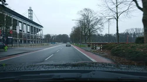
Playa in Cologne
Restaurant · German, Salad, Sausage, Fries · 4.7 km
1 Junkersdorfer Straße, Köln
Mo-Fr 17:00-23:00; Sa 14:00-23:00; Su 12:00-21:00; PH 14:00-23:00
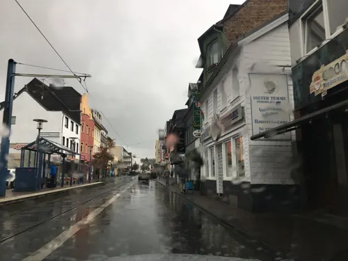
Adana Kebap
Restaurant · Kebab, Turkish · 0.7 km
135 Hauptstraße, Frechen
Mo-Fr 11:00-23:00; Sa,Su 11:30-23:00
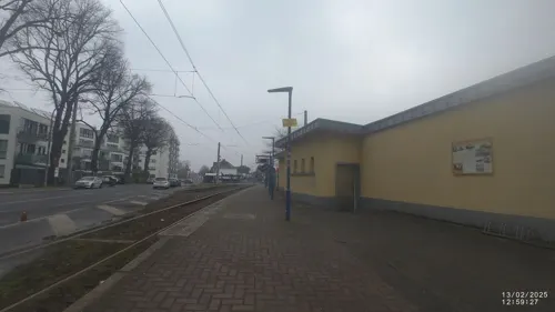
Alter Bahnhof Frechen
Restaurant · 0.8 km
39 Kölner Straße, Frechen
Tu-Th 17:00+; Sa 15:00+; Su 13:30+; PH 12:30+; Mo off
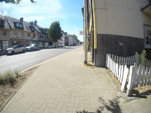
Altes Brauhaus
Restaurant · German · 3.7 km
616 Aachener Straße, Frechen
Mo-Fr 11:00-14:30,17:00+; Sa-Su 00:00-24:00
Anno Pomm Kartoffelhaus
Restaurant · German · 3.5 km
15-17 Wilhelm-von-Capitaine-Straße, Köln
Tu-Th 12:00-22:00; Fr-Sa 12:00-23:00; Su 12:00-21:30; Jun-Sep SH...
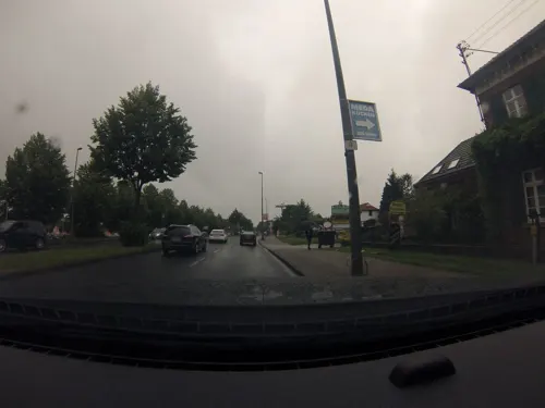
Filoxenia
Restaurant · Greek · 2.8 km
435 Dürener Straße, Köln
Mo-Fr 11:30-14:30,17:30-23:00; Sa 17:30-23:00
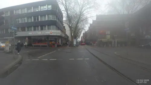
Hanoi Red
Restaurant · Asian · 0.7 km
139 Hauptstraße, Frechen
Th-Fr 11:00-16:00, 17:00-22:00; Sa-Su,PH 12:00-22:00
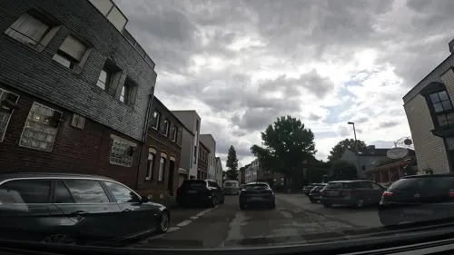
Junkersdorfer Hof
Restaurant · Regional · 3.5 km
11 Wilhelm-von-Capitaine-Straße, Köln
Mo-Fr 11:00-02:00, Sa 16:00-02:00, Su 11:30-02:00

220 more on the map.
History
Frechen was first mentioned in 877 and is situated at the western Cologne city border.
It is the site of the 1257 Battle of Frechen between Conrad von Hochstaden, Archbishop of Cologne and the people of the town. In the 16th century it became known for locally produced terra cotta products, especially the "Bartmannskrug" (beardman jug).
In the late 18th century lignite was industrially mined. Digging for lignite dominated the city's economy until the end of the 20th century, and in 1891 the first briquette factory was opened.
On 2 September 1951 Frechen received its city-rights including the villages of Bachem, Hücheln and Buschbell. On 1 January 1975 the nearby villages of Grefrath, Habbelrath, Königsdorf and Neufreimersdorf were also incorporated.
In 1971, the Keramion, a ceramics museum in a distinctive glass-enclosed modern structure designed by architect Peter Neufert, opened to display the extensive historic and contemporary collection of local collector Gottfried Cremer.
From the 1980s onwards an increasing number of industrial, commercial and service enterprises choose Frechen as their location, so that the town changed its features considerably.
From the History section of Frechen on Wikipedia, under CC BY-SA 4.0.
Notable people from Frechen
 AyọGerman singerPhoto: Bartek Kucharczyk, CC BY 2.0
 Björn OttoGerman pole vaulterPhoto: א (Aleph), CC BY-SA 2.5
 Lennart ThyGerman footballerPhoto: Northside, CC BY-SA 3.0
 Marcel HellerGerman footballerPhoto: Steffen Ewald, CC BY-SA 3.0
 Kirsten BolmGerman hurdlerPhoto: André Zehetbauer from Schwerin, Deutschland, CC BY-SA 2.0
 Andreas Stauffroad bicycle racerPhoto: Jérémy-Günther-Heinz Jähnick, CC BY-SA 3.0
 Janine JackowskiGerman film producerPhoto: Carlos Delgado, CC BY-SA 4.0
 Michael ReschkeGerman association football managerPhoto: Jeollo von http://www.vfb-exklusiv.de, CC BY-SA 3.0
- Sonja BertramGerman actress
- Claudia WeberGerman judoka
- André ElissenDutch politician, consultant and police officer
- Toni SchmückerGerman businessman (1921–1996)
Born in Frechen, according to Wikidata (CC0). Each name links to its Wikipedia article.
Where to stay22
Churches and places of worship36
Shopping74
Gas and EV charging27
Schools, colleges and libraries46
Healthcare20
Map of Frechen
250 places. The map loads OpenStreetMap tiles when you open it.
Getting there and nearby towns
Cologne Bonn Airport (CGN) is the nearest airport with scheduled flights listed in OpenStreetMap, 24 km away.
- Hürth 6 km southeast, about 6 min by car
- Türnich 7 km southwest, about 7 min by car
- Köln 10 km east, about 10 min by car
- Kerpen 9 km southwest, about 9 min by car
- Pulheim 9 km north, about 9 min by car
- Erftstadt 11 km south, about 11 min by car
- Brühl 12 km southeast, about 12 min by car
- Bergheim 13 km west, about 13 min by car
- Wesseling 15 km southeast, about 15 min by car
- Leverkusen 18 km northeast, about 18 min by car
Drive times are estimates from straight-line distance, not routes.
Towns near Frechen


Keep exploring
Local news
Headlines from INDB.
Reviews, tips and questions
Loading what members have shared...
Sources and licences
- GeoNames (CC BY 4.0): population, coordinates, regions and time zone
- Mapillary (see each image): photos
- OpenStreetMap contributors (ODbL 1.0): places, airports, map data
- Wikidata (CC0 1.0): elevation, founding date, time zone, website, landmarks and historic places
- Wikimedia Commons (see each image): photos
- Wikipedia (CC BY-SA 4.0): overview and history text
Photo credits
- Freiheitsring, Frechen - geo.hlipp.de - 23052, Oliver Dixon on geo.hlipp.de, CC BY-SA 2.0
- Aula Gymnasium Frechen, Tohma ( talk ), CC BY-SA 4.0
- Tram in Frechen, Köln - geo.hlipp.de - 3820, Dr Neil Clifton, CC BY-SA 2.0
- Tram in Frechen, Köln - geo.hlipp.de - 3818, Dr Neil Clifton, CC BY-SA 2.0
- Stadtbahnhaltestelle Frechen Kirche-094514039, Raimond Spekking, CC BY-SA 4.0
- Innenraum St. Audomar Frechen, Tohma ( talk ), CC BY-SA 4.0
- Christus Welterlöser - Franz Albermann - Frechen-9550, Raimond Spekking, CC BY-SA 4.0
- Christus Welterlöser - Franz Albermann - Frechen-9552, Raimond Spekking, CC BY-SA 4.0
- Christus Welterlöser - Franz Albermann - Frechen-9551, Raimond Spekking, CC BY-SA 4.0
- Christus Welterlöser - Franz Albermann - Frechen-9553, Raimond Spekking, CC BY-SA 4.0
- Tram in Frechen, Köln - geo.hlipp.de - 3819, Dr Neil Clifton, CC BY-SA 2.0
- Pietà, St. Audomar, Frechen-9554, Raimond Spekking, CC BY-SA 4.0
- Pietà, St. Audomar, Frechen-9555, Raimond Spekking, CC BY-SA 4.0
- Tram in Frechen, Köln - geo.hlipp.de - 4961, Dr Neil Clifton, CC BY-SA 2.0
- Frechen Altes Rathaus, Tohma ( talk ), CC BY-SA 4.0
- Fachhochschule des Mittelstands Frechen, Tohma ( talk ), CC BY-SA 4.0
- Frechen Bahnhof, Bahnsteig Fahrtrichtung Köln-8483, Raimond Spekking, CC BY-SA 4.0
- Frechen Bahnhof, Bahnsteig Fahrtrichtung Benzelrath-8484, Raimond Spekking, CC BY-SA 4.0
- Frechen Bahnhof, Bahnsteig Fahrtrichtung Benzelrath-9576, Raimond Spekking, CC BY-SA 4.0
- Freche Architektur in Frechen, Pimvantend, CC BY-SA 4.0
- Alpha Forum, Kölner Straße 108, Frechen-9575, Raimond Spekking, CC BY-SA 4.0
- Frechen Gewerbegebiet Kölner Straße - Luftaufnahme-0823, Raimond Spekking, CC BY-SA 4.0
- Frechen Gewerbegebiet Kölner Straße - Luftaufnahme-0825, Raimond Spekking, CC BY-SA 4.0
- Frechen Gewerbegebiet Kölner Straße - Luftaufnahme-0824, Raimond Spekking, CC BY-SA 4.0
- Arkadaş Theater, Köln-5172, Raimond Spekking, CC BY-SA 4.0
- Studiobühne Köln - Aussen-7864, Raimond Spekking, CC BY-SA 4.0
- Museum für ostasiatische Kunst (0480-82), Raimond Spekking, CC BY-SA 4.0
- Christus auferstehung 2009, Elke Wetzig ( Elya ), CC BY-SA 3.0
- Hauptgebäude der Universität zu Köln-5634, Raimond Spekking, CC BY-SA 4.0
- Deutsche Sporthochschule Köln, Haupteingang, Duhon, CC BY 3.0
- Drohnenaufnahme RheinEnergieStadion im Sportpark Müngersdorf-0551, Raimond Spekking, CC BY-SA 4.0
- Abtei-Gymnasium Brauweiler, Tohma ( talk ), CC BY-SA 4.0
- Alte Dorfkirche Köln-Junkersdorf 2, Chris06, CC BY-SA 4.0
- Burg Bachem 2, Tohma ( talk ), CC BY-SA 4.0
- St. Severin1a (Köln-Lövenich), Chris06, CC BY-SA 4.0
- Sankt Audomar Frechen, Tohma ( talk ), CC BY-SA 4.0
- Haus Bitz Hofansicht, Markus Volpers, CC BY-SA 3.0
- Römergrab Köln-Weiden - sarcophagus 01, Konrad Förstner, CC0
- Martin-Luther-Kirche Gleuel, Achim Raschka, CC BY-SA 3.0
- Keramion, Tohma, CC BY-SA 4.0
- Evangelische Kirche Frechen, Tohma ( talk ), CC BY-SA 4.0
- Rhein Center, Einkaufscenter in Köln-Weiden, Duhon, CC BY 3.0
- Linden-Theater Frechen, Tohma, CC BY-SA 4.0
- Heilig-Geist-Kirche (Köln-Weiden) (02), Chris06, CC BY-SA 4.0
- St. Marien Weiden, Tohma, CC BY-SA 4.0
- St. Pankratius (Köln-Junkersdorf)-cropped, File:St. Pankratius (Köln-Junkersdorf) (2).jpg : Chris06 derivative work: Elya, CC BY-SA 4.0
- Dietrich-Bonhoeffer-Kirche, Köln-Junkersdorf-7011, Raimond Spekking, CC BY-SA 4.0
- St. Dionysius Gleuel, tohma, CC BY-SA 4.0
- Fürstenbergmaar, Bernd Geßmann, CC BY-SA 3.0
- Huerther Waldsee 02, Achim Raschka ( talk ), CC BY-SA 4.0
- Georg-Büchner-Gymnasium, Köln-9872, Raimond Spekking, CC BY-SA 4.0
- Wilhelmshöhe-Hürth, Gelli63, CC BY-SA 4.0
- Müngersdorf (Köln), Ehrenmal zur Erinn. an das 14. Deutsche Turnfest 1928 (cropped), HOWI - Horsch, Willy, CC BY-SA 4.0
- Deutschland Köln Museumsgebäude Toyota, Buch-t, CC BY-SA 3.0 de
- Burg Schallmauer, Tohma ( talk ), CC BY-SA 4.0
- Street-level photo, countzero5, CC BY-SA 4.0
- Street-level photo, VIA_DT, CC BY-SA 4.0
- Street-level photo, chuck, CC BY-SA 4.0
- Street-level photo, VIA_DT, CC BY-SA 4.0
- Street-level photo, chuck, CC BY-SA 4.0
- Street-level photo, VIA_DT, CC BY-SA 4.0
- Street-level photo, chuck, CC BY-SA 4.0
- Street-level photo, chuck, CC BY-SA 4.0
- Street-level photo, chuck, CC BY-SA 4.0
- Street-level photo, mfa, CC BY-SA 4.0
- Street-level photo, noel, CC BY-SA 4.0
- Street-level photo, tobiasreg, CC BY-SA 4.0
- Street-level photo, delta1977, CC BY-SA 4.0
- Street-level photo, rmic, CC BY-SA 4.0
- Street-level photo, uwekoch, CC BY-SA 4.0
- Street-level photo, raymond, CC BY-SA 4.0
- Street-level photo, mfa, CC BY-SA 4.0
- Street-level photo, mfa, CC BY-SA 4.0
- Street-level photo, etlam, CC BY-SA 4.0
- Street-level photo, marccologne, CC BY-SA 4.0
- Street-level photo, countzero5, CC BY-SA 4.0
- Street-level photo, marccologne, CC BY-SA 4.0
- Street-level photo, mfa, CC BY-SA 4.0
- Street-level photo, raymond, CC BY-SA 4.0
- Street-level photo, Feuerundwasser, CC BY-SA 4.0
- Street-level photo, VIA_KK, CC BY-SA 4.0
- Street-level photo, VIA_DT, CC BY-SA 4.0
- Street-level photo, walldi222, CC BY-SA 4.0
- Street-level photo, raymond, CC BY-SA 4.0
- Street-level photo, countzero5, CC BY-SA 4.0


Page built November 9, 2026. Spotted a mistake? Tell us or suggest a place.