


Why visit Jülich
Townapedia lists 91 museums and landmarks, 39 parks and trails, 126 places to eat, 11 places to stay and 17 attractions in and around town.
Highlights include Goltsteinkuppe, Sophienhöhe, Brückenkopf Park and Glück-Auf Museum.
Weather in Jülich
Forecast from MET Norway (CC BY 4.0). Full forecast
About Jülich
Jülich (German pronunciation: [ˈjyːlɪç] ; in old spellings also known as Guelich or Gülich, Dutch: Gulik, French: Juliers, Ripuarian: Jöllesch) is a town in the district of Düren, in the federal state of North Rhine-Westphalia, in western Germany. As a border region between the competing powers in the Lower Rhine and Meuse areas, the town and the Duchy of Jülich played a historic role from the Middle Ages up to the 17th century.
From the Wikipedia article Jülich (this version), under CC BY-SA 4.0.
Photos of Jülich


Things to do17



Naturkost Jumpertz
Farm and orchard · 4.0 km
Onst, Gemuese und vieles weiteres aus eigener oder regionaler Produktion. 95% Biowaren
Tu 15:00-19:00; We 10:00-19:00; Sa 09:00-16:00; Fr 14:00-19:00
Kartoffelpower Karl-Heinz u Ina Albersmeier GbR
Farm and orchard · 6.3 km
Kartoffeln u Kartoffelprodukte

Tagebau Inden - Aussichtspunkt Schophoven
Scenic view · 6.3 km
View of Tagebau Inden

5 more on the map.
Museums and landmarks91

Brückenkopf Park
Monument and historic site · 1.2 km
Mar-Oct: Mo-Su 09:00-18:00; Nov-Feb: Mo-Su 10:00-16:30

Glück-Auf Museum
Museum · 6.4 km
8a Dietrich-Mülfahrt-Straße, Aldenhoven
Apr 1- Oct 31 Th 17:00-23:00; Apr 1- Oct 31 Su 14:00-17:00; Nov...

Infopavillon
Museum
In der Zitadelle
Apr-Oct Tu-Fr 14:00-17:00, Sa-Su 11:00-17:00; Nov-Mar Sa, Su 11:00-17:00

Stationsweg zu Ehren der sieben Schmerzen Mariens
Monument and historic site · Catholic · 4.6 km
Von der Baronin Margareta von Loe (Haus Overbach) zur Abwendung der Pestgefahr Ende des 16. Jahrhunderts gestiftet. Die heutige...


Gutshof Burg Wolfshoven
Monument and historic site · 3.6 km
Vierseitige Hofanlage an der Hauptstraße in Stetternich. An der Straßenseite steht eine Scheune, ein Unterstellplatz mit alten...

Stationsweg zu Ehren der sieben Schmerzen Mariens
Monument and historic site · Catholic · 4.0 km
Von der Baronin Margareta von Loe (Haus Overbach) zur Abwendung der Pestgefahr Ende des 16. Jahrhunderts gestiftet. Die heutige...


Burg Dürboslar
Monument and historic site · 7.6 km
26 Burgstraße, Aldenhoven

Langweiler
Monument and historic site · 8.9 km
Archaeological site in the Merzbach Valley of Western Germany
79 more on the map.
Parks, trails and playgrounds39




Ruraue vom Merkener Busch bis zum Rurauenwald Indemündung
Hiking and trails · 6.2 km
Wälder um das Forschungszentrum Jülich mit ehemaligem Eisenbahn- Ausbesserungswerk
Hiking and trails · 3.6 km

27 more on the map.
Restaurants and cafes126
Felix Backhandwerk
Bakery · 2.5 km
4 Am Brainergy Park
Tu-Fr 05:00-18:00; Sa 06:00-13:00; Su 06:30-11:00

Cafe Extrablatt
Cafe · Burger, Pizza, Coffee Shop, Ice Cream, American
11 Marktplatz, Jülich
Mo-Sa 08:00-24:00; Su,PH 09:30-24:00

Indemann 1
Restaurant · International · 7.9 km
1 Indemann, Inden
We-Fr 12:00-20:00; Sa,Su 10:00-20:00; Mo,Tu off
Restaurant Olympia im Broicher Hof
Restaurant · 3.4 km
Griechisches Restaurant
72 Alte Dorfstraße, Jülich
Tu-Sa 17:00-24:00; Su 10:00-24:00
Steakhaus El Toro
Restaurant · German, Steak House
34 Große Rurstraße, Jülich
Mo-Sa 11:30-14:30, Fr,Sa 17:30-23:00, Su,PH 11:30-22:00, Mo-Th 17:30-22:00
114 more on the map.
History
Jülich is first mentioned in Roman times as Juliacum along an important road through the Rur valley. Fortified during the late Roman period, it was taken over by the Franks and grew to be the centre of a county which became the nucleus of a regional power. The counts and dukes of Jülich extended their influence during the Middle Ages and granted Jülich city status in 1234 (Count Wilhelm IV). During battles with the Archbishop of Cologne, Jülich was destroyed in 1239 and again in 1278.
In 1416, the city was granted fiscal independence by Duke Rainald of Jülich-Geldern.
Following a fire in 1547, the city was rebuilt as an ideal city in the Renaissance style under the direction of the architect Alessandro Pasqualini.
The citadel of Jülich was later visited by the French military engineer Sébastien le Prestre de Vauban and was rated exemplary.
After the ducal family line was extinguished in 1609, the Duchy of Jülich was divided in the War of the Jülich Succession; as part of that war, the fortress at Jülich was occupied by Emperor Rudolph's forces. The 1610 siege by Dutch, Brandenburg and Palatine forces led to the surrender and withdrawal of Imperial troops.
Read more of the history
Jülich was occupied by the Dutch Republic until 1621-22 when the Spanish took the fortress after a five months of siege. Control of the city later fell to Palatinate-Neuburg, then the Electorate of the Palatinate (1685) and Bavaria (1777).
From 1794 to 1814, Jülich was part of France under the name of Juliers. The French added the Napoleonic bridge head to the fortifications. In 1815, Jülich became a Prussian fortification and district town. The town was subsequently administered within the Prussian Province of Jülich-Cleves-Berg (1815) and then the Rhine Province (1822). The fortification was razed in 1860.
During World War II, forced laborers of the 3rd SS construction brigade were dispatched in the town in 1943. On 16 November 1944, 97% of Jülich was destroyed during Allied bombing, since it was considered one of the main obstacles to the occupation of the Rhineland, although the city fortifications, the bridge head and the citadel had long fallen into disuse. The ruined city was subject to heavy fighting for several months until the Allies eventually managed to cross the Ruhr on 23 February 1945. Newsreel footage exists of Supreme Commander Eisenhower at the southern entrance to the citadel.
Jülich became part of the new state of North Rhine-Westphalia after the war. From 1949 to 1956, the town centre was rebuilt along the plans of the Renaissance town.
In 1998, the state garden fair took place in Jülich. This made the extensive restoration of the bridge head fortifications and the establishment of a large leisure park, the bridge head park, possible.
In June 2025, Jupiter, an exascale supercomputer hosted at Forschungszentrum Jülich in North Rhine-Westphalia, Germany, became operational .It was developed by the Jülich Supercomputing Centre (JSC) and owned by the European High-Performance Computing Joint Undertaking (EuroHPC JU). It is based on a modular architecture featuring NVIDIA GH200 Grace Hopper Superchips and is recognized as Europe's fastest supercomputer, ranking 4th on the November 2025 TOP500 list of the world's fastest supercomputers. Jupiter is also the most energy-efficient system among the top five.
Today, Jülich is mainly known for Forschungszentrum Jülich (established in 1956) and the satellite campus of the Fachhochschule Aachen (established in 1970). The town's landmark is the Witch Tower, a city gate and remnant of the medieval city fortifications. The most impressive remnants from the past are, however, both the Napoleonic Bridgehead and the Citadel.
From the History section of Jülich on Wikipedia, under CC BY-SA 4.0.
More about Jülich
Geography
Jülich stands in the Rur valley on the banks of the river Rur. The town is bordered by the town of Linnich in the north, the municipality of Titz in the northeast, the municipality of Niederzier in the southeast, the municipality of Inden in the south, and by the municipality of Aldenhoven in the west. Its maximum size is 13.3 km from east to west and 10.9 km from north to south.
The highest point in Jülich is in Bourheim, 110 m above sea level (excepting Sophienhöhe, an extensive artificial mountain made up of overburden from a nearby open-pit lignite mine, the Tagebau Hambach). The lowest point, 70 m above sea level, lies in the borough of Barmen.
Arts and culture
In 1956 the WDR broadcaster established the first short wave transmitter near the borough of Mersch. In subsequent years this site was expanded. On September 1, 1961, this site was handed over to the German Federal Post for establishing the German foreign broadcasting service, "Deutsche Welle". In the course of time 10 transmitters of 100 kilowatts were installed, and transmitting antennas were installed, consisting of enormous dipole arrays between free-standing steel framework towers. Later these transmitters were rented predominantly to non-German broadcasting organisations. In the 90's on the area of the shortwave transmission facility a medium wave transmitter was also installed, using a long wire antenna which was mounted on a tower on the transmitter site. It was intended to be used for transmitting the programmes of radio Viva on 702 kHz, but it never went into regular service for this broadcaster. From December 6, 2004, to May 2006, the medium-wave transmitter was used to broadcast the output of the German commercial broadcaster "TruckRadio" on 702 kHz. In 2006 the shortwave-facilities were sold to the British entrepreneur Robert Edmiston and his Christian Vision-organization. However, on October 24, 2009, the site was shut down and antennas and transmitters were subsequently dismantled.
From the Wikipedia article Jülich, under CC BY-SA 4.0.
Notable people from Jülich
 Johann Wilhelm SchirmerGerman landscape artist (1807-1863)Photo: Unknown author Unknown author, Public domain
 Anton Hubert FischerCatholic cardinal (1840-1912)Photo: Max Hasak (1856-1934), Public domain
 Maria of Jülich-BergSpouse of John III, Duke of ClevesPhoto: Unknown author Unknown author, Public domain
 Robert LeipertzGerman footballerPhoto: User:Hunter178, CC BY-SA 3.0
 Hans-Dieter LucasGerman diplomatPhoto: Embassy of Poland in Paris, CC BY 3.0 pl
 Rudolf von WaldenfelsGerman film actor and writerPhoto: Realclearworld, CC BY-SA 4.0
 Britta DasslerGerman politicianPhoto: Harald Krichel, CC BY-SA 4.0
- William II of BergCount of Berg, elevated to Duke of Berg (ca. 1348-1408)
- Frederick StockGerman composer (1872–1942)
- Martin BojowaldGerman physicist and relativity theorist (born 1973)
- Alexander MeyerGerman footballer born 1983
- Johannes FabryGerman physician (1860-1930)
Born in Jülich, according to Wikidata (CC0). Each name links to its Wikipedia article.
Where to stay11
JUFA Energiewelt Indeland (Jugendgästehaus)
Motel and hotel · 1.4 km
13 Rurauenstraße, Jülich
Churches and places of worship67
Heilige Maurische Märtyrer
Church · Catholic · 3.2 km
3 Sankt-Mauri-Straße, Jülich
St. Stephanus
Church · Roman Catholic · 4.7 km
18 Altenburger Straße, Jülich
Shopping38
Gas and EV charging15
Schools, colleges and libraries21
Healthcare10
Map of Jülich
250 places. The map loads OpenStreetMap tiles when you open it.
Getting there and nearby towns
Flugplatz Würselen-Aachen (AAH) is the nearest airport with scheduled flights listed in OpenStreetMap, 17 km away.
- Aldenhoven 6 km southwest, about 6 min by car
- Niederzier 8 km southeast, about 8 min by car
- Inden 9 km south, about 9 min by car
- Niedermerz 8 km southwest, about 8 min by car
- Linnich 9 km northwest, about 9 min by car
- Titz 10 km northeast, about 10 min by car
- Langerwehe 12 km south, about 12 min by car
- Baesweiler 12 km west, about 12 min by car
- Eschweiler 13 km southwest, about 13 min by car
- Alsdorf 15 km west, about 15 min by car
Drive times are estimates from straight-line distance, not routes.
Towns near Jülich


Keep exploring
Local news
Headlines from INDB.
Reviews, tips and questions
Loading what members have shared...
Sources and licences
- GeoNames (CC BY 4.0): population, coordinates, regions and time zone
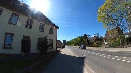
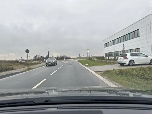
- Mapillary (see each image): photos
- OpenStreetMap contributors (ODbL 1.0): places, airports, map data
- Wikidata (CC0 1.0): elevation, founding date, time zone, website, landmarks and historic places
- Wikimedia Commons (see each image): photos
- Wikipedia (CC BY-SA 4.0): overview and history text
Photo credits
- Hexenturm Jülich-DSC 0004w, Peter Haas, CC BY-SA 3.0
- Jülichschwanenteich2, papa1234, CC BY-SA 3.0
- Kaiser-Friedrich-Denkmal, Schlossplatz, Jülich-0810, Raimond Spekking, CC BY-SA 4.0
- Kaiser-Friedrich-Denkmal, Schlossplatz, Jülich-0811, Raimond Spekking, CC BY-SA 4.0
- Jülich Bücher, Piccippi, CC BY-SA 4.0
- Altes Rathaus, Marktplatz 1, Jülich-0787, Raimond Spekking, CC BY-SA 4.0
- Altes Rathaus, Marktplatz 1, Jülich-0788, Raimond Spekking, CC BY-SA 4.0
- Wappen von Jülich am Alten Rathaus, Marktplatz 1, Jülich-0790, Raimond Spekking, CC BY-SA 4.0
- Brueckenkopf01-DaB., de:Markus Schweiß, CC BY-SA 3.0
- Burg Dürboslar1-4, Burg_Dürboslar1.jpg : Eschweiler derivative work: Saibo ( Δ ), Public domain
- HausOverbach-Bibliothek, David Mülheims, Gymnasium Haus Overbach, CC BY-SA 2.5
- Gymnasium Zitadelle Jülich - Pädagogisches Zentrum und Südflügel-4450, Raimond Spekking, CC BY-SA 4.0
- Jülich-Bourheim Denkmal-Nr. 67, Wasserburg Linzenich (908), Käthe und Bernd Limburg, www.limburg-bernd.de, CC BY-SA 3.0 de
- Bergmannshaus und Bergbaumuseum Aldenhoven, F. Fiedler, CC BY-SA 3.0
- Zitadelle-Pulvermagazin, Christopher Meyer-Kretschmer, Public domain
- Jülich-Barmen Denkmal-Nr. 45, Schloß Kellenberg (851), Käthe und Bernd Limburg, www.limburg-bernd.de, CC BY-SA 3.0 de
- Sophienhöhe l, Unknown author, CC BY-SA 3.0
- Stadtbuecherei-Juelich, Christa Bartel, CC BY-SA 3.0
- St. Rochus Jülich 2009 8799, Elke Wetzig ( Elya ), CC BY-SA 3.0
- BourheimKirche, LittleBoyFromCrowdhousen at German Wikipedia, CC BY-SA 3.0 de
- Christuskirche Jülich-4457, Raimond Spekking, CC BY-SA 4.0
- St Martinus1, Bodoklecksel, CC BY-SA 3.0
- Gedächtniskapelle bei Neu Lohn, 822drei, CC BY-SA 4.0
- Jülich-Barmen Denkmal-Nr. 23, Gansweid - Kirchstraße (784), Käthe und Bernd Limburg, www.limburg-bernd.de, CC BY-SA 3.0 de
- Jülich-Bourheim Denkmal-Nr. 67, Wasserburg Linzenich (907), Käthe und Bernd Limburg, www.limburg-bernd.de, CC BY-SA 3.0 de
- Jülich-Stetternich Denkmal-Nr. 34, Wolfshovener Straße 213 (816), Käthe und Bernd Limburg, www.limburg-bernd.de, CC BY-SA 3.0 de
- Jülich-Barmen Denkmal-Nr. 23e, Auf der Heide Wäldchen (789), Käthe und Bernd Limburg, www.limburg-bernd.de, CC BY-SA 3.0 de
- BourgBourheimSW, Sir Gawain, CC BY-SA 3.0
- Niederzier-Hambach Denkmal-Nr. 6, Schloßstraße 117 (1458), Käthe und Bernd Limburg, www.limburg-bernd.de, CC BY-SA 3.0 de
- NSG Prinzwingert WDPA ID 165043 Zugang III, NoRud, CC BY-SA 4.0
- NSG Quellteiche bei Linnich In Trockenperiode mit Restwasser III, NoRud, CC BY-SA 4.0
- Burg-Obbendorf-01, Superbass, CC BY-SA 3.0
- Titz-Hasselsweiler Denkmal-Nr. 19, Westend 4 (1644), Käthe und Bernd Limburg, www.limburg-bernd.de, CC BY-SA 3.0 de
- Jülich-Mersch Denkmal-Nr. 14, Hahnengasse 1 (761), Käthe und Bernd Limburg, www.limburg-bernd.de, CC BY-SA 3.0 de
- Titz-Müntz Denkmal-Nr. 22, Raiffeisenstraße (1657), Käthe und Bernd Limburg, www.limburg-bernd.de, CC BY-SA 3.0 de
- Jülich-Selgersdorf Denkmal-Nr. 42, Altenburger Straße 18 (835), Käthe und Bernd Limburg, www.limburg-bernd.de, CC BY-SA 3.0 de
- Gedenkkapelle Lohn 10-2010, EveryPicture, CC BY-SA 3.0
- Linnich-Boslar Denkmal-Nr. 8, Gereonstraße - Pferdegasse (6534), Käthe und Bernd Limburg, www.limburg-bernd.de, CC BY-SA 3.0 de
- Niederzier-Hambach Denkmal-Nr. 3, Bachstraße 1 (1455), Käthe und Bernd Limburg, www.limburg-bernd.de, CC BY-SA 3.0 de
- Linnich-Tetz Denkmal-Nr. 57, Lambertusstraße 20 (6582), Käthe und Bernd Limburg, www.limburg-bernd.de, CC BY-SA 3.0 de
- Iulicum Model, -- Hannibal21 07:55, 26. Aug. 2007 (CEST), CC BY-SA 3.0
- Mgj-juelich, A.Savin, CC BY-SA 3.0
- Tagebau Inden, gesehen von der Goltsteinkuppe-0178, Raimond Spekking, CC BY-SA 4.0
- Street-level photo, hektor1989, CC BY-SA 4.0
- Street-level photo, madel, CC BY-SA 4.0
- Street-level photo, noel, CC BY-SA 4.0
- Street-level photo, noel, CC BY-SA 4.0
- Street-level photo, hektor1989, CC BY-SA 4.0
- Street-level photo, hektor1989, CC BY-SA 4.0
- Street-level photo, hektor1989, CC BY-SA 4.0
- Street-level photo, hektor1989, CC BY-SA 4.0
- Street-level photo, hektor1989, CC BY-SA 4.0
- Street-level photo, hektor1989, CC BY-SA 4.0
- Street-level photo, Angi2026, CC BY-SA 4.0
- Street-level photo, noel, CC BY-SA 4.0
- Street-level photo, endradon, CC BY-SA 4.0
- Street-level photo, poxonline, CC BY-SA 4.0
- Street-level photo, hektor1989, CC BY-SA 4.0
- Street-level photo, madel, CC BY-SA 4.0
- Street-level photo, Angi2026, CC BY-SA 4.0
- Street-level photo, hektor1989, CC BY-SA 4.0
- Street-level photo, madel, CC BY-SA 4.0
- Street-level photo, hektor1989, CC BY-SA 4.0
- Street-level photo, FahrradstadtAachen, CC BY-SA 4.0
- Street-level photo, hektor1989, CC BY-SA 4.0
- Street-level photo, hektor1989, CC BY-SA 4.0
- Street-level photo, hektor1989, CC BY-SA 4.0


Page built November 9, 2026. Spotted a mistake? Tell us or suggest a place.