


Erkelenz, Germany
Erkelenz is a town of 44,650 people in North Rhine-Westphalia, Germany.
Why visit Erkelenz
Townapedia lists 143 museums and landmarks, 36 parks and trails, 161 places to eat, 15 places to stay and 15 attractions in and around town.
Highlights include Einkaufen auf dem Bauernhof Küppers, Hofladen Buscherhof, Museum für Europäische Volkstrachten and Flachsmuseum.
Weather in Erkelenz
Forecast from MET Norway (CC BY 4.0). Full forecast
About Erkelenz
Erkelenz (German pronunciation: [ˈɛʁkəlɛnts] , Limburgish: Erkelens [ˈæʀ(ə)kəlæns]) is a town in the Rhineland in western Germany that lies 15 kilometres (9 miles) southwest of Mönchengladbach on the northern edge of the Cologne Lowland, halfway between the Lower Rhine region and the Lower Meuse. It is a medium-sized town (over 44,000) and the largest in the district of Heinsberg in North Rhine-Westphalia.
From the Wikipedia article Erkelenz (this version), under CC BY-SA 4.0.
Photos of Erkelenz


Things to do15


Einkaufen auf dem Bauernhof Küppers
Farm and orchard · 6.7 km
4 Heidekamp, Wegberg
Mo-Fr 09:00-18:30; Sa 09:00-13:00
Hofladen Buscherhof
Farm and orchard · 7.1 km
172 Heinrich-Korsten-Straße, Mönchengladbach
Th-Fr 09:00-12:00,14:30-18:00; Sa 08:30-13:00; Su-We, PH off

Kreskenhof
Farm and orchard · 5.3 km
60 Grobenweg, Wegberg
Mo 14:00-18:30; Tu,Th,Fr 08:30-18:30; Sa 08:30-17:00; We off
Hofladen Familie Brocker
Farm and orchard · 6.0 km
Tu-Th 09:00-12:00,15:00-18:00; Fr 09:00-18:00; Sa 09:00-13:00;Su-Mo, PH off
3 more on the map.
Museums and landmarks143
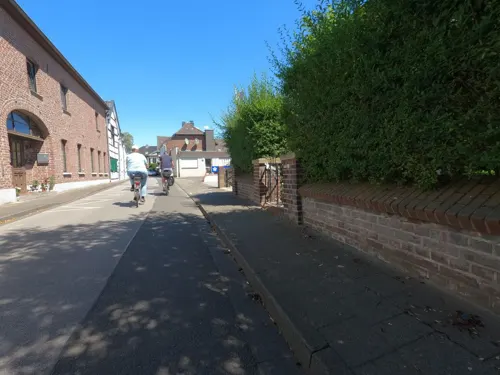
Museum für Europäische Volkstrachten
Museum · 5.9 km
Zweigeschossiges Wohnhaus in sieben Achsen mit einachsigem Mittelrisalit, Backstein, Türgewände und Fensterbänke in Blaustein, im...
7 Kirchplatz, Wegberg
Su 14:00-17:00
Flachsmuseum
Museum · 5.8 km
Bei der sogenannten Zehntscheune in Wegberg - Beeck an der Holtumer Straße handelt es sich um einen Fachwerkbau mit durchgezapften...
Su 14:00-17:00

Route gegen das Vergessen
Monument and historic site
Das Erkelenzer Land war keine Hochburg des Wiederstands gegen das NS-Regime. Dennoch gab es auch hier Sozialdemokraten, Kommunisten und...

Rheinisches Feuerwehrmuseum e.V.
Museum · 5.3 km
Baujahr: Zweite Hälfte des 19. Jahrhunderts Backsteinbau, zweigeschossig in fünf Achsen und Torachse, Türgewände in Blaustein, Ladeneinbau.
23 Hauptstraße, Erkelenz
Sa 14:00-17:00; Su 11:00-17:00

Altes Rathaus
Monument and historic site
Baujahre 1541-1546 und 18. Jh., W bis 1951; freistehender 2-geschossiger Backsteinbau in 5 Achsen, weiß geschlämmt im EG offene...
25 Markt, Erkelenz
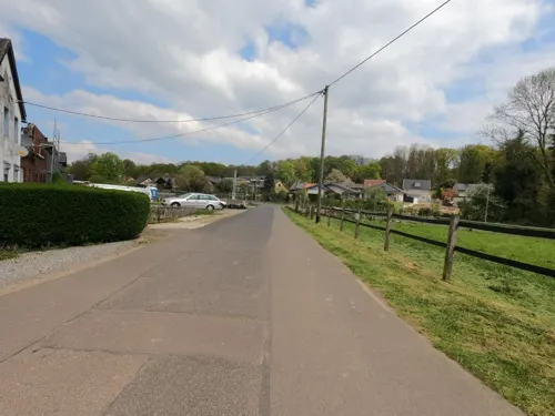
Marien - Kapelle
Monument and historic site · Roman Catholic · 6.3 km
Backstein-Kapelle mit Dachreiter; 1854 (Türkeilstein)

Alte Stadtbefestigung
Monument and historic site
1355 erste Erwähnung, 14. Jh., 15. Jh., A. 16. Jh. Fertig; nur noch in Resten nördlich der Brückstraße erhalten.

Jüdischer Friedhof
Cemetery · 3.7 km
Entstehung und Geschichte der jüdischen Gemeinde von Schwanenberg sind nicht zuletzt im Zusammenhang mit der Situation in Erkelenz zu...

Haus Hohenbusch
Monument and historic site · Catholic · 2.9 km
Von dem ehemaligen Klostergebäude ist das 2-geschossig, 7-achsige Wohnhaus erhalten, Backstein, Gartenseite verputzt, westlich...

Haus Keyenberg
Monument and historic site · 6.8 km
18./19. Jahrhundert, Kern älter; wasserumwehrte Anlage; Herrenhaus mit Wirtschaftsflügel in unregelmäßigem Fünfeck, zum Teil erneuert.
Westricher Ring, Erkelenz

Gut Grittern
Monument and historic site · 7.4 km
Hauptgebäude ehemalige Wasserburg, Backstein Renaissance-Treppengiebel, dreigeschossig, 16. Jahrhundert, um 1900 verändert, 1970/75...
Gut Grittern, Hückelhoven

Mineralien- und Bergbaufreunde
Museum · 6.8 km
1 Ludovicistraße, Hückelhoven
Su 12:00-17:00; We 18:00-21:00
131 more on the map.
Parks, trails and playgrounds36






24 more on the map.
Restaurants and cafes161

Ophover Mühle
Restaurant · 6.7 km
Hauptgebäude zweigeschossig in sechs Achsen; Türgewände und Fensterbänke in Blaustein; die Nebengebäude eingeschossig etwas niedriger,...
14 Forst, Wegberg
Mo-Sa 09:00+; Su 10:00+
Angelpark Tüschenbroich
Restaurant · Seafood · 6.0 km
2 Zur Ulrichskapelle, Wegberg
Mo 06:00-17:00; Tu-Su 06:00-18:00
China Garten
Restaurant · Chinese · 6.1 km
2 Im Wiesengrund, Wegberg
Mo-Sa 12:00-15:00,18:00-23:00; Su, PH 12:00-23:00

Hotel-Restaurant Zum Schwanenhof
Restaurant · German · 1.8 km
Glutenfrei/Zöliakie-Kenntnisse. Glutenfreies Brot zur Vorspeise, glutenfreier Burger nach Vorab-Absprache möglich
9 Am Kapellchen, Erkelenz
Mo-Sa 18:00-21:00; We off; Su 12:00-13:30
Ayana
Restaurant · Indian
1 Anton-Raky-Allee, Erkelenz
Mo-Sa 17:00-22:30; Su,PH 12:00-15:00,17:00-22:00
City Grillpfanne
Restaurant · Turkish · 7.3 km
3 Karmelitergasse, Wegberg
Mo,Tu,Th,Fr 11:30-22:00, Fr,Sa 11:30-23:00, Su,PH 14:00-22:00; We off

Königs-Stuben - "Der Elsässer"
Restaurant · Regional, French
6 Kirchstraße, Erkelenz
Tu-Fr 11:30-14:00,18:00-24:00; Sa 18:00-24:00; Su 12:00-14:00
Mira D'Ouro
Restaurant · Portuguese · 3.7 km
22 Lindches Weg, Erkelenz
Tu-Sa 18:00-22:30; Su 17:00-22:30; Mo off
Oerather Mühle
Restaurant · German · 0.8 km
36 Roermonder Straße, Erkelenz
Tu-Sa 11:30-14:00,17:30-22:00; Su 11:30-20:00; Mo off
149 more on the map.
History
There have been discoveries of Old and New Stone Age flint-knapping sites across the whole of the present area of the borough. Near Haberg House, north of Lövenich, there is a site of national renown. Near Kückhoven a wooden well was discovered in 1990 that belonged to a settlement of the Linear Pottery culture and had been built around 5,100 B.C. This makes it one of the oldest wooden structures in the world. North of the old village of Erkelenz, on the present day Mary Way (Marienweg), lay three cremation graves (Brandgräber), northwest to south of numerous fields of rubble.
The overwhelming theory is that the name Erkelenz belongs to the group of Gallo-Romance -(i)acum placenames. According to this view the name of the town, which first appears in the records in a document dating to 966 A.D. sealed by Otto the Great as herclinze, comes from fundus herculentiacus: Herculentian estate (Estate of Herculentius). From the original adjectival character of the personal name the neuter noun Herculentiacum developed. However a continuity of settlement from Roman to Frankish times cannot be proven. As a result, it is also postulated that the name does not have Roman, but Old High German origins, according to which the word linta = lime tree. In 1118 A.D. the name of the place finally appears as Erkelenze.
From the History section of Erkelenz on Wikipedia, under CC BY-SA 4.0.
More about Erkelenz
Geography
The area is characterised by the gently rolling to almost level countryside of the Jülich-Zülpich Börde, whose fertile loess soils are predominantly used for agriculture. Settlements and roads cover about 20 per cent of the area of the borough and only 2 per cent is wooded. The Wahnenbusch, the largest contiguous wooded area, is located south of the town of Tenholt and covers 25 hectares (62 acres). In the north the börde gives way to the forests and waterways of the Schwalm–Nette-Plateau, part of the Lower Rhine Plain. In the west on the far side of the town, lies the Rur depression, some 30 to 60 metres lower (100 to 200 ft). Its transition is part of the Baal Riedelland. Here, streams have created a richly varying landscape of hills and valleys. In the east is the source region of the River Niers near Kuckum and Keyenberg. To the south the land climbs up towards the Jackerath loess ridge. The lowest point lies at 70 metres (230 ft) above sea level (NN) (Niers region in the northeast and near the Ophover Mill in the southwest) and the highest point is 110 metres (361 ft) above NN (on the boundary of the borough near Holzweiler/Immerath in the south).
Education
In Erkelenz there are ten primary schools, two secondary schools (Hauptschule), 1 secondary modern school (Realschule), two high schools Cornelius-Burgh-Gymnasium, Cusanus-Gymnasium Erkelenz Europaschule), one business college (Berufskolleg des Kreises Heinsberg in Erkelenz) and one school for persons with learning disabilities.
From the Wikipedia article Erkelenz, under CC BY-SA 4.0.
Notable people from Erkelenz
 Lewis HoltbyGerman footballer (born 1990)Photo: Lanthan2003, CC BY-SA 4.0
 Burhan QurbaniGerman-Afghan film directorPhoto: boellstiftung, CC BY-SA 2.0
 Theodoor van Loonpainter from the Southern NetherlandsPhoto: Pontius, Paulus, 1603-1658, artist;..., Public domain
 Reinhold VastersGerman goldsmith (1827–1909)Photo: Reinhold Vasters, Public domain
- Christoph BuddeGerman footballer (1963-2009)
- Egon KöhnenGerman footballer
- Joshua HoltbyGerman football player of English descent
- Lutz MommartzGerman film director (1934–2025)
- Karl H. FellGerman politician (1936-1996)
- Michael BauerGerman artist
- Markus MatzerathGerman politician
Born in Erkelenz, according to Wikidata (CC0). Each name links to its Wikipedia article.
Where to stay15
Churches and places of worship67
Shopping51
Gas and EV charging16
Schools, colleges and libraries36
Healthcare22
Map of Erkelenz
250 places. The map loads OpenStreetMap tiles when you open it.
Getting there and nearby towns
Düsseldorf-Mönchengladbach Airport (MGL) is the nearest airport with scheduled flights listed in OpenStreetMap, 21 km away.
- Hückelhoven 7 km southwest, about 7 min by car
- Wegberg 7 km north, about 7 min by car
- Wassenberg 11 km west, about 11 min by car
- Linnich 11 km south, about 11 min by car
- Titz 11 km southeast, about 11 min by car
- Jüchen 13 km east, about 13 min by car
- Mönchengladbach 15 km northeast, about 15 min by car
- Heinsberg 15 km west, about 15 min by car
- Niederkrüchten 15 km northwest, about 15 min by car
- Schwalmtal 16 km north, about 16 min by car
Drive times are estimates from straight-line distance, not routes.
Towns near Erkelenz


Keep exploring
Local news
Headlines from INDB.
Reviews, tips and questions
Loading what members have shared...
Sources and licences
- GeoNames (CC BY 4.0): population, coordinates, regions and time zone
- Mapillary (see each image): photos
- OpenStreetMap contributors (ODbL 1.0): places, airports, map data
- Wikidata (CC0 1.0): elevation, founding date, time zone, website, landmarks and historic places
- Wikimedia Commons (see each image): photos
- Wikipedia (CC BY-SA 4.0): overview and history text
Photo credits
- Erkelenz. Rathaus zur Karnevalzeit - geo.hlipp.de - 16187, Udo und Joan Fugel on geo.hlipp.de, CC BY-SA 2.0
- GlockenspielErkelenz01, Camillo-venrath, CC BY 4.0
- St. Lambertus Erkelenz, Camillo-venrath, CC0
- Erkelenz - Franziskanerplatz - panoramio, Marius Müller, CC BY-SA 3.0
- 41812 Erkelenz, Germany - panoramio, Marius Müller, CC BY-SA 3.0
- Erkelenz - St. Lambertus - panoramio, Marius Müller, CC BY-SA 3.0
- Erkelenz am Bahnhof - geo.hlipp.de - 16188, Udo und Joan Fugel on geo.hlipp.de, CC BY-SA 2.0
- Gräber auf dem Alten Friedhof in Erkelenz, Aldebaraner, CC BY-SA 4.0
- Erkelenz Wasserturm 2026, Oberlausitzerin64, CC BY-SA 4.0
- Erkelenz altes rathaus, Unknown author, CC BY-SA 3.0
- Doveren, User Bodoklecksel on de.wikipedia, CC BY-SA 3.0
- Jüdischer Friedhof Schwanenberg, Lentholt, CustosEcc, CC BY 3.0
- Fw Museum, bodoklecksel, CC BY-SA 3.0
- Kirche holzweiler 1, Arne Müseler / www.garzweiler.com, CC BY-SA 3.0 de
- Krankenhs EK, Bodoklecksel, CC BY-SA 3.0
- Kuckum Herz Jesu Ansicht, Käthe u. Bernd Limburg, www.limburg-bernd.de, CC BY-SA 3.0 de
- Lövenich Petri Bekehrung, Westerdam, CC BY-SA 4.0
- Turm der Pfarrkirche St. Peter und Paul, Heinz Eßer, CC BY-SA 3.0
- Gerderhahn Kirche Giebelseite, Käthe u. Bernd Limburg, www.limburg-bernd.de, CC BY-SA 3.0 de
- Ek Leonhardkapelle, Bodoklecksel, CC BY-SA 3.0
- Heilig-Kreuz-Kapelle (Kipshoven)2, Chris06, CC BY-SA 4.0
- Haus Keyenberg, Bodoklecksel, CC BY-SA 3.0
- Jüdischer Friedhof Erkelenz 03, Papa1234, CC BY 3.0
- NSG Am hintersten Berg Doveren Kreis Heinsberg Wald mit Hasenglöckchen Caroline Dormans, Caroline Dormans, CC BY-SA 4.0
- Schnecken am Nysterbach, Martin Hopfengart, CC BY-SA 3.0
- Motte Tüschenbroich, NSG HS-017, Huckety, CC BY-SA 3.0
- Ophover Mühle 10, Langela Wegberg, CC BY-SA 3.0 de
- Hohenbusch, User Bodoklecksel on de.wikipedia, CC BY-SA 3.0
- Erkelenz cw, J. F. Welser, Public domain
- Ophover Mühle 1, Käthe u. Bernd Limburg ( http://www.limburg-bernd.de ), CC BY-SA 3.0 de
- BluebellsWood2DoverenGermany2008, Eddi Laumanns aka RX-Guru, CC BY-SA 3.0
- Gerderath1, Bodoklecksel, CC BY-SA 3.0
- Jüdischer Friedhof Erkelenz 01, Papa1234, CC BY 3.0
- Kirche kuckum, Arne Müseler, CC BY-SA 3.0 de
- St. Peter und Paul (Wegberg)! 02, Chris06, CC BY-SA 4.0
- 5974789.Erwin Quedenfeldt, Erwin Quedenfeldt, Public domain
- Ewiglichtampel 2020, Camillo-venrath, CC BY-SA 4.0
- 5974792.Erwin Quedenfeldt, Erwin Quedenfeldt, Public domain
- 5974790.Erwin Quedenfeldt, Erwin Quedenfeldt, Public domain
- St. Lambertus - panoramio, Marius Müller, CC BY-SA 3.0
- Wasser.Blick 21 - Wassererlebnis Schwalm 03, Clisch, CC BY-SA 4.0
- Street-level photo, hektor1989, CC BY-SA 4.0
- Street-level photo, hektor1989, CC BY-SA 4.0
- Street-level photo, descilla, CC BY-SA 4.0
- Street-level photo, hektor1989, CC BY-SA 4.0
- Street-level photo, hektor1989, CC BY-SA 4.0
- Street-level photo, hektor1989, CC BY-SA 4.0
- Street-level photo, hektor1989, CC BY-SA 4.0
- Street-level photo, lintux, CC BY-SA 4.0
- Street-level photo, hektor1989, CC BY-SA 4.0
- Street-level photo, hektor1989, CC BY-SA 4.0
- Street-level photo, hektor1989, CC BY-SA 4.0
- Street-level photo, lintux, CC BY-SA 4.0
- Street-level photo, lintux, CC BY-SA 4.0
- Street-level photo, hektor1989, CC BY-SA 4.0
- Street-level photo, hektor1989, CC BY-SA 4.0
- Street-level photo, hektor1989, CC BY-SA 4.0
- Street-level photo, lintux, CC BY-SA 4.0
- Street-level photo, hektor1989, CC BY-SA 4.0
- Street-level photo, hektor1989, CC BY-SA 4.0
- Street-level photo, hektor1989, CC BY-SA 4.0
- Street-level photo, hektor1989, CC BY-SA 4.0
- Street-level photo, hektor1989, CC BY-SA 4.0
- Street-level photo, hektor1989, CC BY-SA 4.0
- Street-level photo, lintux, CC BY-SA 4.0
- Street-level photo, endradon, CC BY-SA 4.0
- Street-level photo, saschahaberkorn, CC BY-SA 4.0
- Street-level photo, hektor1989, CC BY-SA 4.0
- Street-level photo, lintux, CC BY-SA 4.0
- Street-level photo, hektor1989, CC BY-SA 4.0
- Street-level photo, descilla, CC BY-SA 4.0
- Street-level photo, hektor1989, CC BY-SA 4.0


Page built November 9, 2026. Spotted a mistake? Tell us or suggest a place.