


Hückelhoven, Germany
Hückelhoven is a town of 39,828 people in North Rhine-Westphalia, Germany.
Why visit Hückelhoven
Townapedia lists 133 museums and landmarks, 28 parks and trails, 124 places to eat, 12 places to stay and 15 attractions in and around town.
Highlights include Millicher Halde, Hofladen Clahsen, Haus Hall and Marien - Kapelle.
Weather in Hückelhoven
Forecast from MET Norway (CC BY 4.0). Full forecast
About Hückelhoven
Hückelhoven (German: [ˈhʏkl̩ˌhoːfn̩] ; Limburgish: Hukkelhaove [ˈɦʏkəlˌɦɔː˦və]) is a town in the district of Heinsberg, in North Rhine-Westphalia, Germany. It is situated on the river Rur, approx. 10 km east of Heinsberg, 20 km south-west of Mönchengladbach and approximately 15 km from the border with the Netherlands. Hückelhoven owes its development from village to town to the coal mining industry; the Sophia-Jacoba colliery was opened in 1914.
From the Wikipedia article Hückelhoven (this version), under CC BY-SA 4.0.
Photos of Hückelhoven


Things to do15


Hofladen Clahsen
Farm and orchard · 5.5 km
91 St.-Johannes-Straße, Wassenberg
Th 15:00-18:00; Fr 09:00-13:00,15:00-18:00; Sa 09:00-13:00

Hofladen Müller
Farm and orchard · 4.5 km
Th,Fr 08:30-12:00,14:30-18:00; Sa 08:30-12:00

3 more on the map.
Museums and landmarks133

Haus Hall
Monument and historic site · 3.0 km
Hauptflügel, 2 Geschosse, 5 Achsen, verputzt, Blausteingewände; Hofseite in der Mittelachse. – Eingang, darüber in Stein gehauenes...
1 Hagbrucher Straße, Hückelhoven
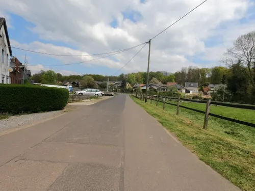
Marien - Kapelle
Monument and historic site · Roman Catholic · 1.8 km
Backstein-Kapelle mit Dachreiter; 1854 (Türkeilstein)
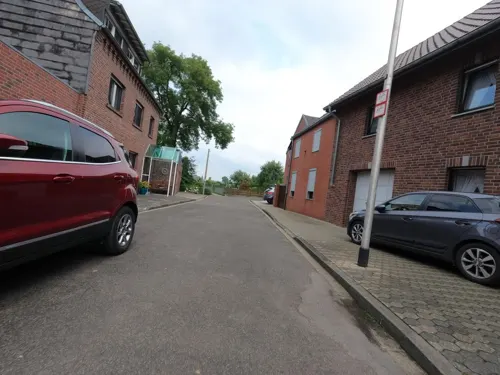
St. Anna Kapelle
Monument and historic site · 4.7 km
Neugotische Backstein-Kapelle, Front teils verputzt und verschiefert, Dachreiter; 1864
118 Annastraße, Hückelhoven

Jüdischer Friedhof
Cemetery · 5.4 km
Entstehung und Geschichte der jüdischen Gemeinde von Schwanenberg sind nicht zuletzt im Zusammenhang mit der Situation in Erkelenz zu...
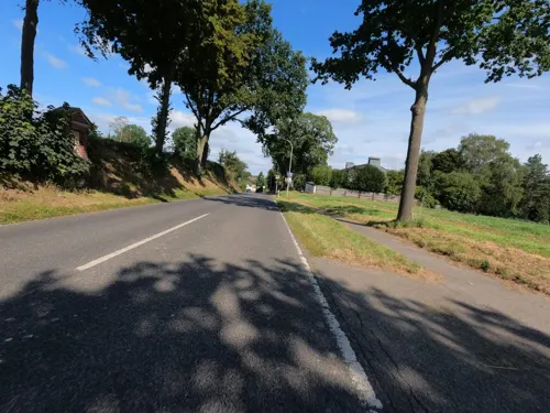
Gebetsstation
Monument and historic site · 6.1 km
Drei Fußfallstationen aus der Zeit um 1900, Backsteinbauten mit Struck - Relief.

Haus Blumenthal
Monument and historic site · 4.9 km
Ehemalige Wasserburg. Erhalten geblieben ist das zweigeschossige ehemals neunachsige Herrenhaus aus der Mitte des 16. Jahrhunderts mit 7...
8 Alter Steinweg, Hückelhoven

Haus Hohenbusch
Monument and historic site · Catholic · 3.9 km
Von dem ehemaligen Klostergebäude ist das 2-geschossig, 7-achsige Wohnhaus erhalten, Backstein, Gartenseite verputzt, westlich...

Gut Grittern
Monument and historic site · 1.8 km
Hauptgebäude ehemalige Wasserburg, Backstein Renaissance-Treppengiebel, dreigeschossig, 16. Jahrhundert, um 1900 verändert, 1970/75...
Gut Grittern, Hückelhoven

Mineralien- und Bergbaufreunde
Museum · 0.6 km
1 Ludovicistraße, Hückelhoven
Su 12:00-17:00; We 18:00-21:00
Haus Honsdorf
Monument and historic site · 6.6 km
Denkmalwerte Substanz von "Haus Honsdorf" sind Reste eines Turmes aus dem 16. Jahrhundert
Honsdorf, Geilenkirchen
Alte Apotheke
Monument and historic site
Zweigeschossiges Backsteinhaus, 7 Achsen, Blausteingewände, Mansarddach, Hofgebäude, zweigeschossig, Satteldach, errichtet 1756,...
2 Haagstraße, Hückelhoven
Altenheim
Monument and historic site · 5.6 km
Hauptgebäude zwei bis drei Geschosse, verputzt, Walmdach, Dachreiter, Vorburg um 1900, zwei Geschosse, 4:6 Achsen, Backstein. Anfag 18....
5 Klosterberg, Hückelhoven
121 more on the map.
Parks, trails and playgrounds28




16 more on the map.
Restaurants and cafes124
"St. Jacques"
Restaurant · French · 5.6 km
Lunch by arrangement;
50 Feldstraße, Heinsberg
We-Su 18:00-23:00; Su 12:00-14:00
Hotel Restaurant Zur Post
Restaurant · Regional · 6.5 km
18 An St. Martinus, Wassenberg
May-Sep: Su 10:00-24:00; Oct-Apr: Su 10:00-14:30,17:00-24:00;...
Kyoto
Restaurant · Asian, Sushi · 5.3 km
194 Erkelenzer Straße, Wassenberg
Mo,We-Th 15:30-21:30; Su 14:30-21:30; Tu off
Mira D'Ouro
Restaurant · Portuguese · 6.0 km
22 Lindches Weg, Erkelenz
Tu-Sa 18:00-22:30; Su 17:00-22:30; Mo off
Oerather Mühle
Restaurant · German · 6.6 km
36 Roermonder Straße, Erkelenz
Tu-Sa 11:30-14:00,17:30-22:00; Su 11:30-20:00; Mo off
Restaurant Mediteran
Restaurant · Croatian
66 Dinstühlerstraße, Hückelhoven
Tu 17:00-22:30; We-Su 11:30-14:30, 17:00-22:30; Mo off
Wan Hao
Restaurant · Chinese, Japanese · 5.9 km
7 Neumühle
Mo,We-Sa 11:30-15:00,17:30-22:30; Su,PH 11:30-22:30; Tu off

Pizza Lounge
Restaurant · Italian · 5.9 km
26b Xantener Allee, Erkelenz
Mo,We-Sa 17:00-22:00; Su,PH 14:00-22:00; Tu off

Batalia
Brewery and winery · 1.1 km
9 Rheinstraße, Hückelhoven
Tu-Fr 10:00-18:00; Sa 10:00-14:00; Su-Mo,PH off
112 more on the map.
History
The place name Hückelhoven with its place name ending in -hoven suggests that it was founded in the Carolingian to late Carolingian period (8th/9th century). However, modest grave finds from the northern edge of the town from the 6th century testify to a settlement beginning in the early Middle Ages.
In 1221, a Sibertus de Hukelhoven is mentioned in a document from Dalheim Abbey. 26 years later (1247), a knight Reinard von Hückelhoven, Reynardo milite de Hukilhoven, appears in a document, who had Haus Hückelhoven built. In 1350 the House of Hückelhoven (Heukelhoven) appears in a feudal register of the Lordship of Wassenberg. A Ludwig Mulstroe is enfeoffed with the Hückelhoven estate around 1470. At the end of the 16th century, this farm was remodelled and a two-storey brick building, ‘the castle’, was built.
In the Middle Ages and early modern times, the village belonged to the court of Doveren in the Wassenberg district of the Duchy of Jülich. In 1798, Hückelhoven was elevated by the French administration to a Mairie (mayor's office), and in 1799 the neighbouring villages of Hückelhoven and Doveren were merged to form the Mairie Doveren. 17 years later (1816), this division was retained under Prussian rule and Hückelhoven now belonged to the Prussian mayoralty of Doveren.
Read more of the history
In 1935, the new municipality of Hückelhoven was formed from the villages of Hückelhoven, Hilfarth, Ratheim, Millich, Schaufenberg and part of Kleingladbach. It was given the name Hückelhoven-Ratheim on 7 January 1950. It was not until 1969 that the former municipality of Hückelhoven-Ratheim became a town. On 1 January 1972, the municipalities of Baal, Brachelen, Doveren, Rurich and the village of Altmyhl were incorporated. The legal basis for the incorporation was the Act on the Reorganisation of the Municipalities and Districts of the Aachen Reorganisation Area of 14 December 1971, known as the Aachen Act for short.
At the end of October 1944, the Gestapo set up a ‘labour education camp’, an ‘emergency prison’, in Hückelhoven. Several people, including forced labourers, were shot.
The town is a former colliery town where the Sophia-Jacoba trade union, for a long time the most modern coal mine in Europe, characterised the townscape and lifestyle for around 80 years. The colliery was closed on 27 March 1997 and since then Hückelhoven has undergone rapid and sometimes dramatic change. As a result of the colliery closure, the percentage of unemployed is significantly higher than the national average, but can still be considered relatively low compared to the Ruhr region due to numerous aid measures. An initial trend-setting goal to improve the attractiveness of the town centre was achieved by the attractive conversion of the ‘Alte Post’ on Parkhofstrasse into a lively business and service centre by private investors. In autumn 2004, the ‘Hückelhoven-Center’ was opened in Hückelhoven, which has attracted many people to the town on the Rur ever since. New shops, offices and doctors' surgeries were built on Wildauer Platz and completed in April 2010.
From the History section of Hückelhoven on Wikipedia, under CC BY-SA 4.0.
Notable people from Hückelhoven
 Thomas JahnGerman film directorPhoto: Olaf Kosinsky, CC BY-SA 3.0 de
Born in Hückelhoven, according to Wikidata (CC0). Each name links to its Wikipedia article.
Where to stay12
Churches and places of worship54
Shopping52
Gas and EV charging17
Schools, colleges and libraries36
Healthcare19
Medizinisches Versorgungszentrum Diaverum Erkelenz
Clinic and pharmacy · 6.4 km
43a Tenholter Straße, Erkelenz
Map of Hückelhoven
250 places. The map loads OpenStreetMap tiles when you open it.
Getting there and nearby towns
NATO E-3A Airbase Geilenkirchen (GKE) is the nearest airport with scheduled flights listed in OpenStreetMap, 17 km away.
- Erkelenz 7 km northeast, about 7 min by car
- Wassenberg 7 km northwest, about 7 min by car
- Heinsberg 9 km west, about 9 min by car
- Linnich 9 km south, about 9 min by car
- Wegberg 10 km northeast, about 10 min by car
- Geilenkirchen 12 km southwest, about 12 min by car
- Titz 15 km east, about 15 min by car
- Baesweiler 16 km south, about 16 min by car
- Niederkrüchten 16 km north, about 16 min by car
- Übach-Palenberg 17 km southwest, about 17 min by car
Drive times are estimates from straight-line distance, not routes.
Towns near Hückelhoven


Keep exploring
Local news
Headlines from INDB.
Reviews, tips and questions
Loading what members have shared...
Sources and licences
- GeoNames (CC BY 4.0): population, coordinates, regions and time zone
- Mapillary (see each image): photos
- OpenStreetMap contributors (ODbL 1.0): places, airports, map data
- Wikidata (CC0 1.0): elevation, founding date, time zone, website
- Wikimedia Commons (see each image): photos
- Wikipedia (CC BY-SA 4.0): overview and history text
Photo credits
- Hückelhoven Evangelische Pfarrkirchen 0349, Sven Teschke, CC BY-SA 3.0 de
- Gymnasium Hückelhoven-105353, Raimond Spekking, CC BY-SA 4.0
- Gymnasium Hückelhoven-105416, Raimond Spekking, CC BY-SA 4.0
- Gymnasium Hückelhoven-105330, Raimond Spekking, CC BY-SA 4.0
- Gymnasium Hückelhoven-105417, Raimond Spekking, CC BY-SA 4.0
- Gymnasium Hückelhoven-105426, Raimond Spekking, CC BY-SA 4.0
- Gymnasium Hückelhoven-105657, Raimond Spekking, CC BY-SA 4.0
- Gymnasium Hückelhoven-105708, Raimond Spekking, CC BY-SA 4.0
- Gymnasium Hückelhoven-105441, Raimond Spekking, CC BY-SA 4.0
- Gymnasium Hückelhoven-105516, Raimond Spekking, CC BY-SA 4.0
- Gymnasium Hückelhoven-105611, Raimond Spekking, CC BY-SA 4.0
- Gymnasium Hückelhoven-105558, Raimond Spekking, CC BY-SA 4.0
- Gymnasium Hückelhoven-105547, Raimond Spekking, CC BY-SA 4.0
- Hückelhoven Wasserturm 2026, Oberlausitzerin64, CC BY-SA 4.0
- Stolperstein Hückelhoven Auf dem Kamp 24 Ernst Mokwa, Gmbo 2013, CC0
- Doveren, User Bodoklecksel on de.wikipedia, CC BY-SA 3.0
- Hückelhoven-Brachelen Haus Blumenthal 0353, Sven Teschke, CC BY-SA 3.0 de
- Jüdischer Friedhof Schwanenberg, Lentholt, CustosEcc, CC BY 3.0
- MillicherHaldePano, Bodoklecksel, CC BY-SA 3.0
- Krankenhs EK, Bodoklecksel, CC BY-SA 3.0
- Myhl Kirche St. Johannes Ansicht, Käthe u. Bernd Limburg, www.limburg-bernd.de, CC BY-SA 3.0 de
- Gerderhahn Kirche Giebelseite, Käthe u. Bernd Limburg, www.limburg-bernd.de, CC BY-SA 3.0 de
- Ek Leonhardkapelle, Bodoklecksel, CC BY-SA 3.0
- Katholische Kirche Ratheim, Alupus, CC BY-SA 3.0
- Jüdischer Friedhof Erkelenz 03, Papa1234, CC BY 3.0
- NSG Am hintersten Berg Doveren Kreis Heinsberg Wald mit Hasenglöckchen Caroline Dormans, Caroline Dormans, CC BY-SA 4.0
- Schnecken am Nysterbach, Martin Hopfengart, CC BY-SA 3.0
- Randerath Evang. Kirche Totalansicht, Käthe u. Bernd Limburg, www.limburg-bernd.de, CC BY-SA 3.0 de
- Kirche Herz-Jesu rurich, The original uploader was Franz Müller at German Wikipedia ., CC BY-SA 2.0 de
- Brachelen Kirche St. Gereon, Käthe u. Bernd Limburg, www.limburg-bernd.de, CC BY-SA 3.0 de
- Pfarrkirche St Johannes, Klaus Littmann, CC BY-SA 3.0
- Hohenbusch, User Bodoklecksel on de.wikipedia, CC BY-SA 3.0
- BluebellsWood2DoverenGermany2008, Eddi Laumanns aka RX-Guru, CC BY-SA 3.0
- Gerderath1, Bodoklecksel, CC BY-SA 3.0
- Rurich Kirche Herz Jesu, Käthe u. Bernd Limburg, www.limburg-bernd.de, CC BY-SA 3.0 de
- Parkhofstraße 2024, Regorg, CC BY-SA 4.0
- Peugeot speedfight 2, Bandit 7883, CC0
- Huckelhoven Deutschland - centrum handlowe - panoramio (1), dzidek, CC BY 3.0
- Huckelhoven Deutschland - centrum handlowe - panoramio, dzidek, CC BY 3.0
- RurKP99, Bodoklecksel, CC BY-SA 3.0
- Haus Hall, Klaus Littmann, CC BY-SA 3.0
- Street-level photo, hektor1989, CC BY-SA 4.0
- Street-level photo, hektor1989, CC BY-SA 4.0
- Street-level photo, hektor1989, CC BY-SA 4.0
- Street-level photo, hektor1989, CC BY-SA 4.0
- Street-level photo, hektor1989, CC BY-SA 4.0
- Street-level photo, hektor1989, CC BY-SA 4.0
- Street-level photo, reigi, CC BY-SA 4.0
- Street-level photo, hektor1989, CC BY-SA 4.0
- Street-level photo, hektor1989, CC BY-SA 4.0
- Street-level photo, hektor1989, CC BY-SA 4.0
- Street-level photo, hektor1989, CC BY-SA 4.0
- Street-level photo, Pipeline, CC BY-SA 4.0
- Street-level photo, madel, CC BY-SA 4.0
- Street-level photo, hektor1989, CC BY-SA 4.0
- Street-level photo, descilla, CC BY-SA 4.0
- Street-level photo, hektor1989, CC BY-SA 4.0
- Street-level photo, hektor1989, CC BY-SA 4.0
- Street-level photo, hektor1989, CC BY-SA 4.0
- Street-level photo, hektor1989, CC BY-SA 4.0
- Street-level photo, hektor1989, CC BY-SA 4.0
- Street-level photo, hektor1989, CC BY-SA 4.0
- Street-level photo, hektor1989, CC BY-SA 4.0
- Street-level photo, hektor1989, CC BY-SA 4.0
- Street-level photo, hektor1989, CC BY-SA 4.0
- Street-level photo, hektor1989, CC BY-SA 4.0
- Street-level photo, descilla, CC BY-SA 4.0
- Street-level photo, hektor1989, CC BY-SA 4.0
- Street-level photo, hektor1989, CC BY-SA 4.0


Page built November 9, 2026. Spotted a mistake? Tell us or suggest a place.