


Heinsberg, Germany
Heinsberg is a town of 41,505 people in North Rhine-Westphalia, Germany.
Why visit Heinsberg
Townapedia lists 153 museums and landmarks, 27 parks and trails, 146 places to eat, 17 places to stay and 14 attractions in and around town.
Highlights include Millicher Halde, Milchhof Gerighausen, BEGAS HAUS and Burg Wassenberg.
Weather in Heinsberg
Forecast from MET Norway (CC BY 4.0). Full forecast
About Heinsberg
Heinsberg (German: [ˈhaɪnsbɛʁk] ; Limburgish: Hinsberg [ˈɦɪnzˌbæʀ˦(ə)x]) is a town in North Rhine-Westphalia, Germany. It is the seat of the district Heinsberg. It is situated near the border with the Netherlands, on the river Wurm, approx. 20 km north-east of Sittard and 30 km south-west of Mönchengladbach.
From the Wikipedia article Heinsberg (this version), under CC BY-SA 4.0.
Photos of Heinsberg


Things to do14



Paraplü
Farm and orchard · 7.5 km
6 Auf dem Wall, Waldfeucht
Mo-Fr 09:30-12:00, Mo-Fr 15:00-18:30, Sa 09:00-14:00
Hofladen Müller
Farm and orchard · 4.8 km
Th,Fr 08:30-12:00,14:30-18:00; Sa 08:30-12:00


2 more on the map.
Museums and landmarks153

BEGAS HAUS
Museum · 0.6 km
Zweigeschossiges Gebäude aus dem 18. Jahrhundert, im Winkel gebaut mit Tordurchfahrt, Ecktürmchen und Blausteingewänden
21 Hochstraße, Heinsberg
Tu-Sa 14:00-17:00; Su 11:00-17:00

Burg Wassenberg
Monument and historic site · 5.8 km
Die Anlage hat einen annähernd quadratischen Grundriß, auf dessen höchster Punkt sich der Bergfried aus der ersten Hälfte des 15....
21 Kirchstraße, Wassenberg
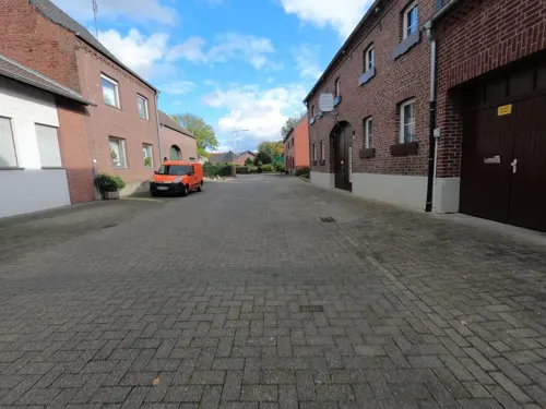
Hofanlage
Monument and historic site · 7.1 km
Zweigeschossige Winkelhofanlage, fünfachsig mit mittlerer Toreinfahrt. Zwei Fensterachsen vermauert. Satteldach, Sägezahnfries als...
18 Schulstraße, Waldfeucht

Haus Effeld
Monument and historic site · 6.6 km
Das in guten Zustand befindliche Wasserschloss Effeld, entstanden aus einer Motte, wurde im 15. Jahrhundert erbaut. Im Jahre 1606 wurde...
12 Schloßstraße, Wassenberg

Haus Hall
Monument and historic site · 6.0 km
Hauptflügel, 2 Geschosse, 5 Achsen, verputzt, Blausteingewände; Hofseite in der Mittelachse. – Eingang, darüber in Stein gehauenes...
1 Hagbrucher Straße, Hückelhoven

Schloss Elsum
Monument and historic site · 6.2 km
Neuanlage der Hauptburg 1503; Vorburg 1714 neu aufgebaut; Kapelle 1860; spätgotische Wasserburg mit einer Vorburg des 18. Jahrhunderts...
Elsumer Weg, Wassenberg
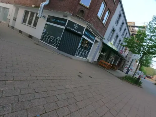
Wohn- und Geschäftshaus
Monument and historic site
Dreigeschossiges Wohnhaus aus dem 18. Jahrhundert, zu drei Achsen, verputzt, Fenster mit Blausteingewände, Mittelbetonung durch flacher Erker
98 Hochstraße, Heinsberg

Gebetsstation
Monument and historic site · 7.5 km
Drei Fußfallstationen aus der Zeit um 1900, Backsteinbauten mit Struck - Relief.
Pfarrhaus
Monument and historic site · Catholic · 5.3 km
Pfarrhaus, Ende des 19. Jahrhunderts, zweigeschossig in fünf zu zwei Achsen, Mittelachse betont.
18 Uetterather Dorfstraße, Heinsberg
Wehrturm
Monument and historic site · 5.7 km
Wehrturm Erkelenzer Straße, 1420, Eckturm am Gondelweiher 1420, Verlorener Turm am Schwimmbad vor 1400
Am Wehrturm, Wassenberg
141 more on the map.
Parks, trails and playgrounds27




Freibad Kirchhoven
Sports field and stadium · 2.3 km
57 Schwimmbadstraße, Heinsberg
Mo-Fr 11:00-19:00; Sa-Su,PH 10:00-19:00


15 more on the map.
Restaurants and cafes146
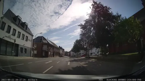
"St. Jacques"
Restaurant · French · 7.5 km
Lunch by arrangement;
50 Feldstraße, Heinsberg
We-Su 18:00-23:00; Su 12:00-14:00
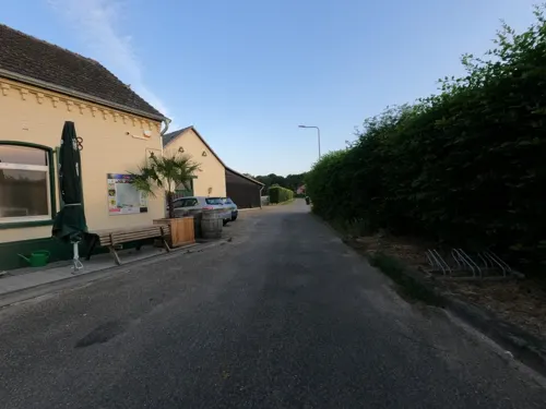
Golden Sushi & Wok
Restaurant · Asian · 7.0 km
8 Starzend, Gangelt
Mo-Fr 15:00-21:30; Tu off; Sa,Su,PH 11:00-21:30

Hotel-Restaurant Braustube
Restaurant · Regional · 5.4 km
Ein zweieinhalbgeschossiges Gebäude in zehn Achsen mit Mittelrisalit und Zwerchgiebel vor dem alles überdeckenden Walmdach. Der...
10 Johannesstraße, Waldfeucht
Mo-Sa 17:30-24:00; Su,PH 11:30-14:30,17:30-24:00
Braukeller Wassenberg Restaurant, Café
Restaurant · Bavarian · 5.6 km
1 Am Roßtor, Wassenberg
We-Sa 16:30-23:00; Su 12:00-23:00; Mo,Tu off
Burg Wassenberg by Savio
Restaurant · Mediterranean · 5.7 km
1 Auf dem Burgberg, Wassenberg
Mo-Su 12:00-22:00

Bäckerei Maria von Heel
Bakery · 6.5 km
Baked goods without adding baking agent
147 Bahnhofstraße, Gangelt
Mo,Sa 05:30-12:30; Tu-Fr 05:30-18:00; Su 07:30-11:00

El Greco
Restaurant · Greek · 1.4 km
110 Kempener Straße, Heinsberg
Tu-Sa 17:00-23:30, Su 12:00-22:30, PH 12:00-22:30
134 more on the map.
History
The first historical mention of the city of Heinsberg as a town occurs in a document issued by Henry I, Lord of Heinsberg in 1255.
From the History section of Heinsberg on Wikipedia, under CC BY-SA 4.0.
More about Heinsberg
Geography
Wassenberg is the town to the north of Heinsberg, Hückelhoven to the east, Waldfeucht and Gangelt to the west, and Geilenkirchen to the south. Two rivers flow through Heinsberg, the Wurm and the Rur. The Wurm flows into the Rur near to Rurkempen, a village of Heinsberg municipality.
Economy
Due to its proximity to the Benelux countries, sufficient industrial park areas, low trade tax and good traffic connections, Heinsberg has good prerequisites for development. Companies include:
Education
Heinsberg possesses many elementary schools and kindergartens. The secondary education facilities include a high school (Gymnasium). Since 2007 there is a school for disabled persons in the building of the former vocational school (Berufsschule).
From the Wikipedia article Heinsberg, under CC BY-SA 4.0.
Notable people from Heinsberg
 Wilhelm RediessGerman Waffen-SS General and Police Leader (1900-1945)Photo: Henriksen & Steen, National Library of Norway, CC BY-SA 4.0
 Carl Joseph BegasGerman painter (1794-1854)Photo: Carl Joseph Begas, Public domain
 Jean-François OebenGerman master cabinetmaker specialized in marquetry having worked in Paris (1721-1763)Photo: Daderot, Public domain
 Hubert HoubenGerman historian (1953-)Photo: ACBahn, CC BY-SA 3.0
 Tiago EstêvãoGerman footballer (born 2002)Photo: Carlo Bruil Fotografie, CC BY 2.0
 Björn KrausGerman philosopher, epistemologist, and systemic therapistPhoto: EHFreiburg-Hirth, CC BY-SA 4.0
- Sandro NicolasGerman singer
- Elke RongenGerman para badminton player
- Tim BerresheimGerman artist
- Gerhard MevissenGerman artist
- Katja NoltenGerman table tennis player
Born in Heinsberg, according to Wikidata (CC0). Each name links to its Wikipedia article.
Where to stay17
Churches and places of worship86
Shopping49
Gas and EV charging18
Schools, colleges and libraries29
Healthcare21
Map of Heinsberg
250 places. The map loads OpenStreetMap tiles when you open it.
Getting there and nearby towns
NATO E-3A Airbase Geilenkirchen (GKE) is the nearest airport with scheduled flights listed in OpenStreetMap, 12 km away.
- Wassenberg 6 km northeast, about 6 min by car
- Waldfeucht 8 km west, about 8 min by car
- Hückelhoven 9 km east, about 9 min by car
- Geilenkirchen 11 km south, about 11 min by car
- Gangelt 11 km southwest, about 11 min by car
- Erkelenz 15 km east, about 15 min by car
- Linnich 15 km southeast, about 15 min by car
- Wegberg 16 km northeast, about 16 min by car
- Übach-Palenberg 16 km south, about 16 min by car
- Niederkrüchten 17 km northeast, about 17 min by car
Drive times are estimates from straight-line distance, not routes.
Towns near Heinsberg


Keep exploring
Local news
Headlines from INDB.
Reviews, tips and questions
Loading what members have shared...
Sources and licences
- GeoNames (CC BY 4.0): population, coordinates, regions and time zone
- Mapillary (see each image): photos
- OpenStreetMap contributors (ODbL 1.0): places, airports, map data
- Wikidata (CC0 1.0): elevation, founding date, time zone, website
- Wikimedia Commons (see each image): photos
- Wikipedia (CC BY-SA 4.0): overview and history text
Photo credits
- StGangolfHeinsberg, Bodoklecksel, CC BY-SA 3.0
- Stolpersteinlage Heinsberg Ostwall 70, Gmbo 2013, CC0
- Stolperstein Heinsberg Ostwall 70 Bertha Hertz, Gmbo 2013, CC0
- Stolpersteine Heinsberg Ostwall 70, Gmbo 2013, CC0
- Stolperstein Heinsberg Ostwall 70 Bella Blech, Gmbo 2013, CC0
- Stolperstein Heinsberg Ostwall 70 Adolph Blech, Gmbo 2013, CC0
- 27.03.17 Heinsberg (Rheinl) 425.104 (33802156235), Phil Richards from London, UK, CC BY-SA 2.0
- Stolperstein Heinsberg Hochstraße 107 Lion Daniels, Gmbo 2013, CC0
- Stolperstein Heinsberg Hochstraße 107 Johanna Daniels, Gmbo 2013, CC0
- Stolpersteine Heinsberg Hochstraße 107, Gmbo 2013, CC0
- Stolperstein Heinsberg Hochstraße 107 Helena Hirsch, Gmbo 2013, CC0
- Stolperstein Heinsberg Hochstraße 107 Elise Bähr, Gmbo 2013, CC0
- Stolperstein Heinsberg Hochstraße 107 Getta Daniels, Gmbo 2013, CC0
- Stolperstein Heinsberg Hochstraße 107 Hermann Bähr, Gmbo 2013, CC0
- Stolperstein Heinsberg Hochstraße 107 Selma Bähr, Gmbo 2013, CC0
- Stolperstein Heinsberg Hochstraße 107 Heinrich Bähr, Gmbo 2013, CC0
- Stolpersteinlage Heinsberg Hochstraße 107, Gmbo 2013, CC0
- Aerial image of the Heinsberg prison (view from the south), Carsten Steger, CC BY-SA 4.0
- Stolpersteine Heinsberg Hochstraße 74, Gmbo 2013, CC0
- Stolperstein Heinsberg Hochstraße 74 Otto Coblenzer, Gmbo 2013, CC0
- Stolpersteinlage Heinsberg Hochstraße 74, Gmbo 2013, CC0
- Stolperstein Heinsberg Hochstraße 74 Auguste Coblenzer, Gmbo 2013, CC0
- Stolpersteinlage Heinsberg Hochstraße 68, Gmbo 2013, CC0
- Stolpersteine Heinsberg Hochstraße 68, Gmbo 2013, CC0
- Stolperstein Heinsberg Hochstraße 68 Joseph Blech, Gmbo 2013, CC0
- Stolperstein Heinsberg Hochstraße 68 Meinhard Blech, Gmbo 2013, CC0
- Stele Heinsberg Auf dem Brand 1, Gmbo 2013, CC0
- Stele Heinsberg Auf dem Brand, Gmbo 2013, CC0
- Stolperstein Heinsberg Hochstraße 66 Erich Manasses, Gmbo 2013, CC0
- Birgeler Pützchen 1, Alupus, CC BY-SA 3.0
- Wassenberg , Deutschland , Burg - panoramio, dzidek, CC BY 3.0
- MillicherHaldePano, Bodoklecksel, CC BY-SA 3.0
- Wassenberg - Elsumer Weg - Schloss Elsum 02 ies, Frank Vincentz, CC BY-SA 3.0
- Heinsberg Krankenhaus Altarraum, Käthe u. Bernd Limburg, www.limburg-bernd.de, CC BY-SA 3.0 de
- Uetterath St. Mariä Himmelfahrt Ansicht, Käthe u. Bernd Limburg, www.limburg-bernd.de, CC BY-SA 3.0 de
- Horst St. Josef Kirche Seitenansicht, Käthe u. Bernd Limburg, www.limburg-bernd.de, CC BY-SA 3.0 de
- Uetterath Muttergottes-Kapelle Ansicht, Käthe u. Bernd Limburg, www.limburg-bernd.de, CC BY-SA 3.0 de
- Myhl Kirche St. Johannes Ansicht, Käthe u. Bernd Limburg, www.limburg-bernd.de, CC BY-SA 3.0 de
- St. Martin (Orsbeck) - 20170916160742, A .Darius, CC BY-SA 4.0
- Effeld, kerk foto4 2011-03-22 12.52, Michielverbeek, CC BY-SA 3.0
- 19-01-11-Begas, Rainer Göttlinger, CC BY-SA 4.0
- Braunsrath Kirche St. Klemens Seitenansicht, Käthe u. Bernd Limburg, www.limburg-bernd.de, CC BY-SA 3.0 de
- Wasser.Blick 24 - Rur 01, Clisch, CC BY-SA 4.0
- Effelder Waldsee, Unknown author, CC BY-SA 3.0
- Schaagbachtal, in Rosenthal, Naturschutzgebiet HS-004, Huckety, CC BY-SA 3.0
- NSG Untere Ruraue Orsbeck, Hilgers69, CC BY-SA 4.0
- Birgelen Pützchen Marienkapelle, Käthe u. Bernd Limburg, www.limburg-bernd.de, CC BY-SA 3.0 de
- Randerath Evang. Kirche Totalansicht, Käthe u. Bernd Limburg, www.limburg-bernd.de, CC BY-SA 3.0 de
- Pfarrkirche St Johannes, Klaus Littmann, CC BY-SA 3.0
- Horst Kirche Turmansicht, Käthe u. Bernd Limburg, www.limburg-bernd.de, CC BY-SA 3.0 de
- Schloss Effeld01, Käthe u. Bernd Limburg, www.limburg-bernd.de, CC BY-SA 3.0 de
- Haus Hall, Klaus Littmann, CC BY-SA 3.0
- Street-level photo, hektor1989, CC BY-SA 4.0
- Street-level photo, hektor1989, CC BY-SA 4.0
- Street-level photo, hektor1989, CC BY-SA 4.0
- Street-level photo, hektor1989, CC BY-SA 4.0
- Street-level photo, hektor1989, CC BY-SA 4.0
- Street-level photo, hektor1989, CC BY-SA 4.0
- Street-level photo, reigi, CC BY-SA 4.0
- Street-level photo, hektor1989, CC BY-SA 4.0
- Street-level photo, hektor1989, CC BY-SA 4.0
- Street-level photo, madel, CC BY-SA 4.0
- Street-level photo, fulnir, CC BY-SA 4.0
- Street-level photo, Pipeline, CC BY-SA 4.0
- Street-level photo, hektor1989, CC BY-SA 4.0
- Street-level photo, hektor1989, CC BY-SA 4.0
- Street-level photo, hektor1989, CC BY-SA 4.0
- Street-level photo, hektor1989, CC BY-SA 4.0
- Street-level photo, madel, CC BY-SA 4.0
- Street-level photo, hektor1989, CC BY-SA 4.0
- Street-level photo, poxonline, CC BY-SA 4.0
- Street-level photo, hektor1989, CC BY-SA 4.0
- Street-level photo, hektor1989, CC BY-SA 4.0
- Street-level photo, hektor1989, CC BY-SA 4.0
- Street-level photo, hektor1989, CC BY-SA 4.0
- Street-level photo, hektor1989, CC BY-SA 4.0
- Street-level photo, hektor1989, CC BY-SA 4.0
- Street-level photo, madel, CC BY-SA 4.0
- Street-level photo, hektor1989, CC BY-SA 4.0


Page built November 9, 2026. Spotted a mistake? Tell us or suggest a place.