


Why visit Erzhausen
Townapedia lists 45 museums and landmarks, 24 parks and trails, 48 places to eat, 6 places to stay and 1 attraction in and around town.
Highlights include Dorfmuseum, Schloss Wolfsgarten, Faulbruch bei Erzhausen and Kammereckswiesen, Herchwiesen, Schmale Wiesen und Belzbornwiesen von Langen.
Weather in Erzhausen
Forecast from MET Norway (CC BY 4.0). Full forecast
About Erzhausen
Erzhausen is a village and a municipality in southern Hesse, Germany. It is part of the district of Darmstadt-Dieburg. It has about 7,900 inhabitants (2020). Wixhausen, a borough of the City of Darmstadt, is just South of Erzhausen.
From the Wikipedia article Erzhausen (this version), under CC BY-SA 4.0.
Travel tips from other travellers: Erzhausen on Wikivoyage (CC BY-SA 4.0).
Things to do1

Museums and landmarks45






33 more on the map.
Parks, trails and playgrounds24


Kammereckswiesen, Herchwiesen, Schmale Wiesen und Belzbornwiesen von Langen
Hiking and trails · 2.7 km



12 more on the map.
Restaurants and cafes48

Casa del Tennis
Restaurant · Italian, Pizza, Pasta · 0.6 km
50 Heinrichstraße, Erzhausen
Tu-Su 17:00-22:00; Tu-Fr 12:00-14:30
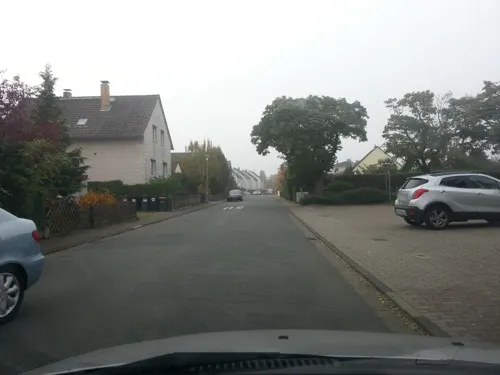
Gaststätte Bürgermeister-Pohl-Haus
Restaurant · German, Balkan · 2.5 km
26 Im Appensee, Darmstadt
Mo-Sa 17:00-23:00; Tu off; Fr,Su 11:30-14:00,17:00-23:00
Gute Landung
Restaurant · Regional · 1.1 km
75 Hans-Fleissner-Straße, Egelsbach
Mo-Th 15:00-22:30; Fr-Su 11:00-22:30

Matis' Waldlust
Restaurant · Regional · 0.6 km
173 Bahnstraße, Erzhausen
Tu-Sa 11:30-15:00, 17:30-23:00
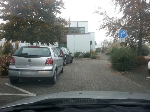
Restaurant Bürgerhaus
Restaurant · Balkan · 1.1 km
7-9 Rodenseestraße, Erzhausen
Tu-Su 11:30-14:30,17:00-24:00
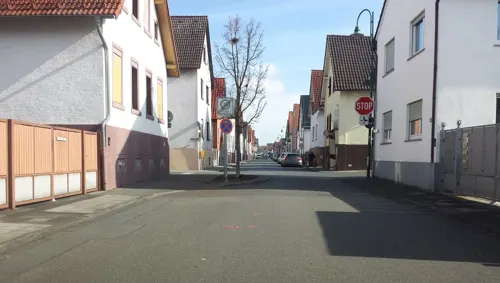
Bäckerei Keller
Bakery · 1.0 km
15 Bahnstraße, Erzhausen
Mo-Fr 06:00-12:30, 14:30-18:00; Sa 06:00-12:30; Su 08:00-11:00
Beni's Pizza
Restaurant · Pizza · 0.9 km
31 Bahnstraße, Erzhausen
Tu-Fr 11:00-14:00,17:00-23:00; Sa 15:00-23:00; Su 16:00-23:00

Eiscafé Da Serafino
Ice cream · Ice Cream · 2.7 km
1 Ludwig-Thoma-Straße, Darmstadt
Wintermonate: Su-Fr 10:30-20:00; Sa 12:00-22:00; Sommerzeit: Mo-Su...


Europa
Restaurant · Italian · 1.7 km
15 Freiherr-vom-Stein-Straße
Mo,We-Su 11:00-14:30,17:30-24:00
36 more on the map.
History
Settlement in the area dates back to about 1500 B.C., as shown by several cairn burial sites found some kilometres west of the town.
The settlement itself is mentioned in documents from 900 A.D. onward under various names like 'Erardishusen', 'Erhartzhausen', 'Ebrichshusen' or 'Erndeshusen'. The oldest document of the Lorsch codex names it as 'Erhartshausen' ('Houses of Erhart').
After remaining a mostly unimportant farming village until the early 20th century, it grew strongly after the railway line from Frankfurt to Darmstadt was built several kilometers to the east of it. The habitation spread out towards it, and workers employed in the nearby cities (which could now be reached a lot easier) settled here.
Today, it is still mostly a residential village, with some commerce and office activities. There is a small seminary of the German Pentecostalism BFP movement situated in the town, Bible School Beröa also called Theologisches Seminar Beröa .
From the History section of Erzhausen on Wikipedia, under CC BY-SA 4.0.
Where to stay6
Churches and places of worship9
Bonifatiuskapelle
Church · Orthodox · 2.7 km
4 Schloss Wolfsgarten, Langen (Hessen)
Shopping14
Einkaufszentrum Lortzingstraße
Shopping center · 2.9 km
69 Lortzingstraße, Darmstadt
Gas and EV charging8
Schools, colleges and libraries8
Healthcare4
Map of Erzhausen
167 places. The map loads OpenStreetMap tiles when you open it.
Getting there and nearby towns
Frankfurt Airport (FRA) is the nearest airport with scheduled flights listed in OpenStreetMap, 11 km away.
- Wixhausen 3 km south, about 3 min by car
- Langen 4 km north, about 4 min by car
- Gräfenhausen 4 km southwest, about 4 min by car
- Mörfelden-Walldorf 6 km northwest, about 6 min by car
- Weiterstadt 7 km southwest, about 7 min by car
- Dreieich 8 km northeast, about 8 min by car
- Darmstadt 9 km south, about 9 min by car
- Neu-Isenburg 11 km north, about 11 min by car
- Dietzenbach 11 km northeast, about 11 min by car
- Büttelborn 11 km southwest, about 11 min by car
Drive times are estimates from straight-line distance, not routes.
Local news
Headlines from INDB.
Reviews, tips and questions
Loading what members have shared...
Sources and licences
- GeoNames (CC BY 4.0): population, coordinates, regions and time zone
- Mapillary (see each image): photos
- OpenStreetMap contributors (ODbL 1.0): places, airports, map data
- Wikidata (CC0 1.0): elevation, founding date, time zone, website
- Wikimedia Commons (see each image): photos
- Wikipedia (CC BY-SA 4.0): overview and history text
Photo credits
- Ev Kirche Erzhausen, The original uploader was Exilsaarländer at German Wikipedia ., CC BY-SA 2.0 de
- Main Street And Cycle Lanes, Erzhausen, Ingolfson, Public domain
- Lokal Kiosk And Pub 'Lisa' In Erzhausen, Ingolfson, Public domain
- Bakery On Mainstreet in Erzhausen, Uploader., Public domain
- Cycle Lanes Through Erzhausen Mainstreet, Ingolfson, Public domain
- Erzhausen Train Station Noisewall, Ingolfson, Public domain
- Local Sparkasse, Mainstreet Erzhausen, Ingolfson, Public domain
- S-Bahn Arriving Erzhausen Bahnhof, Ingolfson, Public domain
- Cycle Parking, Erzhausen Train Station, Ingolfson, Public domain
- Shopping Stretch Main Street, Erzhausen, Ingolfson, Public domain
- Main Street And Houses, Erzhausen, Ingolfson, Public domain
- Former 'Der Krebs' Shop, Erzhausen, Ingolfson, Public domain
- Petrol Station Jakobi, In Erzhausen, Ingolfson, Public domain
- Pedestrian Through Passage, Erzhausen, Ingolfson, Public domain
- Lower Main Street, Older Part Erzhausen, Ingolfson, Public domain
- Guesthouse, Hall Zur Linde, Erzhausen, Ingolfson, Public domain
- RundwegErzhausen, Stefan Oemisch, CC BY-SA 4.0
- Schloss Wolfsgarten Aerial fg117, Fritz Geller-Grimm supported by Rüdiger Wandke, CC BY-SA 3.0
- DA-Wixhausen vilaĝa kirko ev. Kirche 4, Thomas Pusch, CC BY-SA 3.0
- Erzhausen Church And Apple Trees, Ingolfson, Public domain
- Egelsbach evangelische Kirche 20110520, Rudolf Stricker, Attribution
- NSG Kammereckswiesen und Herchwiesen von Langen01, KUGerhardt, CC BY-SA 4.0
- Schillerschule Dorfmuseum Erzhausen, AndreasDelp, CC BY-SA 4.0
- Maria Koenigin Erzhausen Westansicht, C. M., CC BY-SA 4.0
- DA-Wixhausen vilaĝa muzeo Dorfmuseum 1, Thomas Pusch, CC BY-SA 3.0
- OttilienmühleWixhausen, DerNurNochAlsBilderlieferantMitmacht, CC0
- 2017RestaurantWaldlust, DerNurNochAlsBilderlieferantMitmacht, CC0
- 2016KircheWixhausen, Stefan Oemisch, CC BY-SA 4.0
- StJosefEgelsbach, Stefan Oemisch, CC BY-SA 4.0
- Faulbruch3, Ratki, CC BY-SA 4.0
- Lymantria dispar MdE, MdE, CC BY-SA 3.0 de
- Faulbruch1, Ratki, CC BY-SA 4.0
- Faulbruch2, Ratki, CC BY-SA 4.0
- Carduus acanthoides 4 RF, Robert Flogaus-Faust, CC BY 4.0
- Faulbruch4, Ratki, CC BY-SA 4.0
- Rubus armeniacus RF, Robert Flogaus-Faust, CC BY 4.0
- D-EBXH (18104025324), Alec Wilson from Hampton-in-Arden, United Kingdom, CC BY-SA 2.0
- Schuhbeck´s Check Inn Egelsbach, LSDSL, CC BY-SA 2.0 de
- One-Way Street With Cycle Passage, Ingolfson, Public domain
- Faulbruch5, Ratki, CC BY-SA 4.0
- Street-level photo, wegavision, CC BY-SA 4.0
- Street-level photo, wegavision, CC BY-SA 4.0
- Street-level photo, wegavision, CC BY-SA 4.0
- Street-level photo, chuck, CC BY-SA 4.0
- Street-level photo, robffm, CC BY-SA 4.0
- Street-level photo, chuck, CC BY-SA 4.0
- Street-level photo, chuck, CC BY-SA 4.0
- Street-level photo, wegavision, CC BY-SA 4.0
- Street-level photo, wegavision, CC BY-SA 4.0
- Street-level photo, chuck, CC BY-SA 4.0
- Street-level photo, chuck, CC BY-SA 4.0
- Street-level photo, chuck, CC BY-SA 4.0
- Street-level photo, chuck, CC BY-SA 4.0
- Street-level photo, wegavision, CC BY-SA 4.0


Page built November 9, 2026. Spotted a mistake? Tell us or suggest a place.