


Mörfelden-Walldorf, Germany
Mörfelden-Walldorf is a town of 32,753 people in Hesse, Germany, founded in 1977.
Why visit Mörfelden-Walldorf
Townapedia lists 118 museums and landmarks, 39 parks and trails, 166 places to eat, 21 places to stay and 11 attractions in and around town.
Highlights include Oberwaldberg, Lichtburg Filmtheater, Dorfmuseum and Museum Mörfelden.
Weather in Mörfelden-Walldorf
Forecast from MET Norway (CC BY 4.0). Full forecast
About Mörfelden-Walldorf
Mörfelden-Walldorf (German pronunciation: [ˈmœʁfɛldn̩ ˈvaldɔʁf] ) is a town in the Groß-Gerau district, situated in the Frankfurt Rhine-Main region in the federal state (Bundesland) Hesse, Germany.
From the Wikipedia article Mörfelden-Walldorf (this version), under CC BY-SA 4.0.
Travel tips from other travellers: Mörfelden-Walldorf on Wikivoyage (CC BY-SA 4.0).
Photos of Mörfelden-Walldorf


Things to do11



Lichtblick - Walldorfer Kinotreff
Cinema and theater · 1.1 km
20 Mörfelder Straße, Mörfelden-Walldorf



Museums and landmarks118


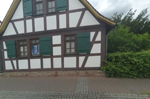

Zeppelin-Museum Zeppelinheim
Museum · 5.0 km
Airship museum in Neu-Isenburg at Frankfurt/Main
Fr 14:00-17:00; Sa,Su,PH 11:00-17:00


Berlin Airlift Memorial
Monument and historic site · 4.9 km
Oct-Mar Mo-Su,PH 08:00-17:00; Apr-Sep Mo-Su,PH 08:00-20:00


Wasserturm
Monument and historic site · 1.4 km
Wasserturm Mörfelden
111-113 Frankfurter Straße, Mörfelden-Walldorf


106 more on the map.
Parks, trails and playgrounds39


Kammereckswiesen, Herchwiesen, Schmale Wiesen und Belzbornwiesen von Langen
Hiking and trails · 5.7 km




27 more on the map.
Restaurants and cafes166
Asia-Kim
Restaurant · Asian · 5.5 km
1 Marienstraße, Langen (Hessen)
Tu-Sa 11:00-22:00; Su,PH 12:00-22:00
Bäumsche am Bahnhof
Restaurant · Regional · 5.3 km
3 Europaplatz, Langen (Hessen)
Mo-Sa 16:00-23:00; PH,Su 12:00-22:00
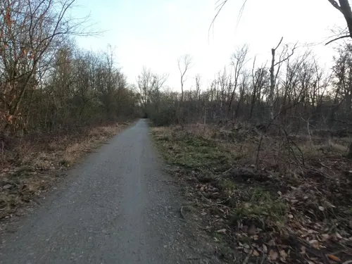
Food Port
Restaurant · Thai, Italian · 3.4 km
Access authorization to CargoCity Süd required. Application possible at https://ccs.fraport.de/de/
Mo-Sa 11:00-21:00
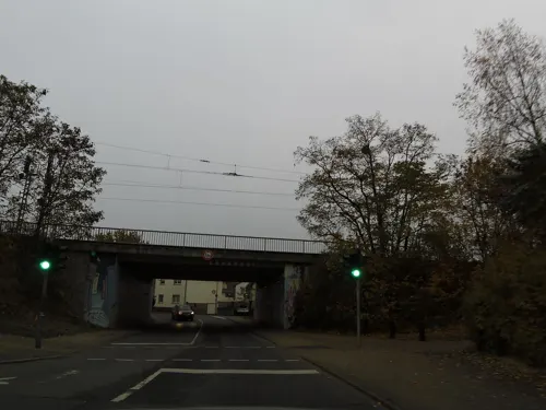
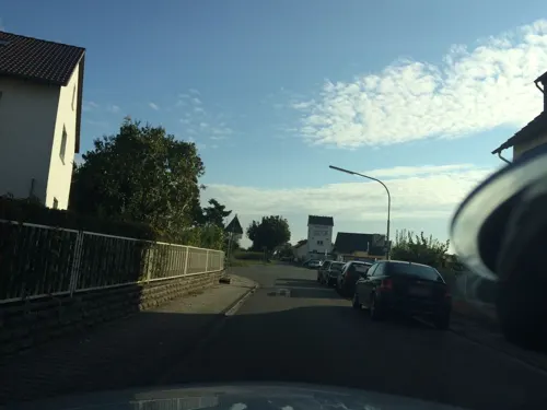
Hotel Gaststätte Luley
Restaurant · Regional, German · 2.0 km
70 Langener Straße, Mörfelden-Walldorf
Mo-Su 11:00-14:00,17:00-22:00; Tu off; Sa 17:00-22:00
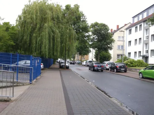
Jokers-Fried-Chicken Langen
Restaurant · Pizza, Fried Chicken · 5.5 km
25 Westendstraße, Langen (Hessen)
Mo-Su 11:00-21:00
La Fattoria
Restaurant · Italian · 0.7 km
4-6 Jourdanallee, Mörfelden-Walldorf
Tu-Su 12:00-15:00; 18:30-23:00

Landgasthof Naturfreundehaus
Restaurant · German, Regional · 1.8 km
Gaststätte, Biergarten, Pension
6 Am Zeltplatz, Mörfelden-Walldorf
Mo-Su 11:30-24:00
Casa del Tennis
Restaurant · Italian, Pizza, Pasta · 5.7 km
50 Heinrichstraße, Erzhausen
Tu-Su 17:00-22:00; Tu-Fr 12:00-14:30
Gute Landung
Restaurant · Regional · 5.5 km
75 Hans-Fleissner-Straße, Egelsbach
Mo-Th 15:00-22:30; Fr-Su 11:00-22:30
154 more on the map.
History
Mörfelden was first mentioned in the "Lorscher Reichsurbar" of 830 to 850 under the name "Mersenualt". The church was mentioned as early as 1304 as being the "Parish Church with branch at the Gundhof". During the Middle Ages, the surrounding forests belonged to the Dreieich Royal Hunting Woods (Wildbann Dreieich), which maintained one of its 30 woods in Mörfelden. In 1600, Mörfelden passed to Hesse-Darmstadt.
In the 15th and 16th centuries, Mörfelden became a significant tradepost with a population of 500, but the Thirty Years' War set back the development of the village. It was repeatedly plundered and ravaged, and the plague took its toll. In the 19th century, however, the village benefited anew from economic development, and from the arrival of a railway line. The village developed early on into a community of workers, who commuted towards nearby cities. The inhabitants specialised as construction workers, and Mörfelden became known as the "bricklayers village".[1]
After World War II, many refugees and expellees from Germany's former Eastern territories settled here. Mörfelden was raised to town status in 1972.
Walldorf was founded in 1699 as "Waldenserkolonie am Gundhof", was given the name Walldorf in 1715 and was raised to town status in 1962.
Read more of the history
From about 23 August to 24 November 1944, there was a concentration camp in Walldorf into which were brought 1,700 Jewish girls and women from Hungary to work at runway and taxiway expansion and repair at Frankfurt Airport. This chapter in the town's history had been forgotten until 1972 when three interested youths rediscovered it. Since then, a film called Rollbahn has dealt with the theme.
The town of Mörfelden-Walldorf came into being on 1 January 1977 through the merger of the until then independent towns of Mörfelden and Walldorf in the face of pressure from Frankfurt to amalgamate with that city.
Guntheim is the third community in Mörfelden-Walldorf's history. It lay in Walldorf's northeast. It had its first documentary mention in 1307 under the name villa Guntheim. There was also a Gunthof nearby, but the Gunthof (always with the definite article) came to be part of Guntheim in the 15th century through division of inheritance. The village ceased to be a population centre in 1647.
Guntheim was established in Merovingian times (481 – 560) as a Frankish military colony at the junction of some old Roman roads in the forest.
From the History section of Mörfelden-Walldorf on Wikipedia, under CC BY-SA 4.0.
More about Mörfelden-Walldorf
Geography
Mörfelden-Walldorf is situated within a triangle formed by the South Hessian cities of Frankfurt am Main, Darmstadt and Wiesbaden, near Frankfurt International Airport.
Mörfelden-Walldorf borders in the north on the district-free city of Frankfurt am Main and the town of Neu-Isenburg (Offenbach district), in the east on the town of Langen and the community of Egelsbach (both in Offenbach district), in the south on the community of Erzhausen, the town of Weiterstadt (both in Darmstadt-Dieburg) and the community of Büttelborn, and in the west on the town of Groß-Gerau, the community of Nauheim and the town of Rüsselsheim.
As its name suggests, Mörfelden-Walldorf consists of two constituent communities, named Mörfelden and Walldorf. There was a third one, called Guntheim, which once lay within the current municipal area of Mörfelden-Walldorf, but it was abandoned in 1647.
From the Wikipedia article Mörfelden-Walldorf, under CC BY-SA 4.0.
Notable people from Mörfelden-Walldorf
- Sandra SchmittGerman freestyle skier (1981-2000)
Born in Mörfelden-Walldorf, according to Wikidata (CC0). Each name links to its Wikipedia article.
Where to stay21
Holiday Inn Express Frankfurt Airport
Motel and hotel · 1.6 km
200 Langener Straße, Mörfelden-Walldorf
Anor Hotel & Conference Center Frankfurt Airport
Motel and hotel · 2.1 km
8-10 An der Brücke, Mörfelden-Walldorf
Appartementhotel Zum Grünen Haag
Motel and hotel · 3.2 km
60 Rüsselsheimer Straße, Mörfelden-Walldorf
Coffee Fellows Hotel Frankfurt Airport-Langen
Motel and hotel · 5.4 km
58 Robert-Bosch-Straße, Langen (Hessen)
Churches and places of worship20
Evangelische Kirche Mörfelden
Church · Protestant · 2.5 km
31 Langgasse, Mörfelden-Walldorf
Martin-Luther-Kirche
Church · Lutheran · 4.7 km
31 Berliner Allee, Langen (Hessen)
Freie evangelische Gemeinde Mörfelden-Walldorf
Church · Protestant · 3.1 km
5 Daimlerstraße, Mörfelden-Walldorf
Kirche Jesu Christi der Heiligen der letzten Tage
Church · Mormon · 5.3 km
22 Birkenstraße, Langen (Hessen)
Shopping35
Gas and EV charging17
Schools, colleges and libraries13
DFS Air Navigation Services Acamdey
School · 5.2 km
4 Am DFS-Campus, Langen (Hessen)
Healthcare11
Schubert-Apotheke
Clinic and pharmacy · 2.7 km
26 Schubertstraße, Mörfelden-Walldorf
Robert Koch Apotheke
Clinic and pharmacy · 2.0 km
11 Aschaffenburger Straße, Mörfelden-Walldorf
Map of Mörfelden-Walldorf
250 places. The map loads OpenStreetMap tiles when you open it.
Getting there and nearby towns
Frankfurt Airport (FRA) is the nearest airport with scheduled flights listed in OpenStreetMap, 4 km away.
- Langen 6 km east, about 6 min by car
- Egelsbach 6 km southeast, about 6 min by car
- Erzhausen 6 km southeast, about 6 min by car
- Gräfenhausen 7 km south, about 7 min by car
- Dreieich 9 km east, about 9 min by car
- Kelsterbach 8 km northwest, about 8 min by car
- Wixhausen 9 km southeast, about 9 min by car
- Neu-Isenburg 10 km northeast, about 10 min by car
- Braunshardt 9 km south, about 9 min by car
- Raunheim 10 km west, about 10 min by car
Drive times are estimates from straight-line distance, not routes.
Towns near Mörfelden-Walldorf


Keep exploring
Local news
Headlines from INDB.
Reviews, tips and questions
Loading what members have shared...
Sources and licences
- GeoNames (CC BY 4.0): population, coordinates, regions and time zone
- Mapillary (see each image): photos
- OpenStreetMap contributors (ODbL 1.0): places, airports, map data
- Wikidata (CC0 1.0): elevation, founding date, time zone, website
- Wikimedia Commons (see each image): photos
- Wikipedia (CC BY-SA 4.0): overview and history text
Photo credits
- Mörfelden Fachwerkhäuser, ThomasPusch, CC BY-SA 3.0
- Residential building in Mörfelden-Walldorf - Germany -46, Norbert Nagel, CC BY-SA 3.0
- Residential building in Mörfelden-Walldorf - Germany -45, Norbert Nagel, CC BY-SA 3.0
- Residential building in Mörfelden-Walldorf - Germany -71, Norbert Nagel, CC BY-SA 3.0
- Residential building in Mörfelden-Walldorf - Germany -44, Norbert Nagel, CC BY-SA 3.0
- Residential building in Mörfelden-Walldorf - Germany -41, Norbert Nagel, CC BY-SA 3.0
- Residential building in Mörfelden-Walldorf - Germany -42, Norbert Nagel, CC BY-SA 3.0
- Residential building in Mörfelden-Walldorf - Germany -70, Norbert Nagel, CC BY-SA 3.0
- Residential building in Mörfelden-Walldorf - Germany -43, Norbert Nagel, CC BY-SA 3.0
- Residential building in Mörfelden-Walldorf - Germany -69, Norbert Nagel, CC BY-SA 3.0
- Residential building in Mörfelden-Walldorf - Germany -51, Norbert Nagel, CC BY-SA 3.0
- Residential building in Mörfelden-Walldorf - Germany -52, Norbert Nagel, CC BY-SA 3.0
- Residential building in Mörfelden-Walldorf - Germany -48, Norbert Nagel, CC BY-SA 3.0
- Residential building in Mörfelden-Walldorf - Germany -50, Norbert Nagel, CC BY-SA 3.0
- Residential building in Mörfelden-Walldorf - Germany -47, Norbert Nagel, CC BY-SA 3.0
- Residential building in Mörfelden-Walldorf - Germany -49, Norbert Nagel, CC BY-SA 3.0
- Residential building in Mörfelden-Walldorf - Germany -30, Norbert Nagel, CC BY-SA 3.0
- Bahnhof Walldorf - Mörfelden-Walldorf - 03, Norbert Nagel, CC BY-SA 3.0
- Residential building in Mörfelden-Walldorf - Germany -31, Norbert Nagel, CC BY-SA 3.0
- Graffiti Bahnunterführung Walldorf - Mörfelden-Walldorf - subway graffito - 04, Photo: Norbert Nagel, CC BY-SA 3.0
- Graffiti Bahnunterführung Walldorf - Mörfelden-Walldorf - subway graffito - 01, Photo: Norbert Nagel, CC BY-SA 3.0
- Graffiti Bahnunterführung Walldorf - Mörfelden-Walldorf - subway graffito - 02, Photo: Norbert Nagel, CC BY-SA 3.0
- Waldenserbrunnen - Bahnhof Walldorf - Mörfelden-Walldorf - 01, Norbert Nagel, CC BY-SA 3.0
- Residential building in Mörfelden-Walldorf - Germany -34, Norbert Nagel, CC BY-SA 3.0
- Residential building in Mörfelden-Walldorf - Germany -35, Norbert Nagel, CC BY-SA 3.0
- Waldenserbrunnen - Bahnhof Walldorf - Mörfelden-Walldorf - 05, Norbert Nagel, CC BY-SA 3.0
- Waldenserbrunnen - Bahnhof Walldorf - Mörfelden-Walldorf - 03, Norbert Nagel, CC BY-SA 3.0
- Waldenserbrunnen - Bahnhof Walldorf - Mörfelden-Walldorf - 04, Norbert Nagel, CC BY-SA 3.0
- Bahnhof Walldorf - Mörfelden-Walldorf - 02, Norbert Nagel, CC BY-SA 3.0
- Waldenserbrunnen - Bahnhof Walldorf - Mörfelden-Walldorf - 02, Norbert Nagel, CC BY-SA 3.0
- Residential building in Mörfelden-Walldorf - Germany -32, Norbert Nagel, CC BY-SA 3.0
- Bahnhof Walldorf - Mörfelden-Walldorf - 01, Norbert Nagel, CC BY-SA 3.0
- Residential building in Mörfelden-Walldorf - Germany -33, Norbert Nagel, CC BY-SA 3.0
- Drei Tänzerinnen - Mörfelden-Walldorf - Germany - 02, Photo: Norbert Nagel, CC BY-SA 3.0
- Drei Tänzerinnen - Mörfelden-Walldorf - Germany - 03, Photo: Norbert Nagel, CC BY-SA 3.0
- Drei Tänzerinnen - Mörfelden-Walldorf - Germany - 04, Photo: Norbert Nagel, CC BY-SA 3.0
- Drei Tänzerinnen - Mörfelden-Walldorf - Germany - 01, Photo: Norbert Nagel, CC BY-SA 3.0
- Zeppelin museum Frankfurt, Andy Dingley, Public domain
- DFS headquarters in Langen, Carlo Dani, CC BY-SA 4.0
- Schloss Wolfsgarten Aerial fg117, Fritz Geller-Grimm supported by Rüdiger Wandke, CC BY-SA 3.0
- Mönchbruch - Moenchbruch - Mörfelden-Walldorf - Germany - March 23th 2013 - 03, Norbert Nagel, CC BY-SA 3.0
- Erzhausen Church And Apple Trees, Ingolfson, Public domain
- NSG Kammereckswiesen und Herchwiesen von Langen01, KUGerhardt, CC BY-SA 4.0
- Schillerschule Dorfmuseum Erzhausen, AndreasDelp, CC BY-SA 4.0
- BerthaVonSuttnerSchule, Frank Murmann, CC BY 3.0
- SanddueneAmApfelbach, André Poth, CC BY-SA 4.0
- Mörfelden Evangelische Kirche 2017, Uwe Barghaan, CC BY-SA 3.0
- Evangelische Kirche Walldorf, Jens Wiki, CC BY-SA 3.0
- 2020 Martin-Luther-Kirche Langen, Stefan Oemisch, CC BY-SA 4.0
- 2020 Thomas von Aquin Langen, Stefan Oemisch, CC BY-SA 4.0
- Intercityhotel frankfurt airport, Thomas Kroemer, CC BY-SA 4.0
- Airlift Memorial 1985 RM AB GE Luftbrückendenkmal Flughafen Frankfurt am Main Fraport - Foto 2007 Wolfgang Pehlemann Steinberg Ostsee DSCN268, Wolfgang Pehlemann, CC BY-SA 3.0
- Heimatmuseum Mörfelden, Welt-der-Form, CC BY-SA 3.0
- Mönchbruch - Moenchbruch - Mörfelden-Walldorf - Germany - May 12th 2012 - 03, Norbert Nagel, CC BY-SA 3.0
- Oberwaldberg, 1, Mörfelden, Mörfelden-Walldorf, Landkreis Groß Gerau, GeorgDerReisende, CC BY-SA 4.0
- Aussichtsturm Mönchbruch 2, Muck, CC BY-SA 4.0
- Wasserturm Mörfelden - Mörfelden-Walldorf - water tower - château d'eau - 03, Norbert Nagel, CC BY-SA 3.0
- Street-level photo, wegavision, CC BY-SA 4.0
- Street-level photo, chuck, CC BY-SA 4.0
- Street-level photo, chuck, CC BY-SA 4.0
- Street-level photo, chuck, CC BY-SA 4.0
- Street-level photo, chuck, CC BY-SA 4.0
- Street-level photo, chuck, CC BY-SA 4.0
- Street-level photo, chuck, CC BY-SA 4.0
- Street-level photo, chuck, CC BY-SA 4.0
- Street-level photo, xodes, CC BY-SA 4.0
- Street-level photo, chuck, CC BY-SA 4.0
- Street-level photo, chuck, CC BY-SA 4.0
- Street-level photo, xodes, CC BY-SA 4.0
- Street-level photo, chuck, CC BY-SA 4.0
- Street-level photo, xodes, CC BY-SA 4.0
- Street-level photo, chuck, CC BY-SA 4.0
- Street-level photo, chuck, CC BY-SA 4.0
- Street-level photo, chuck, CC BY-SA 4.0
- Street-level photo, miguel_andrade, CC BY-SA 4.0
- Street-level photo, chuck, CC BY-SA 4.0
- Street-level photo, mjay, CC BY-SA 4.0
- Street-level photo, xodes, CC BY-SA 4.0
- Street-level photo, chuck, CC BY-SA 4.0
- Street-level photo, wegavision, CC BY-SA 4.0


Page built November 9, 2026. Spotted a mistake? Tell us or suggest a place.